
Where Flight Simulation Enthusiasts Gather from Around the World!
AVSIM Library - Search Results

| Category: Flight Simulator 2002 - Scenery Design | |
| Mesh Terrain Collection of VisionReal (Part 3) |

|
File Description:
Collection of realistic Mesh Terrain for scenery of VisionReal developer Group.
Include:
El Calafate y alrededores,
Comodoro Rivadavia y alrededores,
Bahía Blanca (Sierra de la Ventana),
Balcarce, Tandil y Mar del Plata,
Mendoza y Santiago de Chile,
San Martín de los Andes, Chapelco y Bariloche,
Cordoba y alrededores,
Salta y Jujuy,
Islas Malvinas (Homenaje)
This is Part 3 (Mendoza y Santiago de Chile, with Aconcagua Mountain)
This Mesh Terrain scenery are designed for MICROSOFT FLIGHT SIMULATOR 2002; tested on FLIGHT SIMULATOR 2002
Version Beta 0.7.
| Filename: | Mesh_Terrain_Collection_of_VisionReal_Part_3.zip |
| License: | Freeware, limited distribution |
| Added: | 28th June 2003, 20:09:25 |
| Downloads: | 815 |
| Author: | VisionReal |
| Size: | 7.19 MB |
| Category: Flight Simulator 2004 - Aircraft Repaints, Textures and Modifications | |
| Air Lambert (VA) Airbus A321 'G-LMAE' Updated |
|
File Description:
This Airbus A321 was delivered to Air Lambert on the 27th December 2004 brand new from the Airbus facility and is based at LGW (London Gatwick, UK). It wears special "Mountain" colours and is named 'Pride of the Mountains'. Air Lambert is a successful Virtual Airline with bases at LGW (London Gatwick, UK), MAN (Manchester, UK) and EDI (Edinburgh, UK). We fly to a number of European destinations and our fleet consists of an exciting list of planes! Take a look at our website, www.flylambert.co.uk, join now.
| Filename: | Air_Lambert_VA_Airbus_A321_GLMAE_Updated.zip |
| License: | Freeware |
| Added: | 26th May 2005, 00:32:30 |
| Downloads: | 834 |
| Author: | Sam Lambert |
| Size: | 2.87 MB |
| Category: Flight Simulator 2004 - AI Flight Plans | |
| Desert Air Alaska Fall 2010 |
|
Images related to this file:
File Description:

Desert Air Alaska originally started its Part 135 charter operation in the 1990s in the high mountain desert of Utah flying auto parts across the country and Canada. They began fulltime year-round charter cargo service to rural Alaska across its �¢����ice deserts�¢���� in 2001, adding direct points of service each year to remote Alaska destinations. Flights taken from FlightAware for the week of September 12 thru September 18, 2010
| Filename: | Desert_Air_Alaska_Fall_2010.zip |
| License: | Freeware |
| Added: | 21st September 2010, 21:29:41 |
| Downloads: | 836 |
| Author: | Steve Lewis |
| Size: | 132.22 KB |
| Category: Microsoft Train Simulator - Tracks and Scenery | |
| MSTS Route - Albula Line 2.1 Upgrade |
|
File Description:
MSTS Route - Albula Line 2.1 upgrade.
This file upgrades Albula Line 2, a highly detailed protypical Swiss mountain route.
It adds photoreal station buildings, older-style gantries, 4 new activities,
12 new types of water, changed snow terrain textures, cows and people that
disappear in some seasons and weather, and many other details.
The new activities require 16 new pieces of rolling stock, available separately
in file RhBpack2.zip, and the previous rolling stock, available in RhBpack.zip.
Uses default MSTS tracks. Requires Albula Line 2 (MValb2.zip).
| Filename: | MSTS_Route__Albula_Line_21_Upgrade.zip |
| License: | Freeware |
| Added: | 8th June 2003, 03:32:56 |
| Downloads: | 3,583 |
| Author: | Michael Vone and Joachim Zander |
| Size: | 14.87 MB |
| Category: Flight Simulator 2004 - Flight Plans | |
| Hopping Round the World Adventure - Pack 12 |
|
File Description:
Truth or Consequences? Yes! There is such a place in the USA. I know that FS2004 has grass runways but it was interesting to see KTCS with a paved runway and multiple grass runways as well. Get you mower humming. Don't let the sun in your eyes affect your dusk landing in the mountains. This pack should separate the men from the boys. How does the saying go? Be careful what you wish for because you might get it. Finally the equipment failures creep up and bite you if you don't pay attention. Decision, decision. What will you do? Do you know how to hand crank your landing gears. No belly flopping allowed. Luck may be on your side this day as every pilot will attest. Remember, you must make it to your assigned destination. No excuses!
| Filename: | Hopping_Round_the_World_Adventure__Pack_12.zip |
| License: | Freeware |
| Added: | 11th October 2003, 05:01:28 |
| Downloads: | 3,809 |
| Author: | David Dossiere |
| Size: | 2.39 MB |
| Category: Flight Simulator X - Scenery | |
| YNRB Narembeen, Western Australia airstrip and townsite |
|
File Description:
YNRB Narembeen - The idea of creating a town at the Narembeen siding was the brainchild of a prominent Perth lawyer, Henry Hale, and a Perth publican, Paddy Connolly. When the men realised the problems that were being created by the teetotal community at Emu Hill they purchased 30 acres (about 12 ha) of land at Narembeen, used their influence with the local politicians, got permission to build a pub and then sold off the rest of the land to prospective residents of their 'private town'. The pub, which still stands today, was all that was needed to overwhelm the struggling nearby settlements and become the centre for the whole area. By 1925 Narembeen had a population of 2100. REQUIRES Blencowe_LibraryKit.zip
REQUIRES blencowe_librarykit_309494.zip (Available HERE)
| Filename: | YNRB_Narembeen_Western_Australia_airstrip_and_town.zip |
| License: | Freeware |
| Added: | 28th February 2013, 13:59:07 |
| Downloads: | 220 |
| Author: | Alan Blencowe |
| Size: | 3.77 MB |
| Category: Flight Simulator 2004 - Scenery | |
| VFR of Lario, Area F2 - Como lake, Italy |
|
Images related to this file:
File Description:
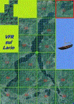
This 10th scenery covers approximately an area of 7.5x6 kmt, from Berlinghera mountain (NW) to Fransedo (NE), from Sorico (SW) to Belenasco (SE); some of dedicated buildings are included, as the Lario's space center of Telespazio and office of the Nature Reserve (Pian di Spagna), Passo's Bridge (Sorico) and the disused old steamer Plinio (Verceia); some other minor boats and docks are placed alongside the lake coast, as well as several smaller bridges across rivers and streams.
Check video available here: http://youtu.be/9k5qeFOPNwk
| Filename: | VFR_of_Lario_Area_F2__Como_lake_Italy.zip |
| License: | Freeware |
| Added: | 25th January 2013, 20:37:04 |
| Downloads: | 953 |
| Author: | Aldo Della Vedova, Daniele Lanfranchi, Gian Mario Verga |
| Size: | 12.52 MB |
| Category: Flight Simulator 2004 - Miscellaneous Files | |
| World Challenge Venzuela Challenge |
|
File Description:
Part two of the challenge. This a challenge for those pilots or groups that like the off beaten path. Flying into the middle of the jungle or landing at night on a airstrip field and you cant see in front of you. Trying to fly over a mountain peak that is higher than your ceiling level with a Trubo prop aircraft. Thats the kind of aircraft you will be using. Most of them are the default FS9 Beechcrafts King Air, Baron 58, Piper, Mooney, Extra 300S, and Cessna, and others you need to download.
| Filename: | World_Challenge_Venzuela_Challenge.zip |
| License: | Freeware |
| Added: | 26th June 2007, 14:01:34 |
| Downloads: | 172 |
| Author: | Hosea Robertson |
| Size: | 5.93 KB |
| Category: Flight Simulator 2004 - Miscellaneous Files | |
| World Challenge Caribbean Challenge |
|
File Description:
This a challenge for those pilots or groups that like the off beaten path. Flying into the middle of the jungle or landing at night on a airstrip field and you cant see in front of you. Trying to fly over a mountain peak that is higher than your ceiling level with a Trubo prop aircraft. Thats the kind of aircraft you will be using. Most of them are the default FS9 Beechcrafts King Air, Baron 58, Piper, Mooney, Extra 300S, and Cessna, and others you need to download.
| Filename: | World_Challenge__Caribbean_Challenge.zip |
| License: | Freeware |
| Added: | 26th June 2007, 14:00:45 |
| Downloads: | 229 |
| Author: | Hosea Robertson |
| Size: | 7.42 KB |
| Category: Flight Simulator 2002 - Scenery | |
| Monashee-Selkirk Region of Southern B.C., Canada Mesh |
|
File Description:
New high-resolution (76-m) terrain mesh of two mountain ranges in south-central British Columbia, covering a 1.5-degree longitude by 2.5-degree latitude transect (N48.5-51, W117-118.5) from south of the U.S. border to Revelstoke and Glacier National Park. Visit the steep valleys and high alpine areas enclosed by Slocan Lake and the Arrow Lakes. Made from 50-m digital elevation data, resampled to LOD9 (76-m) horizontal spacing. Designed as an add-on to my LOD7 mesh of the entire province but can be used independently.
| Filename: | MonasheeSelkirk_Region_of_Southern_BC_Canada_Mesh.zip |
| License: | Freeware, limited distribution |
| Added: | 19th January 2003, 23:59:34 |
| Downloads: | 3,683 |
| Author: | Holger Sandmann |
| Size: | 4.98 MB |
© 2001-2026 AVSIM Online
All Rights Reserved
Privacy Policy |