
Where Flight Simulation Enthusiasts Gather from Around the World!
AVSIM Library - Search Results

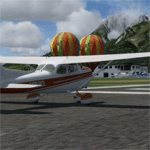
| Category: Flight Simulator 2004 - Scenery | |
| Great Barrier Island Airports |

|
File Description:
Quick scenery for Great Barrier Island's two airports, Claris (Kaitoke) and Okiwi Station. Per request, this scenery includes Great Barrier Air and Mountain Air AI, using Henry Tomkiewicz and Marcel Kuhnt models. Please read the IMPORTANT readme file for the list of Rwy12 Libraries that will need to be installed.
| Filename: | Great_Barrier_Island_Airports.zip |
| License: | Freeware, limited distribution |
| Added: | 26th June 2006, 02:09:49 |
| Downloads: | 1,245 |
| Author: | Rob Diebold |
| Size: | 5.65 MB |
| Category: Flight Simulator 2004 - Scenery | |
| Twenty Papua New Guinea Airports |
|
File Description:
Twenty Papua New Guinea airports set in a rugged country offering
challenging flight. All are imaginary mods. Airports range from coastal tourist resorts to dangerous mountain strips. Most airports feature aircraft displays or other attractions. Docs, Pix, AF2 files & IFR plates included. Requires pngtext3.zip, pngacft3.zip,and Gerrish Gray's Trees.
| Filename: | Twenty_Papua_New_Guinea_Airports.zip |
| License: | Freeware, limited distribution |
| Added: | 29th March 2004, 14:38:48 |
| Downloads: | 3,360 |
| Author: | Adrian Shortall |
| Size: | 5.15 MB |
| Category: Flight Simulator 2004 - Scenery | |
| Chilko Lake CAG3 & Scum Lake CAW3 in British Columbia Canada |
|
Images related to this file:
File Description:
Chilko Lake and Scum Lake are both on the eastern side of the Coast Mountains of British Columbia. Chilko Lake CAG3 is around 30 miles south of Puntzi Mountain and at the northern end of the lake, serving Tsylos Park Lodge, which caters for trekking, horse riding, mountain biking, fishing etc. The runway is 3,200 feet of gravel aligned 18-36 and unlit, at 3,850 feet ASL (above sea level). Scum Lake is around 30 miles southeast of Puntzi Mountain and 25 miles northeast of Chilko Lake. Don't ask me about the name. The airstrip appears to serve a small village and is noted as "private", so perhaps also a lodge operation. The runway is 3,500 feet of gravel aligned 03-21, unlit and at 3,921 feet ASL. I have posted these as a separate scenery, but I suggest that you just add it to your previously created "BC airfields" and avoid the inevitable doubling up of common textures etc. Plus that way you will have just one FS9 library post to do and new airfields will not need yet another posting. Up to you. If you find a defect, email me.
| Filename: | Chilko_Lake_CAG3__Scum_Lake_CAW3_in_British_Columb.zip |
| License: | Freeware, limited distribution |
| Added: | 21st November 2020, 18:24:29 |
| Downloads: | 114 |
| Author: | Roger Wensley |
| Size: | 11.85 MB |
| Category: Flight Simulator 2002 - Scenery | |
| Venezuelan Andes 3-Arc Sec Terrain for FS2002 |
|
File Description:
This freeware add-on file will enhance your VFR Mountain flying experience with Microsoft FS2002. You will enjoy amazing elevation details for the Venezuelan Andes. Please see enclosed picture comparison with actual photograph and terrain mesh coverage. The terrain mesh was created using 3-Arc Second Digital Elevation Model (90 meters/pixel).
| Filename: | Venezuelan_Andes_3Arc_Sec_Terrain_for_FS2002.zip |
| License: | Freeware |
| Added: | 20th January 2023, 01:16:05 |
| Downloads: | 21 |
| Author: | P.Miliani |
| Size: | 3.72 MB |
| Category: Flight Simulator 2002 - Scenery | |
| RCAF Station Holberg |
|
File Description:
This scenery for FS2002 is intended to depict RCAF Station Holberg,(Northern Vancouver Island) a radar station on the Pinetree Line during the 'Cold War'. It does not have a runway but a float plane dock on the Holberg Inlet, a 'townsite' where inhabitants lived and a radar site further up the mountain.
| Filename: | RCAF_Station_Holberg.zip |
| License: | Freeware |
| Added: | 2nd May 2003, 20:57:11 |
| Downloads: | 439 |
| Author: | Al Gay |
| Size: | 4.74 MB |
| Category: Flight Simulator 2004 - AFCAD Files | |
| Kootenay |
|
File Description:
These are AFCAD files for three Kootenay airports, Invermere, Creston and Cranbrook. It also includes ai traffic, but to get all the traffic you must have the PAD dash 8-100, as well as the cdai beech1900d with Central Mountain Air liveries. I also recommend getting the AFCAD files found at www.projectai.com
| Filename: | Kootenay.zip |
| License: | Freeware |
| Added: | 7th September 2004, 14:10:49 |
| Downloads: | 394 |
| Author: | Adam O'Brien |
| Size: | 7.12 KB |
| Category: Flight Simulator 2004 - Scenery | |
| LYVA Valjevo Airport, Serbia - ALPHA |
|
File Description:
Alpha version of Valjevo LYVA sport airfield, Serbia.
Valjevo (LYVA) is an airport in Serbia, near the city of Valjevo and mountain resort Divcibare. It has one grass runway (direction 08/26) that is 1,250 meters long (4,101 ft) and 50 meters wide. The airport is also known as Divci Airport.
| Filename: | LYVA_Valjevo_Airport_Serbia__ALPHA.zip |
| License: | Freeware |
| Added: | 19th August 2010, 14:29:13 |
| Downloads: | 742 |
| Author: | Nikola Jovanovic |
| Size: | 3.71 MB |
| Category: Flight Simulator 2002 - Scenery | |
| Bursa Airport (LTBE) Turkey |
|
File Description:
Bursa is one off the biggest cities of Turkey which located near of famous mountain ULUDAG center of winter sports and ski activity center of the country. Added new scenery obcects and extended runway lenghts for heavy AI aircrafts traffic for to use default scenery off FS2002. Scenery inculiding AFCAD files allso.
| Filename: | Bursa_Airport_LTBE_Turkey.zip |
| License: | Freeware |
| Added: | 12th June 2003, 13:04:59 |
| Downloads: | 2,681 |
| Author: | Salim Unuver |
| Size: | 892.23 KB |
| Category: Prepar3D V1-4 - Scenery | |
| LOIJ |
|
Images related to this file:
File Description:
LOIJ has a beautyfull location within the valley of St. Johann, surrounded by the mountain
“Wilder Kaiserâ€, “Kitzbühler Horn†and the “Lofener Steinbergenâ€. Located close to the bavarian Highlands,
and there fore easy to reach for pilots
I transferred this FSX Version from my x-plane Version with ADE.
| Filename: | LOIJ.zip |
| License: | Freeware |
| Added: | 15th October 2017, 04:22:11 |
| Downloads: | 620 |
| Author: | Karl Malle |
| Size: | 2.13 MB |
| Category: Flight Simulator 2004 - Scenery | |
| 14 Wing Greenwood Nova Scotia, Canada |
|
File Description:
14 Wing Greenwood Nova Scotia, Canada. Home of the CP-140 Aurora and 413 Search and Rescue Squadron. Scenery includes a detailed airport. Version 3 includes the addition of the Primary Search Radar on the North mountain and the removal of the Greenwood Flight Centre and the AVGAS pumping and storage facilities.
| Filename: | 14_Wing_Greenwood_Nova_Scotia_Canada.zip |
| License: | Freeware |
| Added: | 20th December 2005, 15:26:59 |
| Downloads: | 2,057 |
| Author: | Serge Duguay |
| Size: | 1.1 MB |
© 2001-2026 AVSIM Online
All Rights Reserved
Privacy Policy |