
Where Flight Simulation Enthusiasts Gather from Around the World!
AVSIM Library - Search Results

| Category: Prepar3D V1-4 - Scenery | |
| Cascia Peruglia Umbria Italy N42.43.08 E12.00.45 |

|
File Description:
Cascia Peruglia Umbria Italy N42.43.08 E12.00.45 The municipality is located on the border with Lazio (province of Rieti), in the lower province of Perugia, in the low mountain territory, little more than hilly in Valnerina. To the south, the territory extends to higher altitudes towards the Leonessa plateau. The territory of Cascia presents, together with that of Norcia, the highest level of seismicity in Umbria. Throughout history, the town has been the victim of some particularly destructive earthquakes. In addition to the aforementioned catastrophic event of the first century BC we remember those of the autumn-winter of 1300, November 1599 and January 1703. The latter, particularly bloody, caused the death of over 700 people. The city is famous for the beautiful church of Santa Rita da Cascia where they rest the mortal remains of the Saint.
Within the downloaded package you will find readme files for scenery installation. Good fly VFR. Pasquale Marrulli.
| Filename: | Cascia_Peruglia_Umbria_Italy_N424308_E120045.zip |
| License: | Freeware |
| Added: | 4th May 2018, 04:42:41 |
| Downloads: | 155 |
| Author: | Pasquale Marrulli |
| Size: | 115.05 KB |
| Category: Flight Simulator 2004 - Scenery | |
| High Prairie CZHP in Alberta, Canada |
|
Images related to this file:
File Description:
High Prairie is at 1,974 feet asl, 15 miles west of Lesser Slave Lake, 70 miles southeast of Peace River CYPE, and 90 miles east of Grande Prairie CYQU (both already posted). The town has a population of around 2,600 and is based on agriculture, forestry, and oil and gas. The initial impetus behind its growth was the routing of the railroad in 1914. The airport is around 2 miles south of the town, and is fairly basic. There is a single runway just under 4,000 feet of asphalt aligned 07-25. There is a daily flight and around 2010 this was by Central Mountain Air. I believe that there is now a newer terminal building, but a lack of information leaves the older one in place here. There are runway and taxiway lights, unlike some of my recent posts. I made this to fill in the gap between Edmonton and the airports to the northwest such as Grande Prairie.
| Filename: | High_Prairie_CZHP_in_Alberta_Canada.zip |
| License: | Freeware, limited distribution |
| Added: | 9th December 2018, 17:21:09 |
| Downloads: | 123 |
| Author: | Roger Wensley |
| Size: | 3.16 MB |
| Category: Prepar3D V1-4 - Scenery | |
| Morning Star Airport – Cape Town, South Africa |
|
Images related to this file:
File Description:
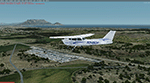
Morning Star airport is situated just north of Cape Town, Next to the N7. A small GA airport with a nice view of Cape Town and Table Mountain and right under the runway 19 approach to FACT. I could not find any official code for the airport, so I called it FAMR. Though I could learn some new skills under the current lockdown, so this is my first attempt at combining most techniques for building an airport, including some hangers and the club house for images I found on the internet. Developed using the P3D V4.5 SDK and tested in P3D V5. Developed to be used with the ORBX OpenLC Africa LC product and I uesd some ORBX library objects.
I included a small update to Robben Island to level the area where the prison is (not sure where it comes from but it is not located in the correct place) and to show the reamains of the old runways on the island.
| Filename: | Morning_Star_Airport__Cape_Town_South_Africa.zip |
| License: | Freeware, limited distribution |
| Added: | 17th May 2020, 17:23:59 |
| Downloads: | 394 |
| Author: | Johan Pienaar |
| Size: | 4.27 MB |
| Category: Flight Simulator 2004 - Scenery | |
| Chilanko Lodge CBX3 in British Columbia Canada version 2 |
|
Images related to this file:
File Description:
This is a revised post of Chilanko Lodge, which is an airstrip that serves the Lodge of the same name on the beach of One Eye Lake. The lake is close to the eastern side of the Coastal Range, 30 miles south of Nimpo Lake and 30 miles west of Puntzi Mountain, both previous posts. There is also a dock for float planes. The runway is 2,900 feet of gravel aligned 10-28, unlit, and at 2,972 feet above sea level. I remade this scenery as I was not very satisfied with the surrounding terrain, and then there was a reported terrain level problem. It is now better than the first time around, in my opinion anyway. I have posted it as version 2 of Chilanko Lodge CBX3, but I suggest that you add this to your "BC airfields" folder as previously suggested. Up to you. If you find a defect, email me.
| Filename: | Chilanko_Lodge_CBX3_in_British_Columbia_Canada_ver.zip |
| License: | Freeware, limited distribution |
| Added: | 20th November 2020, 23:29:53 |
| Downloads: | 80 |
| Author: | Roger Wensley |
| Size: | 8.61 MB |
| Category: Flight Simulator 2004 - Scenery | |
| Just For Fun 1 |
|
File Description:
Here's a little "just for fun" addition to make your GA flying in California a bit more interesting. Moffett Field, Mountain View, CA is a major landmark in the San Francisco Bay area. It is my understanding that NASA now controls this property and may convert all or a part of it to an Aviation Musuem. Microsoft elected to include the two ENORMOUS hangers that apparently were once used by the Navy to store Blimps and train crews. This scenery has the Goodyear Blimp (by Bill Lyons) doing touch and goes - taking off from inside of and landing in one of the immense hangers! Perhaps not very realistic but great fun to watch! Everything is included plus a recommendation to add John Townsend's great Hangar One scenery to the same airport. Works in FS2004 only. Just unzip to a Temp folder and read the simple installation instructions.
Created by David "Opa" Marshall - Plano, Texas
| Filename: | Just_For_Fun_1.zip |
| License: | Freeware |
| Added: | 29th June 2004, 03:00:05 |
| Downloads: | 2,079 |
| Author: | David Marshall |
| Size: | 192.53 KB |
| Category: Flight Simulator 2002 - Miscellaneous Files | |
| Albuquerque Sectional Chart |
|
File Description:
Fly eastbound from Phoenix and visit Area 51 and Roswell (where SETI was "born"), Alamogordo, White Sands National Monument, Trinity Site (where the Manhattan Project tested the first nuclear device), Albuquerque (the state´s capital city), Lincoln County (where Billy the Kid was shot), the Mescalero Reservation (great skiing at Sierra Blanca south of the White Mountain Wilderness Area) and Capitan, Birthplace of Smokey the Bear. Flying VFR in this kind of countryside isn´t easy, as there aren´t all that many landmarks to rely on. Maybe this chart is of some assistance to you. You may use it "as is" without any other software, but it will develop its full potential if used as moving map with SimSystem´s FSFlightMax or FSGarmin. It wouldn´t have been possible to offer this chart without Richard Harvey and his love to flightsimming, so please consider this file to be "donationware" and make a however small contribution to the Richard Harvey Endowed Scholarship.
| Filename: | Albuquerque_Sectional_Chart.zip |
| License: | Check within download |
| Added: | 29th March 2003, 04:15:12 |
| Downloads: | 2,137 |
| Author: | Uwe Rademacher |
| Size: | 15.09 MB |
| Category: Flight Simulator 2004 - Aircraft Repaints, Textures and Modifications | |
| Air Glaciers - HTAI Beech and Mike Cronin Pilatus |
|
File Description:
This package lets you have a Beech holiday in the mountains. Air Glaciers operates Beechcraft King Airs from Sion to various destinations closer to the sea. They are frequent visitors to Corsica across to Krk (Rijeka) from their mountain lair. This package contains three Beech King Air repaints based on the Henry Tomkiewicz AI King Air 200 (4-blade, strakes) and, one they've got you to Sion there are three Pilatus Turbo Porters (based on the Mike Cronin low-poly PC6) to carry you onward into the mountains.
The King Airs have accurate weekly flightplans (plus a few charters) and the Turbo Porters have very simple plans that service nearby airports. The effect at Sion is quite nice. If you want the Turbo Porters to service altiports you'll need to devise your own plans and find a way of landing AI on steep slopes! If you manage that, you can start on the choppers ...
Now I'm going on the piste ... (aka having a beer ...). Enjoy!
| Filename: | Air_Glaciers__HTAI_Beech_and_Mike_Cronin_Pilatus.zip |
| License: | Freeware, limited distribution |
| Added: | 18th February 2005, 20:17:51 |
| Downloads: | 1,756 |
| Author: | Matthew Ministry |
| Size: | 593.1 KB |
| Category: Flight Simulator X - Scenery | |
| CYDA - Dawson Airport - Yukon, Canada |
|
Images related to this file:
File Description:
FSX Scenery - Dawson City Airport (IATA: YDA, ICAO: CYDA) is located 8 nautical miles (15 km; 9.2 mi) east of Dawson City, Yukon, Canada, in the Klondike River valley, and is operated by the Yukon government. It has a terminal building and like most airports in its class, the runway is not paved. The gravel runway is 5,006 ft (1,526 m) long and at an elevation of 1,215 ft (370 m). A number of studies have recommended moving the airport or realigning the runway as it is in a narrow mountain valley. The airport is classified as an airport of entry by Nav Canada and is staffed by the Canada Border Services Agency (CBSA). CBSA officers at this airport can normally handle aircraft with up to 15 passengers, but are equipped to handle daily Boeing 737 charters between Dawson City and Fairbanks (Fairbanks International Airport) during the peak summer tourism season. For your flying pleasure by John B. Loney, Jr.
| Filename: | CYDA__Dawson_Airport__Yukon_Canada.zip |
| License: | Freeware, limited distribution |
| Added: | 7th April 2016, 17:20:42 |
| Downloads: | 910 |
| Author: | John B. Loney, Jr. |
| Size: | 13.92 MB |
| Category: Flight Simulator 2004 - Scenery | |
| Exploring Mt Rainier Natl Park v1.1 |
|
File Description:
Exploring Mt Rainier Natl Park v1.1
UPDATE! Includes missing textures which resulted in some users experiencing CTD and freezes. A complete remapping of Mount Rainier National Park in Washington State. Based upon commercial topographic maps, the designed scenery includes, every hiking trail drawn in meticulous detail including every real life switchback; every lake and small alpine pond 20 feet in diameter and over, modified landclass of alpine, forest & rock; every perennial and many intermittent creeks, all steams and rivers (many braided), a complete glacier mapping of every glacier with custom textures and ice fields on the mountain, a complete mapping of all rock faces and rock, moraine rock deposits, glacier outwash area, mudflows, roads, swamp and marsh areas. Includes some effects. Designed to compliment UT USA and any LOD 9 or 10 mesh. Works well with FS Genesis LOD 10 mesh and Birds Eye View Textures. By Bryan Wallis and Lou Frost.
| Filename: | Exploring_Mt_Rainier_Natl_Park_v11.zip |
| License: | Freeware, limited distribution |
| Added: | 18th February 2006, 23:14:40 |
| Downloads: | 4,154 |
| Author: | Bryan Wallis & Lou Frost |
| Size: | 11.61 MB |
| Category: Flight Simulator 2004 - Scenery | |
| Bora Bora Airport, French Polynesia, NTTB |
|
File Description:
The Bora Bora airport is located on one of the Motus, which surround the Island of Bora Bora. The Motus are raised coral reefs which act as break waters, and create the beautiful turquoise lagoons which surround the French Polynesian Islands. This scenery is a complete remake of the original, and is now much more accurate as to what the airport looks like. It contains the main terminal, a fire station attached to the tower with fuel tanks, open air hangar structures, two helipads, and wood stairs taking you down to the boat docks where you are transported to the main island. This is one of the most unique French Polynesian Islands with it's beautiful and interesting mountain structure. Using the terrain mesh by Rolf Keibel and John Applegate will tremendously enhance this part of the world in FS. It is available at Flightsim under the name fpsimesh.zip. Afcad by Ray Smith is also included.
| Filename: | Bora_Bora_Airport_French_Polynesia_NTTB.zip |
| License: | Freeware |
| Added: | 25th April 2004, 01:39:17 |
| Downloads: | 19,367 |
| Author: | Bill Melichar |
| Size: | 3.11 MB |


© 2001-2026 AVSIM Online
All Rights Reserved
Privacy Policy |