
Where Flight Simulation Enthusiasts Gather from Around the World!
AVSIM Library - Search Results

| Category: Flight Simulator X - Aircraft Repaints, Textures and Modifications | |
| North American T-6 Texan (N3645F) |

|
Images related to this file:
File Description:

The N3645F is a 1943 North American SNJ-5 (C/N 43779) and painted in United States Navy markings originating in the 1950's at Corry Station, Pensacola, Florida. It is owned by Warbird Aviation Rendezvous, Inc. and based in Springfield, Illinois. This is a repaint for the excellent A2A Simulations T-6 Texan. Installation instructions are included.
| Filename: | North_American_T6_Texan_N3645F.zip |
| License: | Freeware |
| Added: | 1st April 2016, 08:16:23 |
| Downloads: | 628 |
| Author: | Tim Scharnhop |
| Size: | 29.82 MB |
| Category: Flight Simulator 2004 - Scenery | |
| Hubschorn Altiport (LSAA) |
|
File Description:
Fictionnal Swiss altiport airfield. Located to 8 nm in the east of Raron (LSMN), in the swiss Alpes (6541fts altitude) .With meteo station, meteo sphere, hangar, house. AFCAD included with 3 small GA parking, 1 helipad and 2 radio frequence (tower & ATIS). Gravel runway (900fts x 55fts). All files included. See the read-me for macro credits.
| Filename: | Hubschorn_Altiport_LSAA.zip |
| License: | Freeware |
| Added: | 23rd August 2005, 12:01:19 |
| Downloads: | 673 |
| Author: | Jean-Jacques Parel |
| Size: | 2.04 MB |
| Category: Flight Simulator 2004 - Scenery | |
| RAF Leeming V2 |
|
File Description:
RAF Leeming in a frontline RAF station that is currently home to F3's and Hawks and a future home for the Typhoon.
Situated in North Yorkshire, NE England this replacement scenery includes the Hardened aircraft shelters, main hangers and
Happy Eater control tower. V2 has a new AF2 file to allow creation of AI traffic.
| Filename: | RAF_Leeming_V2.zip |
| License: | Freeware, limited distribution |
| Added: | 9th August 2005, 18:48:38 |
| Downloads: | 4,273 |
| Author: | Rob Brittain |
| Size: | 3.45 MB |
| Category: Flight Simulator 2004 - Scenery | |
| Princess Juliana Int'l (TNCM) |
|
Images related to this file:
File Description:
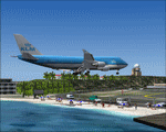
Princess Juliana Int'l Airport, v1.2. Scenery of TNCM, Princess Juliana International Airport of St-Maarten in the Netherlands Antilles. Adds an ILS on runway 9 though in reality Juliana airport is not equipped with this instrument. Adds the weather station, cars on the airport parking, extends the hill near Maho hotel and adds the Juliana heliport. By Delblond Christian.
| Filename: | Princess_Juliana_Intl_TNCM.zip |
| License: | Freeware |
| Added: | 8th June 2022, 00:35:24 |
| Downloads: | 706 |
| Author: | Delblond Christian |
| Size: | 4.76 MB |
| Category: Flight Simulator X - Scenery | |
| NSA - Pine Gap Australia |
|
Images related to this file:
File Description:

Joint Defense Facility Pine Gap is a satellite tracking station in the Australian outback operated by the United States intelligence community. The location is strategically significant because it controls United States spy satellites as they pass over the one third of the globe which includes China, the Asian parts of Russia and the Middle East. Central Australia was chosen because it was too remote for spy ships passing in international waters to intercept the signal. The facility has been described as the ground control and processing station for geosynchronous satellites engaged in signals intelligence collection. JDF Pine Gap is ran by the CIA, NSA, and NRO and is a key location in the global ECHELON surveillance network. Includes a helipad startup location with YPGP ident. Scenery by Jason L. Terry.
| Filename: | NSA__Pine_Gap_Australia.zip |
| License: | Freeware |
| Added: | 16th August 2014, 11:01:35 |
| Downloads: | 544 |
| Author: | Jason L. Terry |
| Size: | 1.21 MB |
| Category: Orbiter - Spaceships | |
| bondVaga_beta1-1.zip |
|
File Description:
bondVaga Space Station
Add-on Description:
This is the beta release V1.1. Feedback and suggestions welcome.
Note: High polygon count (81301 triangles) and textures measuring 512x512. May not be suitable for older machines.
REQUIRES: Vinka's Spacecraft3 dll.
This is a scene study from a novel in progress, and is the version of Titan Werks construction station some forty years after development. The damaged EFT cargo bay (the site of a tug's collision) has been turned into an absurdist shrine to Dali by artist squatters going by the name of the NeoSurrealistCollective.
See release notes for credits, and install-readme.txt for installation instructions.
V 1-0 (fixed scale problem. Now it's the correct size).
V 1-1 (added thrusters for maintaining optimum solar panel position, added simulated running lights, and scenarios)
| Filename: | bondVaga_beta11zip.zip |
| License: | Freeware |
| Added: | 12th February 2008, 22:19:53 |
| Downloads: | 93 |
| Author: | Sean M. Kilpatrick |
| Size: | 5.37 MB |
| Category: Flight Simulator 2004 - Scenery | |
| RAF Swinderby - 1990 |
|
Images related to this file:
File Description:

This scenery represents RAF Swinderby as it was during 1990. Swinderby was the entrance point for all non-commisioned ranks following their entry into the Royal Air Force, where they spent six weeks undertaking basic training.
It was also home to the Chipmunks of the Elementary Flying Training School, where prospective pilots were sent to give them 15 hours introductory flying training before being put into mainstream training. The station was closed in 1993 and now only the flying side of the station exists as warehousing and storage.
Also included are 7 repaints of Mike Cronin's de Havilland Chipmunk in the colours of the EFTS, plus representative flightplans.
The scenery has been constructed using objects mainly from MAIW sceneries, which will need to be installed in order to gain the full visual experince.
| Filename: | RAF_Swinderby__1990.zip |
| License: | Freeware, limited distribution |
| Added: | 1st April 2013, 12:04:43 |
| Downloads: | 1,110 |
| Author: | Brian Clarke, Stewart Pearson, Daryl Payne |
| Size: | 1.93 MB |
| Category: Flight Simulator 2004 - Scenery | |
| Clyde River CYCY & Cape Christian in Nunavut Canada |
|
Images related to this file:
File Description:
Clyde River is a village on the northeast coast of Baffin Island, 250 miles above the Arctic Circle and around 150 miles north of Cape Hooper. It is on the shore of Patricia Bay at the entrance to Cylde Inlet, a fjord which stretches over 60 miles inland. The population is around 880 folks, and it was named by the explorer John Ross in 1818. The airfield is just east of the village and the lighted runway is 3,501' of 100' wide gravel at 87' ASL, aligned 018 True 198 True; "True" as opposed to magnetic in the Northern Domestic Airspace. There are two aprons, one with the new terminal building and one with the old terminal and the garage. Five miles northeast of Clyde River is Cape Christian, where there is a gravel runway around 3,000' long and adjacent to the beach, built to serve what was started as a weather station and later became a LORAN navigation system station. The station is still there, though it was closed some time ago and is now the subject of decontamination work. The runway is usable, though only for light planes as it is a bit rough. First Air and Canadian North are the AI planes visting Clyde River.
| Filename: | Clyde_River_CYCY__Cape_Christian_in_Nunavut_Canada.zip |
| License: | Freeware |
| Added: | 14th July 2011, 20:26:14 |
| Downloads: | 453 |
| Author: | Roger Wensley |
| Size: | 3.33 MB |
| Category: Prepar3D V1-4 - Scenery | |
| Avezzano City and Space Station of Fucino Telespazio Avezzano(L'Aquila) Italy N41.58.43 E13.36.02 |
|
File Description:
Avezzano City and Space Station of Fucino Telespazio Avezzano(L'Aquila) Italy N41.58.43 E13.36.02 has been active since 1963 and today, with its 170 antennas and its 370,000 square meters of surface, is recognized as the first and most important "teleport" in the world civilian uses, Here are satellite orbit control activities, telecommunications, television and multimedia services, with engineers, specialized technicians and operational personnel operating at the COSMO-SkyMed Earth observation satellite observation center and one of the Control Centers (GCCs) that manage the European Galileo Navigation and Location System.In the scenery there is also the town of Avezzano.
Important VFR point for approaching airport Aquila Preturo and Avezzano city.
Within the downloaded package you will find readme files for scenery installation. Good fly VFR. Pasquale Marrulli.
| Filename: | Avezzano_City_and_Space_Station_of_Fucino_Telespaz.zip |
| License: | Freeware |
| Added: | 5th November 2017, 17:47:01 |
| Downloads: | 229 |
| Author: | Pasquale Marrulli |
| Size: | 3.84 KB |
| Category: Flight Simulator 2004 - Scenery | |
| Alternates for Durban Island CWFB FOX-E DEW line station in Nunavut, Canada |
|
File Description:
These are alternative bgls that include a flatten. They will change the shape of the hill that the FOX-E station sits on top of, but they will also make sure that there are no "floating" or "buried" scenery objects. If you are having that problem then just throw these into the scenery folder that you already created when you installed Durban Island, and say Yes! to over-write or whatever the question is. If you have a mesh that is compatible with what I use then you won't be having that problem, so don't do anything.
| Filename: | Alternates_for_Durban_Island_CWFB_FOXE_DEW_line_st.zip |
| License: | Freeware, limited distribution |
| Added: | 1st July 2011, 22:12:35 |
| Downloads: | 266 |
| Author: | Roger Wensley |
| Size: | 353.65 KB |
© 2001-2026 AVSIM Online
All Rights Reserved
Privacy Policy |