
Where Flight Simulation Enthusiasts Gather from Around the World!
AVSIM Library - Search Results

| Category: Prepar3D V1-4 - Scenery | |
| YTUY - Tully airport |

|
File Description:
P3DV4.5 - Tully airport - Queensland - Australia.
Very approximate adaptation of a scenery for Tully Airport - YTUY (Queensland - Australia.
This airport has a paved runway (length=1000m).
Three aircraft locations, including a fuel station.
The scenery also has AI traffic (Piper + Dash 8)
| Filename: | YTUY__Tully_airport.zip |
| License: | Freeware |
| Added: | 15th February 2022, 00:29:53 |
| Downloads: | 92 |
| Author: | Marc Dublain |
| Size: | 754.74 KB |
| Category: Flight Simulator X - AFCAD Files | |
| Tyndall AFB - Panama City, FL (KPAM) |
|
File Description:
Here is an improved version of the stock Tyndall AFB. I added many Military_Cargo and Military_Combat parking spaces. Added an apron to the fire station with fire trucks, added helipads, the water tower, and some taxiways that MS left out.
| Filename: | Tyndall_AFB__Panama_City_FL_KPAM.zip |
| License: | Freeware |
| Added: | 6th May 2008, 03:53:04 |
| Downloads: | 1,320 |
| Author: | Jim Cook |
| Size: | 13.76 KB |
| Category: Flight Simulator 2002 - Aircraft Repaints, Textures and Modifications | |
| Grumman JRF-5 Goose Authentic U.S. Navy textures |
|
File Description:
This file consists of textures only for Mike Stone's Grumman G-21 Goose, available on this server. The colors and markings are authentic. The aircraft depicted was assigned to Naval Air Station Alameda, California and was photographed there in 1949.
| Filename: | Grumman_JRF5_Goose_Authentic_US_Navy_textures.zip |
| License: | Freeware |
| Added: | 18th August 2002, 15:02:29 |
| Downloads: | 643 |
| Author: | Mick Morrissey |
| Size: | 37.15 KB |
| Category: Flight Simulator X - AFCAD Files | |
| MacDill AFB, Tampa, Florida USA (KMCF) v2.2 |
|
Images related to this file:
File Description:
From B-29s to SAC base to headquarters for Central Command and Special Operations Command, MacDill never quits. Completely rebuilt ramps, taxiways, and service roads; parking for aircraft up to C-5B in size. Includes fire station and POL facility.
| Filename: | MacDill_AFB_Tampa_Florida_USA_KMCF_v22.zip |
| License: | Freeware |
| Added: | 14th January 2012, 01:10:47 |
| Downloads: | 913 |
| Author: | Allen Laughmiller |
| Size: | 25.21 KB |
| Category: Flight Simulator 2002 - Utilities | |
| Airport's Chart Viewer v4.0 |
|
File Description:
Airport's Chart Viewer v4.0 is a FS2002 Module that will generate and display a map of all the taxiways (with their ids), gates, parkings,
ILS, and runways of any airport of the FS2002 world. Doesnt need FSUIPC Requires the Manuel's Service Pack 3. Created by Manuel Ambulo
***IMPORTANT NOTE: The Airport's Chart Viewer v4.0 doesnt needs the
FSUIPC for display your current aircraft's position. That is because,
it will gets your aircraft's position information DIRECTLY from your
Microsoft Flight Simulator 2002.
| Filename: | Airports_Chart_Viewer_v40.zip |
| License: | Freeware |
| Added: | 13th June 2004, 21:33:10 |
| Downloads: | 1,709 |
| Author: | Manuel Ambulo |
| Size: | 287.14 KB |
| Category: Flight Simulator 2004 - Utilities | |
| Airport's Chart Viewer v5.0 |
|
File Description:
Airport's Chart Viewer v5.0 is a FS2004 Module that will generate and display a map of all the taxiways (with their ids), gates, parkings,
ILS, and runways of any airport of the FS2004 world. Doesnt need FSUIPC
Requires the Manuel's Service Pack 3. Created by Manuel Ambulo
***IMPORTANT NOTE: The Airport's Chart Viewer v5.0 doesnt needs the FSUIPC for display your current aircraft's position. That is because,
it will gets your aircraft's position information DIRECTLY from your Microsoft Flight Simulator 2004.
| Filename: | Airports_Chart_Viewer_v50.zip |
| License: | Freeware |
| Added: | 13th June 2004, 21:31:57 |
| Downloads: | 20,217 |
| Author: | Manuel Ambulo |
| Size: | 290.49 KB |
| Category: Flight Simulator 2002 - Miscellaneous Files | |
| Active Camera Pro Version 1.3 |
|
File Description:
With this module you can enable supplementary views in Microsoft FS 2002.
Flyby view:
- Customizable flyby view that replaces the tower view
Enhancement of the virtual cockpit view:
- Allows panning and moving with the mouse and/or keyboard
- Adds a head latency effect depending on the aircraft motion
- Adds ground turbulence (aircraft rolling on the runway)
External "Pilot" view:
- Allows walking outside of the aircraft using keyboard commands
- The view can be panned and zoomed with the mouse as well
| Filename: | Active_Camera_Pro_Version_13.zip |
| License: | Freeware, limited distribution |
| Added: | 13th October 2002, 01:55:44 |
| Downloads: | 16,646 |
| Author: | Serge BAYE, Guillaume DARIER, Andy NEWMAN |
| Size: | 200.03 KB |
| Category: Flight Simulator 2004 - Aircraft Repaints, Textures and Modifications | |
| DIAS AIR Embraer 190 |
|
File Description:
These are DIAS AIR International Virtual Airlines (www.diasair.gr) fictional textures for FeelThere PIC E-190 addon. Includes the registrations SX-PRT named "LANTIRN". DIAS AIR is an international virtual company established by an Airline Captain, Pilot Instructor and Examiner, only for hard core members of the Flight Simmers Community. The organization utilizes a sophisticated model for the simulation of the Economical & Technical environment of a real Aviation Company. Our pilot members are paid by an exclusive model using the "OCTANES" payment system, and not only! Our flight operations are global and cover all 5 continents. Our fleet includes many types of aircraft for Microsoft Flight Simulator. FLY WITH US www.diasair.gr
| Filename: | DIAS_AIR__Embraer_190.zip |
| License: | Freeware, limited distribution |
| Added: | 30th October 2008, 03:52:04 |
| Downloads: | 257 |
| Author: | Stathis Tsagaratos |
| Size: | 6.6 MB |
| Category: Flight Simulator 2004 - Scenery | |
| Nicholson Peninsula CWNP & Liverpool Bay CWLB DEW sites in Northwest Territories, Canada |
|
Images related to this file:
File Description:
These are DEW line sites in northern mainland Canada, to the east of Tuktoyaktuk.
Nicholson Peninsula is 100 miles east of Tuktoyaktuk and was not included in FS9. The peninsula is sometimes more like an island than a peninsula as it is barely connected to the mainland and at times is not connected at all (see the current Gogle Earth!). At the northern end there is another long and narrow gravel bar that is formed by the tide and currents and the gravel runway is on the top of this. It is now officially closed, but is still usable. The annual refuelling and maintenance to the NSW station up on the hills is carried out from a barge that lands tanker trucks onto the shore for the drive up the existing gravel roads that have been there since the early DEW station was established.
Liverpool Bay is 50 miles east of Tuktoyaktuk, up on higher land at around 300 feet ASL. The NWS (there was no previous DEW station at this site) is serviced by helicopter from Tuktoyaktuk or from a barge a mile away on the beach. There is a gravel landing pad on the north side of the station. To answer your question, the three little houses on stilts are actually fuel tanks for the generators, shaped to shed snow.
| Filename: | Nicholson_Peninsula_CWNP__Liverpool_Bay_CWLB_DEW_s.zip |
| License: | Freeware, limited distribution |
| Added: | 17th July 2012, 18:55:24 |
| Downloads: | 236 |
| Author: | Roger Wensley |
| Size: | 1.84 MB |
| Category: Flight Simulator 2004 - Aircraft Repaints, Textures and Modifications | |
| US Navy Douglas A-4E (Avionics Hump), VA-94 Mighty Shrikes |
|
Images related to this file:
File Description:
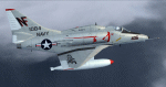
FS9 Douglas A-4E(Hump) Skyhawk US NAVY VA-94. Textures only for US NAVY A-4E VA-94 Mighty Shrikes, August 1970 WestPac cruise (Yankee Station) aboard USS Bon Homme Richard. Requires the Razbam A-4E HB Model. Repaint by Steve Bryant.
| Filename: | US_Navy_Douglas_A4E_Avionics_Hump_VA94_Mighty_Shri.zip |
| License: | Freeware, limited distribution |
| Added: | 11th January 2014, 20:02:44 |
| Downloads: | 72 |
| Author: | Steve Bryant |
| Size: | 8.88 MB |


© 2001-2026 AVSIM Online
All Rights Reserved
Privacy Policy |