
Where Flight Simulation Enthusiasts Gather from Around the World!
AVSIM Library - Search Results

| Category: Flight Simulator X - Scenery | |
| LFMQ - Le Castellet |

|
File Description:
Welcome to Le Castellet Airfield -
This airfield is situated few Nm east of Marseille Provence - LFML, in the south of France. On the 1,000 hectares of plateau he acquired between Marseille and Toulon, Paul Ricard, forever motivated by innovation and development, constructed in 1962 the largest
private airfield in the Provence-Alpes-Côte d’Azur region.
The landing strip at Le Castellet covered a distance of 1,000 metres and allowed for VFR (Visual Flight Rules) operation. Situated on a plateau at the time free of all economic development, it was above all a private airfield. In 1970, the construction
of the Paul Ricard Circuit nearby created an economic dynamic for the first time on Le Castellet plateau. In 1972, Paul Ricard invested in improvements to the runway, lengthening it from 1,000 to 1,750 metres, thus rendering it capable of
receiving business and private airplanes of up to 38 tonnes.
Over twenty years, Le Castellet Airport saw intense periods of activity due to business and private aviation, notably with the arrival of the first F1 French Grand Prix on the Paul Ricard Circuit in 1971, and more recently, with the creation of the Entreprise Zone at Signes, situated only a few kilometres from the airfield. Stop by for an amazing visit at the medieval village as well, situatued on top of a hill.
Nevertheless, from 1972 to 1999, no investment was made at the airfield. In May 1999, the company Excelis S.A. purchased the site (airfield and circuit) and refurbished and modernised the installations.
A truly amazing place to fly to - I have enhanced the entire apron as it is today, all marking correctly set, acces to runway and the Heli area for the "Eggbeater" fan :)
includes the hangar, building and other things around. Hope you'll enjoy your stay at "Le castellet"!
| Filename: | LFMQ__Le_Castellet.zip |
| License: | Freeware |
| Added: | 24th April 2009, 16:28:59 |
| Downloads: | 2,351 |
| Author: | Daniel Louvet |
| Size: | 986.65 KB |
| Category: Flight Simulator 2004 - Scenery | |
| Tuktoyaktuk CYUB in Northwest Territories, Canada |
|
Images related to this file:
File Description:
Tuktoyaktuk is on the northern coast of Canada, 70 miles north of Inuvik and to the east of the Mackenzie River delta. It has a population of around 900 and because of its natural harbour is a centre for oil exploration activity on the surrounding land and on the Beaufort Sea, with sizeable but now under-used yards dating back to the peak of activity in the late 1970's. On land work is restricted to the winter half of the year, as only the freeze-up makes it possible to move on land with heavy equipment, and during the winter further supples are driven over an ice road from Inuvik up to Tuk. The ice-free summer months are used for floating equipment from Yuk along the coast on barges and then up the rivers to inland sites in preparation for the winter activity. Before the oil there was a DEW line station here, and there is still an automated station on the same site and included here, as are the yards. The airfield is on the coast close to the town and the yards, at 15' ASL. The gravel runway 09/27 is 5,000' feet long and 150' wide; both thresholds are displaced by 200', but of course there are no markings on the gravel. The large apron is on the north side at the centre of the runway and is large enough to accomodate several large planes. Inuvik revised should be installed first, now Tuk, then last of the three Sachs Harbour which has AI for Aklak Airlines flights (operated by Kenn Borek) for all three airfields. There is a separate AI file included here, featuring freight delivery by Buffalo Airways and small planes.
| Filename: | Tuktoyaktuk_CYUB_in_Northwest_Territories_Canada.zip |
| License: | Freeware, limited distribution |
| Added: | 14th May 2012, 17:19:20 |
| Downloads: | 621 |
| Author: | Roger Wensley |
| Size: | 8.99 MB |
| Category: Flight Simulator 2004 - Scenery | |
| Grande Prairie CYQU in Alberta, Canada, Updated |
|
Images related to this file:
File Description:
This is a new version of the original post from March 2014, made in 2018. It was made mainly to provide some missing textures, but has been modified to also add parked trucks and floodlights to the de-icing area (the floodlights are inoperative as they will not be on when there is no de-icing in progress) and also street and car parking lighting, a few more parked planes, and some further objects on the terminal apron area. The runway approach lighting was also corrected; moving the airport so that the ILS on 29 did not coincide with the roads would have been nice, but meant too many complications at this stage. The scenery is complete in itself and can be installed as-is if you do not have the original post. Grande Prairie is at 2,195 feet asl, 65 miles southeast of Dawsons Creek, 90 miles southwest of Peace River and around 60 miles east of the Rockies. The town has a population of around 55,000 and growing. The name comes from the wide expanse of prairies all around the town, and there is also a large forested area to the southwest leading up to the Rockies which supplies raw material for industries in the town. The airport is just to the west of the town. It was originally a military base, built during WW2. The two runways are 07-25 and 11-29 and 6,200 and 6,500 feet respectively, both 200 feet wide; runway headings had changed by 2010 in real life but take this as it was in 2008. When one is the active runway then the other is used as a taxiway. Taxiway A is very wide with in real life a repaired central section marked out for use.
| Filename: | Grande_Prairie_CYQU_in_Alberta_Canada_Updated.zip |
| License: | Freeware, limited distribution |
| Added: | 13th December 2018, 04:12:11 |
| Downloads: | 210 |
| Author: | Roger Wensley |
| Size: | 34.97 MB |
| Category: Flight Simulator 2004 - Scenery | |
| Kuujjuarapik CYGW in northern Quebec, Canada |
|
Images related to this file:
File Description:
Kuujjuarapik is in northern Quebec at the southern end of Hudson Bay, 90 miles east of James Bay and on the north shore of the Great Whale River; Kuujjuarapik means Small Great River in Inuktitut. Once again the Hudson Bay trading post that opened (in 1820) was the catalyst for the establishment of first a seasonal encampment and then the beginnings of a town in the late 1930's.
The two adjacent villages that now form the town have a total population (mainly Cree and Inuit) of around 1,500. When the Quebec hydo-electric project was under construction in the early 1980's a large portion of the Inuit population voted to move to a new settlement called Umiujaq (my post) 100 miles to the north.
The airport is to the west of the town, between the town and the sea. The gravel and sand runway (which I have made as gravel as there is no convincing way to mix the two) is 5,500 feet long, 150 feet wide, and aligned 17/35, which is approximately parallel to the coast. There is fuel available, both 100LL and JetA, delivered by truck. The AI included here is for Air Inuit and Wasaya, with Air Inuit making three flights per day plus a fourth flight by the Air Inuit Twotter C-GNDO that is based at the airport, and private flights by various aircraft. Yes, there really is a golf course to the south of the airport, and the last thing to note is that Kuujjuarapik has a mandatory radio frequency and that taking into consideration the scheduled flights I have included the tower radio frequency that makes this a controlled airport in FS9.
| Filename: | Kuujjuarapik_CYGW_in_northern_Quebec_Canada.zip |
| License: | Freeware, limited distribution |
| Added: | 16th February 2013, 00:33:20 |
| Downloads: | 311 |
| Author: | Roger Wensley |
| Size: | 2.8 MB |
| Category: Flight Simulator X - Scenery | |
| EDCB - Ballenstedt Airport - Sachsen-Anhalt, Germany *Version 1* |
|
Images related to this file:
File Description:
The airfield Ballenstedt is located in the eastern foothills of the €œHarz (North German low mountain range) and with twenty thousand aircraft movements per year a relatively highly frequented airport.
The scenery is designed very much in detail. All important objects have been created by me using photos of the original field. Also some clearly visible landmarks are integrated like the large photovoltaic arrangement north of the asphalt runway and the quite large pig farm “Asmusstedt†situated east of the field. An additional important point of reference for glider pilots is the so-called "Gegenstein", a narrow rock on top of the small hill south of the Gliderfield. A retouched photo background, covering all four seasons, completes the scenery.
However, many smaller Objects, like people, cars or static airplanes in this scenery were
taken from three popular freeware libraries for whose use I got the friendly permission of the
authors. If these libraries are not installed , many objects are not visible!
The following libraries are used:
--------------------------------
1. FS-Piloten_Objektlibrary: http://www.fs-piloten.de/thread.php?threadid=1063
2. FSX_FlightPortLib: http://www.flightport.de/libraries/flightport-library/
3. 3d People Library: http://library.avsim.net/download.php?DLID=192454
| Filename: | EDCB__Ballenstedt_Airport__SachsenAnhalt_Germany_V.zip |
| License: | Freeware |
| Added: | 1st May 2016, 21:00:27 |
| Downloads: | 1,369 |
| Author: | Wolfgang Allers |
| Size: | 272.19 MB |
| Category: Flight Simulator 2004 - Original Aircraft | |
| Lockheed EP-3E Aries II |
|
Images related to this file:
File Description:
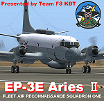
FS2004 Lockheed EP-3E Aries II, a turboprop-based signals reconnaissance aircraft, operated by the United States Navy. It is based on a Lockheed P-3 Orion airframe, which is in turn based on the Lockheed L-188 Electra passenger airliner. There are eleven EP-3Es in the Navy's inventory, the last of which was delivered in 1997. A total of twelve P-3C aircraft were converted to replace older versions of the aircraft, which had been converted in the late 1960s and early 1970s.
On April 1, 2001, an EP-3E (PR-32) was intercepted by Chinese F-8 fighter jets about 70 miles off the Chinese island of Hainan. One of the Chinese jets bumped the wing of the EP-3E, which was forced to make an emergency landing in China. VQ-1 provides electronic reconnaissance from the east coast of Africa to the west coast of the United States. The squadron maintains a permanent detachment in Misawa Japan and has maintained a continuous presence in the Arabian Gulf since July 1992.
The model is the seventh P3 series aircraft by Team FS KBT. This model was made with Gmax. By Team FS KBT
| Filename: | Lockheed_EP3E_Aries_II.zip |
| License: | Freeware |
| Added: | 10th April 2010, 08:39:01 |
| Downloads: | 6,975 |
| Author: | Team FS KBT |
| Size: | 31.24 MB |
| Category: Flight Simulator 2004 - Sounds | |
| ATC Voices - Airline Call Signs set 24 |
|
File Description:
A collection of 13 new or corrected airline callsigns, for use with
Flight Simulator 2004 or 2002. Installation requires the
EditVoicepack software
(see http://bevelstone.xs4all.nl/FlightSimulator/EditVoicepack) by Lars
Møllebjerg which is also available free download from the usual Flight
Simulator download sites such as Avsim.
The callsigns included here represent a range of airlines around the
world for which flightplans and/or aircraft are available. They are:
ADRIA: Adria Airways (Slovenia) - improved,
AIRES: AIRES - Aerovias de Integracion Regional (Colombia) - improved,
CARZAM: Phoebus Apollo (Zambia),
CREOLE: Halcyon Air Cabo Verde (Cape Verde Islands),
CUTE: Island Aviation (Maldives),
EASTERN SKYJETS: Eastern Sky Jets (UAE),
E-WING East Wing (Kazakhstan),
FLYING OLIVE: Aerodynamics Malaga (Spain),
FLYLINK: Flylink Express (Spain),
STARSAWAY: Stars Away Aviation (South Africa),
TAT: Tat European Airlines (France) - improved,
TRANS MALDIVIAN: Trans Maldivian Airways (Maldives), and
VIP TAXI: VIP Air (Slovakia).
All of these callsigns have been cross-checked with reliable sources -
I do not create non-existent callsigns for badly compiled AI packages for
it is obviously more sensible to correct the mistakes in those packages.
If you are familiar with EditVoicePack to do not need to read the
readme.txt file very carefully, in block capitals or indeed at all,
just import these files like you usually do.
| Filename: | ATC_Voices__Airline_Call_Signs_set_24.zip |
| License: | Freeware |
| Added: | 10th December 2008, 08:11:06 |
| Downloads: | 2,609 |
| Author: | John Hinson |
| Size: | 11.2 KB |
| Category: Flight Simulator 2004 - Scenery | |
| Alaska South Slope 10; Port Clarence KPC |
|
Images related to this file:
File Description:
There are four main northwestern Alaska towns which are serviced by Alaska Airlines, and from which local flights spread out. The northernmost is Barrow. Southwest of Barrow is Kotzebue, then Nome, and the furthest south is Bethel (not yet made). This is the third in a series for local flights from Nome, and it is on the coast around 40 miles east of Wales, and 65 miles northwest of Nome. There are two other airfields around a large lagoon that is almost totally enclosed from the sea, and Port Clarence is on the end of the enclosing spit. Port Clarence was, until the LORAN navigation system went out of use, a Coastguard Station that had a LORAN transmitter, with an impressive mast that was 1,350 feet tall. It "was" as the mast was demolished in 2010, after the LORAN systems had been closed down in stages (LORAN-A in 1980 in the US, LORAN-C in 2010). In the meantime the runway had been lengthened to around 8,500 feet, and continued to be used by the Coastguard. Port Clarence has a population of 24, in theory, though presumably the census information refers to Coastguard personnel in the buildings of the LORAN station. The date for this scenery is anytime you like so long as it is before 2010 as the mast is still there. The AI includes Coastguard C-130 Hercules and helicopter flights, plus a weekly fuel delivery by Everts Air Fuel in a fancy colour scheme (Wednesday) and a daily visit by Bering so Coast Guards can go to civilisation in Nome.
| Filename: | Alaska_South_Slope_10_Port_Clarence_KPC.zip |
| License: | Freeware, limited distribution |
| Added: | 23rd October 2016, 18:53:14 |
| Downloads: | 232 |
| Author: | Roger Wensley |
| Size: | 3.05 MB |
| Category: Flight Simulator X - AFCAD Files | |
| Blairstown Airport (1N7), NJ |
|
File Description:
Located 02 miles SW of Blairstown, New Jersey on 151 acres of land, Blairstown Airport is privately owned by J.D. Air Inc. and is home to a moderate number of small GA planes and gliders. This scenery is not completely up to date, as the MegaScenery Earth textures themselves are outdated. Missing are the added taxiway/parking lot north of the existing north taxiway as well as the second hangar area to the north that it leads to. Parking is available on the south tarmac but if that's all taken there is room just to the west in the taxiway offshoot. Also room on the grass, although stay south of the windsock to avoid interfering with glider operations. Glider pilots that wish to start on the grass, select either Runway East or Runway West. Fuel is available by stopping near the gas tank on the south tarmac.
Scenery constructed with use of satellite images/streetview, the author has not been there in person.
This scenery is meant to be used in conjunction with MegaScenery Earth New York 007. It is not required, but apron use is minimized to allow satellite scenery to show through as much as possible, and objects are placed based on the MSE textures - lack of it may make scenery look out of place.
| Filename: | Blairstown_Airport_1N7_NJ.zip |
| License: | Freeware |
| Added: | 8th October 2010, 20:22:59 |
| Downloads: | 247 |
| Author: | Drew Sikora |
| Size: | 576.39 KB |
| Category: Prepar3D V1-4 - Aircraft Repaints, Textures and Modifications | |
| Hunting Percival Sea Prince Belgian Air Force (RM-7) |
|
Images related to this file:
File Description:
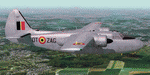
This folder contains a repaint for the Percival Sea Prince by Rob Richardson, in the colors of RM-7 of the Belgian Air Force, in the paintscheme it wore in its first year of service. In 1953 the Belgian Government ordered 12 Percival Pembroke's through Contract N° SP140 as a replacement for the ageing Avro Anson.The aircraft was used for short-range transport and liaison flights. Between 1956 and 1957 several brand-new Pembrokes were stored at Wevelgem awaiting a future detachment to the Belgian Congo, which eventually never materialised.
A number of Pembrokes were also used for the benefit of the Belgian National Geographical Institute that used the aerial photographs obtained with the Pembrokes to produce very detailed maps of the country. In 1978 the Pembrokes were struck of charge after their replacement, the Swearingen Merlin III became operational. All but two Pembrokes were sold to the rather dark company Air America (not to be confused with the CIA-supported Air America that was operational in South-East Asia), which was owned by a drugsdealer. After some very adventurous carreers in Souith America, several former Belgian Pembrokes were acquired and preserved in the USA. RM-7 is preserved in Belgium at Melsbroek air base by the Dakota Historical Center 15th Wing. Repaint by Jan Kees Blom, based on the paintkit by Rob Richardson.
| Filename: | Hunting_Percival_Sea_Prince_Belgian_Air_Force_RM7.zip |
| License: | Freeware |
| Added: | 5th August 2020, 19:14:00 |
| Downloads: | 46 |
| Author: | Jan Kees Blom |
| Size: | 7.83 MB |


© 2001-2026 AVSIM Online
All Rights Reserved
Privacy Policy |