
Where Flight Simulation Enthusiasts Gather from Around the World!
AVSIM Library - Search Results

| Category: Flight Simulator 2002 - Original Aircraft | |
| Commander 114TC Package |

|
File Description:
The Commander 114TC is Commander Aircraft Company's revision on the venerable Rockwell Commander 114. The aircraft is fast, manuverable, and overall reliable. This package includes an all new Commander 114TC panel and an aircraft model. Also comes with extended documentation in a seperate zip.
| Filename: | Commander_114TC_Package.zip |
| License: | Freeware, limited distribution |
| Added: | 25th July 2002, 18:25:05 |
| Downloads: | 10,171 |
| Author: | Panel by Scott Jensen and Tim Pinkawa, Visual Model by Brian Gladden, and flight model by Michael Verlin and modified by Brian Gladden |
| Size: | 5.06 MB |
| Category: Flight Simulator 2004 - Scenery | |
| Arctic Runway Signs in the "Northern Domestic Airspace", Canada |
|
Images related to this file:
File Description:
These are scenery bgl's to replace those previously posted for Cape Dorset, Gjoa Haven, Igloolik, and Whale Cove. All of these airfields are within what is marked on the chart as "Northern Domestic Airspace" and their runway signage is not given as a magnetic bearing but as a true bearing. This is because at those latitudes, close to magnetic north, the magnetic field is more vertical than horizontal and magnetic readings become unreliable. Planes report their course as a true course, and fly at a height that reflects their true course instead of their magnetic course. The picture shows the runway sign for Qikiqtarjuaq CYVM (which used to be called Broughton Island) which I am working on right now, and I realised that my training was so far behind me that I had forgotten all of the above. The boundary line of the two air spaces is not a straight line; the furthest south it reaches is on the west coast of Hudson Bay just north of Churchill. To the east it passes through the southern end of Baffin Island, and to the west it is north of the coast at the Alaskan border, and there is an illustration included here.
| Filename: | Arctic_Runway_Signs_in_the_Northern_Domestic_Airsp.zip |
| License: | Freeware, limited distribution |
| Added: | 11th June 2011, 03:06:36 |
| Downloads: | 308 |
| Author: | Roger Wensley |
| Size: | 1.21 MB |
| Category: Prepar3D V1-4 - Aircraft Repaints, Textures and Modifications | |
| Douglas C-54 NGAT NL-302 |
|
Images related to this file:
File Description:
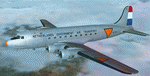
This folder contains a repaint for the Douglas C-54 / DC-4 by Flight Replicas. It shows Douglas C-54A NL-302 of the Netherlands Government Air Transport, 1945. This was originally 42-72274 of the USAAF, which was bought by the Dutch Government in 1945 in a batch of 14 C-54's. These were converted to carry passengers. Although the aircraft were carrying military markings, they were in fact carrying passengers for KLM, among others to the Dutch East Indies. Since civilian aircraft were not always permitted to fly along this route immediately after the war they wore military paint. In 1947 all aircraft were transferred to the KLM and NL-302 became PH-TAD. It later flew with several European companies with registration F-BDRJ, before being scrapped in 1965. Repaint by Jan Kees Blom, based on the paintkit by Flight Replicas.
| Filename: | Douglas_C54_NGAT_NL302.zip |
| License: | Freeware |
| Added: | 13th July 2018, 20:23:31 |
| Downloads: | 100 |
| Author: | Jan Kees Blom |
| Size: | 57.64 MB |
| Category: Flight Simulator X - Scenery | |
| NZGA- Galatea Aerodrome (VectorLandClass, New Zealand) |
|
Images related to this file:
File Description:
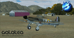
Welcome to Galatea (ICAO: NZGA), a gateway to exploring the Urewera ranges and the east coast of New Zealand. Galatea is a small and basic airstrip with only one old hanger, a public toilet and a small clubhouse on a wide plain surrounded by native bush and pine plantation near Murupara in the Bay of Plenty of New Zealand. It is a grass strip of 1025m length and 60m width and aligned 01/19 with a group rating of 8. No night lighting or fuel is available.
The FSX model includes custom textures and models placed on an aerial image. It makes extensive use of items from the free VLC object libraries which are required to be installed (download from www.vectorlandclass.co.nz downloads menu). This scenery and the VLC libraries have been funded
by sales of VectorLandClass and although you do not need VLC to use it, your purchase helps further development.
To the south west of Murupara township and sawmill is the LakeLand Helicopters base which just fits onto the photo-real coverage. Library objects have been placed here although they may not be accurate as the site was not visited when taking reference photos. This airfield makes a great stop over when flying between Rotorua, Mount Tarawera, Whakatane or Gisborne.
We hope you enjoy exploring the area!
| Filename: | NZGA_Galatea_Aerodrome_VectorLandClass_New_Zealand.zip |
| License: | Freeware, limited distribution |
| Added: | 15th November 2012, 23:35:42 |
| Downloads: | 1,127 |
| Author: | Tim Barnes / VectorLandClass |
| Size: | 45.7 MB |
| Category: Flight Simulator 2004 - Scenery | |
| Squamish CYSE in British Columbia Canada |
|
Images related to this file:
File Description:
Squamish is a town with a population of just under 20,000, located at the northern end of Howe Sound where the Squamish River reaches the sea. Howe Sound is 25 miles deep and around 10 miles northwest of downtown Vancouver. It was for years based on the surrounding timber and a pulp mill, but with the closure of the saw and pulp mills now is more tourist oriented and the escape for Vancouver residents looking for (relative) peace and quiet. The runway is 2,400 feet of asphalt aligned 14-32. The buildings are built on differing levels of terrain, and the taxiways are sloped access ramps between the levels. This, of course, cannot be replicated in FS9, but it explains what at first sight appears to be a strange layout. The buildings are fairly well replicated. This is not an airport, it is an airfield meant for summer use as there is no lighting of any sort for runway or taxiways. The AI includes both GA and the helicopter flights by the two companies with bases at Squamish, Black Tusk and Blackcomb, the latter having several bases in this area with a HQ in Whistler. If you have the Vancouver scenery by FSAddon then you will need to move some of their bgl's aside; there are screenshots so that you can see which ones I have relocated. The UT settings are optional; I have been asked for my personal preferences. If you find a defect, email me.
| Filename: | Squamish_CYSE_in_British_Columbia_Canada.zip |
| License: | Freeware, limited distribution |
| Added: | 16th November 2020, 19:15:12 |
| Downloads: | 125 |
| Author: | Roger Wensley |
| Size: | 15.9 MB |
| Category: Flight Simulator 2004 - Scenery | |
| Camden Field in Trinidad |
|
File Description:
Camden Field was once a wartime American airfield, which shows up in the wide east-west runway that has more recently been partly resurfaced. There are no runway markings beyond a centre line, and it just sort of tapers off at the sides and the eastern end into the bush. In contrast to the renovated hangar to the north of the western end of the runway the buildings to the south haven't been touched by any recent tender-loving-care. There is a wonderful patched-together shed and a small control tower, which was built on the edge of the existing runway. This makes it appear rather close to the edge of the resurfaced runway area. Do not be fooled, this is not an illusion; it IS close to the edge of the runway. Just take comfort in the thought that the prevailing southeast winds (for much of the year) will tend to blow you away from it as you approach for a landing from the west. And I kept the pre-renovation version of the old hangar when I found some old pics of the crop dusting operation from five years ago.
| Filename: | Camden_Field_in_Trinidad.zip |
| License: | Freeware |
| Added: | 14th December 2008, 01:32:05 |
| Downloads: | 536 |
| Author: | Roger Wensley |
| Size: | 2.73 MB |
| Category: Flight Simulator X - Helicopters | |
| Royal Australian Navy Eurocopter AS350 N22-017 |
|
Images related to this file:
File Description:
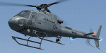
Textures for Nemeth FSX AS 350 as Royal Australian Navy N22-017, Delivered 24/03/84. RAN Code: 27,864. Served with FFG02, HMAS Canberra Flight - dates unknown, but was still painted in blue/white scheme. Served aboard HMAS Success during and after Gulf War 1990. These aircraft were modified to take a 7.62mm machine gun in the cabin doorway. Callsign TAIPAN 64, was embarked in HMAS DARWIN during 1991 for that ship's 'DAMASK 3' deployment, shortly after the Gulf War. It was airborne at the time of the ship's engine fire and could not recover to the ship until the Flight Deck had been cleared of debris ejected through the funnel during the initial explosion in the ship's engine unit. Following recovery, the aircraft was refuelled and flew ship's engineering staff to Bahrain, returning with USN FFG Engine specialists. During the deployment 864 never missed a mission through unserviceability. An engine change was performed whilst alongside in Bahrain, and the aircraft passed the subsequent check test flight first time. Named 'Barney Gumble' in 1998. Onboard HMAS ANZAC during Operation WARDEN, East Timor 1999/2000 - however it hardly flew due to engine problems. In Service 723 Sqn RAN.
| Filename: | Royal_Australian_Navy_Eurocopter_AS350_N22017.zip |
| License: | Freeware |
| Added: | 1st January 2012, 02:56:15 |
| Downloads: | 269 |
| Author: | Matt Levi |
| Size: | 11.84 MB |
| Category: Flight Simulator 2004 - Scenery | |
| Mackar Inlet CWMI in Nunavut, Canada |
|
Images related to this file:
File Description:
Mackar Inlet was a DEW line Auxiliary Station on the west shore of the Melville Peninsula, which is part of the northern Canadian mainland. The station was closed only in 1992, so it is relatively intact. Hall Beach is 120 miles to the east, on the eastern shore of the peninsula, and Kugaaruk is just over 100 miles to the west. The runway is still in good condition and is around 3,800 feet of gravel 110' wide, aligned 164T/344T and at 100 feet ASL. The station buildings are up on the hill at 1,350 feet ASL and 5 miles to the south. None of these DEW line stations are particularly impressive or even interesting. However, you can bet that any pilot flying regularly in the north along the coast knows where all these runways are, in case one of them suddenly becomes his favourite in the whole world just after the sudden silence. I should have mentioned a long time ago that to see the apron lights working (on my fields that HAVE apron lights) requires you to have the "lights_ss_v2" by Sidney Schwartz installed.
| Filename: | Mackar_Inlet_CWMI_in_Nunavut_Canada.zip |
| License: | Freeware, limited distribution |
| Added: | 2nd December 2012, 17:58:34 |
| Downloads: | 217 |
| Author: | Roger Wensley |
| Size: | 1.16 MB |
| Category: Flight Simulator X - Scenery | |
| RAF Catterick |
|
File Description:
RAF Catterick is located alongside the A1 on the outskirts of Catterick Village. Operationally it falls under the command of Catterick Garrison. It currently houses 5th Regiment Royal Artillery and 32 Engineer Regiment.
Catterick airfield first opened in 1914 as a Royal Flying Corps aerodrome with the role of training pilots and to assist in the defence of the North East of England. It came under RAF administration in 1918 and housed Number 49 Training Depot.
In 1927, it temporarily came under the administration of the British Army, under the Army Air Co-Operation Command which would supply the army with any air support needs that would be required. This continued until 1939 when the station was handed back to the RAF.
During the Second World War, the airfield operated a small satellite station called RAF Scorton near the village of Scorton.
Catterick's runway could not be extended from its existing 3,350 ft (1,020 m) for the jet age due to the perimeter being bounded by the Great North Road (A1) and the River Swale. Therefore, Catterick's importance declined after the Second World War, though it still housed training institutes for many years.
Source:Wikipedia
| Filename: | RAF_Catterick.zip |
| License: | Freeware |
| Added: | 18th February 2017, 19:17:37 |
| Downloads: | 128 |
| Author: | Terry Boissel |
| Size: | 1.91 MB |
| Category: Flight Simulator X - Scenery | |
| The French Polynesia Tuamotu Archipelago Scenery X Part B (Tuamotu-X_B) |
|
File Description:
FSX Scenery FRENCH POLYNESIA TUAMOTU ARCHIPELAGO SCENERY Part B
This scenery improves specific area (Tuamotu Archipelago) of FSX.
The archiperago scattered in the northeast of Tahiti island is composed of 78 islands.
I reproduced the 52 islands in the archipelago as add-on senery.
They are islands like a beautiful necklace sprinkled in the tropical ocean.
The French Polynesia Tuamotu Archipelago Scenery X Part B (Tuamotu-X_B)
includes east side of the whole archipelago because of the file size.
This scenery requires Tuamotu-X_A scenery (fpta-xa.zip).
Please be sure to download the Tuamotu-X_A.
When the Tuamotu-X_A scenery is installed together with this scenery,
the huge Tuamotu Archipelago including all of "The Chain Islands" will appear.
By Kazuo Kawamura
| Filename: | The_French_Polynesia_Tuamotu_Archipelago_Scenery_X.zip |
| License: | Freeware, limited distribution |
| Added: | 27th February 2010, 07:38:01 |
| Downloads: | 11,012 |
| Author: | Kazuo Kawamura |
| Size: | 78.1 MB |


© 2001-2026 AVSIM Online
All Rights Reserved
Privacy Policy |