
Where Flight Simulation Enthusiasts Gather from Around the World!
AVSIM Library - Search Results

| Category: Flight Simulator X - Scenery | |
| OMDB - Dubai Intl Airport - Dubai, UAE |

|
Images related to this file:
File Description:
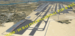
OMDB - GPS-accurate scenery based om Google maps and the FlyTampa base AFCAD (default FSX/P3D AFCAD). Every Runway, Gate and taxiway is right on the actual spot with a very small error margin.
Two types of Jetway structures used for Terminals 1 & 3, and are made by Victor Nauta. The new Concourse-D terminal for airlines other than Emirates is now added, with a basic terminal building design using Google Sketchup for better visuals.
WHAT'S NEW:
- The new Concourse-D terminal east of the existing Terminal 1. Terminal replaces the old Emirates Sky Cargo terminal, and servers all other visiting airlines.
- Apron Q used by FlyDubai is added.
- Extra runway rapid exits added.
- Extra parking gates in the C apron according to the latest charts.
- Extra Taxiways connecting to the runways according to the charts.
- Ground marking for Gates and taxiways! (A, B, C, D and F aprons)
- Aprons G and S are added according to the latest Airport layout and charts.
| Filename: | OMDB__Dubai_Intl_Airport__Dubai_UAE.zip |
| License: | Freeware, limited distribution |
| Added: | 25th July 2016, 20:17:21 |
| Downloads: | 10,981 |
| Author: | Ahmed Abdessalam |
| Size: | 4.16 MB |
| Category: Prepar3D V1-4 - Scenery | |
| Piarco International Airport - TTPP V1.2 |
|
File Description:
TTPP v1.2 - In this version, problems with markings in tax lanes have been fixed. The textures of the taxi stands have also been redone. More vehicles and vegetation were included.
Piarco International Airport (IATA: POS, ICAO: TTPP) is an international airport serving the island of Trinidad and is one of two international airports in Trinidad and Tobago. The airport is located 30 km (19 mi) east of Downtown Port of Spain, located in the adjacent town of Piarco. It is the seventh busiest airport in the Caribbean in terms of passengers served[6] and third busiest in the English-speaking Caribbean, after Sangster International Airport and Lynden Pindling International Airport. The airport is also the primary hub and operating base for the country's national airline, as well as the Caribbean's largest airline, Caribbean Airlines.
Piarco International Airport has direct scheduled service to destinations in the United States, Canada, Central America, South America and Europe. It is also a significant transit hub for the Southern Caribbean and serves as the primary connection point for many passengers travelling from Guyana.
| Filename: | Piarco_International_Airport__TTPP_V12.zip |
| License: | Freeware |
| Added: | 4th February 2022, 03:49:10 |
| Downloads: | 560 |
| Author: | Eduardo Puelker |
| Size: | 53.65 MB |
| Category: Flight Simulator 2004 - Scenery | |
| Grande Cache CEQ5 in Alberta, Canada |
|
Images related to this file:
File Description:
Grande Cache is at 4,117 feet above sea level, just under 90 miles south of Grande Prairie and 220 miles west of Edmonton. It is among the eastern foothills of the Rockies. The town was established to accommodate employees of a coal mine and their families in the early 1970's. There was a financial roller coaster ride for the coalmine during the next few years and despite the opening of a wood chip plant and a federal prison the town was eventually downgraded to a hamlet by a vote in 2018, as it was essentially bankrupt and had a population of less than 4,500. The airport, some 10 miles east of the town, had two aprons, one for GA and scheduled flights and another, the eastern one, for fire fighting planes. I say "had" as it was closed in January 2017. However, the fire fighting area appears to have been maintained (tanks repainted, for instance) and is presumably able to support operations if required. The date for this scenery is 2009.
| Filename: | Grande_Cache_CEQ5_in_Alberta_Canada.zip |
| License: | Freeware, limited distribution |
| Added: | 29th September 2021, 03:59:20 |
| Downloads: | 89 |
| Author: | Roger Wensley |
| Size: | 7.49 MB |
| Category: Flight Simulator 2004 - Scenery | |
| Chennai airport for fs9/Fs2004 |
|
File Description:
Hi everyone
This is my first project, and it took 6 months to complete. This is a freeware airport, but I have tried to put in as much detail as I possibly can. I made this airport because FS9 did not have very many good-quality payware or freeware airports, so I decided to make an airport for my home country. Some general info for the airport is below:
Chennai International Airport (MAA), located in Meenambakkam, is the primary airport serving Chennai, Tamil Nadu, and the southern part of India. It has two terminals: Terminal 1 for domestic flights and Terminal 2 for international flights. The airport is known for its modern infrastructure and facilities, including shopping areas, lounges, dining options, and passenger services. It is an important hub for domestic and international travel, especially for travelers heading to South Asia, Southeast Asia, and the Middle East. The airport also has strong connectivity via road and metro.
Features of the scenery:
1)Has the latest terminal and airport layout since I used the latest data
2)added buildings to the surroundings (Custom 3d model made from scratch even the terminals)
3)has partial photoreal scenery(will talk about issues in bugs area)
4)has good jetbridges
5)3d volumetric grass in certain parts(will talk about issues in bugs area)
6)taxiways designed as in real life
7)Includes parked cars, lights, nearby buildings
8)Added lots of ground equipment
9)Trees around the airport
10)airport perimeter walls
11)Used Lh simulations library for some buildings and volumetric grass
Known bugs:
1)photoreal scenery has some issues since I can't get my photoreal scenery maker to work properly
2)Papi lights are kinda bugged
3)3d volumetric grass is limited to some parts due to fps loss
How to install:
1)Download file
2)Extract from rar using WinRaR or other program
3)paste vomm in the addon scenery of your flight sim installation directory and add scenery in settings once you open fs9
4)Includes better default textures for aprons and taxiways (optional!!!!!)
5)enjoy!!
Reminder: This airport does not have custom taxiways or aprons the default textures modified by me are the ones used in the picture. If you decide to replace your default files with mine all your airports globally(default) will have these textures for taxiways and aprons.
Tested to run on low-end devices with minimal lag
will run well on better devices
Hope you enjoy this completely freeware scenery and always read the above instructions to avoid unnecessary scenery limitation discussions.
Thank all you fs9 folks.
Download link: https://sharemods.com/imxa719wg065/Chennai_airport_fs9.rar.html
| Filename: | Chennai_airport_for_fs9Fs2004.zip |
| License: | Freeware |
| Added: | 18th January 2025, 01:22:51 |
| Downloads: | 243 |
| Author: | Jeremy(lol890) |
| Size: | 92.14 MB |
| Category: Flight Simulator X - Scenery | |
| PACD - Cold Bay Airport - Alaska, USA |
|
File Description:
Cold Bay Airport (IATA: CDB, ICAO: PACD, FAA LID: CDB) is a state owned, public use airport located in Cold Bay,a city in the Aleutians East Borough of the U.S. state of Alaska. First built as a United States Army Air Forces airfield during World War II, it is one of the main airports serving the Alaska Peninsula.
There is a National Weather Service (NWS) office (which sends up radiosonde balloons twice a day) colocated with the FAA Flight Service Station at the airport. The NWS ranks Cold Bay as the cloudiest city in the United States.
Changes were made based on 2011 construction plans and photos taken in 2013. Custom buildings were made for all services at the airport.
| Filename: | PACD__Cold_Bay_Airport__Alaska_USA.zip |
| License: | Freeware |
| Added: | 24th July 2013, 00:34:15 |
| Downloads: | 2,533 |
| Author: | Wayne Roberts |
| Size: | 5.53 MB |
| Category: Flight Simulator X - Scenery | |
| RAF Atcham |
|
File Description:
Royal Air Force Atcham or more simply RAF Atcham is a former Royal Air Force station located 5.0 miles (8.0 km) east of Shrewsbury, Shropshire, England, on the north eastern boundary of Attingham Park.
Initially built for RAF Fighter Command, during the Second World War its primary use was by the United States Army Air Forces (USAAF) Eighth Air Force. It was mainly the home of the 495th Fighter Training Group, where pilots were trained to fly Republic P-47 Thunderbolts although a few also were trained to fly twin-engined Lockheed P-38 Lightnings for both Eighth and Ninth Air Force units. Atcham continued to see use as a training base until it was returned to the RAF in March 1945.
Source:Wikipedia
| Filename: | RAF_Atcham.zip |
| License: | Freeware |
| Added: | 7th February 2017, 21:22:53 |
| Downloads: | 139 |
| Author: | Terry Boissel |
| Size: | 82.57 MB |
| Category: Flight Simulator X - Scenery | |
| LFAW - Villerupt-Errouville |
|
Images related to this file:
File Description:
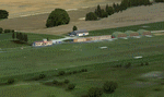
This scenery represents the field of Villerupt-Errouville LFAW where the flying club is based "Nord Lorraine" located in the north of the department 54 a few kilometers from Belgium and Luxembourg borders and the model aircraft club. The buildings have been modeled in GMAX, static devices are also present. Finally the autogen was placed on the same perimeter as the slab photo realistic.
********************************
Cette scene represente le terrain de Villerupt-Errouville LFAW qui est base l'aeroclub Nord Lorraine situe dans le nord du departement 54 a quelques kilometres de la Belgique et du Luxembourg ainsi qu'un club d'aeromodelisme et parachutisme.
L'ensemble des batiments ont ete modelises sous GMAX, des appareils statiques sont egalement presents.
Une dalle photo realiste a ete inseree mais je vous conseille de continuer le sol photo avec des logiciels comme fsEarthTile.
Enfin de l'autogen a ete place sur le meme perimetre que la dalle photo realiste.
| Filename: | LFAW__VilleruptErrouville.zip |
| License: | Freeware, limited distribution |
| Added: | 3rd January 2012, 11:24:06 |
| Downloads: | 1,862 |
| Author: | Alexandre Remy FAF010 |
| Size: | 17.72 MB |
| Category: Flight Simulator 2004 - AI Aircraft | |
| Boeing B-52 Stratofortress (Part 5) |
|
Images related to this file:
File Description:

Boeing B-52 Stratofortress (Part 5). The B-52 first flew in 1952, the last one was built in 1961, and there are still over 90 of the original 744 airframes either in front-line service or in a ready-reserve status. With extensive avionics upgrades starting this year, the USAF plans on using the B-52s until 2045, 93 years after first flight. The aircraft has an impressive resume, having served in five shooting wars and was the backbone of Strategic Air Command's nuclear deterrent air component during almost forty years of Cold War service.
Jake Burrus started this AI traffic model a couple of years ago, and I was honoured to pick up the project and get it across the finish line, with no small amount of help from Mike MacIntyre, as usual. This is a 7-LOD AI traffic model representing the Stratofortress in all of its operational service. This is part 5, showcasing the middle-period B-52G from around 1973 to 1986, covering progressive EVS and ECM upgrades, including a total of 56 repaints. Also included are optional models for VFR traffic use. Aircraft model by Jake Burrus and Mike Pearson, master textures and repaints by Mike Pearson, flight dynamics by Mike MacIntyre. Please read the extensive documentation contained in the file.
| Filename: | Boeing_B52_Stratofortress_Part_5.zip |
| License: | Freeware |
| Added: | 25th September 2013, 23:57:34 |
| Downloads: | 920 |
| Author: | Michael Pearson |
| Size: | 25.75 MB |
| Category: Flight Simulator X - Missions | |
| HAFB Fire Crew Extraction |
|
File Description:
(FSX Acceleration)- Fly from Hill AirForce Base around the Wasatch Front, Near Ogden Utah. Fire Crew, Commander and Pilot are in Immediate need of extraction. The Fire has blocked thier escape route and they need help fast. Fly the AugustaWestland EH101, USAF flavor to get the Crew Out. Drop the Crew off near the Ambulance. Help put out the fires in a Specially modified Goose(Use your Imagination). Fly under 150 Feet over the East side Fires to put them out. Turn back to the lake and Kiss the Water to simulate a Water pick up. Enjoy the company, two other gooses are trying to put out the West Side Fires. Entire mission is in a 17-mile radius. A reward is given after completion of putting out the Fires. All 4-goals need to be accomplished to get the Reward. Enjoy, Many Cheers Ed O........:-)
| Filename: | HAFB_Fire_Crew_Extraction.zip |
| License: | Freeware |
| Added: | 8th January 2008, 23:42:34 |
| Downloads: | 3,771 |
| Author: | Ed Olander |
| Size: | 8.99 MB |
| Category: Flight Simulator X - Scenery | |
| FA44 - Willis / Boynton Beach - Miami, Florida - USA |
|
Images related to this file:
File Description:
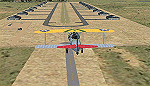
Neighbor to my 'Antiquers Aerodrome' here at avsim, Willis is another small grass strip just North of Antiquers Aerodrome in the Miami/Ft. Lauderdale area.
I gave it a light touch-up, changed concrete taxiways to oil-treated, added an avgas station, lit the runway, fenced it, an added a small parking lot.
This is a bee-utiful area to fly around in with many many airports. Some are nothing more than a a unmarked no bldg. grass strip all the way up to Miami International. Bahamas a short hop to the East, and Key West to the south. Best observed low & slow in an 'ol tail-dragger.
Three freeware beauties are included to get you started: A.F. Scrub's Fairey Fantome, Yak air7, and P. Clawson's Stinson Voyager.
They are written into the Traffic file along with the retro-paints MS Piper Cub and Mooney Bravo.
| Filename: | FA44__Willis__Boynton_Beach__Miami_Florida__USA.zip |
| License: | Freeware, limited distribution |
| Added: | 18th November 2014, 15:01:10 |
| Downloads: | 467 |
| Author: | Jeff Reed |
| Size: | 16.46 MB |


© 2001-2026 AVSIM Online
All Rights Reserved
Privacy Policy |