
Where Flight Simulation Enthusiasts Gather from Around the World!
AVSIM Library - Search Results

| Category: Flight Simulator 2004 - AI Aircraft | |
| Abaete Aerotaxi Cessna 208 Caravan I - Cargo and PAX |

|
File Description:
Cessna caravan C208B, model By Henry Tomkiewicz (HTAI). To be used AI Aircraft.
| Filename: | Abaete_Aerotaxi_Cessna_208_Caravan_I__Cargo_and_PA.zip |
| License: | Freeware |
| Added: | 19th September 2008, 23:10:44 |
| Downloads: | 1,238 |
| Author: | Rodrigo Eduardo |
| Size: | 363.03 KB |
| Category: Flight Simulator 2004 - AI Aircraft | |
| West Caribbean Airways ATR43 and LET410 fleet circa 2005 |
|
Images related to this file:
File Description:
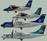
Textures of ATR 42-300 and LET410 West Caribbean Airways old and new colors(circa 2005).
| Filename: | West_Caribbean_Airways_ATR43_and_LET410_fleet_circ.zip |
| License: | Freeware |
| Added: | 26th August 2010, 20:54:25 |
| Downloads: | 357 |
| Author: | Mikhail Ankudinov |
| Size: | 3.5 MB |
| Category: Miscellaneous Files - Demos from Commercial Vendors | |
| TOPCAT 2.35 - Take-Off and Landing Performance Calculation Tool |
|
File Description:
TOPCAT is an acronym for Take-Off and Landing Performance Calculation Tool. It's a highly realistic, easy-to-use planning tool for all serious flight simulator enthusiasts. It brings into a single application all of the calculations required to plan for safe and repeatable take-offs and landings including de-rated thrust and assumed temperature calculation. Currently the follwing airplane types are available in TOPCAT (more to come): Boeing 747-400, Boeing 747-400 Freighter, Boeing 747-400, Boeing 767-300, Boeing 767-300 ER, Boeing 767-300 Freighter and the Airbus A320-214. Now compatible with PMDG 747(F), LDS 767-300 and Wilco/Feelthere Load Managers. NOTE: This is an unlimited, fully functional demo version. Win32 installer package including uninstall function. Take your simulation to the next level!
| Filename: | TOPCAT_235__TakeOff_and_Landing_Performance_Calcul.zip |
| License: | Commercial demo |
| Added: | 30th September 2008, 10:27:42 |
| Downloads: | 1,640 |
| Author: | Judith Blaschegg & Christian Grill |
| Size: | 4.23 MB |
| Category: Flight Simulator 2004 - Scenery | |
| Nursery Corner Farm Field CF13 near Ottawa in Ontario, Canada |
|
Images related to this file:
File Description:
Nursery Corner is a tree nursery around 12 miles southwest of Rideau Valley Airpark CPL3 (which did not appear in FS9, probably because it was then mainly used by gliders, but is a post of mine and downloadable) and 6 miles south of Hicks Farm, a recent post. CPL3 is 15 miles south of Ottawa Airport, tucked into a right angle bend of the Rideau River. Ultimate Terrain puts the river into place and I am not sure how CPL3 works without UT as the river is close by. Fly west from CPL3 along the river and Hicks Farm will be on the south side; fly south parallel to the roads, cross a small river, and in an area which has place names like Hutchins Corners and Pattersons Corners will be the farm field with two grass runways at right angles among the nursery rows of trees. The runways are 36/18 1,700 feet and 27/09 2,000 feet. The single T hangar houses what looked like a Citabria.
| Filename: | Nursery_Corner_Farm_Field_CF13_near_Ottawa_in_Onta.zip |
| License: | Freeware, limited distribution |
| Added: | 11th February 2010, 00:53:28 |
| Downloads: | 248 |
| Author: | Roger Wensley |
| Size: | 14.1 MB |
| Category: Flight Simulator 2004 - Flight Plans | |
| 1946 - Croydon to Beirut by DH Dragon Rapide |
|
File Description:
A letter in the September edition of "Aeroplane" was the inspiration for
the creation of this Flight. Ronald Neal flew as part of the crew on a delivery flight of a De Havilland DH-89 from Marseille to Beirut and listed the refuelling stops across the top of Africa. This occurred not too long after the end of World War 2. I have started the journey at Croydon, with the first stop being St. Nazaire, the port on the east coast of France from which German U-boats ventured. The next stop is Marseille and then the stops referred to in the letter, namely Ajaccio, Tunis, Castel Benito, Marble Arch, Benina, El Adem, Matruh and Heliopolis (Cairo). Thence to Beirut. Dave Garwood created a lovely model of the DH89a for FS2004 and you can find that - and many excellent repaints - right here on Avsim.com. Look for fs9_dh89.zip.
| Filename: | 1946__Croydon_to_Beirut_by_DH_Dragon_Rapide.zip |
| License: | Freeware |
| Added: | 29th September 2006, 17:30:07 |
| Downloads: | 857 |
| Author: | Bruce Kennewell |
| Size: | 156.07 KB |
| Category: Flight Simulator X - Scenery | |
| LKTB - Brno Turany - Brno, Czech Republic |
|
Images related to this file:
File Description:
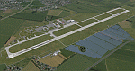
Brno - Turany Airport (IATA: BRQ, ICAO: LKTB) is an airport in Brno, Czech Republic.
The airport was built during the 1950s as a replacement for the old Brno airport located in Slatina
(north east of Turany airport). During the 1980s, the airport was handed over for use by the
Czechoslovak air force, and civil operations were reduced to a minimum. After the fall of communism
in 1989, the airport returned to civil use, and was operated by the state-owned Czech Airport
Authority.
At present, the South-Moravian local government owns the airport, and it is operated by a private
company, Brno Airport Ltd. Although charter and private flights still dominate at the airport, it has
seen significant growth of scheduled service in the last years. Currently, three airlines operate
scheduled passenger flights from the airport: Ryanair, UTair Aviation and Wizzair. Charter flights are
usually operated by Travel Service Airlines.
| Filename: | LKTB__Brno_Turany__Brno_Czech_Republic.zip |
| License: | Check within download |
| Added: | 28th May 2014, 11:01:49 |
| Downloads: | 1,390 |
| Author: | Martin Vseticek, Michal Krechowski, Peter Priskin |
| Size: | 22.78 MB |
| Category: Flight Simulator 2004 - Scenery | |
| LKTB - Brno Turany - Brno, Czech Republic |
|
Images related to this file:
File Description:
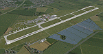
Brno - Turany Airport (IATA: BRQ, ICAO: LKTB) is an airport in Brno, Czech Republic.
The airport was built during the 1950s as a replacement for the old Brno airport located in Slatina
(north east of Turany airport). During the 1980s, the airport was handed over for use by the
Czechoslovak air force, and civil operations were reduced to a minimum. After the fall of communism
in 1989, the airport returned to civil use, and was operated by the state-owned Czech Airport
Authority.
At present, the South-Moravian local government owns the airport, and it is operated by a private
company, Brno Airport Ltd. Although charter and private flights still dominate at the airport, it has
seen significant growth of scheduled service in the last years. Currently, three airlines operate
scheduled passenger flights from the airport: Ryanair, UTair Aviation and Wizzair. Charter flights are
usually operated by Travel Service Airlines.
| Filename: | LKTB__Brno_Turany__Brno_Czech_Republic.zip |
| License: | Check within download |
| Added: | 28th May 2014, 10:59:20 |
| Downloads: | 1,139 |
| Author: | Martin Vseticek, Michal Krechowski, Peter Priskin |
| Size: | 11.15 MB |
| Category: Flight Simulator 2004 - Scenery | |
| Paul Farm Field CF16 in Ontario, Canada |
|
Images related to this file:
File Description:
Paul Field is on the south side of Highway 174, four miles east of Hawkesbury Windover Field and five miles west of the town of Hawkesbury; the town is on the south bank of the Ottawa River approximately midway between Ottawa and Montreal. I first saw the field when I was on the way to Windover a few years ago. I asked some old timers at Windover who the grass strip belonged to and they said "Paul". It may not be what Paul calls it, but it's the only name I know it by. Probably Paul doesn't call it anything, it's just the field where he keeps his plane. There is a grass runway approximately north-south and 2,000 feet long, and two hangars which look to be an old one and a new one. In real life the runway isn't so north-south as it lines up with the farm fields alignment which is of course in FS is auto-generated and not actuality-accurate.
| Filename: | Paul_Farm_Field_CF16_in_Ontario_Canada.zip |
| License: | Freeware, limited distribution |
| Added: | 6th February 2010, 02:36:49 |
| Downloads: | 291 |
| Author: | Roger Wensley |
| Size: | 997.17 KB |
| Category: Prepar3D V5 - AFCAD Files | |
| KLZU - Gwinnett County Airport (Briscoe Field) | Lawrenceville, Georgia |
|
File Description:
This is a modification of the stock Gwinnett County Airport (KLZU) AFCAD/BGL for Prepar3d v5.4. Almost the entire airport has been redone using library objects and generic building files in Prepar3d and matches pretty close to what is shown in Navigraph Charts. Aircraft parking around the airport has been randomized based off Google Maps images. Also included is an exclusion bgl to remove trees and flatten the scenery on the East side of the airport on taxiway Y which did not exist in Prepar3d.
All taxiway names in the original airport were incorrect, this has been corrected. Taxi signage around the airport matches locations/intersections and additional signs have been added where they should have been to begin with.
Control tower and wind socks have been relocated to where they are in real life and according to Navigraph.
I hope you enjoy this scenery and look forward to sharing more in the future!
| Filename: | KLZU__Gwinnett_County_Airport_Briscoe_Field__Lawre.zip |
| License: | Freeware |
| Added: | 10th December 2023, 23:02:50 |
| Downloads: | 28 |
| Author: | Michael Johnson |
| Size: | 227.99 KB |
| Category: Flight Simulator 2004 - Scenery | |
| The Greater Toronto Area Part 1 |
|
File Description:
Part 1 of Flight Ontario's scenery for the Greater Toronto Area and Southern Ontario.
Over a year in the making, this scenery for Fs 2002 and Fs 2004 is bounded by Detroit in the west, Kingston in the east, Huntsville in the north and Buffalo in the south and features:
* all-season scenery
* custom water textures
* completely modelled Toronto Airports...CYTZ (Toronto Island) and CYZD
(Downsview-home to Bombardier Aerospace and the Canadair Regional Jet
and Dash-8, and the Toronto Aerospace Museum)
* custom autogen for the GTA
* Custom landclass for southern Ontario
* custom shorelines (western Lake Ontario, Kingston area, Lake
Couchiching...Severn River...Sparrow Lake area, and the Muskoka Lake
area)
* prominent features around Hamilton include the Burlington Skyway and
Lift Bridge and steel mills
* the Welland Canal is featured with lift bridges, bascule bridge and
fixed link bridge from Pt Weller to Pt Colborne
* the Niagara area includes the Minolta Tower, and 3 hydro generating
plants with reservoirs
* compatibility with SimFlyers CYYZ
This scenery is downloadable in two parts and both parts are essential
| Filename: | The_Greater_Toronto_Area__Part_1.zip |
| License: | Freeware |
| Added: | 9th April 2004, 12:40:02 |
| Downloads: | 37,186 |
| Author: | Flight Ontario |
| Size: | 62.09 MB |


© 2001-2026 AVSIM Online
All Rights Reserved
Privacy Policy |