
Where Flight Simulation Enthusiasts Gather from Around the World!
AVSIM Library - Search Results

| Category: Flight Simulator 2002 - Flight Plans | |
| Biman AI Flightplans V2 |

|
File Description:
Biman airlines is the national carrier for Bangladesh. Biman now flies to 8 South Asian destinations, 6 South-East and Far-Eastern destinations, 9 destinations to Gulf and Middle-East region and 6 European and North American points.
| Filename: | Biman_AI_Flightplans_V2.zip |
| License: | Freeware |
| Added: | 15th June 2004, 18:52:46 |
| Downloads: | 126 |
| Author: | Arjuna Chiththananda |
| Size: | 524.41 KB |
| Category: Flight Simulator 2002 - AI Flight Plans | |
| Biman AI v2 |
|
File Description:
Biman airlines is the national carrier for Bangladesh. Biman now flies to 8 South Asian destinations, 6 South-East and Far-Eastern destinations, 9 destinations to Gulf and Middle-East region and 6 European and North American points.
| Filename: | Biman_AI_v2.zip |
| License: | Freeware |
| Added: | 16th June 2004, 03:36:30 |
| Downloads: | 181 |
| Author: | Arjuna Chiththananda |
| Size: | 524.41 KB |
| Category: Flight Simulator 2002 - Scenery | |
| Al Udeid Air Base |
|
File Description:
Why Al Udeid? The airfield is a US Air Force airbase located in the Middle East nation of Qatar. It is major military logistics base and has one of the longest runways in the Middle East at over 12,000 feet. It is capable of deploying large and heavy cargo planes. The default airfield is just a long runway with no buildings or tawiways.
| Filename: | Al_Udeid_Air_Base.zip |
| License: | Freeware, limited distribution |
| Added: | 7th December 2002, 20:40:13 |
| Downloads: | 1,294 |
| Author: | Kevin Kinscherf |
| Size: | 1 MB |
| Category: Flight Simulator 2004 - Scenery | |
| Ile d'Aix France Photo real |
|
File Description:
Photo scenery of "Ile d'Aix", small island between La Rochelle and Fort Boyard France.
Includes no mesh but provides customized autogen.
| Filename: | Ile_dAix_France_Photo_real.zip |
| License: | Freeware |
| Added: | 8th July 2006, 13:43:19 |
| Downloads: | 1,725 |
| Author: | Alain Nicco |
| Size: | 344.94 KB |
| Category: Flight Simulator X - Scenery | |
| Horn Of Africa Mesh, part 2/3 |
|
Images related to this file:
File Description:
Part 2 of 3: Mesh (lod 1 to 9) of the "Horn Of Africa": Ethiopia, Erythrea, Djibouti and Somalia. (Re-upload)
| Filename: | Horn_Of_Africa_Mesh_part_23.zip |
| License: | Freeware, limited distribution |
| Added: | 10th June 2010, 08:59:50 |
| Downloads: | 2,093 |
| Author: | Marcel "Teutonique" Wislet |
| Size: | 88.72 MB |
| Category: Flight Simulator X - Scenery | |
| Horn Of Africa Mesh, part 3/3 |
|
Images related to this file:
File Description:

Part 3 of 3 : Mesh (lod 1 to 9) of the "Horn Of Africa": Ethiopia, Erythrea, Djibouti and Somalia. (Re-upload)
| Filename: | Horn_Of_Africa_Mesh_part_33.zip |
| License: | Freeware, limited distribution |
| Added: | 10th June 2010, 09:01:32 |
| Downloads: | 2,076 |
| Author: | Marcel "Teutonique" Wislet |
| Size: | 68.12 MB |
| Category: Flight Simulator X - Scenery | |
| Horn Of Africa Mesh, part 1/3 |
|
Images related to this file:
File Description:

Part 1 of 3: Mesh (lod 1 to 9) of the "Horn Of Africa": Ethiopia, Erythrea, Djibouti and Somalia. (Re-upload)
| Filename: | Horn_Of_Africa_Mesh_part_13.zip |
| License: | Freeware, limited distribution |
| Added: | 10th June 2010, 08:57:38 |
| Downloads: | 2,252 |
| Author: | Marcel "Teutonique" Wislet |
| Size: | 82.73 MB |
| Category: Flight Simulator X - Scenery | |
| NWT Landscape - Canada |
|
File Description:
Elevation data (mesh-Lod10 - 38m), land cover, water polygons, rivers, stream lines, lanes and shorelines around airports of Northwest Territories, Canada.
| Filename: | NWT_Landscape__Canada.zip |
| License: | Freeware, limited distribution |
| Added: | 9th February 2011, 17:43:21 |
| Downloads: | 3,350 |
| Author: | Gilles Gauthier |
| Size: | 89.42 MB |
| Category: Flight Simulator X - Scenery | |
| California Central Coast with Megascenery Earth and FSGenesis Mesh |
|
Images related to this file:
File Description:
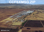
California Central Coast Scenery for FSX with Megascenery Earth and FSGenesis mesh. CCFSXMSG.ZIP covers the California coastal region from N36° 10' (Coalinga) to N34° 25' (Santa Barbara) and from the coast East to W119° 40'. It is a version of my previously created California Central Coast scenery redesigned and expanded to work with FSX MegaScenery Earth and FSGenesis USA Terrain Mesh for FSX V2 by Justin Tyme. Airstrips in the area covered by this scenery have been added for a total of 27 airports and airstrips. 6 imaginary water runways are also added for AI float plane traffic. Several other areas of interest such as the Santa Barbara marina, Morro Bay, etc. are included for a total of 41 points of interest. All airports, airstrips and related structures have been adjusted and realigned to conform to actual positions and dimensions as indicated by the MegaScenery Earth satellite textures. Megascenery Earth California-13, -14 and -15 are required and -12, -28 and -29 are recommended. By Al Wheeler 9/25/09.
| Filename: | California_Central_Coast_with_Megascenery_Earth_an.zip |
| License: | Freeware |
| Added: | 7th January 2010, 19:54:57 |
| Downloads: | 870 |
| Author: | Al Wheeler |
| Size: | 8.13 MB |
| Category: Flight Simulator 2004 - Scenery | |
| The Victoria Falls of the Zambezi River, Zambia/Zimbabwe |
|
File Description:
One of the main landmarks of Africa, the spectacular Victoria Falls of the Zambezi River are missing in out-of-the-box FS. With a local SRTM LOD9 mesh as a base (included) and the help of satellite imagery, maps, Ground2K4, and GMax, we did our best to model a realistic representation of the falls, the river, and the gorge, complete with custom waterfall and spray effects. The portion of the Zambezi covered in this project extends from E25 to E26.5 (more than 100km), with the falls at its center. Also included is a replacement landclass file for an area of about 20km on either side of the Zambezi River and an optional AI boat (by Lynn and Bill Lyons) cruising on the Zambezi above the falls. Tested with FS2004 only but most scenery enhancements (not the AI boat) should work just as well in FS2002.
| Filename: | The_Victoria_Falls_of_the_Zambezi_River_ZambiaZimb.zip |
| License: | Freeware, limited distribution |
| Added: | 8th May 2004, 02:45:30 |
| Downloads: | 19,141 |
| Author: | Holger Sandmann and Johan van Wyk, Aeroworx |
| Size: | 3.5 MB |
© 2001-2026 AVSIM Online
All Rights Reserved
Privacy Policy |