
Where Flight Simulation Enthusiasts Gather from Around the World!
AVSIM Library - Search Results

| Category: Flight Simulator 2004 - Scenery | |
| VFR of Lario, Area B1 - Como lake, Italy |

|
Images related to this file:
File Description:
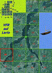
This is the second scenery of the "VFR of Lario" project that follows the previous LagoComo_A1, made with photorealistic terrain (multiseason & night) and with some 3D GMax realistic objects. With this scenery there are also enclosed the great realistic meshes that cover all the Como lake area.
Information: Como's lake (called Lario), is placed in the north of Italy, closed to the Helvetic border. This second scenery covers approximately an area of 7.5x6 kmt, from Bosco di Falmoira/Rondago (NW) to Nesso (NE), and from Balerna/Chiasso (SW) to monte Bolletto (SE), and includes some details of the towns around the lake as Cernobbio (pier, Villa Erba and Convention Center, Villa d'Este, Akzo Nobel buildings), Moltrasio (pier), Carate Urio (pier), Laglio (villa Oleandra), Brienno (buildings and pier), Nesso (pier), Careno (pier), Faggeto Lario (pier), Torno (building and Pier), Blevio (pier).
Contents: several piers and small docks, motor ships and boats, an animated hydrofoil; some other buildings (GenericBuilding system) and trees widespread all over the scenery. Review of Brunate's funicolar and Castel Baradello, due to updated meshes.
| Filename: | VFR_of_Lario_Area_B1__Como_lake_Italy.zip |
| License: | Freeware |
| Added: | 26th January 2012, 15:23:57 |
| Downloads: | 1,953 |
| Author: | Della Vedova Aldo, Daniele Lanfranchi, Diego Caligiuri, Gian Mario Verga |
| Size: | 36.15 MB |
| Category: Flight Simulator 2004 - Scenery | |
| Seward PAWD in Alaska V2 plus 6AK5 |
|
Images related to this file:
File Description:
This is V2, the combined original and also V1. If you have already installed V1 then you do not need this. The town of Seward (population around 2,700) is on the east coast of the Kenai Peninsula, 70 miles east of Kenai town and also 70 miles southeast of Anchorage, amid mountains and glaciers at the northern end of the 20 mile long and fjord-like Resurrection Bay. It is also at the southern end of both the Alaska Railway and the Seward Highway, and has a sheltered dock for freight and also for cruise liners. Passengers from the liners can enjoy local attractions (dog sledging on a glacier?) and also easily continue further north by bus or train to Anchorage or to other tourist attractions such as Denali. The airport is next to the port and the town, with two runways aligned (in FS9, not taking account of the recently wandering magnetic north) 15-33 and 12-30, both asphalt and 2,100 and 4,200 feet long respectively. Only 12-30 (and its taxiways) is lit, with VASI on 30. There are no regularly scheduled flights to Seward; with buses and trains running direct from Anchorage there is no money to be made. There are some charter flights coordinated with cruise liners, and some freight flights, the very occasional visit by the Coastguard, but most flights are GA, air taxi,or short scenery-viewing trips for summer tourists. In a mountainous area the only sure thing about the behaviour of AI aircraft is that it is unpredictable but often involves a mountain; nothing to be done about it. At Seward there is also marine AI from and to the port, in the shape of a cruise liner and an Alaskan ferry, but the latter only if you have Holger Sandmann's Alaska scenery installed. Also included with this is a correction for Fire Island 6AK5, near Anchorage, that takes the airfield out of the water; this is something I have meant to do for the last 5 years.
| Filename: | Seward_PAWD_in_Alaska_V2_plus_6AK5.zip |
| License: | Freeware, limited distribution |
| Added: | 19th January 2016, 18:27:26 |
| Downloads: | 592 |
| Author: | Roger Wensley |
| Size: | 12.47 MB |
| Category: Flight Simulator 2004 - Scenery | |
| CWBH - Bernard Harbour - Nunavut, Canada |
|
Images related to this file:
File Description:
Bernard Harbour was a DEW line "iStation" (a small station with a staff of 5 or 7 people) on the nothern mainland coast 75 miles north of Kugluktuk, and 45 miles west of Lady Franklin Point. It closed in 1963. The slowly deteriorating buildings are still there, along with a fallen radio communications mast. The runway is also still there and has 3,040 feet of gravel, aligned 122T/302T. There is now no runway lighting, no signage, no windsock, and the bushes growing amid the gravel are winning, though slowly. In 1991 a North Warning System (NWS) automated station was established 3 miles to the southwest and there is a second smaller runway there (1,450 feet) along with a helicopter pad. A road joins the two sites for when diesel resupply is undertaken from a ship in the summer, and the zigzag route is (in reality) dictated by the numerous ponds that are too small to be picked up by Ultimate Terrain.
| Filename: | CWBH__Bernard_Harbour__Nunavut_Canada.zip |
| License: | Freeware, limited distribution |
| Added: | 11th November 2012, 01:24:20 |
| Downloads: | 258 |
| Author: | Roger Wensley |
| Size: | 1.49 MB |
| Category: Flight Simulator 2004 - AI Aircraft | |
| Forca Aerea Portuguesa Fiat/Aeritalia G.91 |
|
Images related to this file:
File Description:

Forca Aerea Portuguesa Fiat/Aeritalia G.91. I present a comprehensive AI traffic model package for this backbone of close air support in Europe during the Cold War years. The G.91 was built to suit a requirement for a NATO-compatible aircraft for close air support and light strike roles, able to operate from terrain as primitive as a flat grassy meadow (I found photos during research that support this). Going into production in 1961, this aircraft was manufactured for 19 years and served three European air forces for 35 years. The G.91 saw extensive combat service in Africa while operated by the Portuguese Air Force.
An original 7-LOD model brings this historic aircraft to the flightsim world. This package represents the G.91 in the service of the Forca Aerea Portuguesa ; with a total of 10 models and 56 repaints. Aircraft models covered are the G.91R3, G.91R4, and G.91T3. Aircraft, textures, and flight dynamics by Michael Pearson.
| Filename: | Forca_Aerea_Portuguesa_FiatAeritalia_G91.zip |
| License: | Freeware |
| Added: | 7th October 2013, 22:35:02 |
| Downloads: | 498 |
| Author: | Michael Pearson |
| Size: | 14.88 MB |
| Category: Flight Simulator 2004 - AI Aircraft | |
| Luftwaffe Fiat/Aeritalia G.91 |
|
Images related to this file:
File Description:

Luftwaffe Fiat/Aeritalia G.91. I present a comprehensive AI traffic model package for this backbone of close air support in Europe during the Cold War years. The G.91 was built to suit a requirement for a NATO-compatible aircraft for close air support and light strike roles, able to operate from terrain as primitive as a flat grassy meadow (I found photos during research that support this). Going into production in 1961, this aircraft was manufactured for 19 years and served three European air forces for 35 years. The G.91 saw extensive combat service in Africa while operated by the Portuguese Air Force.
An original 7-LOD model brings this historic aircraft to the flightsim world. This package represents the G.91 in the service of the Luftwaffe; with a total of 10 models and 86 repaints. Aircraft models covered are the G.91R3, G.91R4, and G.91T3. Aircraft, textures, and flight dynamics by Michael Pearson.
| Filename: | Luftwaffe_FiatAeritalia_G91.zip |
| License: | Freeware |
| Added: | 7th October 2013, 22:35:54 |
| Downloads: | 605 |
| Author: | Michael Pearson |
| Size: | 21.16 MB |
| Category: Flight Simulator 2004 - Scenery | |
| Bumba Airport (FZFU/BMB) |
|
File Description:
Scenery for Bumba airport (FZFU/BMB), namely a small airport located in the North part of the Democratic Republic of Congo (DRC), Mondala Province, serving the small town of Bumba located near the Congo river. Bumba is an ideal reference point for VFR flights along the Congo river in that region, as well as around that part of the DRC forest. The scenery contains two parts: the landclass, that defines the terrain at and around the airport, and the airport scenery, which contains the runway, the aprons, and the 3D objects. In comparison with the default FS2004 scenery, this contains brand new runway and aprons, drawn using custom textures that should give a more realistic feeling of the airstrip, and the landclass has been modified in order to represent faithfully the real landscape around the airport. The Static Object Library of RWY12 is necessary in order to properly display the 3D objects: it can be found easily in the AVSIM library.
| Filename: | Bumba_Airport_FZFUBMB.zip |
| License: | Freeware |
| Added: | 30th April 2020, 18:31:15 |
| Downloads: | 161 |
| Author: | Marco Ruggieri |
| Size: | 7.52 MB |
| Category: Flight Simulator 2004 - Flight Plans | |
| Leisure International Level D Flightplan |
|
File Description:
Using information gathered and sent to me by a wonderful individual off the LDS forums, I have compiled the flightplan to reenact the famous Leisure Intl trip from EGKK London Gatwick to KMCO Orlando Intl. This file is ready to fly, just need to input the other data such as your ZFW, etc. All waypoints and routes included INCLUDING the departure and arrival speed/altitude constraints as published in the official charts!!!! This is for the FMC of the Level D Simulation aircraft. I also recommend using the OSS Gatwick 2004 scenery and the Simflyers KMCO scenery, along with FSGenesis terrain meshes to give the best effect for this wonderful flight. Of course who would want to fly this without the awesome Leisure International repaint here in the AVSIM library? No readme included. The procedure is simple -- download it, unzip it and place it in your /Level-D Simulations\navdata\Flightplans folder. Enjoy!!!!!
| Filename: | Leisure_International_Level_D_Flightplan.zip |
| License: | Freeware |
| Added: | 28th April 2005, 13:15:58 |
| Downloads: | 2,004 |
| Author: | Christopher N. Dittmar |
| Size: | 3.77 KB |
| Category: Flight Simulator 2004 - Scenery | |
| AI Tall Ships sailing on Long Island Sound |
|
Images related to this file:
File Description:
AI Tall Ships sailing on Long Island Sound - A gathering of ten vintage AI Sailing Ships near Fisher's Island, New York. This scenery features incredibly detailed AI Sailing Ships modeled by Ron Jeffers, Pierre de Rotalier and Mike Hill. The project includes a replica of the Pequod - Captain Ahab's whaling ship in the epic novel "Moby Dick". Eight of the ten ships make twice daily trips around Fisher's Island. There is also an animated naval rowboat which makes short demonstration runs daily. With one exception, all required files are included. This scenery has been tested with Ultimate Terrain and the FS2004 default environment. Please unzip to a temporary folder and follow the simple, illustrated instructions. Then sit back, watch the seas come to life and relive a little history. This package works very well with John B.Loney's Elizabeth Airport - 0b8_v1.zip - available here. Compiled for your flying (and sailing) enjoyment by David "Opa" Marshall.
| Filename: | AI_Tall_Ships_sailing_on_Long_Island_Sound.zip |
| License: | Freeware |
| Added: | 10th December 2009, 12:42:56 |
| Downloads: | 2,386 |
| Author: | David "Opa" Marshall |
| Size: | 21.05 MB |
| Category: Flight Simulator 2004 - Scenery | |
| CPR5 - Woodstock - Ontario, Canada |
|
Images related to this file:
File Description:
This is the first of a south Ontario series. Woodstock is a town with a population of around 38,000, located 50 miles west of Lake Ontario. The airfield is 3 miles west of the town, with a single grass runway just over 3,000 feet long and 100 plus feet wide, aligned 05/23 in FS9 (in fact it is now 06/24 due to the magnetic north wandering off during the last 10 years). There have been at different times varying amounts of gravel mixed in with the grass on both runway and taxiway; the majority surface by far is grass and I have left it all as such, as there is no visually convincing way to mix the two without unreal sharp edges. The apron is on the northern side of the runway, and is now modified in shape to maximise the area available for crops. There are 10 "T" hangars and a small clubhouse in a single long building. There is no fuel, runway lighting, or taxiway or apron lights so usage is effectively restricted to daylight hours. To the east of CPR5 and on the edge of the town is a private airstrip with 2,800 feet of asphalt runway; I have added this as a visual reference, along with several large grain silos on the other side of the road. Hidden in plain sight amid the surrounding farmland, the first sighting of CPR5 is actually always of the adjacent and far more visible buildings just to the east of the apron, which are owned by a company that deals with everything to do with boats, up to and including fishing gear. These have been included. As ditches cannot be effectively duplicated in FS9 I have included some fences which do not exist in real life, to give some needed visual clues.
| Filename: | CPR5__Woodstock__Ontario_Canada.zip |
| License: | Freeware, limited distribution |
| Added: | 8th July 2015, 13:36:05 |
| Downloads: | 187 |
| Author: | Roger Wensley |
| Size: | 5.57 MB |
| Category: Flight Simulator X - AFCAD Files | |
| KRDU for Default Scenery |
|
File Description:
FSX KRDU Raleigh-Durham AFCAD V1 for default scenery. This file is an update for the gates and parking at KRDU. All gate assignments are correct according to the KRDU website.
A joint Aussie FS/Borderline Flight Sim Release
| Filename: | KRDU_for_Default_Scenery.zip |
| License: | Freeware, limited distribution |
| Added: | 9th August 2010, 11:26:25 |
| Downloads: | 710 |
| Author: | Michael McCracken and Alexander Czarnecki (Aussie FS and Borderline Flight Sim) |
| Size: | 33.11 KB |


© 2001-2026 AVSIM Online
All Rights Reserved
Privacy Policy |