
Where Flight Simulation Enthusiasts Gather from Around the World!
AVSIM Library - Search Results

| Category: Flight Simulator 2004 - Scenery | |
| Colorado Lakes Project IV |

|
File Description:
This project features the lakes of North Central Colorado, replaces all of the prominent reservoirs and lakes of the region (Dillon, Green Mountain, Granby, Williams Fork, and more), and adds over 500 highly detailed lakes to Colorado. They fit seamlessly with my "Colorado Lakes Project III" (colorado_lakes_project_3.zip), "Colorado Lakes Project II" (colorado_lakes_project_2.zip) and "Colorado Lakes Project I" (colorado_lakes_project_1.zip) lakes.
These lakes are specifically designed to show off their photo realistic detail when used in combination with "FSGenesis-The Rockies 38.2m Terrain Mesh-Colorado" available as "fsg_dem38m_usrk_co.zip" at avsim.com, or comparable mesh. The free FSGenesis US National Landclass Project Beta 6 also adds beautifully to the landscape. These lakes work equally as well with the default mesh.
All lake information was projected from satellite imagery and compiled with a beta version of Jim Keir's "Slartibartfast" utility.
| Filename: | Colorado_Lakes_Project_IV.zip |
| License: | Freeware |
| Added: | 10th June 2004, 04:27:10 |
| Downloads: | 4,837 |
| Author: | Carlyle Sharpe |
| Size: | 743.4 KB |
| Category: Flight Simulator 2002 - Scenery | |
| Rocky Mountain National Parks In Canada 1 Of 9 |
|
File Description:
This set of mesh files is built from Canadian 1:50,000 Map Sheet contour lines converted using Geographic Information System software into high resolution (3 meter) mesh scenery. Next phase will to build new scenery from both air photographs and sattelite photos.
| Filename: | Rocky_Mountain_National_Parks_In_Canada_1_Of_9.zip |
| License: | Freeware |
| Added: | 18th January 2003, 03:41:54 |
| Downloads: | 2,526 |
| Author: | Rod Thompson |
| Size: | 3.9 MB |
| Category: Orbiter - Spaceships | |
| Ariane 5 MEP |
|
File Description:
This is just a simple addon that I have made. This addon requires the Tompa's Kourou & ariane 5 mesh addons & spacecraft.dll.
--------------------
Special Thanks to Jack Higgans for the MER Cruise mesh. Thank you =)
| Filename: | Ariane_5_MEP.zip |
| License: | Freeware |
| Added: | 28th December 2003, 18:32:30 |
| Downloads: | 748 |
| Author: | Zachary Grillo |
| Size: | 255.64 KB |
| Category: Flight Simulator X - Scenery | |
| Valley Flying Field (WAVF) |
|
File Description:
Valley Flying Field by Bill and Phil specifically for FSX. WAVF is a small GA airfield in Lilliwaup, WA between the site for the future Emma Field and Lake Cushman.
Designed for use with Ultimate Terrain X (UTX), the FSX Mesh Resolution set to 10m, and some older (FS9) object libraries. See the readme for details.
| Filename: | Valley_Flying_Field_WAVF.zip |
| License: | Freeware, limited distribution |
| Added: | 5th September 2007, 00:52:11 |
| Downloads: | 1,202 |
| Author: | Phil Cayton and Bill Dick |
| Size: | 344 KB |
| Category: X-Plane - Scenery | |
| BR RJ SBRJ - Santos Dumont Airport v1.0.0 |
|
Images related to this file:
File Description:

This is an X-Plane 11 and X-Plane 10 scenery package for Santos Dumont Airport (IATA: SDU, ICAO: SBRJ), which is the second major airport serving Rio de Janeiro, in Brazil. It includes corrected aprons, ramps, gates, taxiways, lighting system, city buildings, ortho-photoscenery for the airfield area, and (XP11 only) airport ground services (like push back). VERY IMPORTANT: In order to work properlly, please download and install, beforehand, the X-Plane scenery file: "Rio de Janeiro improved mesh 2.0, by Rossicev, released February 4, 2016 (33.87 MB)". Found in here: http://forums.x-plane.org/index.php?/files/file/29114-rio-de-janeiro-improved-mesh/ - Without this file, your terrain mesh will not look right, and a few objects may be displaced in your scenery. Only the default X-Plane 11 libraries, by Laminar Research, are needed. No third party libraries are used.
| Filename: | BR_RJ_SBRJ__Santos_Dumont_Airport_v100.zip |
| License: | Freeware |
| Added: | 20th April 2017, 07:22:54 |
| Downloads: | 371 |
| Author: | Rui Mesquita |
| Size: | 47.11 MB |
| Category: Flight Simulator 2004 - Scenery | |
| Colorado Lakes Project III |
|
File Description:
This project features the lakes of Southwest Colorado, replaces the default Navajo Lake on the Colorado-New Mexico border, and adds over 300 highly detailed lakes to Colorado. They fit seamlessly with my "Colorado Lakes Project II" (colorado_lakes_project_2.zip) and "Colorado Lakes Project I" (colorado_lakes_project_1.zip) lakes. The original "Colorado Lakes Project I" is recommended to complete this package, as it contains McPhee, Lemon, and Vallecito Reservoirs.
These lakes are specifically designed to show off their photo realistic detail when used in combination with "FSGenesis-The Rockies 38.2m Terrain Mesh-Colorado" available as "fsg_dem38m_usrk_co.zip" at avsim.com, or comparable mesh. The free FSGenesis US National Landclass Project Beta 6 also adds beautifully to the landscape. These lakes work equally as well with the default mesh.
All lake information was projected from satellite imagery and compiled with a beta version of Jim Keir's "Slartibartfast" utility.
| Filename: | Colorado_Lakes_Project_III.zip |
| License: | Freeware |
| Added: | 3rd June 2004, 21:54:46 |
| Downloads: | 5,016 |
| Author: | Carlyle Sharpe |
| Size: | 444 KB |
| Category: Flight Simulator X - Scenery | |
| Paulinia S.P. - Complement to Americana S.P. 4/5 |
|
File Description:
4/5 - This is the complement of Americana to cover all region taht include the lake Praia Azul. This scenery is composed by five parts. Folow instructions on Readme.txt and have a nice visual flight. Is a good idea install the FSX Mesh South America parts F7 and F8 cordinates in the map to have the essential mesh terrain. There is a link to download:
www.ceaero.com.br/meshxsa/dowsa.html
Other pack that you need install if want to see all hangars in SDAI Aeroclube de Americana,
is the STATIC BJECTS LIBRARY found on RWY12 OBJECTS PLACER found in http://www.rwy12.com/rwy12/
| Filename: | Paulinia_SP__Complement_to_Americana_SP_45.zip |
| License: | Freeware |
| Added: | 8th June 2008, 14:09:41 |
| Downloads: | 1,456 |
| Author: | Gilson A. Rocchetti |
| Size: | 71.84 MB |
| Category: Flight Simulator 2004 - Scenery | |
| Madrid Barajas from 2005 onwards |
|
Images related to this file:
File Description:
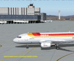
Madrid Barajas FS9 standalone airport, to substitute/update the original FS9 version with the actual 4 RWY operation and two new terminals. Resubmitted at libarian's request. You MUST have a good mesh for spanish terrain, otherwise this scenery won't look good. May I suggest a visit to AirHispania L.A.V. web site, www.airhispania.com, for a free download of their mesh from the scenery section, under "Publicaciones" (publications). Based on LEMDGB from the Zafra brothers original work to complement/update Simwings original Madrid airport, and published with their permission, this version does not require any payware. Taxiway signs now obsolete. Enjoy . Fernando de la Portilla
| Filename: | Madrid_Barajas_from_2005_onwards.zip |
| License: | Freeware |
| Added: | 21st February 2010, 01:45:52 |
| Downloads: | 8,205 |
| Author: | Fernando de la Portilla |
| Size: | 804.05 KB |
| Category: Flight Simulator 2004 - Scenery | |
| Terrain Mesh (LOD08) for Nunavut, Canada (File 4 of 4) |
|
File Description:
Re-uploaded file. FS2002 and FS2004. The files in this package contain a new 153m (LOD08) terrain mesh for Nunavut, Canada ( and northern part of Northwest Territories) to use with FS2002 and FS2004. The source data is GeoBase (CDED-1 : 250 000). All data were compiled and edited in MicroDEM 7.01 alpha and resampled to LOD08 (Level of Details), or 152.88 meters horizontal resolution, with the Microsoft Terrain Software Developer's Kit (SDK) utilities.
(Nunavut8a.zip, Nunavut8b.zip Nunavut8c.zip Nunavut8d.zip - 4 Parts).
| Filename: | Terrain_Mesh_LOD08_for_Nunavut_Canada_File_4_of_4.zip |
| License: | Freeware, limited distribution |
| Added: | 5th May 2010, 09:14:41 |
| Downloads: | 4,253 |
| Author: | Gilles Gauthier |
| Size: | 30.7 MB |
| Category: Flight Simulator 2004 - Scenery | |
| Terrain Mesh (LOD08) for Nunavut, Canada (File 2 of 4) |
|
File Description:
FS2002 and FS2004. The files in this package contain a new 153m (LOD08) terrain mesh for Nunavut, Canada ( and northern part of Northwest Territories) to use with FS2002 and FS2004. The source data is GeoBase (CDED – 1 : 250 000). All data were compiled and edited in MicroDEM 7.01 alpha and resampled to LOD08 (Level of Details), or 152.88 meters horizontal resolution, with the Microsoft Terrain Software Developer's Kit (SDK) utilities.
(Nunavut8a.zip, Nunavut8b.zip Nunavut8c.zip Nunavut8d.zip - 4 Parts).
| Filename: | Terrain_Mesh_LOD08_for_Nunavut_Canada_File_2_of_4.zip |
| License: | Freeware, limited distribution |
| Added: | 30th December 2003, 23:42:23 |
| Downloads: | 3,892 |
| Author: | Gilles Gauthier |
| Size: | 22.71 MB |


© 2001-2026 AVSIM Online
All Rights Reserved
Privacy Policy |