
Where Flight Simulation Enthusiasts Gather from Around the World!
AVSIM Library - Search Results

| Category: Flight Simulator 2004 - Scenery | |
| Joshua Tree + San Bernardino Mountains, California 38m Terrain Mesh |

|
File Description:
USGS SRTM30 1 arc-second, resampled to LOD10 (38.2 meters). This terrain mesh is centered at Joshua Tree National Park in southern California. Coverage area: From West 115.1° to West 117.4° and North 33.7° to North 34.3°. It includes the National Park, the Palm Springs area with Mount San Jacinto and the San Bernardino Mountains.
| Filename: | Joshua_Tree__San_Bernardino_Mountains_California_3.zip |
| License: | Freeware, limited distribution |
| Added: | 4th January 2004, 21:05:58 |
| Downloads: | 3,716 |
| Author: | Andreas Trawny |
| Size: | 4.57 MB |
| Category: Flight Simulator 2004 - Scenery | |
| Backcountry USFS fields for 19m terrain mesh in Idaho |
|
Images related to this file:
File Description:
These backcountry airfields are for use with the FSGenesis 19m mesh of Idaho; they almost certainly do not work without it. I also have Ultimate Terrain installed, with the settings as noted. The 15 airfields included here are almost all United States Forestry Service fields: 1U1 Moose Creek, 2ID7 Cayuse Creek, 2U5 Shearer, 3U1 Warren, 12ID Flying B Ranch, 24K Krassel, 75c Orogrande, I08 Cabin Creek, ID67 Lower Loon Creek, ID76 Wilson Bar, S81 Indian Creek, S92 Fish Lake, U54 Bernard, U79 Chamberlain, U81 Cold Meadows. There is also a 85U bgl included to remove the remnants of Soldier Bar which is impossible to make into a scenery with the terrain mesh, and spoiled the surroundings if left untouched and intact. The screenshots are typical examples giving a good impression of the terrain.
| Filename: | Backcountry_USFS_fields_for_19m_terrain_mesh_in_Id.zip |
| License: | Freeware, limited distribution |
| Added: | 22nd July 2019, 16:38:48 |
| Downloads: | 102 |
| Author: | Roger Wensley |
| Size: | 22.2 MB |
| Category: X-Plane - Scenery | |
| Hawaii Photoreal - Niihau, Lehua and Kaula |
|
File Description:
The Hawaii Photoreal project from FSX is proud to bring a gorgeous island to X-Plane, Niihau! This is the first Hawaii Photoreal Scenery available with HD Mesh for X-Plane 10! Installation instructions are included. You must download both files for full HD Mesh experience. This scenery will not align correctly with default terrain and coastlines or those available with AlpilotX's HD Mesh 2. It should also be noted that this scenery will explode upon decompression - the true size of the folder is 341MB, whereas the download size is only 88MB. Make sure you aren't almost out of space. Niihau for X-Plane 10 includes customized HD Mesh for the entire island, including Lehua and Kaula. This isn't just processed DEM data - we have reviewed and perfected the coastlines and cliffs for ideal appearance. Please show support for this project by considering donating to the Hawaii Photoreal Project through the website.
| Filename: | Hawaii_Photoreal__Niihau_Lehua_and_Kaula.zip |
| License: | Freeware, limited distribution |
| Added: | 27th March 2016, 19:27:43 |
| Downloads: | 149 |
| Author: | Colin Stepney |
| Size: | 86.31 MB |
| Category: Flight Simulator 2004 - Scenery | |
| Pudding Hill - NZPH |
|
Images related to this file:
File Description:
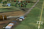
44nm east from Christchurch, New Zealand. 22nm from Ashburton.
Pudding Hill Lodge and Holiday Park. Skydiving area. Choice of 2 runways. Made for Christian Stock's NZ mesh in the form of "Mountains of New Zealand" and topo in the form of "Lakes and Rivers of New Zealand".
| Filename: | Pudding_Hill__NZPH.zip |
| License: | Freeware |
| Added: | 2nd January 2011, 21:56:28 |
| Downloads: | 288 |
| Author: | Godfrey Tier |
| Size: | 1.15 MB |
| Category: Flight Simulator 2004 - Scenery | |
| Project Mexico Real LOD9 File 4 of 4 |
|
Images related to this file:
File Description:
File 4th of 4 of a Terrain Mesh that covers the entirety of Mexican Territory and related bordering U.S., Guatemala and Belice areas, part of the "Proyecto M�©xico Real" project, compiled at LOD9 (2.48 arcseconds in latitude and 3.3 arcseconds in longitude) resolution from INEGI data. Intended to enhance the virtual flying experience with the more detailed LOD10 version and complement the LOD8 version compiled from the same data. Compatible backwards with Flight Simulator 2000, Flight Simulator 2002 and Combat Flight Simulator 2. Refer to the file contents about the cover area to this compressed file. (Re-upload due to AVSIM hack)
| Filename: | Project_Mexico_Real_LOD9_File_4_of_4.zip |
| License: | Check within download |
| Added: | 6th June 2010, 08:50:44 |
| Downloads: | 2,727 |
| Author: | Juan Jose Galvan Bautista |
| Size: | 54.82 MB |
| Category: Flight Simulator 2004 - Scenery | |
| Project México Real LOD9 File 3 of 4 |
|
Images related to this file:
File Description:
Re-upload. File 3rd of 4 of a Terrain Mesh that covers the entirety of Mexican Territory and related bordering U.S., Guatemala and Belice areas, part of the "Proyecto México Real" project, compiled at LOD9 (2.48 arcseconds in latitude and 3.3 arcseconds in longitude) resolution from INEGI data. Intended to enhance the virtual flying experience with the more detailed LOD10 version and complement the LOD8 version compiled from the same data. Compatible backwards with Flight Simulator 2000, Flight Simulator 2002 and Combat Flight Simulator 2. Refer to the file contents about the cover area to this compressed file. (Re-upload due to AVSIM hack)
| Filename: | Project_Mxico_Real_LOD9_File_3_of_4.zip |
| License: | Check within download |
| Added: | 6th June 2010, 03:15:08 |
| Downloads: | 2,597 |
| Author: | Juan José Galvén Bautista |
| Size: | 53.8 MB |
| Category: Fly! II - Scenery | |
| Alicante |
|
File Description:
Alicante (Spain) Photoscenery plus elevations mesh.
| Filename: | Alicante.zip |
| License: | Freeware, limited distribution |
| Added: | 28th January 2004, 04:02:25 |
| Downloads: | 458 |
| Author: | A. Rubio |
| Size: | 15.98 MB |
| Category: Flight Simulator X - Aircraft Repaints, Textures and Modifications | |
| EgyptAir Boeing 777-200ER (SU-GBR) |
|
Images related to this file:
File Description:

EgyptAir is the flag carrier airline of Egypt, based at Cairo International Airport and serving the Middle East, Europe, Africa, Asia and the Americas. EgyptAir currently operates 2 Boeing 777-200ERs.
This repaint has all the great features of my other works. To use this repaint, the Captain Sim B777-200 (PW) v1.6 is required. Repainted by Garrett Rowley, tested by Marlon Carter.
| Filename: | EgyptAir__Boeing_777200ER_SUGBR.zip |
| License: | Freeware |
| Added: | 1st April 2015, 09:21:01 |
| Downloads: | 616 |
| Author: | Garrett Rowley, Captain Sim |
| Size: | 30.7 MB |
| Category: Flight Simulator X - AFCAD Files | |
| Middle East AFCAD Pack 1 |
|
File Description:
These files will add additional parking and fuel trucks to the default FSX airports for Hurghada, Egypt (HEGN), Tel Aviv, Israel (LLBG), Manama, Bahrain (OBBI), Jeddah, Saudi Arabia (OEJN), and Riyadh, Saudi Arabia (OERK).
| Filename: | Middle_East_AFCAD_Pack_1.zip |
| License: | Freeware |
| Added: | 26th November 2007, 02:22:39 |
| Downloads: | 4,132 |
| Author: | Denny Payne |
| Size: | 52.75 KB |
| Category: Flight Simulator X - Scenery | |
| Bella Coola Valley Landscape Enhancements |
|
File Description:
One of the most spectacular watersheds of British Columbia's Midcoast, the Bella Coola Valley looks pretty boring in its default FSX rendition and the oddly shaped default Bella Coola River cuts deep into the terrain. These files provide a terrain mesh made from CDED1 0.75-arcsec data (multi-LOD, with maximum resolution of 38-m grid spacing), updated land class, water class, and seasons files, and accurate placements of lakes, rivers, streams, roads, and bridges. Also added are the glaciers of the Monarch Mountain Icefield as well as several forestry roads and clearcuts in the side valleys. Main roads have vehicle traffic moving in both directions. Coverage area is N51*45'-52*40' and W125*35'-127*25'. These files are fully compatible with other landscape enhancements for FSX, such as FS Genesis North America terrain mesh, Cloud 9's X-class, Adam Mill's ground texture replacements, or Flight1's Ultimate Terrain Canada/Alaska.
| Filename: | Bella_Coola_Valley_Landscape_Enhancements.zip |
| License: | Freeware, limited distribution |
| Added: | 24th February 2007, 08:27:54 |
| Downloads: | 12,654 |
| Author: | Holger Sandmann |
| Size: | 15.68 MB |


© 2001-2026 AVSIM Online
All Rights Reserved
Privacy Policy |