
Where Flight Simulation Enthusiasts Gather from Around the World!
AVSIM Library - Search Results

| Category: Flight Simulator 2002 - Scenery | |
| Lundy Island UK |

|
File Description:
This scenery represents Lundy Island in the Bristol Channel UK it features a small village with a church, a revolving wind turbine, 3 lighthouses and the 400 metre grass strip, designed primarily for use with addon mesh terrain.
| Filename: | Lundy_Island_UK.zip |
| License: | Freeware |
| Added: | 22nd October 2002, 15:20:47 |
| Downloads: | 1,219 |
| Author: | Nick Ryall and Steve Mullen |
| Size: | 1020.92 KB |
| Category: Flight Simulator X - Scenery | |
| Mesh for Southern Africa, Base Grid 0704 |
|
Images related to this file:
File Description:
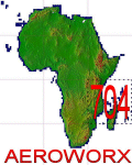
Highly detailed 76m SRTM mesh for Africa using the latest release of STRM Data V2.1. This file covers the Africa Area of base file 0704 (S01 and E30), South of the Equator, Mauritius, Madagascar, Comoros, Reunion Island, Tromelin Island included. DO NOT DISABLE THE DEFAULT DEM 704 FILE.
| Filename: | Mesh_for_Southern_Africa_Base_Grid_0704.zip |
| License: | Freeware |
| Added: | 8th February 2014, 08:47:05 |
| Downloads: | 3,234 |
| Author: | Martin du Preez, Hannes Steyn, Aeroworx |
| Size: | 252.42 MB |
| Category: Flight Simulator X - Scenery | |
| Mesh for Northern Africa, Base Grid 0702 |
|
Images related to this file:
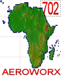
File Description: Highly detailed 76m SRTM mesh for Africa using the latest release of STRM
Data V2.1. This file covers the Africa Area of base file 0702 (N23 and E30),
North of the Equator, Arabia is not included, DO NOT DISABLE THE DEFAULT DEM
702 FILE.
| Filename: | Mesh_for_Northern_Africa_Base_Grid_0702.zip |
| License: | Freeware |
| Added: | 11th January 2014, 05:27:05 |
| Downloads: | 1,549 |
| Author: | Martin du Preez, Hannes Steyn, Aeroworx |
| Size: | 33.93 MB |
| Category: Flight Simulator 2004 - Scenery | |
| South Africa (Johannesburg(Transvaal)/Swasiland/Lesotho/Orange Freestate- 76M SRTM TERRAIN MESH) Part 1 |
|
File Description:
This mesh of South Africa includes beautiful areas of Transvaal(Johannesburg), Swasiland, Orange Freestate and Lesotho.It comes in 3 files. Part 1 of 3.
All the 3 files cover the area from S25 E31 to S30 E31.
| Filename: | South_Africa_JohannesburgTransvaalSwasilandLesotho.zip |
| License: | Freeware, limited distribution |
| Added: | 24th April 2004, 02:06:43 |
| Downloads: | 5,024 |
| Author: | Michael Speck |
| Size: | 4.84 MB |
| Category: Flight Simulator 2004 - Scenery | |
| South Africa (Johannesburg(Transvaal)/Swasiland/Lesotho/Orange Freestate- 76M SRTM TERRAIN MESH) Part 2 |
|
File Description:
This mesh of South Africa includes beautiful areas of Transvaal(Johannesburg), Swasiland, Orange Freestate and Lesotho.It comes in 3 files. Part 2 of 3.
All the 3 files cover the area from S25 E26(!) to S30 E31.
| Filename: | South_Africa_JohannesburgTransvaalSwasilandLesotho.zip |
| License: | Freeware, limited distribution |
| Added: | 24th April 2004, 02:25:21 |
| Downloads: | 4,208 |
| Author: | Michael Speck |
| Size: | 15.87 MB |
| Category: Flight Simulator 2004 - Scenery | |
| New Caledonia (Landclass and Terrain Mesh) AFCAD and Scenery Fix for file n_caled.zip |
|
File Description:
This is a fix for my New Caledonia Landclass and Terrain Mesh file n_caled.zip The AFCAD and scenery files included will repair the problems of AI Aircraft freezing on runways. Scenery modifications have also been made around many of the airports.
| Filename: | New_Caledonia_Landclass_and_Terrain_Mesh__AFCAD_an.zip |
| License: | Freeware |
| Added: | 14th May 2010, 05:07:26 |
| Downloads: | 567 |
| Author: | Charles Reid |
| Size: | 49.16 KB |
| Category: Flight Simulator 2004 - Scenery | |
| SCIR Isla Robinson Crusoe Chile |
|
Images related to this file:
File Description:
Terrain and Mesh for Robinson Crusoe Island and Selkirk Island, including the airport SCIR (Robinson Crusoe). Robinson Crusoe Island is located west of Santiago, Chile at approximately S33-40/W78-50. It is about 2.5 hours flying time from Santiago(SCEL).
| Filename: | SCIR_Isla_Robinson_Crusoe_Chile.zip |
| License: | Freeware, limited distribution |
| Added: | 23rd October 2011, 14:08:29 |
| Downloads: | 1,248 |
| Author: | Scott Smart |
| Size: | 9.44 MB |
| Category: Flight Simulator 2004 - Scenery | |
| Appalachian Mountains, Virginia / West Virginia |
|
File Description:
USGS SRTM30 1 arc-second, resampled to LOD10 (38.2 meters).
This high-resolution terrain mesh is centered in the Appalachian Mountains
between Virginia and West Virginia. Coverage area: From West -81° to West -79°
and North 37° to North 39°.
| Filename: | Appalachian_Mountains_Virginia__West_Virginia.zip |
| License: | Freeware, limited distribution |
| Added: | 10th January 2004, 18:06:59 |
| Downloads: | 3,681 |
| Author: | Andreas Trawny |
| Size: | 17.1 MB |
| Category: Flight Simulator X - Scenery | |
| CANMeshX - CAN_28 |
|
Images related to this file:
File Description:
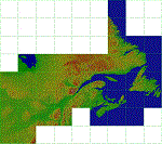
This is a LOD 5 (1216.05m per pixel) to LOD 11 (19m per pixel) terrain mesh scenery file. This terrain mesh is a work in progress, it was started more than two years ago and was never finished. While the files uploaded here have been checked thoroughly there may be errors. If you find any obvious errors please do let me know by email, my intention is to eventually finish this project as the difference in the before and after is astounding especially in areas where I have also included new coastlines. This mesh does cover some border areas of the United States of America too and eventually my intentions are to provide the same product coverage there including higher LOD levels where data is available. This is 1 of 40 files currently available.
| Filename: | CANMeshX__CAN_28.zip |
| License: | Freeware, limited distribution |
| Added: | 8th November 2015, 16:17:57 |
| Downloads: | 245 |
| Author: | Ben Clark |
| Size: | 115.32 KB |
| Category: Flight Simulator X - Scenery | |
| CANMeshX - CAN_131 |
|
Images related to this file:
File Description:
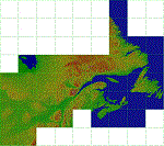
This is a LOD 5 (1216.05m per pixel) to LOD 11 (19m per pixel) terrain mesh scenery file. This terrain mesh is a work in progress, it was started more than two years ago and was never finished. While the files uploaded here have been checked thoroughly there may be errors. If you find any obvious errors please do let me know by email, my intention is to eventually finish this project as the difference in the before and after is astounding especially in areas where I have also included new coastlines. This mesh does cover some border areas of the United States of America too and eventually my intentions are to provide the same product coverage there including higher LOD levels where data is available. This is 1 of 40 files currently available.
| Filename: | CANMeshX__CAN_131.zip |
| License: | Freeware, limited distribution |
| Added: | 8th November 2015, 16:18:01 |
| Downloads: | 222 |
| Author: | Ben Clark |
| Size: | 981.82 KB |


© 2001-2026 AVSIM Online
All Rights Reserved
Privacy Policy |