
Where Flight Simulation Enthusiasts Gather from Around the World!
AVSIM Library - Search Results

| Category: Flight Simulator 2004 - Aircraft Repaints, Textures and Modifications | |
| Land O'Lakes Boeing B747-400 (Meljet) |

|
File Description:
This aircraft is flying for XTC Vitual Airlines.
X.T.C. is a fictitious virtual airline that operates in the USA and the caribbean. X.T.C. stands for "eXecutive Travel Concept" and is partner of Northwest Airlink and LIAT. For our new connection to South-East-Asia we decided to use the Meljet B747-400. The XTC website can be found at http://minnesota-xtc.sky4you.de This is one of the latest Premium NEMESISCOM Repaints. This Repaint contains everything. No additional files needed. Visit my site at http://www.sky4you.de
| Filename: | Land_OLakes_Boeing_B747400_Meljet.zip |
| License: | Freeware, limited distribution |
| Added: | 15th December 2004, 05:46:57 |
| Downloads: | 312 |
| Author: | Joerg Zeitschel (Nemesiscom) |
| Size: | 1.9 MB |
| Category: Flight Simulator 2004 - Flight Plans | |
| FSPilot - Waterford to Dublin |
|
File Description:
This flightplan requires the freeware Autopilot/EFIS/Flight Planner software, FSPilot, available here at Avsim (fspilot_142.zip). 3 different versions of the flight plan are included in this archive - one each for the default Learjet and Cessna 172 along with one for Jordan Moore's Bell 412. The trip takes between 30 and 50 minutes depending the aircraft selected. Enjoy the trip over the Wicklow Mountains National Park before crossing the east coast at Bray and skirting the Howth peninsula before landing at Dublin runway 28.
| Filename: | FSPilot__Waterford_to_Dublin.zip |
| License: | Freeware |
| Added: | 7th May 2006, 22:56:37 |
| Downloads: | 381 |
| Author: | John May |
| Size: | 141.16 KB |
| Category: Flight Simulator 2004 - Aircraft Repaints, Textures and Modifications | |
| USAF Boeing C-17 Globemaster III Dover AFB |
|
File Description:
On June 4th, 2007, Dover AFB received its first C-17 Globemaster III, becoming one of the most important airlift Air Force Bases in the United States and the East Coast. This repaint portrays aicraft 7175 which is assigned to the 436th & 512th AW and operating for the AMC & AFRC.
Repaint was done thanks to the excellent FSD repaint kit and is haindpainted. The FSD C-17 Globemaster III is required, available at www.fsd-international.com. Textures only. Repaint by Tomas Cubero Maingot.
| Filename: | USAF_Boeing_C17_Globemaster_III_Dover_AFB.zip |
| License: | Freeware, limited distribution |
| Added: | 22nd March 2009, 15:07:08 |
| Downloads: | 373 |
| Author: | FSD International, Tomas Cubero Maingot |
| Size: | 4.81 MB |
| Category: Flight Simulator 2004 - AI Flight Plans | |
| Europe Airpost _ Summer 2010 Flights Plans |
|
Images related to this file:
File Description:

Europe Airpost, descendant of the prestigious 'Aeropostale', is a French airline, based in Paris CDG, which operates a fleet of 19 aircrafts across Western Europe and especially France.
She is responsible for transport of mail, the night across the country. During the day, its devices are equipped to perform multiple charter flights on behalf of tour operator.
The company also operates cargo flights to Portugal on behalf of Agroar between Lisbon and Madeira, as well as in Britain, between Edinburgh and East Middland for the RoyalMail.
| Filename: | Europe_Airpost___Summer_2010_Flights_Plans.zip |
| License: | Freeware, limited distribution |
| Added: | 5th September 2010, 01:31:29 |
| Downloads: | 1,533 |
| Author: | Graf Maxence |
| Size: | 13.16 KB |
| Category: Flight Simulator 2004 - Scenery | |
| FQIA - Inhaca Airport - Maputo Province, Mozambique |
|
Images related to this file:
File Description:

A Gmax representation of Inhaca Airport (FQIA), Inhaca Island, Mozambique with photoreal textures.
Inhaca island is a small island situated about 32 km east of Maputo, the capital of Mozambique. Transairways provide daily flights from Maputo airport to Inhaca airport, typically with smaller (18 seat) aircraft and the flight lasts no more than about 15 minutes.
The airport consist of a very small terminal building and two runways. Runway 18/36 (asphalt) measuring 650m and runway 10/28 (grass) which also measures 650m.
| Filename: | FQIA__Inhaca_Airport__Maputo_Province_Mozambique.zip |
| License: | Freeware, limited distribution |
| Added: | 12th September 2015, 00:12:07 |
| Downloads: | 362 |
| Author: | Kobus van Wyk, Aeroworx |
| Size: | 1.25 MB |
| Category: Flight Simulator 2004 - Scenery | |
| Airstrips of North-West Europe |
|
Images related to this file:
File Description:
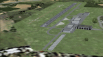
The sales blurb for FS2004 announced the inclusion of over 23,000 airfields ... unfortunately a significant number of those consisted of little or nothing more than a runway on a flatten with a rectangular background polygon.
To enable the addition of an amount of lightweight GA AI traffic, without overloading those airfields that were designed with parking spaces and taxi-ways, (and are probably already busy), I herewith include over 140 small sceneries, of mostly default airfields, from NW France, up the English Channel and the North Sea coast through Belgium, the Netherlands and NW Germany to Denmark, all with added taxiways and parking spots, aprons, generic buildings and background polygons as appropriate, to enable AI traffic to be generated without interrupting things at the more major airports.
A few of the French airfields are "new", not included originally with FS2004, and a couple have been updated to suit more recent developments :- for example, LFES "Scaer Guiscriff" is now LFES "Bretagne Atlantique", LFOR "Chartres Champhol" is now LFOR "Chartres Metropole", EHSE "Seppe" is now EHSE "Breda International" and EKVH "Vesthimmerlands" was previously EKVH "Aars".
There's no photo-realism here, just a selection of basic 'generic' buildings, more or less accurately sized and placed to reflect the airfield layout as seen on on-line satellite imagery and aerial photography. These buildings have minimal effect on frame-rates, so are ideal for this kind of job.
The airfields are aligned as well as possible with the roads etc. in UT Europe and the Genesis Europe mesh, but should mostly be fine in a default installation or other configuration.
Please read the rest of this "waffle" in the included text file ... it might save some confusion ;)
Enjoy :)
| Filename: | Airstrips_of_NorthWest_Europe.zip |
| License: | Freeware |
| Added: | 14th June 2024, 13:44:58 |
| Downloads: | 290 |
| Author: | Chris Eve |
| Size: | 9.95 MB |
| Category: Flight Simulator 2004 - Scenery | |
| Bryce Canyon National Park (KBCE), Utah, Photo-Scenery |
|
Images related to this file:
File Description:
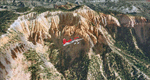
Bryce Canyon National Park (KBCE), Utah, Photo-Scenery (FS9 & FSX)
Despite its name, Bryce Canyon is not actually a canyon that was formed by a river, but rather a giant natural cliff shaped through erosion by wind, water, and ice. Bryce is distinctive due to its geological formations, delicate and colorful pinnacles called hoodoos that are up to 200ft high. The bizarre forms and red, orange and white colors of the rocks provide spectacular views. Unfortunately the hoodoos are too small for the elevation mesh in flight simulator. But you can enjoy the colors and shape of the cliffs. The cliffs in main region of the park, just south of the airport are partly covered
by snow. But on the southern and western part of the plateau you can enjoy them free of snow. Bryce Canyon is named after the Mormon pioneer Ebenezer Bryce who settled in this area in the 1850s. It was designated as a national park in 1928.
Bryce Canyon Airport (KBCE) just handles small aircraft on a daily basis. But is was actually built to handle larger aircraft in case of emergency. And so on Oct.6th 2000 an American Airlines MD-82 from Denver to Los Angeles made a successful emergency landing after reporting smoke in the cockpit and a loss of cabin pressure.
High resolution versions of this scenery for FS9 and FSX (much sharper, but larger and multiple downloads)are available at www.blueskyscenery.com/CNY_South2West4.html . The screenies are taken from the high-res versions, so expect this version to be slightly more blurry. Thanks to Joop Mak for providing a custom AFCADs that correct airport layouts so that they align with the photo-textures! They are available here: www.blueskyscenery.com/AFCADs.html . YourDonation@Work: Dedicated to Michael, Pat and Keith.
| Filename: | Bryce_Canyon_National_Park_KBCE_Utah_PhotoScenery.zip |
| License: | Freeware, limited distribution |
| Added: | 7th March 2010, 11:17:56 |
| Downloads: | 2,211 |
| Author: | Gottfried Razek, blueskyscenery.com |
| Size: | 96.35 MB |
| Category: Prepar3D V1-4 - Scenery | |
| Udine Friuli Venezia Giulia Italy N46.3.85 E13.14.19. |
|
Images related to this file:
File Description:
Udine Friuli Venezia Giulia Italy N46.3.85 E13.14.19. The city is located in the center of the Friuli region. It is just over 20 km from Slovenia and about 54 km from Austria. This puts it in a strategic position, at the intersection of the East-West European Corridors (Corridor V or Mediterranean) and North-South (Via Iulia Augusta, now recognized by the European Union as part of the Baltic-Adriatic Corridor) , on the way to Austria and to Eastern Europe. It rises in the high plains, around an isolated hill (according to the legend built by Attila to admire the fire that he himself caused to the city of Aquileia, but in reality is formed by conglomeratic rocks more than 100,000 years old), on top of which the castle is located, a few kilometers from the hilly belt, and is bordered by the Cormor torrent to the west and the Torre torrent to the east. Important VFR point for approaching airport Trieste Ronchi dei Legionari (LIPQ) and airporto Udine Boscomantico (LIPD).
Within the downloaded package you will find readme files for scenery installation. Good fly VFR. Pasquale Marrulli.
| Filename: | Udine_Friuli_Venezia_Giulia_Italy_N46385_E131419.zip |
| License: | Freeware |
| Added: | 21st December 2017, 17:40:48 |
| Downloads: | 261 |
| Author: | Pasquale Marrulli |
| Size: | 3.11 KB |
| Category: Flight Simulator 2004 - Scenery | |
| Wekweeti CFJ2 in the Northwest Territories, Canada |
|
Images related to this file:
File Description:
Wekweeti is a small village in the Northwest Territories, around 120 miles north of Yellowknife and 100 east of Gameti, which was recently posted. It has a population of around 125. There is no all-weather road access and the village is reliant upon the airfield for supplies, along with an ice road in the winter months. The area is a complex collection of lakes and small rivers and the airfield is around 3 miles east of the village on a lake shore. The lit gravel runway of 3,400 feet with PAPI at both ends is aligned 307T-127T with T standing for "true" and not the unreliable magnetic heading in the Canadian northern domestic airspace. The airfield is served by Air Tindi from Yellowknife on an almost daily basis, included in the AI here along with some GA and a Thursday delivery by a Buffalo DC3. A note here about my scenery making. There will not be many more to follow this as I am almost at the end of the photos I either took or found for scenery purposes, plus I expect to move on from FS9 at some point during next year.
| Filename: | Wekweeti_CFJ2_in_the_Northwest_Territories_Canada.zip |
| License: | Freeware, limited distribution |
| Added: | 4th January 2020, 18:23:59 |
| Downloads: | 154 |
| Author: | Roger Wensley |
| Size: | 4.39 MB |
| Category: Flight Simulator 2004 - Miscellaneous Files | |
| Air Ambulance Aviator for B200 |
|
File Description:
This is a spreadsheet that models a fictitious air ambulance company based in the North East of the USA. You are a Junior Captain who has started working for an air ambulance company called MedEvac Services. With a home base at Albany, NY, this company operates a single B200 to some 64 destination airfields in the North East of the USA. The company uses just one captain (you) and several co-pilots. All pilots earn salaries based on an hourly rate but only you get an additional profits-related bonus.
The spreadsheet will randomly create a variety of assignments at different times of day, with two- or three-leg operations involving patient transfers and organ transplant transits plus a host of operational and financial challenges thrown in. Your aim is to fulfil your assignments and fly your aircraft as well as possible in order to earn money and gain points. As your points increase, so will your rank, hourly rate and bonus percentage. Either you can see how quickly you can attain the most senior rank or see how much money you can earn in a set period of time. The challenge is up to you!
| Filename: | Air_Ambulance_Aviator_for_B200.zip |
| License: | Freeware |
| Added: | 16th January 2007, 17:17:28 |
| Downloads: | 413 |
| Author: | Owen Hanmer |
| Size: | 83.62 KB |


© 2001-2026 AVSIM Online
All Rights Reserved
Privacy Policy |