
Where Flight Simulation Enthusiasts Gather from Around the World!
AVSIM Library - Search Results

| Category: Flight Simulator 2004 - Scenery | |
| Port McNeill CAM8 float base in British Columbia, Canada |

|
Images related to this file:
File Description:
This is the seventh in a series of new and renovated float bases in BC. Port McNeill is a float base in a sheltered inlet on the northeast coast of Vancouver Island, close to the town and just under 20 miles east of the Port Hardy float base. There is no fuel available as the Port Hardy floatbase (already posted) acts as a refuelling centre for this and other float bases in the neighbourhood. The dock is to the west of the marina and east of the log raft area. The AI is a further adaptation of the CF36 AI and involves Beavers as listed in the AI folder. At Port McNeill all the AI works for both landing and takeoff for all of the planes, no matter what the wind direction is. All of these float bases can be installed together in the same folders, with a saving in duplicate textures. So a series called BC Floats (or whatever you want to call it) or individually installed float bases; your choice. The next in the series was suposed to be Sullivan Bay, another floating marina, but I digressed to Port Hardy and Port McNeill.
| Filename: | Port_McNeill_CAM8_float_base_in_British_Columbia_C.zip |
| License: | Freeware, limited distribution |
| Added: | 21st January 2017, 19:11:03 |
| Downloads: | 171 |
| Author: | Roger Wensley |
| Size: | 5.07 MB |
| Category: Flight Simulator 2004 - Scenery | |
| Hope Field near Ottawa Ontario, Canada |
|
Images related to this file:
File Description:
The field is newly included in the Canada Flight Supplement. Unusually for a grass field the runway has the numbers marked out in white; given that this is a private airfield that does not invite unexpected guests and has only one plane based there, and presuming that the owner can remember his own runway headings, it is unlikely that these will still be there in a year's time. There is no hangar as yet. To the west is highway 416 and to the east is the Rideau River, both of which run north-south. Lke Rockcliffe (which is to the north) the airfield is right on the edge of the Ottawa control zone, so you should already be below 1,500 feet ASL when approaching from the south and talking to Ottawa tower when arriving from the north. The runway is 07/25 and 2,800 feet long, which should be enough for almost anybody, and the field is at 315 feet ASL. Manotick is a mile to the north east on the Rideau River and the Rideau Valley Airpark CPL3 is six miles south in the bend of the Rideau where it turns west.
| Filename: | Hope_Field_near_Ottawa_Ontario_Canada.zip |
| License: | Freeware, limited distribution |
| Added: | 10th July 2010, 19:34:51 |
| Downloads: | 201 |
| Author: | Roger Wensley |
| Size: | 3.15 MB |
| Category: Flight Simulator 2004 - Scenery | |
| Attawapiskat CYAT in northern Ontario, Canada |
|
Images related to this file:
File Description:
Attawapiskat is on the north bank of the river of the same name, around 7 miles upstream from where the river meets the west shore of James Bay at its mid point. The top end of the Bay is around 140 miles north, Moosonee is around the same to the south, and the east shore 140 miles to the east. The town has a population of around 1,600, although this varies with the seasons as hunting and the traditional way of life on the land is still important to the Cree-speaking inhabitants. The airport is just to the north of the town with a gravel runway almost 3,500 feet long, and I have included the recently installed PAPI. The Canada Flight Supplement does not say anything about fuel being available so I presume the tanks beside the apron are no longer in use. There is also no apron lighting, unless it has been installed recently. There are flights by Air Creebec and by several other smaller airlines and I have included both Air Creebec and Wasaya; their textures are available for download and the planes are as listed in the AI folder.
| Filename: | Attawapiskat_CYAT_in_northern_Ontario_Canada.zip |
| License: | Freeware, limited distribution |
| Added: | 3rd January 2013, 01:37:50 |
| Downloads: | 378 |
| Author: | Roger Wensley |
| Size: | 3.54 MB |
| Category: Prepar3D V1-4 - Scenery | |
| Flying M Ranch - 7TA7 (Reklaw, TX) |
|
Images related to this file:
File Description:
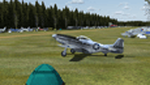
This scenery represents the Flying M Ranch which is a private airfield located in Reklaw, Texas about 123 NM ESE of the Dallas/Fort Worth area. The airfield is known for its annual Fall fly-in and campout and its challenging approaches due to the proximity of trees around the airport. The fly-in has attracted hundreds of aircraft each year and continues to gain popularity. This scenery is not an exact copy of the airport but it does it justice compared to the default scenery which is just a grass strip in the middle of a large blank airfield landclass. The scenery was created with the fantastic Airport Design Editor (ADE) and all objects used are from the default library.
| Filename: | Flying_M_Ranch__7TA7_Reklaw_TX.zip |
| License: | Freeware |
| Added: | 28th May 2020, 19:37:53 |
| Downloads: | 133 |
| Author: | Dylan Phelps |
| Size: | 9.32 MB |
| Category: Flight Simulator 2002 - AFCAD Files | |
| Tahiti Afcad V.2 |
|
File Description:
Tahiti Afcad files and flight plans for FS 2002. Here is five afcad files for the following scenery Tahiti International-NTAA, Bora Bora-NTTB, Raiatea-NTTR, Huahine-NTTH and Moorea-NTTM made by Bill Melichar use them with Lee Swordy's AFCAD program. I have hangered some aircraft and also put new taxi paths on the runways so the aircraft takeoff down the middle of the runway. Also include are afcad files for Anaa-NTGA,Hao-NTTO and Nuku-Hiva-NTMD these are as FS2002 standard airport scenery. Also I have made up some flight plans that can be used with Traffic Tools
I have included Lee Swordy's latest invention, the AF Installer, along with these files. It automatically installs each AFCAD airport file in FS2002.
| Filename: | Tahiti_Afcad_V2.zip |
| License: | Freeware, limited distribution |
| Added: | 26th September 2002, 02:27:11 |
| Downloads: | 1,669 |
| Author: | Robert Bakhuis |
| Size: | 560.11 KB |
| Category: Flight Simulator 2004 - Aircraft Repaints, Textures and Modifications | |
| Air China Boeing 777-200PW |
|
File Description:
Here's a repaint (textures only) of Meljet fabulous Boeing 777-200PW in Air
China livery (reg.# B-2067). Now some language class(!!) Welll, I tried hard
and almost killed myself(!) to finally read those Chinese characters written
on the fuselage (congrat me!) and here wish to share my knowledge with
you (correct me if I'm mistaking anything please): it reads as zhong guo guo
ji hang kong gong si where the first two words stand for China / Middle
Kingdom, the second pair of words means international and the rest
remaining ones mean airline company. Yeah, I'm really proud of myself
now!!
Model and base textures by Meljet (MJ722PW.zip which can be
downloaded from www.meljet.com), Air China repaint by Pantee Farhangi.
Happy Flying!
| Filename: | Air_China_Boeing_777200PW.zip |
| License: | Freeware |
| Added: | 29th December 2004, 18:58:26 |
| Downloads: | 1,186 |
| Author: | Pantee Farhangi, Meljet |
| Size: | 1.83 MB |
| Category: Flight Simulator X - AFCAD Files | |
| Guntersville Municipal Airport 8A1 |
|
File Description:
Guntersville Municipal Airport 8A1, also known as Joe Starnes Field, is an airport located three miles northeast of Guntersville, Alabama. The scenery adds the new runway 7-25 and closes the old runway 3-21. It also adds the water runway 6W-24W, and the new tarmac with a small amount of hangers. The buildings are placed as close to real world locations as I could get using Google Earth. Only generic FSX objects were used for ease of distribution. The file has been tested with Ultimate terrain and MegaSceneryEarth Alabama can be edited with ADE
| Filename: | Guntersville_Municipal_Airport_8A1.zip |
| License: | Freeware |
| Added: | 6th July 2017, 18:32:00 |
| Downloads: | 91 |
| Author: | Brad Banister |
| Size: | 5.94 KB |
| Category: Flight Simulator 2002 - Scenery Design | |
| LWMDraw4 |
|
File Description:
LWMDraw4 -- FS2002 Scenery Design
LWMDraw4 is developed to be an easy to use and helpful
time saving tool for placing free design shapes or photoreal
default type water areas such as lakes "with effects" onto
the FS2002 terrain surface generating a "ready to assemble"
LWMSource.asm file. Features include the addition of default
type FS2002 roads/lines/shorelines, Polygons, and LandClass
with the generation of a separate VTPSource.asm file as well.
Includes many additional features, a new tabbed interface,
and more options explained within the detailed Help menu
along with Quick Start Guide menu for fast placement.
Freeware by Ken Nelson
| Filename: | LWMDraw4.zip |
| License: | Freeware, limited distribution |
| Added: | 16th May 2010, 23:27:23 |
| Downloads: | 974 |
| Author: | Ken Nelson |
| Size: | 1.77 MB |
| Category: Flight Simulator 2002 - Flight Plans | |
| U.S. National Parks 1.0 |
|
File Description:
This series of flights -- for those who like hands-on, low and slow pilotage -- takes you sightseeing over all 55 U.S. National Parks, plus Virgin Islands National Park, in a Cessna 172SP. No flight plans here -- just briefings on each park, one suggested tour through each park, plus flight and weather files for each park to get you started. (Print out the briefings or open the .BRF files in Notepad during your flights.) The parks are beautiful with a basic FS2K2 installation, but with the FSGenesis 38.2m and/or 9.6m enhanced terrain meshes, they can be spectacular.
| Filename: | US_National_Parks_10.zip |
| License: | Freeware |
| Added: | 16th October 2002, 11:43:25 |
| Downloads: | 999 |
| Author: | Dick Muldoon |
| Size: | 398.22 KB |
| Category: Flight Simulator 2004 - Scenery | |
| Vernon Regional Airport (CYVK) - Vernon, B.C.; Canada |
|
File Description:
Scenery add-on for Vernon Regional Airport (CYVK) - Vernon, B.C.; Canada. Vernon Regional boasts over 120,000 square feet of land and has become the center for aviation manufacturing and maintenance in the Pacific Northwest. This add-ons places the Vernon Flying Club building, plus a number of hangars on the airport grounds. Includes AFCAD file to add aircraft parking. Scenery was designed to reflect the current placement of buildings at CYVK within the limitations of the flight simulator terrain. Consideration was also given to system effects and framerates. This package requires the NovaSim Gold textures (Not included-directions provided in ReadMe file).
| Filename: | Vernon_Regional_Airport_CYVK__Vernon_BC_Canada.zip |
| License: | Freeware, limited distribution |
| Added: | 3rd January 2004, 02:49:42 |
| Downloads: | 912 |
| Author: | Jeff Shields |
| Size: | 39.16 KB |


© 2001-2026 AVSIM Online
All Rights Reserved
Privacy Policy |