
Where Flight Simulation Enthusiasts Gather from Around the World!
AVSIM Library - Search Results

| Category: Flight Simulator 2004 - Scenery | |
| FS2004 Scenery - Elizabeth Field 0B8 |

|
File Description:
FS2004 Scenery - Elizabeth Field Airport (0B8) serves Fishers Island and Suffolk County Long Island, N.Y. and is owned by Town Of Southold. The airport has more than one runway. The longest is a paved runway extending 2328 feet. The facility is at an elevation of 9 feet. The scenery objects were placed using Instant Scenery using the EZ Scenery libraries. Instructions for Ultimate Terrain users included. Created in collaboration with Ray Lunning by John B. Loney, Jr.
| Filename: | FS2004_Scenery__Elizabeth_Field_0B8.zip |
| License: | Freeware, limited distribution |
| Added: | 21st December 2007, 04:36:10 |
| Downloads: | 815 |
| Author: | John B. Loney, Jr. |
| Size: | 219.35 KB |
| Category: Flight Simulator 2004 - Scenery | |
| St Charles Municipal 3SQ |
|
File Description:
FS2004 Scenery - St Charles Municipal Airport (3SQ) is a small public airport in eastern Missouri, USA in the town of St Charles. Located about 10nm northwest of St Louis, the airport has three runways. Two grass running 2310 ft and 2146 ft as well as an asphalt runway running 3445 ft. Created with Instant Scenery. All AI aircraft are included with the download. Works equally well with default FS and Ultimate Terrain. By John B. Loney, Jr.
| Filename: | St_Charles_Municipal_3SQ.zip |
| License: | Freeware, limited distribution |
| Added: | 27th March 2009, 01:57:21 |
| Downloads: | 500 |
| Author: | John B. Loney, Jr. |
| Size: | 4.66 MB |
| Category: Flight Simulator 2004 - Aircraft Repaints, Textures and Modifications | |
| Iraqi Air Force Mil Mi-24 Hind camo |
|
Images related to this file:
File Description:
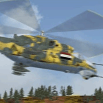
This is my Mil Mi-24 Hind attack Gunship Helicopter Iraqi Air Force Camo in the first Gulf war, During Iran-Iraqi war.
i based my repaint on documentary photographic, and tried to be as real as possible.
the camo is pretty compatible with the iraqi land terrain.
the Fighter helicopter in the Iraqi air force were called (Army Aviation) not Air Force.
i wish you enjoy, and like it guys. Requires the LAGO payware MI-24.
| Filename: | Iraqi_Air_Force_Mil_Mi24_Hind_camo.zip |
| License: | Freeware |
| Added: | 23rd December 2009, 22:20:40 |
| Downloads: | 125 |
| Author: | Hanaw .H.A |
| Size: | 7.07 MB |
| Category: Flight Simulator X - Scenery | |
| Paraguana Airport (SVJC) - Venezuela |
|
Images related to this file:
File Description:
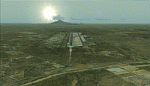
Josefa Camejo International Airport, located in Las Piedras
near the city of Punto Fijo, in western Venezuela.
This scenery add facilities Amuay refinery, the world's largest.
Includes some interesting special effects, like the explosion of a transformer
at the airport every hour o'clock and smoke effects in the refinery.
With photo-terrain scenery from satellite imagery in Google Earth.
Includes terminal building and hangars with realistic
textures from images obtained from Internet.
Also includes a friendly Auto-Install.
| Filename: | Paraguana_Airport_SVJC__Venezuela.zip |
| License: | Freeware |
| Added: | 11th September 2011, 20:59:37 |
| Downloads: | 1,922 |
| Author: | David Maldonado |
| Size: | 79.54 MB |
| Category: Flight Simulator 2004 - Aircraft Repaints, Textures and Modifications | |
| Commercial Air Services (Comair South Africa) Fairchild F-24R |
|
Images related to this file:
File Description:
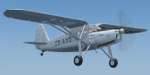
c/n 1162. Issued USAAF s/n 44-83201 and passed to RAF as KK544. Shipped 10 December 1944 to Algiers on SS EA Paden, arriving 29 December 1944. Stored at No. 351 Maintenance Unit RAF until returned to American authorities on 2 May 1946. Acquired by Commercial Air Services in Cairo, Egypt. Ferried in RAF markings, arriving Germiston Air Station on 23 May 1946. Registered 29 July 1946 as ZS-AXD. Sold in 1947. Destroyed in an accident on 13 December 1950 at Vereeniging, South Africa.
These are texture files only for the Fairchild 24R (f24r3.zip) by William Ortis, Lionheart Creations Ltd. Repaint by Andre Reimers.
| Filename: | Commercial_Air_Services_Comair_South_Africa_Fairch.zip |
| License: | Freeware |
| Added: | 14th December 2012, 22:39:16 |
| Downloads: | 136 |
| Author: | Andre Reimers |
| Size: | 3.54 MB |
| Category: Flight Simulator X - Aircraft Repaints, Textures and Modifications | |
| Royal Navy Grumman F9F, HMS Centaur, 1956 |
|
Images related to this file:
File Description:
This livery represents a fictional "What if" repaint of the magnificent payware Grumman F9F-5 Panther by VertigoStudios in a Royal Navy Livery.
The aircraft resembles what it would look like if the United Kingdom government chose the Grumman F9F Panther over, or together with the
Hawker Seahawk as their primary naval (carrier based) attack fighter in the mid 50-ies. This particular aircraft is in the colors of the
HMS Centaur (R06) aircraft carrier based 806 Sqn operating in Suez, Egypt, 1956. The livery has the Suez-crisis black and yellow identification
stripes. You need the payware Vertigo Studios F9F in order to use this repaint.
| Filename: | Royal_Navy_Grumman_F9F_HMS_Centaur_1956.zip |
| License: | Freeware |
| Added: | 16th January 2011, 23:09:46 |
| Downloads: | 127 |
| Author: | Rene Spaan |
| Size: | 6.24 MB |
| Category: Flight Simulator 2004 - Scenery | |
| 3 Northern Ontario Airports: Kenora (CYQK), Wawa (CYXZ) and Marathon (CYSP) - CanUk Scenery |
|
File Description:
Kenora, Wawa and Marathon airports offer destinations in Northern Ontario and are intended to be used with Flight Ontario's Thunder Bay2 and Toronto sceneries. Ultimate Terrain compatible. Zip file includes 3 separate scenery folders so you can choose which of the sceneries you would like to install. Created in GMAX, these sceneries are fairly accurate representations of their real world counterparts. Custom landclass, automated hanger doors, photoreal buildings, 3-D taxiway lights, custom AFCAD2 and static vehicles included. Please see ReadMe for proper installation.
| Filename: | 3_Northern_Ontario_Airports_Kenora_CYQK_Wawa_CYXZ_.zip |
| License: | Freeware, limited distribution |
| Added: | 19th September 2005, 21:50:30 |
| Downloads: | 4,900 |
| Author: | Adam Bentley and David Madge |
| Size: | 14.5 MB |
| Category: Flight Simulator X - Scenery | |
| Namibia Airports (207 airports across Namibia) |
|
Images related to this file:
File Description:
This pack contains 207 airports for Namibia, including all the majors (with recent runway extensions and so forth, as per information available on the web, via NOTAM, etc.), plus many bush strips from across the country. It also contains various other features, such as details at major ports, mines, and radio/TV towers. All were designed with ADE X v1.5, and tested in FSX SP2. The airports are designed to go with Aeroworx's excellent series of Southern Africa landclass and terrain features (see readme).
| Filename: | Namibia_Airports_207_airports_across_Namibia.zip |
| License: | Freeware |
| Added: | 20th April 2012, 21:20:17 |
| Downloads: | 2,340 |
| Author: | David Atkinson |
| Size: | 521.46 KB |
| Category: Microsoft Train Simulator - Tracks and Scenery | |
| MSTS Route - Albula Line 2.1 Upgrade |
|
File Description:
MSTS Route - Albula Line 2.1 upgrade.
This file upgrades Albula Line 2, a highly detailed protypical Swiss mountain route.
It adds photoreal station buildings, older-style gantries, 4 new activities,
12 new types of water, changed snow terrain textures, cows and people that
disappear in some seasons and weather, and many other details.
The new activities require 16 new pieces of rolling stock, available separately
in file RhBpack2.zip, and the previous rolling stock, available in RhBpack.zip.
Uses default MSTS tracks. Requires Albula Line 2 (MValb2.zip).
| Filename: | MSTS_Route__Albula_Line_21_Upgrade.zip |
| License: | Freeware |
| Added: | 8th June 2003, 03:32:56 |
| Downloads: | 3,587 |
| Author: | Michael Vone and Joachim Zander |
| Size: | 14.87 MB |
| Category: Civil Flight Simulators - Looking Glass Flight Unlimited 3 | |
| Visual GTL Editor |
|
Images related to this file:
File Description:

This is a standalone program that allows you to change the terrain textures of outer terrain megatiles by applying altitude based rule changes. This means that the Editor allows you to do what FU3 does through the RULES.TXT file but in visual form and on a per tile basis. The Editor converts and displays l0xxxx.gtl files and their corresponding l5xxxx.geo elevation files to 512x512 bitmaps. It also displays useful information when moving the mouse across the main display, i.e. Min Alt, Max Alt, Alt Range, Alt Index, Texture and so on. The Index value is an altitude range corresponding to the 64 colours used to create the elevation bitmap and is useful when specifying Min Alt and Max Alt values for rule changes. You can apply up to 8 rule changes at a time (just repeat until you get the desired results), either to the entire tile or to a subsection defined as X and Y co-ordinates. The Editor displays X-origin and Y-origin values within the tile as an aid to this. You can use this with the default 13 textures or with my extended 26 textures.
| Filename: | Visual_GTL_Editor.zip |
| License: | Freeware |
| Added: | 29th June 2011, 21:14:30 |
| Downloads: | 76 |
| Author: | Jonathan Stonehouse |
| Size: | 2.76 MB |


© 2001-2026 AVSIM Online
All Rights Reserved
Privacy Policy |