
Where Flight Simulation Enthusiasts Gather from Around the World!
AVSIM Library - Search Results

| Category: Flight Simulator 2004 - Scenery | |
| Glacier Bay National Park, Alaska |

|
File Description:
Add-on meshes can greatly improve the detail of the FS terrain but often conflict with the inaccurate placement of the other default FS landscape elements, particularly in coastal and mountainous areas. This project showcases new methods and software that allow for semi-automated development of FS landscapes from accurate source data. The files completely replace the default FS landscape of Southeast Alaska's Glacier Bay National Park and the adjacent Lynn Canal area between Juneau and Skagway (N58-60 W134-138), including shorelines, islands, and lakes, as well as glaciers, landclass, man-made features, and a LOD9 (76-m) terrain mesh. Optional AI floatplane traffic at four seaplane bases is included. A LOD10 (38-m) mesh of the same area is available as a separate optional download. FS2002 users please use fs8glbay.zip instead.
| Filename: | Glacier_Bay_National_Park_Alaska.zip |
| License: | Freeware, limited distribution |
| Added: | 16th February 2004, 03:40:31 |
| Downloads: | 17,192 |
| Author: | Holger Sandmann, Jim Keir |
| Size: | 10.43 MB |
| Category: Flight Simulator 2002 - Scenery | |
| Lillooet-Thompson Region, Southwestern B.C., Canada Mesh |
|
File Description:
New high-resolution (76-m) terrain mesh of 30,000 square km of southwestern British Columbia, covering a 4-degree longitude by 1-degree latitude transect from the mainland coast to Kamloops (N50-51, W120-124). This is probably one of the more spectacular regions of B.C. to represent in such vivid detail. Visit the Fraser and Stein River canyons, Princess Louisa Inlet, and the glacial lakes in the Pemberton area. Made from 50-m digital elevation data, resampled to LOD9 (76-m) horizontal spacing. Designed as an add-on to my LOD7 mesh of the entire province but can be used independently. By Holger Sandmann.
| Filename: | LillooetThompson_Region_Southwestern_BC_Canada_Mes.zip |
| License: | Freeware, limited distribution |
| Added: | 19th January 2003, 23:07:36 |
| Downloads: | 4,462 |
| Author: | Holger Sandmann |
| Size: | 5.35 MB |
| Category: Flight Simulator 2004 - Scenery | |
| Nashville Area Mesh |
|
File Description:
This is a mesh file that includes the immediate Nashville International Airport (KBNA) area. It is from N036W87 & N036W86 SRTM data information. This is produced using the 1 Arc per Sec method.
| Filename: | Nashville_Area_Mesh.zip |
| License: | Freeware |
| Added: | 24th November 2003, 20:59:20 |
| Downloads: | 2,195 |
| Author: | Larry Stewart |
| Size: | 6.72 MB |
| Category: Flight Simulator 2004 - Scenery | |
| Hong Kong VFR v.0.5 Alpha (Photo Scenery) |
|
Images related to this file:
File Description:
This is a photo scenery of Hong Kong in alpha stage which was finished in 2010. The scenery is just similar with Project Visual Hong Kong but with accurate coordinates. The scenery covers a part of Shenzhen and most part of Hong Kong (Except the North East Part of Hong Kong). Terrain mesh is included.
| Filename: | Hong_Kong_VFR_v05_Alpha_Photo_Scenery.zip |
| License: | Freeware |
| Added: | 9th October 2011, 20:36:38 |
| Downloads: | 1,823 |
| Author: | Thomas Lau |
| Size: | 51.13 MB |
| Category: Prepar3D V1-4 - AFCAD Files | |
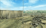
| FNDA Aeroporto of N'dalatando (Comandante Ngueto) - Angola |
|
Images related to this file:
File Description:
N'dalatando Airport (IATA: NDF) is an airport serving the city of N'dalatando, in Cuanza Norte Province, Angola. The runway is 6 kilometres (3.7 mi) east of the city.
The airport was capable of receiving medium-sized aircraft, such as Fokker 50s and Embraer 120s, 135s and 145s.
Optimized for ETM12m Africa - Enhanced Terrain Mesh 12m for ANGOLA vol.04.
| Filename: | FNDA_Aeroporto_of_Ndalatando_Comandante_Ngueto__An.zip |
| License: | Freeware |
| Added: | 18th September 2019, 02:31:55 |
| Downloads: | 254 |
| Author: | Giovanni Miduri |
| Size: | 4.15 MB |
| Category: Flight Simulator 2004 - Scenery | |
| EZ Scenery Grimes OK (1OK7) |
|
File Description:
FS2004 EZ Scenery Grimes OK (1OK7)
Area outside of airport's default flatten area require FS Global or Abasus extreme landscapes for mesh and the FREE library of EZ scenery objects available on FlightSim.com or AVSIM. I also use Ground Environment and Ultimate Terrain USA for landclass and mesh. FSX compatable.
Instructions inside.
jimmy R martin
| Filename: | EZ_Scenery_Grimes_OK_1OK7.zip |
| License: | Freeware |
| Added: | 3rd June 2006, 05:45:57 |
| Downloads: | 374 |
| Author: | jimmy R martin |
| Size: | 31.64 KB |
| Category: Flight Simulator 2004 - Scenery | |
| FS2004 EZ Scenery Elk City Mun OK (KELK) |
|
File Description:
FS2004 EZ Scenery Elk City Mun OK (KELK)
Area outside of airport's default flatten area require FS Global or Abasus extreme landscapes for mesh and the FREE library of RWY12 - EZ scenery objects available on FlightSim.com or AVSIM. I also use Ground Environment and Ultimate Terrain USA for landclass and mesh. FSX compatable.
Instructions inside.
| Filename: | FS2004_EZ_Scenery_Elk_City_Mun_OK_KELK.zip |
| License: | Freeware |
| Added: | 3rd June 2006, 21:38:22 |
| Downloads: | 446 |
| Author: | jimmy R martin |
| Size: | 139 KB |
| Category: Flight Simulator X - Aircraft Repaints, Textures and Modifications | |
| Middle East Airlines Boeing 777-300ER GE (OD-GAR) |
|
Images related to this file:
File Description:

This is a repaint of a Boeing 777-300ER, registration code OD-GAR of Middle East Airlines, the flag carrier airline of Lebanon. It operates international services to Asia, Europe and Africa. Middle East Airlines currently does not operate any Boeing 777-300ERs. This repaint has all the great features of my other works. To use this repaint, the Captain Sim B777-300 v1.4 is required. Repainted by Garrett Rowley, send me comments/requests at [email protected]
| Filename: | Middle_East_Airlines_Boeing_777300ER_GE_ODGAR.zip |
| License: | Freeware |
| Added: | 22nd July 2014, 02:26:36 |
| Downloads: | 383 |
| Author: | Garrett Rowley, Captain Sim |
| Size: | 27.14 MB |
| Category: Flight Simulator X - AFCAD Files | |
| Cali SKCL |
|
Images related to this file:
File Description:
For those of you who are using accurate terrain mesh this is a fix for Cali airport in Colombia. FSX has the airport about 800 feet lower than it should be. So if you use terrain mesh it looks like the airport is in a giant sinkhole. This fixes that plus I've added the terminal and the correct number of gates, so it loosk better than the default.
| Filename: | Cali_SKCL.zip |
| License: | Freeware |
| Added: | 24th April 2012, 02:09:43 |
| Downloads: | 1,165 |
| Author: | Eric Thornton |
| Size: | 6.33 KB |
| Category: Flight Simulator X - Scenery | |
| Flattening Patch for FSX Tarija (SLTJ), Bolivia When Used with FreeMeshX |
|
Images related to this file:
File Description:
That is a flattening patch for the airport of Tarija (SLTJ), Bolivia when using FreeMeshX terrain by NineTwo Production, a freeware global terrain mesh for FSX. Comes with a French readme too. Freeware
| Filename: | Flattening_Patch_for_FSX_Tarija_SLTJ_Bolivia_When_.zip |
| License: | Freeware |
| Added: | 18th January 2017, 17:11:39 |
| Downloads: | 225 |
| Author: | G. Guichard |
| Size: | 125.39 KB |
© 2001-2026 AVSIM Online
All Rights Reserved
Privacy Policy |