
Where Flight Simulation Enthusiasts Gather from Around the World!
AVSIM Library - Search Results

| Category: Orbiter - Miscellaneous Files | |
| Marius Hills: Apollo 18 Landing Site |

|
File Description:
This ORBITER add-on features the lunar surface mesh of the Marius Hills area of the moon, which I built up from lunar orbiter photographs of the area. This pack also contains an Alternate-History Apollo 18 Mission, containing a completely new J (or in Apollo 18's case, K) type Lunar Module 3D-mesh, which has enlarged descent quads, to house various scientific equipment and the LRV or lunar rover. Also, I included a new EVA astronaut which is more accurate compared to my earlier Apollo lunar EVA astronauts, and a new, more accurate LRV with two seated astronauts as passengers.
| Filename: | Marius_Hills_Apollo_18_Landing_Site.zip |
| License: | Freeware, limited distribution |
| Added: | 4th August 2003, 16:21:45 |
| Downloads: | 2,201 |
| Author: | Rodion M. Herrera |
| Size: | 10.27 MB |
| Category: Flight Simulator X - Scenery | |
| Israel Navy Ships |
|
File Description:
This BGL file adds few Israel Navy ships in the Mediterranean sea near Israel.
| Filename: | Israel_Navy_Ships.zip |
| License: | Freeware, limited distribution |
| Added: | 21st June 2015, 15:25:54 |
| Downloads: | 614 |
| Author: | Stas Harchuk |
| Size: | 1.53 KB |
| Category: Flight Simulator 2004 - Scenery | |
| Ascension Island Landclass Update |
|
File Description:
Updated Ascension Island Landclass. Rids Ascension of its green jungle look, and adds lava rock in its place. Only greenery is atop Green Mtn. where it actually exists. Works great and highly recommended with John Holden's mesh scenery (southatlantic.zip) Tested in FS2004 and FSX.
| Filename: | Ascension_Island_Landclass_Update.zip |
| License: | Freeware |
| Added: | 20th February 2008, 00:59:32 |
| Downloads: | 2,268 |
| Author: | Scott Wilson |
| Size: | 140.44 KB |
| Category: Flight Simulator X - Scenery | |
| St Eustatius, Caribbean, PhotoScenery V2 |
|
Images related to this file:
File Description:
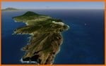
St Eustatius, Caribbean, PhotoScenery V2 with added Valladier Tower and Terminal.
Photo scenery of St.Eustatius (Statia) in the Caribbean with the airport F.D. Roosevelt (TNCE) in Oranjestad. JL Valladier's model of terminal, tower and PIR included with permission. This file also includes updates and mesh.
| Filename: | St_Eustatius_Caribbean_PhotoScenery_V2.zip |
| License: | Freeware |
| Added: | 11th December 2012, 17:33:53 |
| Downloads: | 3,339 |
| Author: | Harald Sandvik |
| Size: | 63.43 MB |
| Category: Flight Simulator 2004 - Scenery | |
| Beaver Creek CYXQ in Yukon Territory, Canada |
|
Images related to this file:
File Description:
Beaver Creek is located at mile 1202 of the Alaska Highway, just east of the Alaska/Yukon border. The populaton is around 100 and the main employment is with the Border Agency, the White River First Nation, or with local tourist lodges. The airfield is a mile north of the town and close to the Canadian border post, which is included in the scenery. It was built by Jack Stalberg in the 1960's, and I have no further information beyond the fact that he loved to fly. The airport serves as an "airport of entry", though it is restricted in hours of opening and in the size of aircraft that it can handle; up to a maximum of only 15 seats. The single runway is 3,745 feet long and 100 feet wide, gravel, aligned 13-31 in FS9, lit, and with vasi at both ends. Righthand circuits for runway 13. There is a 340 feet threshold displacement to runway 31, which is of course unmarked on a gravel runway. The terminal building was recently reclad; I don't like it, but they didn't consult me. The ai reflects the sort of traffic the airfield gets; ie brief paperwork stopovers for GA or small charter flights into Canada from Alaska, usually in the mornings.I have adjusted the local scenery terrain levels to remove adjacent hills that I believe do not exist in real life but are part of the Northern Canada terrain mesh that I have installed. If you do not have this mesh you may find that the scenery works fine for you without the API flatten that is included here. The airfield is at 2,129 feet ASL.
| Filename: | Beaver_Creek_CYXQ_in_Yukon_Territory_Canada.zip |
| License: | Freeware, limited distribution |
| Added: | 28th January 2019, 06:19:20 |
| Downloads: | 175 |
| Author: | Roger Wensley |
| Size: | 4.68 MB |
| Category: Flight Simulator X - Scenery | |
| Whale Island Scenery: "Islands of the Bay of Plenty" |
|
File Description:
This scenery was created from a digital Orthorectified aerial mosaic owned by Environment Bay of Plenty (The Bay of Plenty Regional Council). The imagery has been de-sampled for use in Flight Simulator X and utilizes the default terrain mesh. The textures are intended for summer daylight flying only, although due to the sparse nature of White Islands' Evegetation, the Islands appearance remains relatively consistent throughout the year.
It includes autogen trees, a landable helicopter pad on the top of the Island, Radio masts, and the Department of Conservation (DOC) hut in the south western bay of the island.
| Filename: | Whale_Island_Scenery__Islands_of_the_Bay_of_Plenty.zip |
| License: | Freeware, limited distribution |
| Added: | 9th May 2007, 08:42:59 |
| Downloads: | 1,496 |
| Author: | Tim Barnes |
| Size: | 7.05 MB |
| Category: Flight Simulator 2004 - Scenery | |
| Fernando de Noronha, Brazil - SBFN (Photoreal for Fs9) |
|
File Description:
Photoreal Fs9 Fernando de Noronha island. This addon WAS NOT created by me,
but I was given permission to upload it. It's author is Amengol.
The island is steeped in history and has it's own connection with aviation history. For it was one of the fuel stops that were used on the very first Africa to South America trans-atlantic flight. March 30 - June 17, 1922, using three Fairey IIID floatplanes. Perhaps you might like to retrace the brave pilots route to see if you can make the trip!
Featuring: Photoreal textures, A.I. Aircraft, and Custom Terrain mesh.
| Filename: | Fernando_de_Noronha_Brazil__SBFN_Photoreal_for_Fs9.zip |
| License: | Freeware |
| Added: | 27th January 2009, 00:55:22 |
| Downloads: | 2,225 |
| Author: | Amengol and Rob Barnett |
| Size: | 2.84 MB |
| Category: Flight Simulator 2004 - Scenery | |
| Islas Desventuradas Islands |
|
File Description:
A replacement for the stock Islas Desventuradas (San Felix & San Ambrosio) of Chile, comprising new coastline, landclass, mesh and airfield SCFX. The islands are at S26* 20.12' W80* 0.09', 500 miles off the mainland and about the same distance north of Robinson Crusoe Island.
| Filename: | Islas_Desventuradas_Islands.zip |
| License: | Freeware |
| Added: | 3rd April 2012, 22:28:02 |
| Downloads: | 374 |
| Author: | Dave Morgan & Richard Ludowise |
| Size: | 958.97 KB |
| Category: Flight Simulator 2002 - Scenery | |
| CALVI v2 |
|
File Description:
Calvi scenery. Corsica. France. Take off from LFKC 36. Very accurate with lots of details of the city, 13th century citadel, harbor and beach. Photorealistic textures for most buildings, church, hotels, casino, etc...
Requires Gerrish Gray's trees library(trees_v3) and Thierry Pignot Mesh of Corsica.
| Filename: | CALVI__v2.zip |
| License: | Freeware |
| Added: | 12th November 2002, 00:00:25 |
| Downloads: | 4,171 |
| Author: | Christian Santoni |
| Size: | 7.13 MB |
| Category: Prepar3D V1-4 - Aircraft Repaints, Textures and Modifications | |
| A2A Curtiss P-40 A4O-MS Oman |
|
Images related to this file:
File Description:
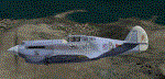
This is an imaginary repaint to fly over Middle East / Africa (great with Orbx Open LC Africa), with a registration code from Oman / Mascate city
Made by Jean Marc with Gimp and FSRepaint 2.25, from the initial repaint "USAAC Primer" by Tom Weiss
| Filename: | A2A_Curtiss_P40_A4OMS_Oman.zip |
| License: | Freeware |
| Added: | 5th August 2020, 19:16:57 |
| Downloads: | 44 |
| Author: | jean marc |
| Size: | 22.01 MB |


© 2001-2026 AVSIM Online
All Rights Reserved
Privacy Policy |