
Where Flight Simulation Enthusiasts Gather from Around the World!
AVSIM Library - Search Results

| Category: Flight Simulator 2004 - Scenery | |
| Palermo Punta Raisi Area 2013 |

|
Images related to this file:
File Description:
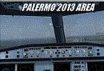
Dear Friends simmer, using the great objects bgl by mr Gianluca Giovannini, I tried to fill with autogen trees / buildings , the urban area near the international airport of Palermo "Falcone Borsellino". With the current integration of scenery i have created the town of Cinisi, Villagrazia di Carini, Torre Muzza and part of the smalls village near Airport.
Warning Very Important: the scenery "is not complete" and to get the best result YOU MUST INSTALL the following files:
-mesh by Pietro mauri (or SIMILAR mesh OF Sicily) (available HERE);
-install the wonderfull scenery LICJ by Francesco Salsano (available HERE);
-the "Palermo Vfr" by Fulvio Mazzokan (available HERE).
Most information inside the read me file. I hope you like this for your eternal fs 2004 and for your flights in Sicily. Best regards from Italy, Fabio Ferrari Castione della Presolana (bg).
| Filename: | Palermo_Punta_Raisi_Area_2013.zip |
| License: | Freeware, limited distribution |
| Added: | 20th February 2013, 21:57:36 |
| Downloads: | 2,710 |
| Author: | Fabio Ferrari |
| Size: | 4.72 MB |
| Category: Prepar3D V1-4 - AFCAD Files | |
| FNBG Aeroporto di Benguela-17 de Setembro - Angola vers. 2.0 |
|
Images related to this file:
File Description:
Benguela Airport (Portuguese: Aeroporto de Benguela - 17 de Setembro) (IATA: BUG, ICAO: FNBG) is an airport serving Benguela, the capital city of Benguela Province in Angola.The defaul airport (17 of November (?)) In FSX / P3D is in the wrong position with respect to the real position as well as the NDB beacon (BG). Update the position on the ground of the NDB radio beacon (BG). This is for (ONLY) P3D all version, optimized for ETM12m Africa - Enhanced Terrain Mesh 12m for ANGOLA vol.07.
| Filename: | FNBG_Aeroporto_di_Benguela17_de_Setembro__Angola_v.zip |
| License: | Freeware |
| Added: | 21st March 2020, 16:46:49 |
| Downloads: | 260 |
| Author: | Giovanni Miduri |
| Size: | 4.33 MB |
| Category: Flight Simulator X - Miscellaneous Files | |
| Morocco VFR - HPX (Hydro Polygons) Lakes and Dam |
|
Images related to this file:
File Description:
Natural and artificial lakes as originally created in FSX were drawn basing the drawing on low resolution data, as a result of this they tend to have an extremely approximate visualization and a very approximate and non realistic positioning in relation to the area.
This work places the natural and artificial lakes in the correct location and the elevation updated with the new terrain mesh SRTM 1 Arc Sec Global LOD 11.
Fully compatible with P3D.
| Filename: | Morocco_VFR__HPX_Hydro_Polygons_Lakes_and_Dam.zip |
| License: | Freeware |
| Added: | 19th December 2015, 23:58:02 |
| Downloads: | 951 |
| Author: | Giovanni Miduri |
| Size: | 12.44 MB |
| Category: Flight Simulator 2004 - Scenery | |
| Mangalore Airport VOML |
|
File Description:
This scenery models Bajpe Airport, Mangalore (VOML) in Southern India (as seen in 2004). Works best when combined with my "India_76m-Mesh_Part_A" available at the AVSIM library.
Mangalore airport is known for it's infamously short runway that sits on top of a table-top mountain. This is modelled quite accurately in my mesh for Southern India. There have been quite a few near miss incidents in the past 20Yrs. So, if you're flying big tin, don't forget to step on the brakes ;-)
| Filename: | Mangalore_Airport_VOML.zip |
| License: | Freeware |
| Added: | 21st January 2006, 22:36:44 |
| Downloads: | 2,872 |
| Author: | Keith Sebastian |
| Size: | 169.52 KB |
| Category: Flight Simulator 2004 - Scenery | |
| 28A - Goose Creek Airport |
|
Images related to this file:
File Description:
FS2004 Scenery--Goose Creek Airport (28A), is a small GA airfield located near Indian-Trail, North Carolina (NC), USA. It is home to Pressley Aviation Inc., a popular flight-training school. This scenery package uses common objects from the Rwy12 and EZ-Scenery libraries (not included) and these are required for correct scenery display. A good high-quality terrain mesh from FSGenesis or equivalent supplier is also recommended for best results. It will work with the default FS2004 terrain engine as well.
| Filename: | 28A__Goose_Creek_Airport.zip |
| License: | Freeware |
| Added: | 30th October 2011, 14:42:17 |
| Downloads: | 737 |
| Author: | Glenn Mullis |
| Size: | 3.81 MB |
| Category: Flight Simulator 2002 - Scenery | |
| Fish Lake Fix |
|
File Description:
This is a fix for the FS2002 default scenery that surrounds the airport at fish lake USFS in Idaho. It also works with Denney's mesh (originally created for FS2000, but works fine in FS2002). The default scenery has fish lake that is situated at the approach end of of runway 21 elevated about fifty feet above the elevation of the airport. This scenery .bgl flattens the lake area to make the approach to runway 21 as it is at the real airport.
| Filename: | Fish_Lake_Fix.zip |
| License: | Freeware |
| Added: | 22nd May 2003, 21:18:32 |
| Downloads: | 362 |
| Author: | Tim Slanczka |
| Size: | 209.95 KB |
| Category: Flight Simulator 2002 - Scenery | |
| Olympic National Park Bush Scenery |
|
File Description:
Ultra-challenging bush scenery set in Washington state's Olympic National Park, just west of Seattle. Consists mainly of small mountain lakes to test the skills of floatplane pilots, but there is also a special sloping airstrip for regular planes. There are 2 groups of scenery included: one on Mount Olympus itself, and the other just a few miles North of Emma Field in the southeast corner of the Park. Requires Steve Greenwood's Olympic National Park/Emma Field mesh (fst-30m10-wa-ef.zip).
| Filename: | Olympic_National_Park_Bush_Scenery.zip |
| License: | Freeware |
| Added: | 28th January 2003, 17:26:26 |
| Downloads: | 1,286 |
| Author: | James Belk |
| Size: | 3.04 MB |
| Category: Flight Simulator 2004 - Scenery | |
| New Airport for Canadian Mountain Parks Pack |
|
File Description:
FS2004 Scenery - This file adds 1 new airport to Canadian Mountain Parks Pack (cmpcanmtpks_v1.zip available at AVSIM) . Required is: cmpcanmtpks_v1.zip, Holger Sandmann's excellent BC mesh, which was the original reason for these files in the first place, and Lago's FSE demo file. Pack designed for low level visual 30 mile scenic flights. The strip is ficticious, but the names and places are real. There is parking for you to add your own AI traffic as well. One flight included.
| Filename: | New_Airport_for_Canadian_Mountain_Parks_Pack.zip |
| License: | Freeware |
| Added: | 27th April 2004, 17:53:12 |
| Downloads: | 710 |
| Author: | Peter Vibe |
| Size: | 296.49 KB |
| Category: Flight Simulator 2004 - AI Flight Plans | |
| Abaete Linhas Aereas - Summer |
|
File Description:
These are some ficticious FPs,(only the destinations and days are real, since they do not give any departure times in their site. For the use of the existing freeware repaint abaeti_emb-110.zip (avsim)
AFCAD modifications of the default airports for SBSV,SBLP,SNBR,SNGI,(ficticious) + callsign (ficticious ,but possible).
In order of the airports to be shown correctly, you will need the freeware SRTM Terrain Mesh of South America by Andy Weir (avsim)- Files: sa11.zip, sa14.zip,\ & sa17.zip
| Filename: | Abaete_Linhas_Aereas__Summer.zip |
| License: | Freeware |
| Added: | 1st September 2005, 17:28:24 |
| Downloads: | 618 |
| Author: | John Tsimas |
| Size: | 8 KB |
| Category: Flight Simulator 2004 - AFCAD Files | |
| Official Water Aerodromes located in Province of Quebec territory. |
|
File Description:
These are AFCAD2 Scenery files for most popular and visited waterbases located in the province of Quebec, Canada. Your Ai floatplanes will come alive with these "invisible" waterbases airports installed (AI traffic flightplans required.) and your flyable floatplanes will be allowed to take-off directly into water, at official water aerodromes, using FS9 airports menu. Thanks to Holger Sandmann who has developped this technique. Must be used with Gilles Gauthier's "Terrain Mesh Province of Quebec" for FS2004 and his excellent "Quebec Sceneries Enchancements".
| Filename: | Official_Water_Aerodromes_located_in_Province_of_Q.zip |
| License: | Freeware |
| Added: | 21st July 2006, 20:05:28 |
| Downloads: | 2,241 |
| Author: | Guy F. Jutras |
| Size: | 379.29 KB |
© 2001-2026 AVSIM Online
All Rights Reserved
Privacy Policy |