
Where Flight Simulation Enthusiasts Gather from Around the World!
AVSIM Library - Search Results

| Category: X-Plane - Scenery | |
| WXPN Susi Air Pulau Nurseen Airstrip v1.0.0 |

|
Images related to this file:
File Description:

This is an X-Plane 11 scenery for Pulau Nurseen Airstrip (WXPN) in the Island of Nurseen, Indonesia. This is a fictitious airfield, located in a tiny isolated island. This fictitious airfield may serve as a stopover for flights between Java and Papua, for the Susi Air scenery package. This is one of the destinations for "PT ASI Pujiastuti Aviation", operating as Susi Air, an Indonesia airlines established in late 2004 by Mrs. Susi Pudjiastuti. This scenery was tested and is operational (as of January 17, 2017) in "X-Plane 11 Public Beta #5 64 bit", Windows 10 Home. It was also tested and is not really operational (as of January 17, 2017) in "X-Plane 10.51 64 bit", Windows 10 Home. XP10's mesh is different, and presents problems in placing the runway over the water, instead of the land, plus some terrain elevations issues as well. Sorry, XP11 only.
| Filename: | WXPN_Susi_Air_Pulau_Nurseen_Airstrip_v100.zip |
| License: | Freeware |
| Added: | 18th January 2017, 05:00:53 |
| Downloads: | 45 |
| Author: | Rui Mesquita |
| Size: | 2.65 MB |
| Category: X-Plane - Scenery | |
| WIPB Susi Int'l Pangandaran Beach Airstrip v1.0.0 |
|
Images related to this file:
File Description:
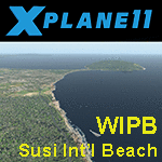
This is an X-Plane 11 scenery for the Susi Int'l Pangandaran Beach Airstrip (WIPB) in Pangandaran, West Java, Indonesia. This is a real private airfield, 9nm east of the Susi Air's headquarters at WICN/WI1A airport. This airfield is one of the destinations for "PT ASI Pujiastuti Aviation", operating as Susi Air, an Indonesia airlines established in late 2004 by Mrs. Susi Pudjiastuti. This scenery was tested and is operational (as of January 20, 2017) in "X-Plane 11 Public Beta #8 64 bit", Windows 10 Home. It was also tested and is partially operational (as of January 20, 2017) in "X-Plane 10.51 64 bit", Windows 10 Home. The issue with XP10 is the mesh again: there is a road crossing the airfield, by the end of rwy 28. If you can live with that, it's still operational in XP10, as a courtesy.
| Filename: | WIPB_Susi_Intl_Pangandaran_Beach_Airstrip_v100.zip |
| License: | Freeware |
| Added: | 21st January 2017, 18:45:03 |
| Downloads: | 40 |
| Author: | Rui Mesquita |
| Size: | 1.74 MB |
| Category: Flight Simulator 2002 - Miscellaneous Files | |
| Los Angeles Terminal Area Chart |
|
File Description:
The rendition of Los Angeles´ KLAX airport is one of the most detailed in FS2002 and a great starting point to explore the West Coast. The library hosts a few awesome landclass and mesh files for this area that offer an "as real as it gets" VFR experience if used with this chart. The 1:250.000 scaled chart is scanned in high resolution (8400*4700 pixel). It covers a much smaller area, but offers considerably more detail than the LA sectional. You may use this chart "as is" without any other software, but it will develop its full potential if used as moving map with SimSystem´s FSFlightMax or FSGarmin. It wouldn´t have been possible to offer this chart without Richard Harvey and his love to flightsimming, so please consider this file to be "donationware" and make a however small contribution to the Richard Harvey Endowed Scholarship.
| Filename: | Los_Angeles_Terminal_Area_Chart.zip |
| License: | Check within download |
| Added: | 30th March 2003, 15:27:19 |
| Downloads: | 1,472 |
| Author: | Uwe Rademacher |
| Size: | 28.03 MB |
| Category: Flight Simulator 2004 - Scenery | |
| BFU Brooks |
|
File Description:
With BFU Brooks, BFU enters the faraway bush country of northern Alaska. Located at Coldfoot in the southern foothills of the Brooks mountains, this base will cater to the needs of visitors to the area, and of sportsmen who indulge in hunting and fishing. This scenery package consists of three sceneries: our new northern base BFU Brooks, Moose Camp and Moose Lodge. The camp sits in the mountains on a small lake, whereas the lodge is situated on the shore of a large lake. Visitors are flown into Coldfoot from Fairbanks, then on to the camp or lodge as desired. Moose Camp and Moose Lodge will not show on the GPS, and of course do not have an NDB or similar to guide you. You'd better start in the camp/lodge, and fly toward Coldfoot to get to know the area. The sceneries have only been tested with the default mesh.
| Filename: | BFU_Brooks.zip |
| License: | Freeware |
| Added: | 30th September 2003, 15:17:31 |
| Downloads: | 5,313 |
| Author: | Naji Chehabeddine |
| Size: | 2.96 MB |
| Category: Prepar3D V1-4 - Scenery | |
| Square Kilometre Array (MeerKAT) – South Africa |
|
Images related to this file:
File Description:

This scenery is of the MeerKAT radio telescope site (originally the Karoo Array Telescope – KAT but was changed to MeerKAT, meer=more) when the project was expanded to 64 dishes. It forms part of an international Square Kilometre Array (SKA) project. It is situated in the Karoo near the town of Carnarvon. The scenery includes the landing strip just North East of the biggest concentration of dishes. I could not find a code for this strip and called it FAKA (MeerKAT SKA), or take off from Carnarvon (FACN) and fly a heading of 320 degrees for 73 km. The scenery was designed and tested for P3D V5 to work with the ORBX Africa LC and Pilots NG2020 mesh products. I am not sure what the actual site would look like at night, but I included some night lighting to make the array visible after dark.
| Filename: | Square_Kilometre_Array_MeerKAT__South_Africa.zip |
| License: | Freeware |
| Added: | 14th August 2020, 22:53:38 |
| Downloads: | 99 |
| Author: | Johan Pienaar |
| Size: | 20.33 MB |
| Category: Flight Simulator 2002 - Scenery | |
| British Columbia Bush Scenery: Grant Narrows & Rambo's Hideout |
|
File Description:
The larger runway at Grant Narrows has a 15 degree bend, and the shorter runway is on a slope that involves an unconventional downhill landing & an uphill take-off (STOL planes only!). Both strips are bumpy, and require Holger Sandmann's mesh of the Lower Mainland of Southern British Columbia (bcmesh9c.zip) for the required effect. A dock is provided down on the lake shore for visitors on floats. The landing strips are fictional, set in an area of wilderness on the shores of Pitt Lake - but only 20 miles from downtown Vancouver. The first Rambo movie was filmed in the hills just to the east in the Golden Ears Provincial Park: if you fly north from Grant Narrows you'll find Rambo's airstrip hideout just a couple of miles past the end of the lake - the real life location of a popular fishing lodge. Also requires Gerrish Gray's trees (trees_v3.zip).
| Filename: | British_Columbia_Bush_Scenery_Grant_Narrows__Rambo.zip |
| License: | Freeware, limited distribution |
| Added: | 13th March 2003, 21:26:06 |
| Downloads: | 946 |
| Author: | James Belk |
| Size: | 1.74 MB |
| Category: Flight Simulator 2002 - Scenery | |
| British Farm Strips: Eastbach, Milson, & Nayland |
|
File Description:
Three interesting small English farm strips. Nayland is in Suffolk, near Colchester - the main 600m grass strip has a gradient of 8% in its first half:
probably the closest you'll get in Britain to one of the French alpine runways like Courchevel or Megève. Milson is in rural Shropshire on the side of a shallow valley; it has both a helipad & a 450m grass strip - most of which is on a fairly gentle 3.5% slope apart from the last 70 feet which rises up more steeply. The two runways at Gloucestershire's Eastbach Farm, on the edge of the Forest of Dean, are also on a slight slope but most of the excitement comes from their short length (250m & 350m respectively) - ideal for microlights and STOL planes. All three airfields are compatible ONLY with LAGO's TerraMesh Part 13 of England & Wales - no other mesh will work.
| Filename: | British_Farm_Strips_Eastbach_Milson__Nayland.zip |
| License: | Freeware, limited distribution |
| Added: | 31st March 2003, 13:05:02 |
| Downloads: | 1,298 |
| Author: | James Belk |
| Size: | 2.73 MB |
| Category: Flight Simulator X - AFCAD Files | |
| Fly-N-D Landing Strip Airport (92NJ), NJ |
|
File Description:
Located 01 miles E of Kingwood Township, New Jersey on 121 acres of land, Fly-N-D Landing Strip Airport is a private turf field with a 2200' runway. There is no hard surface runway so setting your mesh as high as possible will lead to the best effects of landing on terrain. No transient storage or services are offered, and the airfield is not lit, so daytime VFR operations are recommended only.
Scenery constructed with use of satellite images/streetview/aerial photos - the author has not been there in person.
This scenery is meant to be used in conjunction with MegaScenery Earth New Jersey/Delaware 001. It is not required, but apron use is minimized to allow satellite scenery to show through as much as possible, and objects are placed based on the MSE textures - lack of it may make scenery look out of place.
| Filename: | FlyND_Landing_Strip_Airport_92NJ_NJ.zip |
| License: | Freeware |
| Added: | 23rd March 2011, 13:33:27 |
| Downloads: | 174 |
| Author: | Drew Sikora |
| Size: | 474.94 KB |
| Category: Flight Simulator X - AFCAD Files | |
| Woodcrest Farms Airstrip Airport (JY17), NJ |
|
File Description:
Located 02 miles NE of Shiloh, New Jersey, Woodcrest Farms Airstrip Airport is a private turf field 2303' in length. There are no services offered for transient aircraft and the field is not lit, so daytime VFR operations only are recommended. There is no hard-surfaced runway so make sure your terrain mesh is set as high as possible. You can start on the runway or parked next to the hangar east of the field
Scenery constructed with use of satellite images/streetview/aerial photos - the author has not been there in person.
This scenery is meant to be used in conjunction with MegaScenery Earth New Jersey/Delaware 004. It is not required, but apron use is minimized to allow satellite scenery to show through as much as possible, and objects are placed based on the MSE textures - lack of it may make scenery look out of place.
| Filename: | Woodcrest_Farms_Airstrip_Airport_JY17_NJ.zip |
| License: | Freeware |
| Added: | 11th May 2011, 03:29:54 |
| Downloads: | 170 |
| Author: | Drew Sikora |
| Size: | 443.09 KB |
| Category: Flight Simulator 2004 - Scenery | |
| Revised East Vancouver Islands - compatible with vicenh05 |
|
File Description:
These files are a revision of the default Vancouver Island shorelines and landclass textures from Chemainus to Campbell River, British Columbia. Included are the islands from the Southern Gulf Islands to Texada Island and inland to Cowichan Lake. Most of the smaller lakes within 20 km of the shoreline have been redrawn as well. In this version shorelines have been revised to match Jon Patch & Holger Sandman's vicenh05.zip. As well major corrections for the shorelines in LOD5 area 117-114, Comox, have been made so that the shorelines now conform to the 38.2m mesh and to Vern Opperman's CFB - Comox version 042. Shoreline types are changed to look more like the Pacific Northwest courtesy of Holger Sandman's who made his shoreline textures for vicenh05 available. Also in this version no roads are included since complete British Columbia roads in bcroadsys.zip are now available.
| Filename: | Revised_East_Vancouver_Islands__compatible_with_vi.zip |
| License: | Freeware, limited distribution |
| Added: | 8th October 2005, 20:17:46 |
| Downloads: | 3,924 |
| Author: | Harvey Janszen |
| Size: | 346.85 KB |
© 2001-2026 AVSIM Online
All Rights Reserved
Privacy Policy |