
Where Flight Simulation Enthusiasts Gather from Around the World!
AVSIM Library - Search Results

| Category: Flight Simulator 2002 - Miscellaneous Files | |
| Anchorage South and Seaward Sectional Charts |

|
File Description:
The northern coast of the Gulf of Alaska is a paradise for Bush pilots. You´ll find many small interesting airstrips and exciting glacier formations up here, especially when you use some third party mesh and landclass files. While it can be used "as is" without any other software, it will develop its full potential if used as moving map with SimSystem´s FSFlightMax or FSGarmin. It wouldn´t have been possible without Richard Harvey and his love to flightsimming, so please consider this file to be "donationware" and make a however small contribution to the Richard Harvey Endowed Scholarship.
| Filename: | Anchorage_South_and_Seaward_Sectional_Charts.zip |
| License: | Check within download |
| Added: | 24th March 2003, 02:02:27 |
| Downloads: | 2,483 |
| Author: | Uwe Rademacher |
| Size: | 19.79 MB |
| Category: Flight Simulator 2002 - Scenery | |
| Patches for LOD7/LOD9 Terrain Meshes of British Columbia and Southeast Alaska |
|
File Description:
Patches (flatten files) for 108 lakes in British Columbia and Southeast Alaska that were either sunken below or raised above the terrain surface due to discrepancies between my add-on LOD7 and LOD9 mesh files and FS2002's default scenery. In some areas, such as the Prince George/Burns Lake region, the effect of the patches is obvious even from a great distance; in other areas, you'll have to be close to the lake to notice the difference. Also included are flatten files for nine airfields that had problems with sloping terrain or texture "bleed-through".
| Filename: | Patches_for_LOD7LOD9_Terrain_Meshes_of_British_Col.zip |
| License: | Freeware, limited distribution |
| Added: | 18th February 2003, 22:28:49 |
| Downloads: | 2,831 |
| Author: | Holger Sandmann |
| Size: | 613.45 KB |
| Category: Orbiter - Miscellaneous Files | |
| Mars Softlanding Sites and Approach Paths V 1.02 |
|
File Description:
With this addon you can see where are located 6 softlanding sites on Mars.
You can also get experience (feel taste) of Mars approach and Mars landing.
Included scenarios brings you on approach path few hours before Mars landing (or swingby) of these spacecrafts: Nozomi orbiter, Mars Express orbiter, Beagle 2 lander, MER Spirit lander, MER Opportunity lander). For better experience some lander scenarios uses MER meshes from Ariane 5 MER addon. Other scenarios not requires any Orbiter addon installed, because they only uses DeltaGlider for simulation.
You can also use other or future mesh models for simulation (if will be available).
| Filename: | Mars_Softlanding_Sites_and_Approach_Paths_V_102.zip |
| License: | Freeware |
| Added: | 13th January 2004, 15:37:49 |
| Downloads: | 1,096 |
| Author: | Ales Holub |
| Size: | 16.04 KB |
| Category: Flight Simulator 2004 - Scenery | |
| Reichenbach LSAZ |
|
File Description:
The virtual airfield includes several buildings such as a hangar, a restaurant, a club house, military shelters, a playground and stationary cars. The surrounding area of Reichenbach has been populated with autogens: From the lake of Thoune down to Gemmi pass South of Kandersteg, and up until Adelboden to the West. Moreover, there is a high-voltage power line from Gemmi pass to the Gürbe valley, which should help during visual flight.
The scenery has been designed in Gmax and optimized for the mesh of Switzerland Professional. In order to save system performance, a series of LODS have been created.
| Filename: | Reichenbach_LSAZ.zip |
| License: | Freeware |
| Added: | 20th January 2006, 04:36:22 |
| Downloads: | 4,238 |
| Author: | Michael Röthlisberger |
| Size: | 2.95 MB |
| Category: Flight Simulator X - Scenery | |
| Whale Island Scenery: "Islands of the Bay of Plenty" |
|
File Description:
This scenery was created from a digital Orthorectified aerial mosaic owned by Environment Bay of Plenty (The Bay of Plenty Regional Council). The imagery has been de-sampled for use in Flight Simulator X and utilizes the default terrain mesh. The textures are intended for summer daylight flying only, although due to the sparse nature of White Islands' Evegetation, the Islands appearance remains relatively consistent throughout the year.
It includes autogen trees, a landable helicopter pad on the top of the Island, Radio masts, and the Department of Conservation (DOC) hut in the south western bay of the island.
| Filename: | Whale_Island_Scenery__Islands_of_the_Bay_of_Plenty.zip |
| License: | Freeware, limited distribution |
| Added: | 9th May 2007, 08:42:59 |
| Downloads: | 1,496 |
| Author: | Tim Barnes |
| Size: | 7.05 MB |
| Category: Flight Simulator 2004 - Scenery | |
| Hauraki Gulf, v6 |
|
Images related to this file:
File Description:
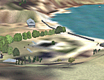
This replaces all my previous Pakatoa Island and Hauraki Gulf sceneries. You must have Christian Stock's NZ mesh in the form of "Mountains of New Zealand" and topo in the form of "Lakes and Rivers of New Zealand" (payware).
New additions...PAKIHI ISLAND: Small jetty and nearby buildings. TAKANGAROA ISLAND: House on Island. House & Jetty island north of Takangaroa Island. MOTUREKAREKA ISLAND: Wreck of the Rewa. PONUI ISLAND: Chamberlain's Bay Airstrip. Chamberlain's Donkey Farm. Third Bay Airstrip. Motunau Bay Jetty. KARAMURAMU ISLAND: Jetty and quarry. ROTOROA ISLAND: Rotoroa Jetty. MOTUIHE ISLAND: Motuihe Wharf.
| Filename: | Hauraki_Gulf_v6.zip |
| License: | Freeware |
| Added: | 17th April 2010, 16:10:12 |
| Downloads: | 218 |
| Author: | Godfrey Tier |
| Size: | 6.61 MB |
| Category: Flight Simulator 2004 - Scenery | |
| Project Mexico Real LOD10 File 1 of 11 |
|
Images related to this file:
File Description:
File 1st of 11 of a Terrain Mesh that covers the entirety of Mexican Territory and related bordering U.S., Guatemala and Belice areas, part of the "Proyecto Mexico Real" project, compiled at LOD10 (1.24 arcseconds in latitude and 1.65 arcseconds in longitude) resolution from INEGI data. Intended to enhance the virtual flying experience complementing the LOD8 and LOD9 versions compiled from the same data. Compatible backwards with Flight Simulator 2000, Flight Simulator 2002 and Combat Flight Simulator 2. Refer to the file contents about the cover area to this compressed file. (Re-upload due to AVSIM hack)
| Filename: | Project_Mexico_Real_LOD10_File_1_of_11.zip |
| License: | Check within download |
| Added: | 6th June 2010, 09:05:59 |
| Downloads: | 4,162 |
| Author: | Juan Jose Galvan Bautista |
| Size: | 73.44 MB |
| Category: Flight Simulator 2004 - Scenery | |
| Old Rhinebeck Aerodrome |
|
File Description:
Old Rhinebeck, the living museum of antique aviation, located at NY94 in Rhinebeck NY. Included are all the buildings and hangars at the field. Photoreal ground textures for the Rock City area surrounding ORA. All lakes streams, and rivers were hand edited for accuracy. Hand placed autogen and trees to match the ground textures. Special effects that make crowds of people appear during show times, and a few easter eggs as well. Mesh compliled from clean 1 arc sec SRTM data. Afcad is AI ready for your flightplans. All Gmax 3d models, and optimized textures for smooth performance.
happy flyin.
| Filename: | Old_Rhinebeck_Aerodrome.zip |
| License: | Freeware, limited distribution |
| Added: | 4th December 2005, 03:32:41 |
| Downloads: | 4,616 |
| Author: | Joe Binka |
| Size: | 38.57 MB |
| Category: Flight Simulator 2004 - Scenery | |
| Private Strips - revisited |
|
File Description:
Herewith my previously uploaded collections of various Private/Extra/Grass/Microlight/Miscellaneous etc. airfields from around England and Wales, all now in one place and re-edited with parking and taxiways for the facilitation of ai aircraft.
Please note :- these sceneries have been designed for use in FS2004 with the original UK VFR Photographic scenery and mesh. They rely for details on the "usual" collections of library objects, specifically EZ-Scenery, UKVFR and Rwy12 libraries. Whilst other configurations will probably work, to a degree, you'll have to try them and see if they suit you.
See the enclosed ReadMe for further details.
| Filename: | Private_Strips__revisited.zip |
| License: | Freeware |
| Added: | 6th March 2021, 16:15:32 |
| Downloads: | 154 |
| Author: | Chris Eve |
| Size: | 2 MB |
| Category: Flight Simulator 2004 - Scenery | |
| Project Mexico Real LOD10 File 7 of 11 |
|
Images related to this file:
File Description:
File 7th of 11 of a Terrain Mesh that covers the entirety of Mexican Territory and related bordering U.S., Guatemala and Belice areas, part of the "Proyecto Mexico Real" project, compiled at LOD10 (1.24 arcseconds in latitude and 1.65 arcseconds in longitude) resolution from INEGI data. Intended to enhance the virtual flying experience complementing the LOD8 and LOD9 versions compiled from the same data. Compatible backwards with Flight Simulator 2000, Flight Simulator 2002 and Combat Flight Simulator 2. Refer to the file contents about the cover area to this compressed file. (Re-upload due to AVSIM hack)
| Filename: | Project_Mexico_Real_LOD10_File_7_of_11.zip |
| License: | Check within download |
| Added: | 23rd August 2010, 00:40:35 |
| Downloads: | 2,864 |
| Author: | Juan Jose Galvan Bautista |
| Size: | 74.25 MB |
© 2001-2026 AVSIM Online
All Rights Reserved
Privacy Policy |