
Where Flight Simulation Enthusiasts Gather from Around the World!
AVSIM Library - Search Results

| Category: Flight Simulator X - Scenery | |
| Ireland VFR Small Airports Part 3 |

|
Images related to this file:
File Description:
Ireland VFR Small Airports Part 3. This scenery consists of 1. EIKY Kerry International Airport, 2. EIBN Bantry Airfield, 3. EIBR Birr Airfield, and 4. Clonbullogue Airfield.
Kerry is situated in the South West of Ireland and serves as a gateway to the world famous Lakes of Killarney, The Ring of Kerry and the Dingle Peninsula. Bantry is ideal for visiting the rugged beauty of West Cork. Clonbullogue is home to the Irish Parachute Club and is situated approximately 30 miles southwest of EIDW Dublin. Birr is almost in the centre of Ireland and is home to a very active group of GA aviators.
The scenery has been created almost entirely from real photographs and all objects have been placed accurately using ordinance survey data and satellite imagery. It also includes animated marshallers, aircrew and passengers together with animated animals and vehicles. Appropriate sound effects have been added to each file together with smoke and strobe lighting. Full night lighting is included, with flood and wash lighting of the aprons and carparks. Each airport has been sub-divided into seperate elements, which can be switched on or off according to the users preference and hardware setup. It caters for GA enthuasiasts and for those who prefer to fly the heavies.
This scenery has not been designed as a standalone, it calls on many objects from my Ireland VFR Small Airports parts 1 and 2. It has also been designed to complement photographic scenery but will also work with the default terrain and I have inlcuded a set of landclass and photoreal textures. It also includes an extended set of photoscenery treescapes. Full installation instructions, settings, credits and tips can be found in the README file.
Please enjoy and I hope you like my airports as much as I enjoyed making them.
| Filename: | Ireland_VFR_Small_Airports_Part_3.zip |
| License: | Freeware, limited distribution |
| Added: | 8th April 2012, 22:40:52 |
| Downloads: | 3,747 |
| Author: | George Keogh |
| Size: | 81.33 MB |
| Category: Flight Simulator 2004 - Original Aircraft | |
| Savoia Marchetti SM.79 Sparviero, SERVICE PACK 1 (v.02) |
|
Images related to this file:
File Description:
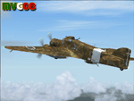
It was the most important Italian bomber of World War II, this tough three-engined aircraft established a reputation that contrasted with most Italian weapons of the day, and it was flown with courage and skill. SM.79s served widely in the normal bombing role, but it is as a land-based torpedo bomber that the type deserves its place in military aviation history, being regarded by many as one of the finest torpedo bombers of the war. In spite of its cumbersome appearance and outdated construction, with an internal provision for 2,750 lb (1,250 kg) of bombs, supplemented by under fuselage rack for a torpedo, the S.M.79 was a rugged, reliable multi-role medium bomber which did quite a bit of damage in the face of heavy opposition. About 1,300 production models were built over a nine year period. The SM.79 had a distinctive 'hump' on the upper forward fuselage, which housed both the fixed forward-firing heavy machine-gun and the dorsal gunner's position. Its appearance earned the aircraft the nickname 'Gobbo Maledetto' ('Damned Hunchback'). During the last phases of the war the surviving SM.79s were converted into various versions of utility transports and used in that role until 1952.
This "Service Pack" contains:
-4 UPGRADED + 1 NEW Hi-Res GMax models (5 different versions) feature the usual moving parts, such as all flight controls, props pitch and leading edge flaps.
-Eleven (11) different liveries (6 R.A., 1 A.N.R., 1 I.C.A.F., 1 Post-war A.M.I., 2 Spanish Nationalist Air Force).
-Revised SM.79M CFG & AIR files, New SM.79Bis CFG & AIR files
-Revised Sounds, Gauges & Effects
VC only. This plane was developed for FS9, but it works (it seems without problems) either in FSX. Created by Manuele Villa & ItalianWings, February 2008. Installation instructions included.
| Filename: | Savoia_Marchetti_SM79_Sparviero_SERVICE_PACK_1_v02.zip |
| License: | Freeware |
| Added: | 31st May 2010, 09:24:20 |
| Downloads: | 3,320 |
| Author: | Manuele Villa, Italianwings |
| Size: | 32.56 MB |
| Category: Flight Simulator 2004 - Utilities | |
| FlightSim Manager 2.8.5 |
|
File Description:
Compatible with both FS2002 and FS2004. FlightSim Manager is a great tool for managing add-ons to Microsoft Flight
Simulator. Using easy to Wizard - FSM can install various addins from
distribution ZIP files that you may have downloaded, with easy uninstaller. FSM
has lots of feature to offer, from an easy to use Aircraft editor to add/edit
aircraft variants, to an comprehensive Hangar management that allows you to
manage and configure your add-ons off your live FS installation. You can create
Virtual Fleets, and enable/disable the complete fleet with ease. For serious
pilots, there is also a complete Logbook. If you have access to networked PCs, you can use FSM Lan View feature to create
virtual cockpits with as many different views as you like. FSM also make it very
easy to control Flight Simulator with speech commands, with additional support
for auto-saving flight, warning system, and your own custom event sounds. Also
FSM introduces a new ViewMode that replaces the existing boring tower view into
exciting camera view. Using a powerful Editor, you can now edit your AI Flight Plans - plans can be
saved as sets, which then in turn can be enabled in Flight Simulator. With FSM,
you can create Texture Sets ( your own custom texture installer ) - capture
screenshots, complete Benchmark with log, launching Flight Simulator with Random
Screens, and fly from anywhere in the world using an map view.
Finally with a comprehensive Diagnostic Tools and Repository feature, FSM keeps
your FS installation clean. Apart from the usual Missing and unused gauges, FSM
can also locate Aircraft problems, Missing and unused effects, and Scenery
Problems with an unique LandClass File relocate feature - say bye-bye to all
those memory leaks. There are still a lot more features that you will need to discover by yourself. You can find the latest version from: http://www.ranainside.com/
| Filename: | FlightSim_Manager_285.zip |
| License: | Freeware |
| Added: | 20th November 2005, 03:15:59 |
| Downloads: | 48,579 |
| Author: | Rana Hossain |
| Size: | 5.48 MB |
| Category: Flight Simulator 2004 - Scenery | |
| Airstrips of Austria |
|
Images related to this file:
File Description:

Probably the last of my Airstrips of Western Europe project, herewith 30+ sceneries for smaller airfields in Austria, a particularly scenic area of Europe, many of which are not included in FS2004, each enhanced with taxiways, parking spaces, buildings etc. and aprons as appropriate, to further facilitate the generation of lightweight AI traffic in the area, without overloading the more major airfields.
Again, there's no photo-realism here, just a selection of basic 'generic' buildings, more or less accurately sized and placed to reflect the airfield layout as seen on on-line satellite imagery and aerial photography. These buildings have minimal effect on frame-rates, so are ideal for this kind of job. The airfields are aligned as well as possible with the roads etc. in UT Europe and the Genesis Europe mesh, but should mostly be fine in a default installation or other configuration.
As before, the files for each airfield can be easily identified by the ICAO code, even if the airfield names vary slightly, so you can pick and choose and mix and match to suit any sceneries you already have, should you so wish. There is no requirement for any other download. Each airfield will exist as a stand-alone entity should you only want a few of them.
Very few basic library objects are used ... you can add "eye-candy" to suit your own taste should you wish, or just leave them as vague shapes in the scenery that can put a few more small aircraft into the air. As with other airfields in this series, now these are "ai-activated" you might expect to see the occasional little aircraft turn up at some of them if you've got any third-party traffic installed.
| Filename: | Airstrips_of_Austria.zip |
| License: | Freeware |
| Added: | 26th April 2025, 13:59:32 |
| Downloads: | 83 |
| Author: | Chris Eve |
| Size: | 1.04 MB |
| Category: Flight Simulator 2004 - Scenery | |
| Airstrips East of the Adriatic |
|
Images related to this file:
File Description:
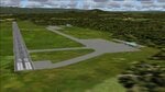
A collection of about 60 small airfields in Albania, Bosnia & Herzegovina, Kosovo, North Macedonia and Serbia & Montenegro, many of which aren't featured in FS2004, each enhanced with taxiways, parking spaces, buildings etc. and aprons as appropriate, to fill in a few gaps to the east of Italy. Most of these airfields are relatively "rural", often little more than a shed and a grass runway in a field, but they allow the generation of lightweight GA AI traffic in this area and into the adjacent countries.Again, there's no photo-realism here, just a selection of basic 'generic' buildings, more or less accurately sized and placed to reflect the airfield layout as seen on on-line satellite imagery and aerial photography. These buildings have minimal effect on frame-rates, so are ideal for this kind of job. The airfields are aligned as well as possible with the default roads etc. and the Genesis Europe mesh, but should mostly be fine in a default installation or other configuration.As before, the files for each airfield can be easily identified by the ICAO code, even if the airfield names vary slightly, so you can pick and choose and mix and match to suit any sceneries you already have, should you so wish. There is no requirement for any other download. Each airfield will exist as a stand-alone entity should you only want a few of them. A few default airfields have had new ICAO codes allocated, in these instances I've provided files to remove the default scenery from the landscape, though the original airfield will still appear on the maps and menu.
| Filename: | Airstrips_East_of_the_Adriatic.zip |
| License: | Freeware |
| Added: | 20th October 2025, 11:48:25 |
| Downloads: | 55 |
| Author: | Chris Eve |
| Size: | 525.71 KB |
| Category: Flight Simulator 2004 - Scenery | |
| CZNL - Nelson - Nelson, British Columbia, Canada |
|
Images related to this file:
File Description:
Nelson is a town with a population of around 10,000, located 250 miles or so east of Vancouver on the southern shore of an east-west offshoot of Kootenay Lake. The surrounding landscape can be described as "steep" without fear of contradiction, and the diagram of arrival and departure routes (included here) shows that straight finals to either end of the runway are non-existant. The airport is right beside the water, with a single runway 3,100 feet long and 75 feet wide, aligned 04/22. The apron is at the western end. There are a number (3?) of helicopter companies based at the western end of the apron, and there is also a terminal building, though there are in fact no regular scheduled flights; there are occasional charters to cater for town events during the summer tourist season. There is no runway lighting, or taxiway or apron lights, so usage is effectively restricted to daylight hours (though not legally stated as such). All circuits are over the water and not the town, though even this means you climb quickly and dog-leg to follow the water until you have gained enough altitude to turn. Winter maintenance is limited. And if all this is not enough you are advised to "watch for wildlife on the rwy". The nature of the surrounding terrain makes AI hit-and-miss; mostly hit. AI Planes will taxi out and then take off, and provided you don't follow them until they fly into a mountain it will all appear normal. Planes that are arriving will appear by magic on their parking spots, as they have crashed before they arrive. To avoid repetitive unrealistic arrivals I have limited the AI to only 3 planes. The scenery includes some of the nearby buidings and landmarks, as shown in the screenshots.
| Filename: | CZNL__Nelson__Nelson_British_Columbia_Canada.zip |
| License: | Freeware, limited distribution |
| Added: | 7th June 2015, 10:23:49 |
| Downloads: | 425 |
| Author: | Roger Wensley |
| Size: | 17.84 MB |
| Category: Flight Simulator 2004 - Scenery | |
| Fort St James CYJM in British Columbia Canada |
|
Images related to this file:
File Description:
Fort St James is a small town of around 1,600 folks at the southeastern end of Stuart Lake, at the head of the Stuart River, and around 360 miles north of Vancouver and 220 miles inland from the coast. It was a long-established trading post for furs, with a permanent presence there from 1806 onwards. The airfield is 3 miles south of the town and is called "Fort St James (Perison)" in the Nav Canada listings. I presume that this is part of their trend towards calling airfields by their location rather than by their name. Makes sense as it is difficult to find information by searching for an airfield that is listed under a name you don't know. The field has an asphalt runway of 4,000 feet aligned 10-28 and at 2,364 feet ASL. There is no lighting. The main user of the airfield is Interior Helicopters Ltd. who are based there as operators, and at Williams Lake as helicopter dealers. For the AI helicopters, there is a screenshot (01) of the AS350 helicopter installation folder when it has been transformed into an AI helicopter. The process is to download and install the Ecuriel AS 350, along with the additional textures, as normal; this is straightforward. Then you download the software shown in screenshot 02 and add it as instructed and as shown in 01 so that the helicopter now operates as AI, with a different air file and a modified config file. I should have included this with the Pemberton post. I have posted this as Fort St James CYJM, but I suggest that you just add it to your previously created "BC airfields" and avoid the inevitable doubling up of common textures etc. Up to you. If you find a defect, email me.
| Filename: | Fort_St_James_CYJM_in_British_Columbia_Canada.zip |
| License: | Freeware, limited distribution |
| Added: | 23rd November 2020, 20:14:04 |
| Downloads: | 151 |
| Author: | Roger Wensley |
| Size: | 2.62 MB |
| Category: Flight Simulator 2004 - Scenery | |
| Kuujjuarapik CYGW in northern Quebec, Canada |
|
Images related to this file:
File Description:
Kuujjuarapik is in northern Quebec at the southern end of Hudson Bay, 90 miles east of James Bay and on the north shore of the Great Whale River; Kuujjuarapik means Small Great River in Inuktitut. Once again the Hudson Bay trading post that opened (in 1820) was the catalyst for the establishment of first a seasonal encampment and then the beginnings of a town in the late 1930's.
The two adjacent villages that now form the town have a total population (mainly Cree and Inuit) of around 1,500. When the Quebec hydo-electric project was under construction in the early 1980's a large portion of the Inuit population voted to move to a new settlement called Umiujaq (my post) 100 miles to the north.
The airport is to the west of the town, between the town and the sea. The gravel and sand runway (which I have made as gravel as there is no convincing way to mix the two) is 5,500 feet long, 150 feet wide, and aligned 17/35, which is approximately parallel to the coast. There is fuel available, both 100LL and JetA, delivered by truck. The AI included here is for Air Inuit and Wasaya, with Air Inuit making three flights per day plus a fourth flight by the Air Inuit Twotter C-GNDO that is based at the airport, and private flights by various aircraft. Yes, there really is a golf course to the south of the airport, and the last thing to note is that Kuujjuarapik has a mandatory radio frequency and that taking into consideration the scheduled flights I have included the tower radio frequency that makes this a controlled airport in FS9.
| Filename: | Kuujjuarapik_CYGW_in_northern_Quebec_Canada.zip |
| License: | Freeware, limited distribution |
| Added: | 16th February 2013, 00:33:20 |
| Downloads: | 306 |
| Author: | Roger Wensley |
| Size: | 2.8 MB |
| Category: Flight Simulator 2004 - Scenery | |
| 9A8 - Ugashik, PAII - Egegik, AK96 - Bartletts, AK36 - Coffee Point , Alaska, USA |
|
Images related to this file:
File Description:
All four of these depend heavily on fishing but two of them only spring into existance during the salmon catching-and-canning season. Grant Air run scheduled flights to the two permanent settlements, and there are irregular scheduled flights and charters to the others according to demand. Ugashik is a permanent settlement 60 miles northeast of Port Heiden, stretched out along the east bank of the Ugashik River. There are two canneries, one old and collapsing and the other newer and functioning. The population is given as 12, though during the season this increases significantly. The (newer) airfield is at the northern end of the village with a gravel runway 3,500 feet long aligned 06-24. Egegik is the second permanent settlement, 45 miles north of Ugashik and 40 miles southwest of King Salmon, on the east bank of the Egegik River. The town is on a corner of land, with a population of around 110 and two operating canneries. The airport is a mile and a half south of the town with two gravel runways, 12-30 at just under 5,600 feet and 03-21 with 1,500 feet; both are lit. On the other side of the Egegik River are more canneries and two airfields, both of which have two runways but are otherwise entirely without facilities or luxuries such as lights. They are called Bartletts (named for the cannery it serves) and Coffee Point (named for the location). The shacks of the seasonal fishermen are strung out along the coast and a lot of the salmon fishing is by net, laid by a small boat and later pulled ashore for emptying. Only one cannery on the west shore has a docking facility for unloading boat-caught fish.
| Filename: | 9A8__Ugashik_PAII__Egegik_AK96__Bartletts_AK36__Co.zip |
| License: | Freeware, limited distribution |
| Added: | 3rd April 2015, 18:06:49 |
| Downloads: | 1,135 |
| Author: | Roger Wensley |
| Size: | 4.98 MB |
| Category: Prepar3D V1-4 - Original Aircraft | |
| UV-4 V/STOL UAV (Experimental) |
|
Images related to this file:
File Description:
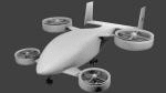
Created as a means to display the potential of a ducted fan rotorcraft powered by multiple electric motors. The system made its launch in 2015, since then advances and improvements have been completed to the airframe and power plant configurations. Delivering an efficient means of lift using smaller and therefore quieter propeller then traditional helicopters. The function of the ducted system serves as a mean of channeling pressure and vectoring thrust. Giving the UV-4 a unique control system and improved maneuverability. The design of a low speed "T-Tail" houses the function of yaw control with multiple rudders located on its vertical stabilizer, and elevators on its horizontal stabilizer. In addition the rear ducted systems may pivot up to less then sixty degrees forward and backwards to deliver the vector thrust where the aircraft needs it to be. The cargo bay may house up to four thousand pounds of deliverable payload. As its max gross take-off weight is designed to reach twelve thousand five hundred pounds. The electrical systems on the aircraft use a network of batteries, generators, and its two electrical motors. Proving five hundred horse power each, totaling an amount of one thousand horse power. An electrical charge then powers the mechanization used to spin the propeller to its desired rate per minute. Perhaps in the near future an additional system can be created to then generate electrical charges created by the spinning propeller of inside the duct back into the aircraft to then power systems or recharge the battery. We forward to providing this aircraft on Microsoft Flight Simulator X, Lockheed-Martin Prepar3d, and X-Plane 10 for download by the end of 2016. Aircraft by Rob Gomez & Kris Pyatt
| Filename: | UV4_VSTOL_UAV_Experimental.zip |
| License: | Commercial demo |
| Added: | 22nd January 2017, 04:10:41 |
| Downloads: | 185 |
| Author: | Rob Gomez & Kris Pyatt |
| Size: | 8.13 MB |


© 2001-2026 AVSIM Online
All Rights Reserved
Privacy Policy |