
Where Flight Simulation Enthusiasts Gather from Around the World!
AVSIM Library - Search Results

| Category: Flight Simulator X - Scenery | |
| Mesh for Northern Africa, Base Grid 0603 - Part 1 |

|
Images related to this file:
File Description:
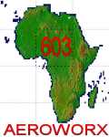
Highly detailed 76m SRTM mesh for Africa using the latest release of STRM Data V2.1. This file covers the Africa Area of base file 0603 (N01 and E00), North of the Equator. You need to download all two parts to restore the mesh bgl file. DO NOT DISABLE THE DEFAULT DEM 603 FILE.
| Filename: | Mesh_for_Northern_Africa_Base_Grid_0603__Part_1.zip |
| License: | Freeware |
| Added: | 8th February 2014, 22:03:34 |
| Downloads: | 2,536 |
| Author: | Martin du Preez, Hannes Steyn, Aeroworx |
| Size: | 307.22 MB |
| Category: Flight Simulator X - Scenery | |
| Mesh for Northern Africa, Base Grid 0603 - Part 2 |
|
Images related to this file:
File Description:
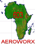
Highly detailed 76m SRTM mesh for Africa using the latest release of STRM Data V2.1. This file covers the Africa Area of base file 0603 (N01 and E00), North of the Equator. You need to download all two parts to restore the mesh bgl file. DO NOT DISABLE THE DEFAULT DEM 603 FILE.
| Filename: | Mesh_for_Northern_Africa_Base_Grid_0603__Part_2.zip |
| License: | Freeware |
| Added: | 8th February 2014, 22:03:46 |
| Downloads: | 2,162 |
| Author: | Martin du Preez, Hannes Steyn, Aeroworx |
| Size: | 296.72 MB |
| Category: Miscellaneous Files - General Utilities | |
| Professional Flight Planner X (PFPX) Boeing 767-300ER Winglets (WL) Performance Profiles Pack Version 1.1 |
|
Images related to this file:
File Description:

PFPX performance profiles for the complete family of wingleted variants of Boeing 767-300ER with winglets with all available engines for real-world operators. Multiple engine out schedules and all engine schedules, mach numbers and cost index data.
For use with Level-D 767-300ER Winglets model.
See Readme.txt for details.
| Filename: | Professional_Flight_Planner_X_PFPX_Boeing_767300ER.zip |
| License: | Freeware |
| Added: | 12th July 2015, 18:06:01 |
| Downloads: | 956 |
| Author: | Mykyta Demydiuk | FlyPrecisely |
| Size: | 1.4 MB |
| Category: Flight Simulator X - Scenery | |
| KVSF Hartness State (Springfield) Airport |
|
File Description:
FSX Scenery--KVSF Hartness State (Springfield) Airport, Vermont (VT), USA. A basic rebuild of the original FSX KVSF Hartness State (Springfield) Airport using ADE as editing tool with standard FSX library. The basic design is based on both Skyvector & Google Earth data to match the geography of the real airport as of February 2017.
| Filename: | KVSF_Hartness_State_Springfield_Airport.zip |
| License: | Freeware |
| Added: | 22nd February 2017, 17:13:07 |
| Downloads: | 210 |
| Author: | Leonardo Pierry |
| Size: | 6.18 KB |
| Category: Fly! II - TerraScene | |
| Florida Terascene Project Pack #2 |
|
File Description:
It's here folks! After much delay and sleep deprived nights, the Florida Terrascene project with Tiger2000 shapefiles is complete! This is the second of two files required in order to render the individual global tiles. This file contains USGS data that Terrascene normally downloads. It's here because of the recent trouble with their server.
| Filename: | Florida_Terascene_Project_Pack_2.zip |
| License: | Freeware |
| Added: | 9th February 2004, 02:25:15 |
| Downloads: | 320 |
| Author: | James Burns |
| Size: | 163.96 MB |
| Category: Flight Simulator 2004 - Scenery | |
| Falklands Islands (Malvinas) Mesh |
|
File Description:
This is a terrain mesh scenery for Falklands Islands (Malvinas) moreover there are all PPL (Populated Place Location) and add some object scenery with BGLcomp
SDK.
The Mesh are based on SRTM Data (3 arc/sec), generated with Matthew Styles's program "SRTM To BGL v1.04", sampled to LOD9 resolution (76m) with 10 interpolation passes.
| Filename: | Falklands_Islands_Malvinas_Mesh.zip |
| License: | Freeware |
| Added: | 7th March 2004, 01:31:41 |
| Downloads: | 3,619 |
| Author: | Giovanni Miduri |
| Size: | 4.94 MB |
| Category: Flight Simulator 2004 - AFCAD Files | |
| LIRU - Urbe AFCAD for ISD LIRF 2005 Project |
|
File Description:
AFCAD file for Urbe - LIRU airport , use with ultimate ISD LIRF2005 project
In this best project is after landclass_rome part this airport full of houses , see before.jpg image
this BGL file solve this problem
Warning : Don't try edit this file with AFCAD program , Bgl include vesides AFCAD data alo some objects and exclude commands
| Filename: | LIRU__Urbe_AFCAD_for_ISD_LIRF_2005_Project.zip |
| License: | Freeware |
| Added: | 19th January 2005, 20:14:05 |
| Downloads: | 2,774 |
| Author: | Vladimir Svoboda (Cesmina) |
| Size: | 208.54 KB |
| Category: Flight Simulator 2002 - AFCAD Files | |
| KJFK Airport 2000 Vol. 1 AFCAD Overlay |
|
File Description:
An AFCAD overlay of the Airport 2000 vol1 John F Kennedy International Airport, New York. Majority of gates in this ovelay are medium to large to facilitate 757 and larger aircraft. Runways have been adjusted so aircraft will takeoff at their proper points. Frequency and airport data from the default airport have been retained.
| Filename: | KJFK__Airport_2000_Vol_1_AFCAD_Overlay.zip |
| License: | Freeware, limited distribution |
| Added: | 26th December 2002, 16:57:20 |
| Downloads: | 1,467 |
| Author: | Antonio Harris |
| Size: | 239.66 KB |
| Category: Flight Simulator 2002 - Miscellaneous Files | |
| FAA Flight Plan Form in PDF Format |
|
File Description:
Realistic FAA Flight Plan form in PDF format.
This form is a reproduction of the FAA Flight Plan form to enhance simming realism.
It can be printed blank, or you can input your data right into the form and print it out!
Instructions are on the form itself. This form is for simulator use only.
| Filename: | FAA_Flight_Plan_Form_in_PDF_Format.zip |
| License: | Freeware |
| Added: | 31st October 2002, 23:10:25 |
| Downloads: | 1,221 |
| Author: | Jorge 'eko' Salas |
| Size: | 166.07 KB |
| Category: Flight Simulator 2002 - Flight Plans | |
| White Eagle Aviation Flight Plans |
|
File Description:
Here's a set of ficticious flight plans for White Egale Aviation (WEA) Poland.
Ficticious because they are charter so it's difficult getting data, but most of the destinations are there.
At least it will give more population to Warsaw
WEA are based in Warsaw and fly to many holiday destinstaions in Europe and Africa.
| Filename: | White_Eagle_Aviation_Flight_Plans.zip |
| License: | Freeware |
| Added: | 23rd June 2003, 13:25:00 |
| Downloads: | 629 |
| Author: | Chris Bird |
| Size: | 1.69 KB |


© 2001-2026 AVSIM Online
All Rights Reserved
Privacy Policy |