
Where Flight Simulation Enthusiasts Gather from Around the World!
AVSIM Library - Search Results

| Category: Navigation and ATC - Navigation | |
| Dutch Info Package |

|
File Description:
With this package you have all the information you need for an flight in The Netherlands, you've got all the frequencies, charts, notams and all other information you need for an good and safe flight in The Netherlands. Enjoy this package and i hope you will make a lot of great flying hours in The Netherlands. For more information or if you have questions: http://www.fsforum.nl
| Filename: | Dutch_Info_Package.zip |
| License: | Freeware |
| Added: | 7th January 2007, 11:34:53 |
| Downloads: | 570 |
| Author: | Shaddy Fouad |
| Size: | 4.96 KB |
| Category: Prepar3D V1-4 - Scenery | |
| MDPC - Punta Cana Intl - Higuey, Dominican Republic |
|
File Description:
this is an updated version of the default p3d airport:
*added north runway 08/26
*added / updated all taxiways and signage
*added terminal and gates
*current as of airac 2004
my intent is to have a functional and current airport, not eye candy. the idea is to pretty much
match the real charts for online use (vatsim, etc) -- not tested with any type of AI traffic.
| Filename: | MDPC__Punta_Cana_Intl__Higuey_Dominican_Republic.zip |
| License: | Freeware |
| Added: | 31st March 2020, 17:06:33 |
| Downloads: | 976 |
| Author: | Mike Teague |
| Size: | 131.72 KB |
| Category: Flight Simulator X - Scenery | |
| Porto Intl Airport (LPPR), Portugal |
|
Images related to this file:
File Description:
This airport update is for Francisco Sa Carneiro airport and made only for FSX: the terminal completely remodeled, Airlines assigned to their gates, taxiways and taxi signs updated to the latest charts, apron T added for the new DHL cargo terminal and many other scenery objects added, airport views are from the roof of the control tower (when in tower view) please view the readme before installation.
| Filename: | Porto_Intl_Airport_LPPR_Portugal.zip |
| License: | Freeware, limited distribution |
| Added: | 20th March 2014, 00:34:59 |
| Downloads: | 25,408 |
| Author: | Craig Scott |
| Size: | 658.54 KB |
| Category: Prepar3D V5 - AFCAD Files | |
| KRYY - Cobb County International Airport (McCollum Field) - Atlanta, Georgia |
|
Images related to this file:
File Description:
This is a modification of the stock Cobb County International Airport AFCAD/BGL in Prepar3d v5.4. All parking has been redone to match closer to what is shown in Navigraph Charts. Several buildings have been removed which do not exist in real life and a few added using library objects and generic building files in Prepar3d.
The ramp on the North side of the airport has been redesigned in its entirety to reflect what is shown in Google Maps and Navigraph Charts. Random parking has been placed on the North and South ramp areas around the FBO and flight schools that populate the airport. Buildings have been deleted added to reflect the current layout of the field. All taxiway signage are correct and correctly positioned.
Aircraft tower and windsocks have been placed in the appropriate positions on the field and all taxiway signage is correct and correctly placed.
| Filename: | KRYY__Cobb_County_International_Airport_McCollum_F.zip |
| License: | Freeware |
| Added: | 17th December 2023, 20:02:03 |
| Downloads: | 27 |
| Author: | Michael Johnson |
| Size: | 173.69 KB |
| Category: Flight Simulator 2002 - Scenery | |
| Aleutian Islands Scenery Enhancement - Part I |
|
File Description:
This scenery enhances the Aleutian Islands in Alaska. Over 80 small, individual
scenery areas have been added to the Aleutians to provide VFR landmarks while
flying this area with World Aeronautical Charts. (WAC)
All cabin and building markers from WAC charts CE-12 and CE-13 are present in
the scenery. It consists mostly of cabins which are spread out through the Aleutians.
Unalaska has been completely enhanced, adding the city, ships, and docks to the default airport. Some floatbases (not covered by Dave's scenery) in the Aleutians now have corresponding cabins and wood docks around them.
This scenery is fully compatible with Dave Erickson's "Alaskan Docks 2" scenery,
and is HIGHLY recommended, as I did not touch any of the areas which are covered by that scenery, except for Unalaska, for which I used a city map to recreate and upgrade. Details in the readme.
| Filename: | Aleutian_Islands_Scenery_Enhancement__Part_I.zip |
| License: | Freeware |
| Added: | 18th November 2002, 04:06:24 |
| Downloads: | 2,911 |
| Author: | Jorge 'eko' Salas |
| Size: | 6.13 MB |
| Category: Flight Simulator X - Scenery | |
| EDDF - Frankfurt/Main - Germany ** Version 2 ** |
|
Images related to this file:
File Description:
This airport is a very accurate rendition of EDDF to represent today situation and made only for FSX with two optional files: one file with the Crosswind runway 18/36 operating (18 takeoff only) where all 4 runways will be used simultaneously and one file as the default airport runway operation: The Northwest runway 7L/25R (landing only), ILS frequencies and approaches now corrected to the latest charts and some transitions, assigned parking as per their website with extra parking including gates for the A380, taxiways and taxi signs updated to the latest charts, new north side control tower, the South cargo apron updated, the A380 maintenance apron, extra fuel trucks, support vehicle roads rebuilt and many other scenery improvements and objects added, airport views are from the roof of the new North side control tower (when in tower view) please view the readme before installation.
| Filename: | EDDF__FrankfurtMain__Germany__Version_2_.zip |
| License: | Freeware, limited distribution |
| Added: | 6th July 2016, 09:06:54 |
| Downloads: | 44,936 |
| Author: | Ray Smith |
| Size: | 2.5 MB |
| Category: Flight Simulator X - Scenery | |
| HALA - Hawassa Intl. - Hawassa, Ethiopia |
|
Images related to this file:
File Description:
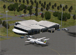
This project adds the booming city of Hawassa, Ethiopia, creates the new international airport (HALA), moves (and rebuilds) the downtown airport (recoded to HALX), and includes AI flight plans for the Ethiopian Airlines service that began April 2016. Tested in both the default FSX: Acceleration and with FTX Global/Vector, accurate coastlines, lakes, road data, and SRTMGL1 (30m) mesh, as well as corrected landclass are provided based on the latest available satellite imagery. The Hawassa International Airport was created using information from the current satellite footprint and the promotional video from Ethiopian Airports Enterprise (EAE). Although there is still very little published data on the airport, it is fully functional.
Updates were created or rebuilt in a manner which carefully aligns airport data with current satellite imagery. Scenery was created using Airport Design Editor X v1.70.6042, SBuilderX 3.13, and the FSX Object Placement Tool. Scenery objects were added and modified from stock FSX scenery to resemble as closely as possible the actual airports. The FSX apron lights included are from the set created by Jim Dhaenens. Thanks to Ron Blehm for bringing this part of the world to my attention.
| Filename: | HALA__Hawassa_Intl___Hawassa_Ethiopia.zip |
| License: | Freeware |
| Added: | 20th July 2016, 09:06:40 |
| Downloads: | 1,021 |
| Author: | Carlyle Sharpe |
| Size: | 10.41 MB |
| Category: Flight Simulator 2004 - Scenery | |
| Tehran area SRTM mesh |
|
File Description:
This terrain mesh scenery is centered on Tehran city. Ranging from 34.1°N to 37.5°N and 49.2°E to 54.8°E, it includes Elbourz moutain range as well as Caspian sea shores (28 meters below sea lavel).
Based on SRTM Data (3 arcsec, 90m) and sampled to LOD9 resolution (76m) using Matthew Styles's program "SRTM To BGL v1.04". While only tested with Fs2004, this mesh should also run with FS2002.
SRTM 3 arcsec dataset has numerous and sometimes huge void areas. But thanks to John Child's beautiful and powerful "Blackart" utility it's now easy to patch these areas with lower resolution dataset: I took the coupled interpolation method to merge SRTM 3-arcsec with SRTM 30-arcsec dataset when needed. This gives the best results, as patched areas with 30-arcsec data are blending naturally with surrounding 3-arcsec mesh. Of course the resolution of patched areas is quite poor, but still a bit better than the default LOD5 mesh. However, in exception of Demavend Peak, the SRTM data was quite good for this area and didn't need much patching so that the rendering is allways excellent.
| Filename: | Tehran_area_SRTM_mesh.zip |
| License: | Freeware, limited distribution |
| Added: | 20th June 2004, 14:14:31 |
| Downloads: | 5,582 |
| Author: | Yohann Baptiste |
| Size: | 18.1 MB |
| Category: Flight Simulator 2004 - AI Flight Plans | |
| Allegiant Air Winter 2003/2004 |
|
File Description:
Flight Plans for Allegiant Air effective October 8, 2003. Allegiant Air is a certified "Scheduled Air Carrier" which operates MD-80 aircraft out of Las Vegas (KLAS) to KCOS, KDEN, KDSM, KFNL, KFAT, KLAN and KICT. Very accurate plans written from their flight schedule, available at http://www.allegiant-air.com.
| Filename: | Allegiant_Air_Winter_20032004.zip |
| License: | Freeware |
| Added: | 6th December 2003, 07:37:29 |
| Downloads: | 1,382 |
| Author: | Steve Bond |
| Size: | 2.04 KB |
| Category: Flight Simulator 2004 - AI Flight Plans | |
| Cham Wings, Winter 2010 |
|
Images related to this file:
File Description:

These flightplans include all scheduled flights of Cham Wings. All flights were taken from Cham Wings official website timetable. Cham Wings' main hub is Damascus International Airport and flies to destinations in Europe (Brussels and Malmo), and Iraq (Baghdad and Najaf); Using 1 MD-83 leased from skywings.
| Filename: | Cham_Wings_Winter_2010.zip |
| License: | Freeware, limited distribution |
| Added: | 13th January 2010, 09:27:04 |
| Downloads: | 414 |
| Author: | Zafer El-Khatib |
| Size: | 22.35 KB |


© 2001-2026 AVSIM Online
All Rights Reserved
Privacy Policy |