
Where Flight Simulation Enthusiasts Gather from Around the World!
AVSIM Library - Search Results

| Category: Flight Simulator 2004 - AFCAD Files | |
| LLMG Meggido, Israel |

|
Images related to this file:
File Description:
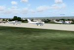
Googlyafcad A&F Data for Meggido, based on Google Earth satellite data.
Unfortunately, Microsoft have provided no facilities at this airport in Flight Simulator 2004 other than a runway and this file will allow you and your "AI" traffic to land, taxi, park and take off in a realistic manner.
Meggidio airfield was built in 1942 by the British Forces and was used by the Israeli Air Force (under the name Shachar 7) until turned over to general aviation, gliding and crop spraying use in the 1970s. There are proposals to transform it into a commercial airport with international flights to develop tourism. [File re-uploaded at request of AVSIM]
| Filename: | LLMG_Meggido_Israel.zip |
| License: | Freeware |
| Added: | 20th June 2010, 10:49:59 |
| Downloads: | 498 |
| Author: | John Hinson |
| Size: | 47.28 KB |
| Category: Flight Simulator X - Scenery | |
| Northeast New Jersey 5 Meter Mesh Terrain |
|
Images related to this file:
File Description:
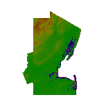
High Resolution Northeast New Jersey 5 Meter Mesh Terrain by Wally-Bob represents a significant improvement over FSX default 38 meter mesh terrain. The results are also dramatic compared to 10 meter compressed payware mesh as lossless compression compilation (read no data loss) is used. Lossless compiling produces renderings that have the Crispness of the Real World Terrain. Fly the Hudson River and view the Palisades as they are in real life, see the screen shots enclosed. High Quality 5 meter mesh terrain is a must have for mountainous areas especially where photo scenery is also used to render the virtual world. Manual includes FSX configuration and scenery installation tips. USGS LiDAR 1/9 Arc-Second source data.
| Filename: | Northeast_New_Jersey_5_Meter_Mesh_Terrain.zip |
| License: | Freeware, limited distribution |
| Added: | 26th February 2011, 21:35:52 |
| Downloads: | 1,101 |
| Author: | Walter Roberts |
| Size: | 135.89 MB |
| Category: Flight Simulator X - Utilities | |
| FS2004/FSX/Prepar3D Flight Analyzer/Logbook Utility V6.14 |
|
File Description:
FS2004/FSX/Prepar3D Flight Analyzer/Logbook Utility V6.14 Flight Data Recorder - Logbook. Now a few bugs are fixed. Very easy to use, just make a flight plan in the simulator or in this utility. What this program does: quickly change the settings of P3D/FSX/Fs2004, such as time, date, fuel, weight, traffic etc.; start a failure sytem, such as gear, flaps, engine, etc.; freeze the time, so you can fly in a for everlasting sunset; runway detecting system to see wich runways are in use; flight analyzing/data recording from departure to parking at the gate; When flight analysis is finished you can print a report, the report is automaticly saved as pdf File. By Evander Tholen.
| Filename: | FS2004FSXPrepar3D_Flight_AnalyzerLogbook_Utility_V.zip |
| License: | Shareware, limited functionality |
| Added: | 21st January 2020, 17:43:48 |
| Downloads: | 194 |
| Author: | Evander Tholen |
| Size: | 3.43 MB |
| Category: Flight Simulator 2004 - Gauges | |
| Apollo MX20 Multi-Function Display/GPS |
|
File Description:
This gauge is modeled after the Apollo MX20 Multi-Function Display. This gauge is written in XML and is designed to mesh with the default FS9GPS map input data. Compatible with FS2004 (FS9) ONLY!
Although I tried to make this gauge as close to the real Apollo MX20 as possible it is not considered to be an exact replica. It is limited to certain features that the FS9 data will provide. It does however have all the great features that the default FS9GPS offers and offers an alternative to the default GPS.
Size (pixel size) is the same as the FS9 default GPS so placement (or replacement) of the gauge is quick and easy.
| Filename: | Apollo_MX20_MultiFunction_DisplayGPS.zip |
| License: | Freeware |
| Added: | 24th December 2003, 05:29:16 |
| Downloads: | 9,192 |
| Author: | Keith Giveans |
| Size: | 156.91 KB |
| Category: Flight Simulator X - Miscellaneous Files | |
| JS41 Cold and Dark LUA Script V1.1 |
|
File Description:
An FSUIPC4 LUA script for making the PMDG Jetstream 4100 "Cold and Dark" after entering the cockpit. The following are accomplished:
MUTE button ON,
RIGHT Engine OFF (includes setting start latch),
LEFT Engine OFF (includes setting start latch),
LEFT Generator Switch OFF,
RIGHT Generator Switch OFF,
LEFT Battery Switch OFF,
Right Battery Switch OFF,
Left Avionics Switch OFF,
RIGHT Avionics Switch OFF,
LEFT Fuel Pump Switch OFF,
RIGHT Fuel Pump Switch OFF,
DC Power Source Knob OFF,
Beacon OFF,
Left Windshield Antiice OFF,
Right Windshield Antiice OFF,
Left Air Data OFF,
Right Air Data OFF,
Move Yokes to Lower Position.
Credits go to the following people:
Guenter Steiner,
Tom Risager,
Richard Cooke,
| Filename: | JS41_Cold_and_Dark_LUA_Script_V11.zip |
| License: | Freeware |
| Added: | 15th February 2010, 10:57:06 |
| Downloads: | 3,099 |
| Author: | William Ruppel |
| Size: | 2.31 KB |
| Category: Flight Simulator 2004 - Scenery | |
| Greece SRTM Mesh Part 2 |
|
File Description:
This terrain mesh scenery covers Greece, including all Aegean sea islands, plus most parts of Albania and Macedonia up to 41°50'N. Some parts of Bulgaria and Turkey are also included in northern and eastern boundaries of the mesh. The greek island of Crete isn't part of this mesh because SRTM data isn't yet released for the whole island.
Based on SRTM Data (3 arcsec, 90m), generated with Matthew Styles's program "SRTM To BGL v1.04", sampled to LOD9 resolution (76m). While only tested with Fs2004, this mesh should also run with FS2002.
This part contains all bgl files except Greece-N.bgl, Greece-NE1.bgl and Greece-NE2.bgl. See Greece_Mesh_Part2-1.jpg for details.
| Filename: | Greece_SRTM_Mesh_Part_2.zip |
| License: | Freeware |
| Added: | 10th November 2003, 02:09:45 |
| Downloads: | 10,931 |
| Author: | Yohann Baptiste |
| Size: | 18.54 MB |
| Category: Flight Simulator 2004 - Scenery | |
| Greece SRTM Mesh Part 1 |
|
File Description:
This terrain mesh scenery covers Greece, including all Aegean sea islands, plus most parts of Albania and Macedonia up to 41°50'N. Some parts of Bulgaria and Turkey are also included in northern and eastern boundaries of the mesh. The greek island of Crete isn't part of this mesh because SRTM data isn't yet released for the whole island.
Based on SRTM Data (3 arcsec, 90m), generated with Matthew Styles's program "SRTM To BGL v1.04", sampled to LOD9 resolution (76m). While only tested with Fs2004, this mesh should also run with FS2002.
This part contains northern parts of the mesh: Greece-N.bgl, Greece-NE1.bgl and Greece-NE2.bgl. See Greece_Mesh_Part1-1.jpg for exact bgl coverage.
| Filename: | Greece_SRTM_Mesh_Part_1.zip |
| License: | Freeware |
| Added: | 10th November 2003, 02:08:20 |
| Downloads: | 10,992 |
| Author: | Yohann Baptiste |
| Size: | 17.75 MB |
| Category: Flight Simulator 2004 - Scenery | |
| LOD10 (38-m) Glacier Bay National Park, Alaska |
|
File Description:
This LOD10 (38-m) add-on mesh of Glacier Bay National Park and the adjacent Lynn Canal area between Juneau and Skagway (N58-60 W134-138) is an optional (!) upgrade of gl_bay_1.zip (by Holger Sandmann and Jim Keir). It adds more detail to the mountainous areas and allows to locally override other installed Alaska add-on meshes without having to deactivate them. The USGS NED seamless digital elevation data used for this mesh have a 2-arcsec (~60-m) resolution. Thus, the compilation as LOD10 (38-m) will reveal all terrain details contained in the source data. Please read the gl_bay_1.zip read-me file for further information about the special features of the Glacier Bay Project.
| Filename: | LOD10_38m_Glacier_Bay_National_Park_Alaska.zip |
| License: | Freeware, limited distribution |
| Added: | 16th February 2004, 03:40:57 |
| Downloads: | 8,596 |
| Author: | Holger Sandmann |
| Size: | 24.98 MB |
| Category: Flight Simulator 2004 - Scenery | |
| Europe SRTM mesh part 05: Poland |
|
File Description:
Europe SRTM LOD9 mesh part 5 of 13: Covers all parts of Poland north of 50'N. This Europe SRTM project was optimized for the lowest HDD space use: Each part matching exactly the boundaries of its neighbors, you'll have a complete coverage of Europe without gap or overlapping scenery.
Based on SRTM Data v1 and v2 (3 arcsec, 90m) and sampled to LOD9 resolution (90m). Each SRTM tile was carefully checked and repaired with Blackart v4.02: water areas are now flattened (lighter mesh), and SRTM voids were treated taking advantage of Blackart's sophisticated interpolation algorithm. When required, biggest voids were patched with oversampled SRTM 30 arcsec data and/or manual input.
| Filename: | Europe_SRTM_mesh_part_05_Poland.zip |
| License: | Freeware, limited distribution |
| Added: | 23rd December 2009, 10:34:50 |
| Downloads: | 17,178 |
| Author: | Yohann Baptiste |
| Size: | 35.01 MB |
| Category: Flight Simulator 2004 - Aircraft Repaints, Textures and Modifications | |
| Eastern Airlines MD-80 for Flight1 |
|
File Description:
Two repaints of Flight1's excellent DC-9-80 (MD-80) in Eastern Airlines white and baremetal livery. Also includes alternate darker main mount wheels (shown in screenshots) for realistic brake dust effect. See Readme file for a link to download Optimized VC textures for faster loading.
| Filename: | Eastern_Airlines_MD80_for_Flight1.zip |
| License: | Freeware, limited distribution |
| Added: | 5th December 2005, 19:15:29 |
| Downloads: | 924 |
| Author: | Flight1, Paul Holstein |
| Size: | 1.26 MB |


© 2001-2026 AVSIM Online
All Rights Reserved
Privacy Policy |