
Where Flight Simulation Enthusiasts Gather from Around the World!
AVSIM Library - Search Results

| Category: Flight Simulator 2004 - Scenery | |
| South-east Asia SRTM Mesh part 4 |

|
File Description:
This release covers all of following countries: Thailand, Laos, Kampuchea and Vietnam. Also include parts of Malaysia (Malacca peninsula), Burma (along Thai border) and China (along Vietnam and Laos borders). See SE-Asia-Mesh-part4-1.jpg for detail of BGL coverage. This part includes Laos-N BGL file. Based on SRTM Data (3 arcsec, 90m), generated with Matthew Styles's program "SRTM To BGL v1.04", sampled to LOD9 resolution (76m). John Childs's Blackart program was used to fix large void areas by merging with DTED0 data.
| Filename: | Southeast_Asia_SRTM_Mesh_part_4.zip |
| License: | Freeware, limited distribution |
| Added: | 1st March 2004, 13:36:01 |
| Downloads: | 12,593 |
| Author: | Yohann Baptiste |
| Size: | 27.3 MB |
| Category: Flight Simulator 2004 - AFCAD Files | |
| Aozou, Libya |
|
File Description:
Googlyafcad A&F Data file for Aozou, based on Google Earth satellite data. Aozou
is a small airport with an enormous runway situated in Southern Libya or Northern
Chad, depending whose side you take over the disputed strip of land in the Tibesti
mountains which just happens to be rich in mineral deposits.
Unfortunately, Microsoft have provided no facilities in Flight Simulator 2004
at this airport. This file will allow you and your "AI" traffic to land,
taxi, park and take off in a realistic manner.
| Filename: | Aozou_Libya.zip |
| License: | Freeware |
| Added: | 2nd August 2007, 00:23:01 |
| Downloads: | 436 |
| Author: | John Hinson |
| Size: | 65.55 KB |
| Category: Navigation and ATC - ATCSimulator | |
| VRC Alias and Simulator File Generator |
|
File Description:
This is an MS Access2003 database file for compiling Alias files for VATSIM ATC Client and Scenarios for training students on the VRC Simulator. Specifically designed for Instructors and CATCO's to generate alias.txt files and scenario.acs files for use on the VATSIM network with VRC software. It includes:
* Division Information
* Comprehensive Alias file creator
* Accurate aircraft data convertor
* a coverter to convert the GPS co-ordinates from degrees,minutes,seconds - to Decimal format
Have fun and let me know if you need any adjustments.
Includes Sample data!
| Filename: | VRC_Alias_and_Simulator_File_Generator.zip |
| License: | Freeware, limited distribution |
| Added: | 13th May 2007, 00:18:06 |
| Downloads: | 321 |
| Author: | Wayne Higgins-Oliver |
| Size: | 410.88 KB |
| Category: Flight Simulator 2004 - Gauges | |
| Boeing-style HSI gauge for the CIVA 1.50 INS (V1.1 corrected) |
|
File Description:
(V1.1--mag deviation errors corrected)
Boeing-style HSI gauge and INS/VNAV selector switch which permit integrated HSI display of INS nav data in addition to standard VOR/LOC/DME data. Designed specifically for version 1.50 of the freeware CIVA Delco Carousel INS gauges, available separately from www.simufly.com.
Works as a drop-in replacement for the Ready for Pushback B747-200 panel with the new version of the CIVA INS. Designed for FS2004 -- may or may not work in FSX.
| Filename: | Boeingstyle_HSI_gauge_for_the_CIVA_150_INS_V11_cor.zip |
| License: | Freeware, limited distribution |
| Added: | 28th May 2007, 18:56:18 |
| Downloads: | 4,377 |
| Author: | Bob Scott |
| Size: | 159.22 KB |
| Category: Flight Simulator X - AFCAD Files | |
| Airport of Madrid/Barajas (LEMD) AFCAD only for FSX |
|
File Description:
This is a modified version of the default LEMD airport.
The most important improvements are:
-Many gates renumbered based on AENA data.
-Added several additional real ramp stands, also based on AENA data.
-Airline codes assigned to the stands (i.e. you will see Iberia planes going only to the T4 and T4S, ...)
-PAPI 4 light system changed from single side to both runway sides.
Additionally I've included another file with a couple of gates for the default FSX Gibraltar Airport, which has no parking stands.
| Filename: | Airport_of_MadridBarajas_LEMD_AFCAD_only_for_FSX.zip |
| License: | Freeware |
| Added: | 6th April 2007, 07:14:41 |
| Downloads: | 5,616 |
| Author: | Miguel A. Perez Soria |
| Size: | 33.63 KB |
| Category: Miscellaneous Files - General Utilities | |
| Boeing Autobrake Calculator |
|
File Description:
This little console application is intended for Boeing 737, however, it is highly likely the data it uses in this very first release will also work correctly for other Boeing models. The only difference is lack of Autobrake 4 setting. Input data are speed, runway and weather conditions. The program calculates necessary autobrake setting for full stop landing, as well as setting allowing to vacate using desired rapid exit or normal taxiway. Wind speed limitations for 737 and contaminated runway factor are also implemented.
| Filename: | Boeing_Autobrake_Calculator.zip |
| License: | Freeware, limited distribution |
| Added: | 5th July 2007, 16:15:10 |
| Downloads: | 553 |
| Author: | Michal Kwiecinski |
| Size: | 8.55 KB |
| Category: Flight Simulator 2004 - Scenery | |
| Baluchistan SRTM Mesh |
|
File Description:
This mesh includes both Pakistani and Iranian "Baluchistan" south of 28.5°N. The Baluchistan area would approximately fit in a square defined by Zahedan - Quetta - Karachi - Chah Bahar cities. The northernmost part of Baluchistan is already covered by my "Southern Afghanistan SRTM mesh" (afghanistan_south_srtm.zip).
Based on SRTM Data (3 arcsec, 90m) and sampled to LOD9 resolution (76m) using Matthew Styles's program "SRTM To BGL v1.04".
Big SRTM "holes" (void data) were patched with SRTM 30-arcsec dataset thanks to John Child's beautiful and powerful "Blackart" utility.
| Filename: | Baluchistan_SRTM_Mesh.zip |
| License: | Freeware, limited distribution |
| Added: | 15th August 2005, 03:13:38 |
| Downloads: | 2,588 |
| Author: | Yohann Baptiste |
| Size: | 28.81 MB |
| Category: Prepar3D V1-4 - Miscellaneous Files | |
| QualityWings 787 Airport Map Files |
|
Images related to this file:
File Description:
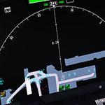
Addon scenery Airport Maps for the QualityWings 787 Dreamliner product. Just copy and past the files into your Apt Data folder:..FlightSimulator\QualityWings\QW787\Navdata\Apt Data\
FSDreamTeam:
CYVR KIAH KJFK KLAX
FlyTampa:
CYYZ EHAM EKCH KBOS LGAV LOWW OMDB YSSY
Taxi2Gate:
EDDM KSEA LFPG LTBA VHHH
Aerosoft
EDDB EDDF EGLL ENGM LEBL LIMC LPMA LSZH
Flightbeam:
KIAD KSFO
JustSim:
ELLX LCLK LFMN
ORBX:
ESSA LDDU LOWI
Pilots:
LEAM
MK Studios:
GCFV
Drzewiecki Design:
EPWA KPAE
TropicalSim:
LPFR LPPR
LatinVFR:
KMIA
UK2000:
EGKK
DigitalDesign:
GCTS
| Filename: | QualityWings_787_Airport_Map_Files.zip |
| License: | Freeware |
| Added: | 25th May 2018, 23:54:23 |
| Downloads: | 3,819 |
| Author: | Timm Rehberg |
| Size: | 1.95 MB |
| Category: Flight Simulator X - Scenery | |
| Detailed Terrain Features for Southern Africa, Update 5 |
|
Images related to this file:
File Description:

Scenery consists of Updated Terrain Vector data concerning Coastlines, rivers, dams, streams, roads, traffic, railroads, power lines and extrusion bridges for Southern Africa countries South of the Equator. The data around Kroonstad, Welkom, Kitty Hawk Aerodrome, Middelburg, Ermelo (South Africa) and smaller detail in other parts of Africa was updated by utilizing Satellite image backgrounds. This scenery is important and will be needed with release of future scenery by Aeroworx. Please install the previous release fsxWorx01 and updates 1 to 4 before this file.
| Filename: | Detailed_Terrain_Features_for_Southern_Africa_Upda.zip |
| License: | Freeware |
| Added: | 12th April 2013, 20:29:01 |
| Downloads: | 3,326 |
| Author: | Hannes Steyn, Aeroworx |
| Size: | 7.18 MB |
| Category: Fly! Legacy - Fly Legacy Scenery | |
| Fullerton LA |
|
File Description:
"LA_Fullerton" is a Fly!Legacy scenery made by using the Fly!Legacy City-editor.
The "City-editor" integrated in Fly!Legacy generates scenery 3D objects based on "Openstreetmap" data.
Fly!Legacy is an opensource and freeware flightsimulator under development - http://fly.simvol.org/indexus.php
This flightsim contains a unique "City-editor" which allows the generation of scenery 3D objects based on "Opensource" data (e.g. http://www.openstreetmap.org/) - LA_Fullerton is a first example of such a generated scenery.
| Filename: | Fullerton_LA.zip |
| License: | Freeware |
| Added: | 21st July 2012, 08:16:12 |
| Downloads: | 29 |
| Author: | Frank Dhont |
| Size: | 3.62 MB |


© 2001-2026 AVSIM Online
All Rights Reserved
Privacy Policy |