
Where Flight Simulation Enthusiasts Gather from Around the World!
AVSIM Library - Search Results

| Category: Flight Simulator 2004 - AFCAD Files | |
| LOWI Innsbruck Kranebitten |

|
File Description:
worked from government precision charts to represent correct LOC/DME 26 approach.
Parking locations as per recent airport photographs.
| Filename: | LOWI_Innsbruck_Kranebitten.zip |
| License: | Freeware, limited distribution |
| Added: | 7th July 2004, 23:57:18 |
| Downloads: | 1,523 |
| Author: | Karl F. Hajek |
| Size: | 3.41 KB |
| Category: Flight Simulator 2004 - Miscellaneous Files | |
| MROC |
|
File Description:
MROC (San Jose, Costa Rica) Terminal procedure database for Level D Simulations 767-300 FMC. Based on current charts.
| Filename: | MROC.zip |
| License: | Freeware |
| Added: | 1st April 2005, 21:52:09 |
| Downloads: | 345 |
| Author: | Lee Holdridge |
| Size: | 2.61 KB |
| Category: Flight Simulator 2004 - Miscellaneous Files | |
| SID's and STAR's for Luxembourg (ELLX) |
|
File Description:
Sids, Stars and Approaches for Luxembourg (ELLX) for the Level-D Simulations 767-300ER, taken from the Beluxvacc charts.
| Filename: | SIDs_and_STARs_for_Luxembourg_ELLX.zip |
| License: | Freeware |
| Added: | 7th April 2005, 13:37:25 |
| Downloads: | 484 |
| Author: | Andrew Piper |
| Size: | 5.33 KB |
| Category: Flight Simulator 2004 - Miscellaneous Files | |
| SID's and STAR's for Liege (EBLG) |
|
File Description:
Sids, Stars and Approaches for Liege (EBLG) for the Level-D Simulations 767-300ER, taken from the Beluxvacc charts
| Filename: | SIDs_and_STARs_for_Liege_EBLG.zip |
| License: | Freeware |
| Added: | 3rd April 2005, 04:58:22 |
| Downloads: | 360 |
| Author: | Andrew Piper |
| Size: | 4.65 KB |
| Category: Flight Simulator 2004 - AFCAD Files | |
| Diori Hamani international airport Niamey (DRRN) |
|
File Description:
Afcad file for the international airport of Niamey (Niger). This Afcad was created with Google Earth and SIA charts.
| Filename: | Diori_Hamani_international_airport__Niamey___DRRN.zip |
| License: | Freeware |
| Added: | 5th September 2007, 00:47:32 |
| Downloads: | 466 |
| Author: | Salah Benhenda |
| Size: | 9.05 KB |
| Category: Flight Simulator 2004 - Scenery | |
| Hungary - 2004 |
|
File Description:
This is a Photoreal Scenery of 14 Hungarian Airports. Charts Included. Also contains 33 landmarks, all over the country.
| Filename: | Hungary__2004.zip |
| License: | Freeware |
| Added: | 23rd July 2004, 22:58:02 |
| Downloads: | 10,317 |
| Author: | Tamás Várhegyi, Péter Borovszky, László Horváth |
| Size: | 23.76 MB |
| Category: Miscellaneous Files - General Utilities | |
| Wx2pfpx v2.6.4 |
|
Images related to this file:
File Description:
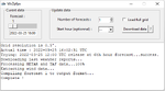
A simple weather data provider for the discontinued Professional Flight Plan X software. The script fetches raw weather data, METAR and TAF data from the NOAA, US national weather service, which is then compiled to a single file that can be imported in PFPX. More than 15000 reference stations (airports) from PFPX are used and wind/temperature data is provided for each of them. When available, METAR and TAF data is also provided for more than 5000 airports. The original data source is updated 4 times a day, and can provide forecasts for every 3 following hours up to 16 days. *** A new script can trigger antivirus analysis as it's unknown, you can ignore it.*** V2: Great precision improvement, possibility of importing the whole NOAA dataset grid, a bit of documentation. V2.6: Repaired due to API change.
| Filename: | Wx2pfpx_v264.zip |
| License: | Freeware, limited distribution |
| Added: | 27th September 2025, 15:55:08 |
| Downloads: | 96 |
| Author: | John Smith |
| Size: | 21.97 MB |
| Category: Flight Simulator 2004 - Aircraft Repaints, Textures and Modifications | |
| Mountain Express Airways - MD-90 |
|
File Description:
A repaint of Mike Stone's MD-90 for Mountain Express Airways. This repaint requires the previous installation of the base model MD-90 available at Mike wbsite. http://www.pmstone.com/
Notable for its extremely long fuselage the MD-90 was the largest of the MadDog series of highly successful airliners based on the original DC-9.
| Filename: | Mountain_Express_Airways__MD90.zip |
| License: | Freeware |
| Added: | 25th April 2005, 02:49:13 |
| Downloads: | 153 |
| Author: | Todd Lucas |
| Size: | 230.44 KB |
| Category: Navigation and ATC - Navigation | |
| IFR Enroute High Alt Charts for Moving Map Application |
|
Images related to this file:
File Description:
IFR ENROUTE HIGH ALTITUDE chart chunks from the late 2009 charts, formatted in the lat/long geographic coordinate system for GPS, moving map application for flight simulation use.
These chart chunks were converted to the JPEG format for compatibility and size. Coverage is the lower 48 H-series divided into 45 JPEG tiles from a full mosaic. Included is the needed projection files and world files.
The images are customized for moving map display (see link), and included is a Legend in PDF format.
Note: This type of map is an equal grid and no further calibration is needed, for users of FSM Moving Map, just mass import, done.
| Filename: | IFR_Enroute_High_Alt_Charts_for_Moving_Map_Applica.zip |
| License: | Freeware |
| Added: | 13th April 2010, 19:11:17 |
| Downloads: | 329 |
| Author: | David Myers |
| Size: | 88.99 MB |
| Category: Miscellaneous Files - General Utilities | |
| My Destination Chooser V4 - DEMO weather & charts part (v1.00) |
|
Images related to this file:
File Description:

Following delays over the initial My Destination Chooser v4 schedule, we have decided to make this small demonstration.
The aim is to show you some functions that will be included in MDCv4: the Weather and Charts part.
Weather Feature: Seach by ICAO code (METAR/TAF) ; Integrated METAR decoder ; Advanced Weather Chart display (Available sources : JEPPESEN, Eurocockpit, IVAO)
Charts Feature : Charts page (See the aiports charts of various airport spread all over the world!)
The Weather function available on MDCv4 is one of the most complete and integrated one available on any free pre flight planner tool. You can also easily find the most airport chart in the world thanks to this software.
Please, remember that is only a part of the futur addon: My Destination Chooser V4
This soft can be used for all you flight, and add a step forward for you flight preparation.
WARNING: Framework 4 required (link in the manuel).
Made by AirTimSimulation Team
| Filename: | My_Destination_Chooser_V4__DEMO_weather__charts_pa.zip |
| License: | Freeware, limited distribution |
| Added: | 13th November 2010, 14:58:44 |
| Downloads: | 569 |
| Author: | "AirTimSimulation" |
| Size: | 1.72 MB |


© 2001-2026 AVSIM Online
All Rights Reserved
Privacy Policy |