
Where Flight Simulation Enthusiasts Gather from Around the World!
AVSIM Library - Search Results

| Category: Flight Simulator 2004 - AFCAD Files | |
| The U.S. Virgin Islands (TISX/TIST) |

|
File Description:
Accurate rendition of the TIST and TISX airports. Includes accuarate gate numbering and locations for all airlines serving the airport as well as for general aviation aircraft. This is my continuing series of doing airports that have been neglected by both MS and the community. Hopefully this will enhance flying into this airport for those of you that frequent it. Unfortuantely there aren't many reference materials in terms of gate assignments or locations or numbering on the internet. I've flown in and out of this airport several times so most of this is from memory and a few shots I managed to find on airliners.net and jetphotos.net. It may not be 100% correct but it's pretty close and defientely a major improvement over the default scenery, which by the way...MS decided to place two large cell phone or radio towers right on the tarmac in front of the terminal, brilliant idea! If anyone out there knows of a way to remove them please e-mail me. Having said that, it's a beautiful island and a fun airport to fly into and out of. The St. Croix airport is also pretty much done from memory and a few photos since there isn't much reference material for gates, in this instance there aren't airline assignments to the gates since this is a smaller airport and the airlines pretty much are assigned random gates since there are only about a handful of gates. Again, though, definetely an improvement over the default. Now if only someone would do some landclass for the Virgin Islands ;-) Hope this enhances your flying into the sunny Caribbean!
| Filename: | The_US_Virgin_Islands_TISXTIST.zip |
| License: | Freeware |
| Added: | 30th June 2004, 04:52:33 |
| Downloads: | 2,702 |
| Author: | Jason Diaz |
| Size: | 136.53 KB |
| Category: Flight Simulator 2004 - Scenery | |
| Beaver Creek CYXQ in Yukon Territory, Canada |
|
Images related to this file:
File Description:
Beaver Creek is located at mile 1202 of the Alaska Highway, just east of the Alaska/Yukon border. The populaton is around 100 and the main employment is with the Border Agency, the White River First Nation, or with local tourist lodges. The airfield is a mile north of the town and close to the Canadian border post, which is included in the scenery. It was built by Jack Stalberg in the 1960's, and I have no further information beyond the fact that he loved to fly. The airport serves as an "airport of entry", though it is restricted in hours of opening and in the size of aircraft that it can handle; up to a maximum of only 15 seats. The single runway is 3,745 feet long and 100 feet wide, gravel, aligned 13-31 in FS9, lit, and with vasi at both ends. Righthand circuits for runway 13. There is a 340 feet threshold displacement to runway 31, which is of course unmarked on a gravel runway. The terminal building was recently reclad; I don't like it, but they didn't consult me. The ai reflects the sort of traffic the airfield gets; ie brief paperwork stopovers for GA or small charter flights into Canada from Alaska, usually in the mornings.I have adjusted the local scenery terrain levels to remove adjacent hills that I believe do not exist in real life but are part of the Northern Canada terrain mesh that I have installed. If you do not have this mesh you may find that the scenery works fine for you without the API flatten that is included here. The airfield is at 2,129 feet ASL.
| Filename: | Beaver_Creek_CYXQ_in_Yukon_Territory_Canada.zip |
| License: | Freeware, limited distribution |
| Added: | 28th January 2019, 06:19:20 |
| Downloads: | 174 |
| Author: | Roger Wensley |
| Size: | 4.68 MB |
| Category: Flight Simulator 2004 - AFCAD Files | |
| Honolulu International Airport, Honolulu, Oahu, Hawaii (PHNL) with Active Crosswind Runways V2 |
|
File Description:
A high quality AFCAD2 for Honolulu Int'l Airport (PHNL). Only for use with the freeware scenery by Bill Melichar (honov5.zip). The file is built from scratch using the latest FAA charts, various photographs and information from the airport website, in order to be as near real as possible. All taxiways are named as per real life and runway lengths are 100% accurate. All Airline gates are named as per real life and have the correct airlines assigned to them. Using the crosswind runway technique, all runways are now active for use at the same time. The Air Freight Terminal, to the west of the airport is also featured, with parking assignments for the cargo carriers that use it. Hickham AFB parking is included, consisting of a Military Combat area, Military Cargo area and airline gates for troop charter flights. Maintenance parking for Air Pacific, Aloha Airlines and Hawaiian airlines jets can be found on the south ramp area. An extensive GA area can also be found on the south ramp, and can accomodate any privately owned aircraft ranging from Cessna to Boeing 747. It is recommended (but not necessary) that you also download the freeware "Hickam AFB" scenery by Derek and Brendan Webb (dbwsimhickam04.zip) as it greatly enhances the appearance of the Air Force Base. This file has been extensively tested and all AI flows as it should. New in this release are updated gate assignments for new airlines that recently started to serve Honlulu, plus updated parking for new cargo carriers. Previous version of this file had over 2000 downloads. Enjoy!!
| Filename: | Honolulu_International_Airport_Honolulu_Oahu_Hawai.zip |
| License: | Freeware, limited distribution |
| Added: | 9th December 2005, 02:05:45 |
| Downloads: | 8,238 |
| Author: | Lee Brompton |
| Size: | 113.3 KB |
| Category: Flight Simulator 2004 - Scenery | |
| Havana 1962 Scenery |
|
File Description:
This scenery includes Havana as it was in 1962 (a mysterious city of much fascination for me) including El Morro Fortress on its rocky outcropping at the entrance to Havana harbor, the largest such fortress in the Caribbean, and its adjacent lighthouse. In downtown Havana you will see the capital building and several old cathedrals. Near the Malicon sea walk by the beach, you will find 3 famous hotels and former casinos, the Flamingo, the Riviera, and the Havana Hilton. The Havana Hilton opened just days before Castro seized power and nationalized it. When he first came to power he occupied the top floor for some time. Havana Airport opened originally as Rancho Los Boyeos Airport, located just southwest from the city in the village of the same name, which was then mostly farms, small ranches, and tiny communities. The original terminal was a very pretty Spanish colonial building, which the dictator Fulgencio Batista had remodeled in a 1950's cubist-tudor style. It was at the time of this remodeling (1957) that the airport's name was changed to Jose Marti International Airport, named after the famous Cuban revolutionary and poet of the 19th century. Jose Marti Airport was in the 1950s and 1960s the primary port of entry airport for Cuba. Up until the January 1st 1959 revolution many US airlines served Havana, but due to mounting tensions, the crisis of the Bay of Pigs attack, and later on the October 1962 missile crisis, traffic and tourism was ended as the US led blockade of Cuba took hold. By the time of this scenery, April 1962, the once former bustling Jose Marti airport had become quite sedate.
| Filename: | Havana_1962_Scenery.zip |
| License: | Freeware, limited distribution |
| Added: | 4th March 2010, 23:36:41 |
| Downloads: | 3,864 |
| Author: | Mike Stevens and Tom Gibson |
| Size: | 9.72 MB |
| Category: Flight Simulator 2004 - Scenery | |
| CYRL & CKS4 - Red Lake & Fishing Lodge Outposts - Ontario, Canada |
|
Images related to this file:
File Description:
Red Lake is in Ontario, 90 miles east of the Manitoba border & 120 miles north of the US border. The town is at what was the northern end of "the road" for many years, & this has led to it becoming a centre for floatplane flights north to fishing lodges etc. It has also become THE centre of Noorduyn Norseman floatplanes in Canada & there is a Norseman on display & an annual Norseman festival. Red Lake CYRL airport is 3 miles north of the town with 5,000 feet of asphalt runway aligned 08-26 with PAPI at both ends. The apron is in two parts; the western for the fire fighting planes & the eastern for the new terminal & the hangars for North Star, Superior, and Wasaya. There is also a scruffy hangar that is used for storage & to the south of the east apron some private hangars. The town & the float base (CKS4) are at the southern end of Howey Bay. Planes taxi north before going to full power for take off, & there are two main companies based at CKS4, Chimo & Green's, both of them using Norsemans (or Norsemen?) among other planes. Chimo service their fishing lodge & outposts in the Roderick Lake area, & Green's (who have a base on the west side of Howey Bay) service their own outposts on Trout Lake & Nungesser Lake in the AI. There are other Red Lake float operations using Norsemans from further north on the lake & they service fishing lodges in the AI on Peisk Lake and Uchi Lake. The AI also includes some GA float planes, & there are numerous GA & scheduled flights into CYRL.
| Filename: | CYRL__CKS4__Red_Lake__Fishing_Lodge_Outposts__Onta.zip |
| License: | Freeware, limited distribution |
| Added: | 15th November 2015, 14:29:42 |
| Downloads: | 500 |
| Author: | Roger Wensley |
| Size: | 32.92 MB |
| Category: Flight Simulator X - Scenery | |
| Frankfurt Main Airport (EDDF) v8 - Manual installation |
|
Images related to this file:
File Description:
This major update represents EDDF in the July 2015 timeframe.
This version includes further expansion of the Terminal 3 area now in use as extended apron parking, with new J and K ramps for airline, general aviation and cargo aircraft, new apron night lighting, vehicular traffic/roadways as well as support for 70+ airlines coded for AI traffic.
In addition, this update features some brand new taxiways and updated airport navaids including use of the secondary 3.2 degree ILS approach paths for the Northwest runway.
For visual improvements, a new sound wall for the northern perimeter is included along with improvements in landclass to match Orbx FTX Global and inclusion of an optional 200Mb ground photo scenery layer providing even more realism.
Extended compatibility is also provided for P3D and GSX v1.9 (Ground Services for FSX) with the latter providing customized service vehicle parking for each parking position across the whole airport and in some cases, custom GSX pushback operations have been introduced at selected gates. The associated GSX airport .ini file is supplied in this package.
Last of all, more flexibility is delivered. This new scenery now comes supplied with 3 separate .BGL files - the standard .BGL AFCAD file together with the exclusions file ( _CVX) and the separate airport objects file ( _OBJ) so that the airport AFCAD can continue to be updated independently from the airport objects and exclusion files by users wishing to modify the airport layout to their own needs.
Default FSX scenery is required.
Please consult the readme and the comprehensive help manual prior to installation and for more information.
| Filename: | Frankfurt_Main_Airport_EDDF_v8__Manual_installatio.zip |
| License: | Freeware |
| Added: | 5th August 2015, 18:49:53 |
| Downloads: | 7,199 |
| Author: | Mark Aldridge |
| Size: | 230.24 MB |
| Category: Flight Simulator X - AFCAD Files | |
| KEGE - Eagle County Regional - Eagle, Colorado USA * FIX * |
|
File Description: KEGE - Eagle County Rgnl - Eagle, CO, USA version 1.1 by Jason Boche
This is an update of the default FSX KEGE airport.
Enhancements include:
-Runway 7/25 lengthened to current, displaced threshold and markings added
-Blast pads added
-Updated taxiways to current
-PAPI lights moved to right/north side of runway 25
-Updated LOC frequency for runway 25 to 109.75
-Moved and added additional LOC antennea to the west end of runway 7
-Tower moved and model replaced
-Realistic terminal parking spots 1-10
-Asphalt and concrete aprons added/updated, ground lighting updated
-Asphalt, concrete, and gravel roads added
-Many bulidings updated
-All applicable runway signs updated
-Added airport, civilian, and construction vehicles
-Airport perimeter fencing updated
-Runway demolition fencing added
-National Guard helipads added
-GA refueling moved to the north end of the field
Please provide any feedback and suggestions to me at the email address listed
in the readme.txt. Thank you.
Acknowledgements:
Airport Design Editor (ADE -Freeware) - Jon Masterson.........http://www.scruffyduck.org.uk/
This also has a download centre for many other ADE files.
Please visit here for more information...........http://www.airportdesigneditor.co.uk
Any questions relating to ADE can be answered at www.fsdeveloper.com/forum......look
for Airport Design Editor author
Ray Smith for providing so many freeware airports and airport updates which
inspired me to give ADE a try.
Jason Boche
| Filename: | KEGE__Eagle_County_Regional__Eagle_Colorado_USA__F.zip |
| License: | Freeware |
| Added: | 30th November 2013, 10:42:48 |
| Downloads: | 1,476 |
| Author: | Jason Boche |
| Size: | 373.01 KB |
| Category: Flight Simulator 2004 - Scenery | |
| PIK2004 |
|
File Description:
FS2004 - (Glasgow)Prestwick International Airport.
This whole package is intended to compliment the comprehensive scenery for Scotland provided by the Scotflight Commercial Product, whilst at the same time being fully compatible with default scenery also.
This Fs2004 only compatible scenery gives highly detailed scenery for Prestwick Airport and it's immediate surrounds.
Prestwick Airport is a hub for the low-cost carrier Ryanair providing flights to many European destinations. Other holiday charter flights operate from the airport and there is a busy cargo terminal. Also adjacent to the airfield is the BAE Systems factory ( formerly Scottish Aviation) and extensive detailed scenery for this site is included.
The ground elements of the scenery are drawn with Lee Swordy's excellent Afcad program. The same file also adds AI traffic and accurately placed gates and parking spots. Included is the recently added FlightCentre, with AI traffic movements, the new Ryanair Service Hangar and new Business Park.
All added buildings are custom made, many with photo-texturing. The scenery has taxiway signs, active wigwags and full night lighting and a few static aircraft, discreetly placed.
A stretch of redrawn accurate coastline is included allowing the addition of the sandy beaches on the approach to Runway 13.
The two renowned championship golf courses of Royal Troon and Old Prestwick also feature on the seaward approach plus further golf courses in the towns of Prestwick and Ayr.
A local replacement road system covering the airport surrounds and the towns of Prestwick and Ayr is also included and this together with the replacement coastline should be compatible with any of the new Coastline and Roads products now available.
| Filename: | PIK2004.zip |
| License: | Freeware, limited distribution |
| Added: | 27th August 2005, 19:32:32 |
| Downloads: | 24,606 |
| Author: | Iain Gallacher-Scotflight Scenery |
| Size: | 8.07 MB |
| Category: Flight Simulator X - Scenery | |
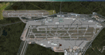
| Frankfurt Main Airport (EDDF) v8 - Auto installer |
|
Images related to this file:
File Description:

This major update represents EDDF in the July 2015 timeframe.
This version includes further expansion of the Terminal 3 area now in use as extended apron parking, with new J and K ramps for airline, general aviation and cargo aircraft, new apron night lighting, vehicular traffic/roadways as well as support for 70+ airlines coded for AI traffic.
In addition, this update features some brand new taxiways and updated airport navaids including use of the secondary 3.2 degree ILS approach paths for the Northwest runway.
For visual improvements, a new sound wall for the northern perimeter is included along with improvements in landclass to match Orbx FTX Global and inclusion of an optional 200Mb ground photo scenery layer providing even more realism.
Extended compatibility is also provided for P3D and GSX v1.9 (Ground Services for FSX) with the latter providing customized service vehicle parking for each parking position across the whole airport and in some cases, custom GSX pushback operations have been introduced at selected gates. The associated GSX airport .ini file is supplied in this package.
Last of all, more flexibility is delivered. This new scenery now comes supplied with 3 separate .BGL files - the standard .BGL AFCAD file together with the exclusions file ( _CVX) and the separate airport objects file ( _OBJ) so that the airport AFCAD can continue to be updated independently from the airport objects and exclusion files by users wishing to modify the airport layout to their own needs.
Default FSX scenery is required.
Please consult the readme and the comprehensive help manual prior to installation and for more information.
| Filename: | Frankfurt_Main_Airport_EDDF_v8__Auto_installer.zip |
| License: | Freeware |
| Added: | 5th August 2015, 18:50:05 |
| Downloads: | 15,650 |
| Author: | Mark Aldridge |
| Size: | 232.05 MB |
| Category: Flight Simulator X - AFCAD Files | |
| Ocean City Municipal Airport (26N), NJ |
|
File Description:
Located 02 miles SW of Ocean City, New Jersey on 60 acres of land, Ocean City Municipal Airport is host to quite a few GA aircraft, and has plenty of room for anyone looking to fly in for a few days. Around 60 tiedown spots are available on the tarmac. The main tarmac can host planes with wingspans up to 40 feet. If you managed to fly in anything larger than that head for the west end of the field to tie down. FSX may spawn some AI craft in that area but it is not attached to the main taxi network so no planes will leave from there - the majority of planes FSX spawns in that larger spot can't handle the runway length! Be sure to check your aircraft can handle takeoffs without freezing temps and a ton of headwind before you fly in. You can gas up by stopping near the fuel truck by the terminal or by the gas tank at the west end of the tarmac. Don't ask me what that yellow circle is on the tarmac - if anyone knows you can tell *me* :P It's in the airport photos so its there. Runway touchdown markings are enabled as in real life, but apparently FSX decides not to draw them because the runway is too thin.
Scenery constructed with use of satellite images/streetview, the author has not been there in person.
This scenery is meant to be used in conjunction with MegaScenery Earth New Jersey/Delaware 003. It is not required, but apron use is minimized to allow satellite scenery to show through as much as possible, and objects are placed based on the MSE textures - lack of it may make scenery look out of place.
| Filename: | Ocean_City_Municipal_Airport_26N_NJ.zip |
| License: | Freeware |
| Added: | 10th October 2010, 13:25:12 |
| Downloads: | 320 |
| Author: | Drew Sikora |
| Size: | 443.39 KB |
© 2001-2026 AVSIM Online
All Rights Reserved
Privacy Policy |