
Where Flight Simulation Enthusiasts Gather from Around the World!
AVSIM Library - Search Results

| Category: Flight Simulator X - Scenery | |
| Tangier Island, Virginia |

|
Images related to this file:
File Description:

This is a freeware addon scenery of Tangier Island, Virginia for FSX. It includes photoscenery of the island, original ground polygons for the airport grounds (custom runway, custom apron, volumetric grass), accurate-ish autogen, and a bunch of default library items (mostly docks and boats) placed to approximate the real thing.
| Filename: | Tangier_Island_Virginia.zip |
| License: | Freeware |
| Added: | 25th March 2013, 05:26:02 |
| Downloads: | 1,012 |
| Author: | Brian Martin |
| Size: | 331.95 MB |
| Category: Flight Simulator X - Missions | |
| BreedonHillChurchVisit.zip |
|
File Description:
Helicopter mission. A company helicopter at EGBD airport provides services. Take passengers for a walk in tour of the church of Saint Mary and Hardulph on Breedon Hill in the UK. This mission requires you have Orbx FTX EU England installed on your system. The church is in that scenery.
| Filename: | BreedonHillChurchVisitzip.zip |
| License: | Freeware |
| Added: | 7th April 2023, 14:44:58 |
| Downloads: | 27 |
| Author: | helomissionman |
| Size: | 2.05 MB |
| Category: Prepar3D V1-4 - Scenery | |
| FSX/P3D - Gummels Heliport Suriname SMHP |
|
File Description:
Hello everyone and to my Caribbean and South American community, this is a fairly accurate version of Gummels heliport located in Suriname. This is my first ever scenery, so I hope you all like it, click on the ZIP VIEW for more screenshots and I have more details in the readme.
| Filename: | FSXP3D__Gummels_Heliport_Suriname_SMHP.zip |
| License: | Freeware |
| Added: | 5th January 2023, 04:28:43 |
| Downloads: | 59 |
| Author: | Andre Noreiga |
| Size: | 30.72 MB |
| Category: Prepar3D V1-4 - Scenery | |
| GMMN - Mohammed V International Airport |
|
File Description:
P3Dv4.5 - Mohammed V International Airport - IATA: CMN - ICAO: GMMN
The scenery was made using the Airport Design Editor, ModelConverterX, FSEarthTiles, SketchUp 2017 an others.
Mohammed V International Airport - IATA: CMN, ICAO: GMMN) is an international airport serving Casablanca, Morocco. Located in Nouaceur Province, it is operated by ONDA (National Airports Office).
| Filename: | GMMN__Mohammed_V_International_Airport.zip |
| License: | Freeware |
| Added: | 10th November 2022, 03:08:16 |
| Downloads: | 121 |
| Author: | Eduardo Puelker |
| Size: | 48.98 MB |
| Category: Flight Simulator X - Missions | |
| WatsonLakeRescueTeam.zip |
|
File Description:
Helicopter mission. A helicopter company at CYQH airport provides emergency services. Take injured skiers on Ski Hill near Watson Lake, Yukon to the local hospital for treatment. Please be advised that this mission works best with Orbx base sceneries. It will work without it but there will be minor scenery discrepancies.
| Filename: | WatsonLakeRescueTeamzip.zip |
| License: | Freeware |
| Added: | 10th December 2022, 16:33:55 |
| Downloads: | 33 |
| Author: | helomissionman |
| Size: | 3.16 MB |
| Category: Flight Simulator 2004 - Scenery | |
| LFPO Paris Orly 1950 |
|
File Description:
By 1950 Paris Orly had taken over from Le Bourget as the most important Parisian airport. It served more of the destinations outside France and these included New York. If you want to fly the earliest versions of the Constellation across the Atlantic in FS9, this scenery is for you.
| Filename: | LFPO_Paris_Orly_1950.zip |
| License: | Freeware, limited distribution |
| Added: | 21st November 2025, 12:42:33 |
| Downloads: | 46 |
| Author: | Ken Lawson |
| Size: | 4.43 MB |
| Category: Flight Simulator X - AFCAD Files | |
| WIRR (WIIA / WICB) - Tangerang/Budiarto Airport, Banten, Indonesia. |
|
File Description:
This is a redesign of WIRR (WIIA / WICB) - Tangerang/Budiarto Airport, Banten, Indonesia. Google Maps has been used to provide the correct (as physically possible within FSX and ADE) position, size and type of runway, aprons and buildings. The immediate surrounding scenery has been included. ADE used to compile the design.
| Filename: | WIRR_WIIA__WICB__TangerangBudiarto_Airport_Banten_.zip |
| License: | Freeware |
| Added: | 5th March 2018, 22:29:37 |
| Downloads: | 1,278 |
| Author: | Matthew Ward |
| Size: | 1.19 MB |
| Category: Flight Simulator X - Scenery | |
| Tandragee airfield, home of "Kernan Aviation" - Northern Ireland - v1.00 |
|
Images related to this file:
File Description:

Tandragee airfield Northern Ireland, home of "Kernan Aviation" for FSX SP2/Accel/P3D. by Vassilios Dimoulas v1.00 6-10-2014br>
Kernan Aviation (http://www.kernanaviation.co.uk/) operates a fleet of microlight aircraft out of a home strip about two miles north of the town of Tandragee, Northern Ireland. The field is as described in their site, a home strip. There is a 300m long gravel runway with just 3.5m width. The runway intersects a road and has a generally North-South direction (actually 355-175 magnetic). There is an equivalent length grass runway to the east just over the small stream where students practice grass tngs and emergency landings. The field sports a roomy hangar, a clubhouse and a briefing house, as well as outdoor seating and barbecue facilities.
The scenery uses photoreal background and is made to match the FTX Northern Ireland region by ORBX. It will work best with that region activated. Seasonal variations are included for all seasons, including hard winter with snow (January). In order however to cater for those not having this scenery I have provided alternative background bgls for two more options, i.e. ORBX Global textures and GEX textures. The alternative bgls do not have the hard winter option as this is a feature only of FTX NI. The scenery will have also no problem to fit with UTX and Global vector. All buildings were custom made from photos of the original. The scenery has been tested and found to work also in P3D v2.3.
| Filename: | Tandragee_airfield_home_of_Kernan_Aviation__Northe.zip |
| License: | Freeware |
| Added: | 7th October 2014, 12:38:14 |
| Downloads: | 1,094 |
| Author: | Vassilios Dimoulas |
| Size: | 240.38 MB |
| Category: Flight Simulator X - AFCAD Files | |
| Mount Pleasant Landing Strip Airport (67NJ), NJ |
|
File Description:
Located 01 miles S of Hainesburg, New Jersey on 192 acres of land, Mount Pleasant Landing Strip Airport is a private turf field. The strip itself is 2100 feet in length over fairly level ground. There is no hard-surfaced grass runway in place, so setting your mesh to the highest resolution is recommended as you will be landing on bare terrain. Next to Runway 06 is a path through the trees you can taxi along to get to a hangar - although it is not available for transient aircraft and is closed. Collision with the trees along the path near the hangar and the static aircraft parked near it is disabled to make it easier to move through this relatively tight area. Immediately beyond the hangar is a clearing with ample room to turn around to taxi back out. You can also start parked in front of the hangar. The windsock is located a few feet west of the hangar and is not lit. The runway also has no edge lighting so daytime VFR operations only are recommended for this airfield.
Scenery constructed with use of satellite images/streetview/aerial photos - the author has not been there in person.
This scenery is meant to be used in conjunction with MegaScenery Earth New York 007. It is not required, but apron use is minimized to allow satellite scenery to show through as much as possible, and objects are placed based on the MSE textures - lack of it may make scenery look out of place.
| Filename: | Mount_Pleasant_Landing_Strip_Airport_67NJ_NJ.zip |
| License: | Freeware |
| Added: | 7th February 2011, 23:49:26 |
| Downloads: | 198 |
| Author: | Drew Sikora |
| Size: | 468.64 KB |
| Category: Flight Simulator 2004 - Scenery | |
| OSM World: South America |
|
Images related to this file:
File Description:
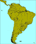
OSM World is a community project! If you wish to help, check the documentation and contact the author!
Welcome to OSM Wold: South America! This is a vector data scenery package covering the South American area. Coastlines, Rivers, lakes, roads, railways, and power lines with detail never before seen! All in an autogen-compatible density! You can see roundabouts, train terminals, harbor areas in a resolution of a point every 10 meters. At this same resolution a vectorial city class places residential (in small and big building variations, depending on surface area) and industrial areas exactly where they are supposed to be. This gives the city areas a resolution far superior to the capacity of FS-2004 default landclass bitmaps, limited to approximately 1 Km x 1 Km squares. OSM World: South America will even give you small roads leading to small towns (even a few houses across)! From big highway intersections, including ramps, to the tiniest rural pathways covering the entire South american area! Wherever in South America you fly, there is something to see!
You can enjoy this scenery near coastlines too! harbor areas and extremely detailed coastal topology (try the southern Chile). This scenery makes sure that the ocean is always flat, you can forget about the climbing water often found around photo-sceneries! This scenery is best paired with a good set of terrain meshes (like the freeware global SRTM mesh by Stephen Rothlisberger , available here: http://simviation.com/1/fs2004terrainmesh).
| Filename: | OSM_World_South_America.zip |
| License: | Freeware |
| Added: | 5th August 2015, 02:31:08 |
| Downloads: | 3,101 |
| Author: | Mario Noriega, Luis Miguel Hernandez |
| Size: | 64.37 MB |


© 2001-2026 AVSIM Online
All Rights Reserved
Privacy Policy |