
Where Flight Simulation Enthusiasts Gather from Around the World!
AVSIM Library - Search Results

| Category: Prepar3D V1-4 - Scenery | |
| Civita di Bagnoreggio Umbria Italy N42.37.40 E12.06.48 |

|
File Description:
Civita di Bagnoreggio Umbria Italy N42.37.40 E12.06.48 founded by the Etruscans lies on a tufted cuneiform hill 443 meters above sea level, between the two deep ravines of the Rio Chiaro and Rio Torbido. The scenery offered by the Valle dei Calanchi and the town of Civita di Bagnoregio, forms one of the most extraordinary and unique landscapes in Italy. Important VFR point.
Within the downloaded package you will find readme files for scenery installation. Good fly VFR. Pasquale Marrulli.
| Filename: | Civita_di_Bagnoreggio_Umbria_Italy_N423740_E120648.zip |
| License: | Freeware |
| Added: | 8th May 2018, 20:07:25 |
| Downloads: | 163 |
| Author: | Pasquale Marrulli |
| Size: | 18.2 KB |
| Category: Flight Simulator X - Scenery | |
| Tindari Geographic Coordinates N 38.08.27 E 15.02.48.Important VFR reference point for planes coming from Palermo and heading to Reggio Calabria |
|
File Description:
I wanted to realize the scenery of the sanctuary of Maria Santissima of Tindari village of Patti, in the province of Messina. It rises on the summit of the homonymous hill and overlooks Marinello's ponds in the homonymous nature reserve. Important VFR reference point for planes coming from Palermo and heading to Reggio Calabria. Geographic Coordinates N 38.08.27 E 15.02.48. For more information on the site search on google. In the Package you will also find instructions for installing the scenery.
| Filename: | Tindari_Geographic_Coordinates_N_380827_E_150248Im.zip |
| License: | Freeware |
| Added: | 24th August 2017, 05:08:31 |
| Downloads: | 255 |
| Author: | Pasquale Marrulli |
| Size: | 1.6 KB |
| Category: Flight Simulator X - Scenery | |
| San Giovanni Rotondo Puglia Italy Coordinate N 41°42 'E 15° 44' |
|
File Description:
San Giovanni Rotondo is an Italian municipality in the province of Foggia in Puglia Italy, rises 1256m above the
promontory of El Gargano, famous in the world for hosting the remains of St. Pius by Pietrelcina, cappuccino friar who
lived long in the homonym city. Geographic coordinates N 41° 42 'E 15° 44'. The scenery is an important VFR point at
1256m for those who want to fly over the Gargano. Within the package you will find instructions for installing the scenery.
| Filename: | San_Giovanni_Rotondo_Puglia_Italy_Coordinate_N_414.zip |
| License: | Freeware |
| Added: | 2nd September 2017, 18:12:17 |
| Downloads: | 370 |
| Author: | Pasquale Marrulli |
| Size: | 1.71 KB |
| Category: Flight Simulator 2004 - Scenery | |
| Julius Nyerere International Airport V2 |
|
Images related to this file:
File Description:
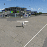
Thanks for downloading Julius Nyerere International Airport (HTDA) Version 2. This is the Largest Airport in Tanzania. The Airport scenery was built from Sketchup, SBUILDER and ADE v1.76 utilizing Google Earth for correct positions. Objects placed with Instant Scenery 3. This is version 2, it includes Terminal 1, Terminal 2, Terminal 3 (underconstruction), VIP trminal, Fire Station and Radar and Control tower in the correct position. and the "correct" afcad. More improvements will come once Terminal 3 is opened . Needs RWY12 Object library.
| Filename: | Julius_Nyerere_International_Airport_V2.zip |
| License: | Freeware |
| Added: | 16th October 2018, 15:36:32 |
| Downloads: | 1,175 |
| Author: | Emmanuel Mwandosya |
| Size: | 102.6 MB |
| Category: Flight Simulator X - Scenery | |
| ENOV-Orsta Volda Hovden v2 |
|
Images related to this file:
File Description:
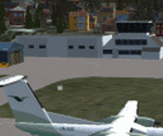
Freeware scenery made by Knudsenair simulations. Scenery is V2 of ENOV in Norway regional pack.
Ørsta–Volda Airport, Hovden (Norwegian: Ørsta–Volda lufthamn, Hovden; IATA: HOV, ICAO: ENOV) is a regional airport situated at Hovden (Hovdebygda), in Ørsta, Norway, midway between the towns of Ørsta and Volda. The airport features a 1,070-meter (3,510 ft) asphalt runway aligned 06/24. Services are provided by Widerøe using their de Havilland Canada Dash 8 as a public service obligation.
| Filename: | ENOVOrsta_Volda_Hovden_v2.zip |
| License: | Freeware |
| Added: | 29th April 2020, 19:17:25 |
| Downloads: | 323 |
| Author: | Knudsenair simulations |
| Size: | 389.98 KB |
| Category: Flight Simulator X - Scenery | |
| LRTZ(Tuzla Airfield) Update + Costinesti Airfield |
|
Images related to this file:
File Description:
This is the new version of Tuzla Airfield with lots of new scenery objects and some new parking spots for a more realistic scenery.
Also included in this update is the Costinesti Airfield located right near the edge of the Black Sea, south of Schitu village. The airport ICAO code is RO12 and in real life it is used for Ultralights and small GA airplanes. There are 3 hangars where you can start the flight from and you have one big grass runway.
| Filename: | LRTZTuzla_Airfield_Update__Costinesti_Airfield.zip |
| License: | Freeware |
| Added: | 27th August 2021, 17:22:01 |
| Downloads: | 131 |
| Author: | Liviu |
| Size: | 180.86 KB |
| Category: Flight Simulator X - Missions | |
| WhistlerAirGolfOuting(2).zip |
|
File Description:
Helicopter mission. A helicopter at CYPS airport provides services. Take golfers out to the Whistler Golf resort in British Columbia . The weather is CAVU with light winds. This zip file contains two versions of this mission. V2 of the mission will work with Orbx base scenery and PNW, P3DV5, and P3DV6. V1 works with FSX, FSXSE, P3DV4. Which ever sim you are running, chose the right version. Also be advised that there may be some scenery anomalies but the mission will still work.
| Filename: | WhistlerAirGolfOuting2zip.zip |
| License: | Freeware |
| Added: | 12th November 2023, 22:24:06 |
| Downloads: | 33 |
| Author: | helomissionman |
| Size: | 10.81 MB |
| Category: Flight Simulator 2004 - AFCAD Files | |
| LGSA Chania Souda |
|
File Description:
This file makes FS2004 use the correct taxiways and gates at the freeware scenery of Chania Souda by Emmanuel Stefanakis and Milos airport with the FS9 default scenery.
It keeps the AI Aircraft from taxiing cross country. It was created with AFCAD 2.11.
It contains enough parkings for:
-enough parkings for small and medium and prop airliners and seperate military Cargo and fighter parkings at Chania Souda (LGSA),
-one GA parking and one ATR-class parking (used by Olympic and Aegean Airlines) for Milos (LGML) with the default scenery. Adds turn pads and hold short nodes here. This will also satisfy those with many many military fighter and and military cargo flightplans but also those with many civil chatrter flightplans as there are more than enough parkings for everey category.
| Filename: | LGSA_Chania_Souda.zip |
| License: | Freeware |
| Added: | 2nd December 2003, 01:05:10 |
| Downloads: | 1,357 |
| Author: | Felix Hippmann |
| Size: | 6.34 KB |
| Category: Flight Simulator X - Scenery | |
| Descobrir Portugal X |
|
File Description:
This is the first version of DESCOBRIR PORTUGAL for FSX.
My intention is to create a new global scenery for the Portuguese territory, with new coast lines, roads, railroads, landclass, airports and local landmarks, lighthouses, bridges, castels and many other improvements.
In this first attempt for FSX:
Complete Scenery for: LPMU Mogadouro, LPCS Cascais Tires, LPEV Évora, LPPM Portimão.
Incomplete scenery for: LPBR Braga, LPBG Bragança, LPPR Oporto Intl, LPHR Horta; LPCE Cerval.
Realistic afcads for: LPVL Maia, LPVR Vila Real, LPMR Monte Real AB, LPSR Santarem, LPAT Almoster, LPMX Machede, LPLG Lagos, LPTV Tavira, LPAP Armação de Pera, LPPV Praia Verde, LPPI Pico.
150 Kms. Of replaced coastlines.
6200 Kms2 of realistic landcass, roads, Rivers, landmarks, etc.
Any comments and suggestions are wellcome.
ONLY for flight Simulator X.
| Filename: | Descobrir_Portugal_X.zip |
| License: | Freeware |
| Added: | 24th February 2007, 22:52:09 |
| Downloads: | 13,263 |
| Author: | José Maia |
| Size: | 24.29 MB |
| Category: Flight Simulator 2004 - Scenery Design | |
| EZ-Decorative Shrubs |
|
File Description:
This is a collection of decorative shrubs and flowers that can be placed in planters or on the ground. This is a standard FS9 object library and can be used with EZ-Scenery or any other program that allows you to place such objects in your FS9 scenery. These are plane objects, meaning they are 2-dimensional. Each shrub or flower object comes in two versions, static and rotational. The static version will stay in whatever direction it is facing when you place it in your scenery. The rotational version will rotate so that it is always facing you. Static versions are best for placing against walls, sides of buildings, etc. You can tell which version is which by the name. Flowers_01_s is static and flowers_01_r is rotational.
| Filename: | EZDecorative_Shrubs.zip |
| License: | Freeware |
| Added: | 11th June 2006, 02:02:22 |
| Downloads: | 4,252 |
| Author: | Sidney Schwartz |
| Size: | 1.13 MB |


© 2001-2026 AVSIM Online
All Rights Reserved
Privacy Policy |