
Where Flight Simulation Enthusiasts Gather from Around the World!
AVSIM Library - Search Results

| Category: Flight Simulator X - AFCAD Files | |
| Rainbow's End Airport (JY39), NJ |

|
File Description:
Located 07 miles S of Salem, New Jersey on 20 acres of land, Rainbow's End Airport is a private turf strip 2200' in length. There are no services for transient aircraft and the airport is not lit at night, so daytime VFR operations only are recommended. If you have an aircraft with 40' or less of wingspan you can start at one of the parking spaces east or west of the runway by the hangars. Otherwise it is suggested you start on the runway. There is no hard surfaced runway so set your terrain mesh as high as possible.
Scenery constructed with use of satellite images/streetview/aerial photos - the author has not been there in person.
This scenery is meant to be used in conjunction with MegaScenery Earth New Jersey/Delaware 005 & New Jersey/Delaware 004. It is not required, but apron use is minimized to allow satellite scenery to show through as much as possible, and objects are placed based on the MSE textures - lack of it may make scenery look out of place.
| Filename: | Rainbows_End_Airport_JY39_NJ.zip |
| License: | Freeware |
| Added: | 12th May 2011, 00:58:29 |
| Downloads: | 173 |
| Author: | Drew Sikora |
| Size: | 626.46 KB |
| Category: Flight Simulator X - AFCAD Files | |
| Warren Grove Range Airport (NJ24), New Jersey |
|
File Description:
Located 03 miles SW of Burlington County, New Jersey, Warren Grove Range is a private concrete airfield 1800' in length. It is owned by the Department of Defense and exists in a restricted flight area. The bare sand of this area has washed out the satellite images tremendously from over-exposure thanks to reflected sunlight - you can't even make out the runway (which FSX places incorrectly over a mile away). Due to lack of ground definition and primary use as a military facility, this airport has not been developed by MSEAirports and the concrete runway has been removed.
Scenery constructed with use of satellite images/streetview/aerial photos - the author has not been there in person.
This scenery is meant to be used in conjunction with MegaScenery Earth New Jersey/Delaware 003. It is not required, but apron use is minimized to allow satellite scenery to show through as much as possible, and objects are placed based on the MSE textures - lack of it may make scenery look out of place.
| Filename: | Warren_Grove_Range_Airport_NJ24_New_Jersey.zip |
| License: | Freeware |
| Added: | 20th August 2011, 19:58:05 |
| Downloads: | 174 |
| Author: | Drew Sikora |
| Size: | 153.47 KB |
| Category: Flight Simulator 2004 - AFCAD Files | |
| EGNM AFCAD v2.5 |
|
Images related to this file:
File Description: Can be used with the following on AVSIM:

Peter Slater's FS9 AFCAD for EGNM (2009 v2.5). This is the AFCAD (updated and tweaked) for:
Default Scenery Users (Default FS2004 Scenery)
EGNM Extreme Freeware Scenery Package v1.0 (Package by Peter Slater - found here on AVSIM)
UK2000 Part 7 (which includes EGNM) by Gary Summons
British Airports Vol.6 (which includes EGNM) by Justflight
BA and UK2000 AFCAD updated only but the v1 for the others are included. Please make sure you read the readme.txt before installing. You have the choice to configure which runway is used if not both (i.e. 14, 32 or both). By Peter Slater, uploaded by Gareth Abbott. Those who downloaded v2 please re-download this version. Visit his web site for his other projects at www.fsprojects.co.nr or search 'peter slater' here on AVSIM.
| Filename: | EGNM_AFCAD_v25.zip |
| License: | Freeware |
| Added: | 12th January 2012, 19:39:10 |
| Downloads: | 905 |
| Author: | Peter Slater, Gareth Abbott |
| Size: | 1.34 MB |
| Category: Flight Simulator 2004 - Scenery | |
| ETUO - RAF Gutersloh AB |
|
Images related to this file:
File Description:
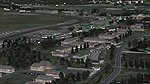
FS 2004 scenery - RAF Gutersloh AB (ICAO: ETUO)
The scenery represents the former airbase of RAF Gutersloh, one of the most populated military bases in West Germany during the Cold War, due to its location near the former East/West border. This scenery reflects the era at the end of the 1980s/beginning of the 90s, when the Harrier GR3 was in operation there, along with Chinook helicopters.
The airfield was built in 1935 and was used by the German Air Force during WW2, flying the Junkers JU-86 and Heinkel H-111. The first British squadrons were stationed there from 1947, with Mosquitos, Vampires and then Canberras.
The first Harrier arrived at Gutersloh in January 1977 and 3 and 4 Squadrons became resident until their farewell in 1993, after the cold war had ended. The airfield is currently used by the British army, but they will leave in 2014 to relinquish the area to the Government of Gutersloh for civil usage.
High detailed scenery by Manfred Schyma and Pete Beeby, supported by the Airfield Construction Group.
| Filename: | ETUO__RAF_Gutersloh_AB.zip |
| License: | Freeware |
| Added: | 10th October 2013, 20:30:01 |
| Downloads: | 1,925 |
| Author: | Manfred Schyma / Pete Beeby |
| Size: | 173.25 MB |
| Category: Prepar3D V1-4 - Scenery | |
| SEATTLE X DEMO - the City and the Airports |
|
Images related to this file:
File Description:

SEATTLE X DEMO features an extremely detailed scenery of large area of Seattle, USA, fully compatible with FSX, FSX SE, P3D v1/v2/v3/v4 and FSW by Dovetail.
With Seattle X you are free to fly to any of 5 airports: KSEA Tacoma, KPAE Paine Field, KBFI Boeing Field, KRNT Renton, S50 Auburn, admire some of the world-renowned landmarks, bridges, harbours, heliports, seaplane bases, ships, etc.
This Demo version features both - the City and the Airports packages (commercial poducts) and includes some downtown buildings as well as all airports with terminals but with low resolution textures, non-animated jetways and generally much less details. This ensures no problems with online (VATSIM, IVAO and multiplayer) flying in case some users have the payware scenery and some don't.
It's equipped with an automatic installer, which means that the scenery will be automatically added to the Flight Simulator Scenery Library.
Please uninstall all previous versions of the above-mentioned airports you may have installed before. Please make also sure that no duplicated AFCAD files are installed.
Enjoy your virtual flying with Drzewiecki Design!
| Filename: | SEATTLE_X_DEMO__the_City_and_the_Airports.zip |
| License: | Freeware, limited distribution |
| Added: | 1st May 2018, 15:50:13 |
| Downloads: | 942 |
| Author: | Drzewiecki Design |
| Size: | 90.12 MB |
| Category: Prepar3D V1-4 - Scenery | |
| EPKK KRAKOW BALICE X V2 DEMO |
|
Images related to this file:
File Description:
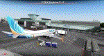
EPKK KRAKOW BALICE X V2 DEMO features the scenery of EPKK Krakow Balice airport and Krakow City, Poland, fully compatible with FSX, FSX:SE, FSW, P3Dv1-v4.
It's a fully functional DEMO version of the commercial payware product. It features same airport layout as in the full version but with limited 3D objects and low resolution textures. Using this free demo ensures no problems with online (VATSIM, IVAO, multiplayer etc.) flying in case some users use the payware scenery and some don't.
John Paul II International Airport Krakow-Balice (KRK / EPKK) is an international airport located near Krakow, in the village of Balice, 11 km (6.8 mi) west of the city centre, in southern Poland. The airport has one concrete runway, number 07/25, 2550x60m.
It's equipped with an automatic installer, which means that the scenery will be automatically added to the Flight Simulator Scenery Library.
Please uninstall all previous versions of this airport you may have installed before. Please make also sure that no duplicated AFCAD files are installed.
Enjoy your virtual flying with Drzewiecki Design!
| Filename: | EPKK_KRAKOW_BALICE_X_V2_DEMO.zip |
| License: | Freeware, limited distribution |
| Added: | 22nd November 2018, 00:56:01 |
| Downloads: | 521 |
| Author: | Drzewiecki Design |
| Size: | 12.67 MB |
| Category: Flight Simulator X - Scenery | |
| Mid West Victoria UPDATED. 14 airports. YARA YSWL YMBU YSTA YDOD YWYF YBIR YHPN YKER YSLK YSWH + *NEW* YNHL YHML YWKB |
|
Images related to this file:
File Description:
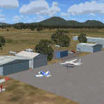
This is an updated version (original Jan 2018). Fixed some ground texture problems plus a lot of added and improved objects and 3 NEW airports. There are 14 airports starting at Ararat and extending up to the Murray at Swan Hill. YARA Ararat YSWL Stawell YMBU Maryborough YSTA Saint Arnaud YDOD Donald YWYF Wycheproof YBIR Birchip YHPN Hopetoun YKER Kerang YSLK Sealake YSWH Swanhill + *NEW* YNHL Nhill YHML Hamilton YWKB Warracknabeal. A lot of airports but not a quicky slap dash effort. It is several hundred hours over many months. Surrounding scenery modified to match real life. Towns, race courses, forests, sewage treatment ponds, obstacles (towers etc) have been added. Included is an AI traffic file that covers all airports that don't already have AI. These files are for Flight Simulator X. Made using Airport Design Editor using some objects borrowed from Robert Budd's excellent Baccus Marsh. RECOMMENDED The scenery is designed to interface with ORBX FTX_AU scenery for Australia (payware). It will work without ORBX but will not interface as well with standard scenery.
| Filename: | Mid_West_Victoria_UPDATED_14_airports_YARA__YSWL__.zip |
| License: | Freeware |
| Added: | 16th May 2019, 18:19:35 |
| Downloads: | 418 |
| Author: | Colin Jeffery |
| Size: | 5.23 MB |
| Category: Flight Simulator 2004 - Scenery Design | |
| EZ-Inland River Barges Object Library |
|
File Description:
EZ-Inland River Barges Object Library
For FS2004. Contains a mixture of various Inland River Barges (16 Barges including 3 different Office Barges for Barge Fleets) as is commonly seen on the Mississippi River and it's tributaries. Textures are a mix of DXT3 and 8bit.Barges also feature Timberheads and Cavels as seen on the real thing. This will be the final relese of our universal object libraries, the rest will be included in the KBTRv2 Scenery package which is now in Beta Testing. Please visit www.flightlevel390.org for more info. Use these objects in conjunction with Ron Jeffers EZ Maritime2 Object Library for the Towboats, and some of his own custom barges, His EZ Effects contain small black smoke (animated FX) which when placed over the stacks on the towboat bring it life.
You may use these Objects with your own Freeware Scenery Projects.
I have included the XML files from the other 2 object libraries to allow Scenery Designers to use other programs other than EZ Scenery to place my objects. -See Zipdive for more screenshots
| Filename: | EZInland_River_Barges_Object_Library.zip |
| License: | Freeware |
| Added: | 30th May 2007, 19:20:38 |
| Downloads: | 1,553 |
| Author: | FlightLevel390 |
| Size: | 1.45 MB |
| Category: Flight Simulator 2004 - AFCAD Files | |
| LPPT by PPP, and EDDH |
|
File Description:
AFCAD2 File for :
Lisbon, Portela Intl Airport, Portugal ( LPPT )
for PPP Scenery of Portugals's LPPT, LPPR and LPFR airports.
Although Runway 17/35 is rarely used, I have decided to open it for Take-off and landing .
Primarily 21 and secundary 35 ( Can't make 3 and 17 work, though I haven't tested it with wind.
Can be found on Avsim as ppp30.zip ( PPP version 3.0 )
All credits to the PPP team for LPPT/LPPR/LPFR sceneries, many many thanks .
( Not to bo used with the default scenery )
You may have to delete Airport.bgl in the scenery file of PPP, otherwise this Afcad file will not work .
For that reason also back-up Afcad files for PPP's LPPR and LPFR included.
Also included Hamburg, Fuhlsbuttel airport, Germany ( EDDH ) for Jan Martin's
jtacof_4.zip ( Jetways & Terminals For ACOF Package Four ) ( can also be used with default scenery )
Primarily Runway 15 and secundary 05 ( again I am not sure if 33 and 23 work , haven't tested
it with wind .
Tested them in my own FS2004, and it works well .
Have fun!
| Filename: | LPPT_by_PPP_and_EDDH.zip |
| License: | Freeware |
| Added: | 10th October 2004, 03:42:57 |
| Downloads: | 1,639 |
| Author: | Silvester van Wijk |
| Size: | 26.7 KB |
| Category: Flight Simulator 2004 - Scenery | |
| VFR of Lario, Area B1 - Como lake, Italy |
|
Images related to this file:
File Description:

This is the second scenery of the "VFR of Lario" project that follows the previous LagoComo_A1, made with photorealistic terrain (multiseason & night) and with some 3D GMax realistic objects. With this scenery there are also enclosed the great realistic meshes that cover all the Como lake area.
Information: Como's lake (called Lario), is placed in the north of Italy, closed to the Helvetic border. This second scenery covers approximately an area of 7.5x6 kmt, from Bosco di Falmoira/Rondago (NW) to Nesso (NE), and from Balerna/Chiasso (SW) to monte Bolletto (SE), and includes some details of the towns around the lake as Cernobbio (pier, Villa Erba and Convention Center, Villa d'Este, Akzo Nobel buildings), Moltrasio (pier), Carate Urio (pier), Laglio (villa Oleandra), Brienno (buildings and pier), Nesso (pier), Careno (pier), Faggeto Lario (pier), Torno (building and Pier), Blevio (pier).
Contents: several piers and small docks, motor ships and boats, an animated hydrofoil; some other buildings (GenericBuilding system) and trees widespread all over the scenery. Review of Brunate's funicolar and Castel Baradello, due to updated meshes.
| Filename: | VFR_of_Lario_Area_B1__Como_lake_Italy.zip |
| License: | Freeware |
| Added: | 26th January 2012, 15:23:57 |
| Downloads: | 1,948 |
| Author: | Della Vedova Aldo, Daniele Lanfranchi, Diego Caligiuri, Gian Mario Verga |
| Size: | 36.15 MB |


© 2001-2026 AVSIM Online
All Rights Reserved
Privacy Policy |