
Where Flight Simulation Enthusiasts Gather from Around the World!
AVSIM Library - Search Results

| Category: Flight Simulator X - Utilities | |
| ILS Approach Checklist |

|
Images related to this file:
File Description:
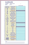
This is an easy to read Excel spreadsheet that is an ILS Approach Checklist that starts when you receive landing clearance by ATC that you are approx. 70 miles out from your assigned ILS Runway. By utilizing this checklist you will ensure not to forget any of the steps necessary for a successful ILS Landing. The following fields are provided:
(Landing Instructions) (Clearance) (Landing Info)
(Descent Rate) (ILS Frequency) (Course)
(Airport Elevation) (Radio Stack) (Nav 1 Frequency)
(Click Nav 1) (Hear Morse Code) (Enter Course)
(Enter Speed) (10 nm Cleared to Land) (Press Approach Button)
(Arm Auto Brake) (Arm Spoilers) (Gear Down)
(Set Flaps) (10-15-20-25-30-35-40 Flaps) (500' Disengage Auto-Pilot)
(Flare-Nose Up) (Reverse Thrusters) (Apply Brakes)
(Gate Assignment) (Gate Arrival) (Unload Passengers)
(Shutdown).
| Filename: | ILS_Approach_Checklist.zip |
| License: | Freeware |
| Added: | 5th February 2012, 14:15:06 |
| Downloads: | 1,569 |
| Author: | William R Ayers |
| Size: | 18.98 KB |
| Category: Flight Simulator X - Scenery | |
| JZZ - Koliganek Airport - Alaska, USA |
|
Images related to this file:
File Description:
Koliganek Airport (IATA: KGK, ICAO: PAJZ, FAA LID: JZZ) is a state-owned, public-use airport located one nautical mile (1.85 km) east of the central business district of Koliganek,in the Dillingham Census Area of the U.S. state of Alaska. Scheduled airline service to Dillingham Airport is provided by Peninsula Airways (PenAir).The airport opened in 1997.
Increased length of runway 9/27 from 3,000 feet to 3,300 feet.Added runway 17/35 (3,300 feet and 75 feet wide). Changes were based on 2011 construction plans.
Created with Airport Design Editor 9x by ScruffyDuck Software using current FAA documentation and Google Earth measurements, this package offers a replacement for FSX's stock airport. All these enhancements are as close to the real airport as I can get with stock library objects and custom buildings.
| Filename: | JZZ__Koliganek_Airport__Alaska_USA.zip |
| License: | Freeware |
| Added: | 25th December 2014, 01:15:29 |
| Downloads: | 597 |
| Author: | Wayne Roberts |
| Size: | 214.91 KB |
| Category: Flight Simulator X - Scenery | |
| SL02 - Alcantari International - Sucre-Yamparaez - Bolivia |
|
File Description:
The Alcantari International Airport (96% completed) (Spanish: Aeropuerto Internacional Alcantari) (IATA: unknown yet, ICAO: SL02, accordingly with some information over the WEB, pending of confirmation) is a new airport under construction in Yamparaez municipality, Chuquisaca, Bolivia, around 35 Km to the south of Sucre City. Alcantari International Airport is being built to address a number of limitations of the Sucre s current airport, Juana Azurduy de Padilla Airport (ICAO: SLSU).
The airport resides at an elevation of 10.210 ft (3.112 m) above mean sea level. The new airport will have one runway designated 18/36 (pending of confirmation) with an asphalt surface measuring 11,811 by 147.63 ft (3,600 m by 45 m)and it is expected to be operational by the first quarter of 2016.
Compatible with both FSX and P3D.
| Filename: | SL02__Alcantari_International__SucreYamparaez__Bol.zip |
| License: | Freeware |
| Added: | 3rd November 2015, 00:21:08 |
| Downloads: | 665 |
| Author: | Marcos A. Rivas Torrez |
| Size: | 9.31 MB |
| Category: Flight Simulator X - Scenery | |
| KPHL - Philadelphia Intl - Pennsylvania, USA |
|
Images related to this file:
File Description:
This is an accurate and up-to-date version of Philadelphia Intl Airport with two optional files and made only for FSX, do not use in P3D: There is one version with the Crosswind runway 17/35 activated where all 4 runways will be used for takeoff/landing and one file as the default airport runway operation: assigned parking as per their website with extra parking, extra fuel trucks, runway 9R/27L now at its new length, taxiways and taxi signs updated to the latest charts where possible as there is still construction going on by 27L, the Fedex and UPS cargo ramps and buildings replaced, support vehicle roads rebuilt and many other scenery improvements and objects added, airport views are from the roof of the control tower (when in tower view) please view the readme before installation.
| Filename: | KPHL__Philadelphia_Intl__Pennsylvania_USA.zip |
| License: | Freeware, limited distribution |
| Added: | 27th June 2018, 23:37:27 |
| Downloads: | 42,325 |
| Author: | Ray Smith |
| Size: | 6.85 MB |
| Category: Prepar3D V1-4 - Scenery | |
| ZMNA Nalayh Air Base |
|
Images related to this file:
File Description:
ZMNA Nalayh/Nalaikh AB is a former Russian airport in Mongolia and is now used by the Mongolian Air Force.
About 35 km South East of the Mongolian capital Ulaanbaatar.
At the base there is very little air traffic, mainly Mil-Mi8 helicopters.
This is because the Mongolian Air Force has relatively few aircraft/Helicopter (11 on 2022-01-01).
Nalayh AB leaves a dilapidated impression.
I made this scenery because I don't live far from the base myself.
As every flightsimmer knows, it is not nice to land on a naked airport.
That's why I added all kinds of things to make Nalayh AB a bit more lively,
I've added various parts that don't really belong there.
The runway, taxiways, controltower HAS Shelters and most of the hangars and buildings are real.
If you don't like this, just delete this scenery.
| Filename: | ZMNA_Nalayh_Air_Base.zip |
| License: | Freeware |
| Added: | 11th June 2022, 22:10:11 |
| Downloads: | 65 |
| Author: | Peter ZIEGLER |
| Size: | 30.45 MB |
| Category: Flight Simulator X - Scenery | |
| Palermo Punta Raisi LICJ, 2011 - version 2 |
|
Images related to this file:
File Description:
Palermo Falcone e Borsellino airport (also known as Punta Raisi) is an international airport serving the western part of Sicily Island. The airport itself is located 35 km west from Palermo. The airport (LICJ) ranks third by passenger number in southern Italy after Napoli and Catania. This scenery comes with custom terminals, tower, hangers, textures, night lighting, etc. It was designed to fit Mazzokan's Sicily photo scenery and Pietro Mauri's ItalyMesh2004. Both downloads are heavily encouraged. All details about these files are included in the LICJ 2011 User Manual. This scenery was created for FSX only. It has been tested with FSX sp2, but it should work fine with sp1.
This is version 2, it includes many more airport buildings than version 1, the existing buildings have been heavily updated, previous bugs are solved, etc.
| Filename: | Palermo_Punta_Raisi_LICJ_2011__version_2.zip |
| License: | Freeware, limited distribution |
| Added: | 15th July 2011, 14:58:16 |
| Downloads: | 11,029 |
| Author: | Thomas Lo Gerfo |
| Size: | 7.08 MB |
| Category: Flight Simulator 2004 - Original Aircraft | |
| Piaggio PD-808GE |
|
File Description:
NEEDS FS9_pd808rm.ZIP TO WORK. THIS PACKAGE DOES NOT INCLUDE THE NEEDED PANEL, GAUGES AND SOUNDS.
This is a complete simulation of the Piaggio PD-808. It includes advanced engine management, realistic systems, and some failure modeling. The model features a complete 3-D virtual cockpit,and a 2-D panel. The external model features all typical animations plus a load of custom ones. Also incluides all custom special effects, including different selectable floodlights for the virtual cockpit (by simply flicking ON the proper light switch on the cockpit itself). Plus with a fly-on-the-numbers flight dynamics file. Includes full documentation. THIS IS THE FS-2004 RELEASE. IT WILL NOT WORK PROPERLY WITH FS-X. THERE IS ALSO A FS-X RELEASE THAT WILL NOT WORK PROPERLY WITH FS-2004. THis is the "GE" variant of the aircraft and requires the base package "FS9_PD808RM.zip" to work.
| Filename: | Piaggio_PD808GE.zip |
| License: | Freeware |
| Added: | 15th February 2009, 11:53:18 |
| Downloads: | 1,601 |
| Author: | Mario Noriega |
| Size: | 14.19 MB |
| Category: Flight Simulator X - Utilities | |
| FS Earth 5.2 for Google Earth and FSX |
|
Images related to this file:
File Description:
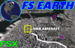
This program acts as a link between Flight Simulator X and Google Earth, letting to follow a flight in real time, over the satellite images generated by Google Earth. Flights can be saved, and many options are available for fine tuning the performance, as well as the map's style (zoom, tilt, orientation). Works on a single computer running FSX and Google Earth all together or, for best experience, can be used on two networked computers running respectively FSX (master) and Google Earth (slave). AI and Multiplayer traffic is also displayed in Google Earth, with course prediction and other information. Requires Flight Simulator X and Google Earth. The program running in trial mode works only around Anchorage, Alaska, (PANC / ANC) for a maximum of five minutes per flight session. Version 5.2 has new aircraft icons & labels and improves the compatibility with Windows Vista. A version for FS2004 is available also.
| Filename: | FS_Earth_52_for_Google_Earth_and_FSX.zip |
| License: | Shareware, time limited |
| Added: | 3rd May 2010, 07:38:23 |
| Downloads: | 2,701 |
| Author: | Luciano Napolitano |
| Size: | 3.46 MB |
| Category: Flight Simulator X - Utilities | |
| FS Earth 4.2 for Google Earth |
|
File Description:
This program acts as an interface between Flight Simulator X and Google Earth, letting to follow a flight in real time, over the satellite images generated by Google Earth. Flights can be saved, and many options are available for fine tuning the performance, as well as the map's style (zoom, tilt, orientation). Works on a single computer running FSX and Google Earth all together or, for best experience, can be used on two networked computers running respectively FSX (master) and Google Earth (slave). AI and Multiplayer traffic is also displayed in Google Earth, with course prediction and other information. Requires Flight Simulator X and Google Earth. The program running in trial mode works only around Anchorage, Alaska, (PANC / ANC) for a maximum of five minutes per flight session. Version 4.2 has improved compatibility with Windows Vista and minor bug fixes. A version for FS2004 is available also. By Luciano Napolitano.
| Filename: | FS_Earth_42_for_Google_Earth.zip |
| License: | Shareware, time limited |
| Added: | 9th March 2007, 13:39:05 |
| Downloads: | 2,213 |
| Author: | Luciano Napolitano |
| Size: | 2.44 MB |
| Category: Flight Simulator X - Utilities | |
| FS Earth 5.0 for Google Earth |
|
File Description:
This program acts as an interface between Flight Simulator X and Google Earth, letting to follow a flight in real time, over the satellite images generated by Google Earth. Flights can be saved, and many options are available for fine tuning the performance, as well as the map's style (zoom, tilt, orientation). Works on a single computer running FSX and Google Earth all together or, for best experience, can be used on two networked computers running respectively FSX (master) and Google Earth (slave). AI and Multiplayer traffic is also displayed in Google Earth, with course prediction and other information. Requires Flight Simulator X and Google Earth. The program running in trial mode works only around Anchorage, Alaska, (PANC / ANC) for a maximum of five minutes per flight session. Version 5.0 has improved compatibility with latest releases of Google Earth and several additional improvements. A version for FS2004 is available also.
| Filename: | FS_Earth_50_for_Google_Earth.zip |
| License: | Shareware, time limited |
| Added: | 19th July 2007, 00:46:27 |
| Downloads: | 1,104 |
| Author: | Luciano Napolitano |
| Size: | 2.44 MB |


© 2001-2026 AVSIM Online
All Rights Reserved
Privacy Policy |