
Where Flight Simulation Enthusiasts Gather from Around the World!
AVSIM Library - Search Results

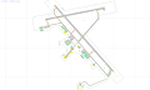
| Category: Flight Simulator X - AFCAD Files | |
| KCJR - Culpeper Regional Airport - Virginia, USA |

|
Images related to this file:
File Description:
Culpeper Regional Airport (ICAO: KCJR, FAA LID: CJR) is a county-owned public-use airport located seven nautical miles (13 km) northeast of the central business district of Culpeper, a city in Culpeper County, Virginia, United States.Located in Brandy Station, Virginia, the airport opened in 1968. The runway originally measured 3200 ft. by 75 ft. In 1983, the runway was lengthened to 4000 ft. In 2004, the runway was expanded to 5000 ft. by 100 ft. It can handle corporate size jets and large twin engine aircraft. The airport has an airfest every October since 1998, with performances such as aerobatics.
Created with Airport Design Editor by ScruffyDuck Software using current FAA documentation and Google Earth measurements, this package offers a replacement for FSX's stock airport. All these enhancements are as close to the real airport as I can get with stock library objects.
| Filename: | KCJR__Culpeper_Regional_Airport__Virginia_USA.zip |
| License: | Freeware |
| Added: | 19th September 2014, 00:13:38 |
| Downloads: | 175 |
| Author: | Wayne Roberts |
| Size: | 6.82 KB |
| Category: Prepar3D V1-4 - Scenery | |
| EPGY - Ostrow Mazowiecka-Grady 2020 |
|
File Description:
Prosta sceneria lotniska Ostrow Mazowiecka-Grady i landclass okolic.
EPGY:
- asfaltowy pas 09/27
- płyta postojowa przed hangarem
- dodane obiekty z domyślnej biblioteki
MIASTO I OKOLICE:
- dodano kilka lokalnych dróg w okolicy lotniska
- zaktualizowany landclass terenów wokół lotniska
- zaktualizowana linia drzew na lotnisku oraz kształt lasów i ich położenie w okolicy lotniska
Najlepsze wrażenia wizualne z ORBX Global + Vector i openLC Europe.
Simple scenery of the Ostrow Mazowiecka-Grady airport and surrounding landclass.
EPGY:
- asphalt runway 09/27
- apron in front of the hangar
- added objects from the default library
CITY AND VICINITY:
- several local roads around the airport have been added
- updated landclass of areas around the airport
- updated line of trees at the airport and the shape of forests and their location in the vicinity of the airport
The best visual experience with ORBX Global + Vector and openLC Europe.
| Filename: | EPGY__Ostrow_MazowieckaGrady_2020.zip |
| License: | Freeware |
| Added: | 27th April 2020, 18:02:14 |
| Downloads: | 137 |
| Author: | Åukasz Tyszkiewicz |
| Size: | 5.2 KB |
| Category: Prepar3D V5 - AFCAD Files | |
| KRYY - Cobb County International Airport (McCollum Field) - Atlanta, Georgia |
|
Images related to this file:
File Description:
This is a modification of the stock Cobb County International Airport AFCAD/BGL in Prepar3d v5.4. All parking has been redone to match closer to what is shown in Navigraph Charts. Several buildings have been removed which do not exist in real life and a few added using library objects and generic building files in Prepar3d.
The ramp on the North side of the airport has been redesigned in its entirety to reflect what is shown in Google Maps and Navigraph Charts. Random parking has been placed on the North and South ramp areas around the FBO and flight schools that populate the airport. Buildings have been deleted added to reflect the current layout of the field. All taxiway signage are correct and correctly positioned.
Aircraft tower and windsocks have been placed in the appropriate positions on the field and all taxiway signage is correct and correctly placed.
| Filename: | KRYY__Cobb_County_International_Airport_McCollum_F.zip |
| License: | Freeware |
| Added: | 17th December 2023, 20:02:03 |
| Downloads: | 27 |
| Author: | Michael Johnson |
| Size: | 173.69 KB |
| Category: X-Plane - Scenery | |
| ENNM - Namsos Airport - Namsos, Norway |
|
Images related to this file:
File Description:
This Namsos scenery corresponds to the current Airport Layout of ENNM. The near surroundings are designed based on a satellite photo so that VFR flights and VFR orientation should be very easy. The second bridge a bit far west of the airport is included, also the City of Namsos, a cruise ship dock and the marina south of the Namsos Bridge.
I used some parts of freeware libraries, which are already included in this package.
The airport buildings are converted from the famous FS2004 scenery from Kjell Arild Bersaas & Arne Sundsboe.
I did some small changes which were absolutely necessary to fit the new airport layout. Finally I only deleted a fence which blocked the new apron.
This scenery is converted from my ENNM-FSX scenery and the reworked with WED and OverlayEditor. The library "OpenSceneryX" must be installed first:
http://www.opensceneryx.com/
| Filename: | ENNM__Namsos_Airport__Namsos_Norway.zip |
| License: | Freeware |
| Added: | 17th May 2015, 08:59:30 |
| Downloads: | 140 |
| Author: | Wolfgang Allers |
| Size: | 16.75 MB |
| Category: Flight Simulator X - AFCAD Files | |
| CYXU - London International Airport / London, Ontario, Canada |
|
Images related to this file:
File Description:
CYXU - London International Airport / London, Ontario, Canada
This airport update was made with the latest version of ADE (Airport Design Editor) and made for FSX as a replacement for the stock (default) airport. I've made several changes to the airport which are listed below. All these enchancements are as close to the real airport as I can get with stock library objects. I've used satellite images, terminal photos and maps throughout the whole process so building locations are as accurate as possible. Happy landings in the beautiful Canada!
Features:
*Expanded parking apron
*Main terminal building with its jetways and regional jet parking area
*Seperate parking aprons for GA traffic
*Hangars and other airport buildings added
*Airport vehicles and objects throughout the airport
*Parking lots with static vehicles
*Airport fire station with fire trucks
*De-icing vehicles/runway plows
*Cargo ramp
*Helipad
*Diamond Aircraft Industries building/apron
| Filename: | CYXU__London_International_Airport__London_Ontario.zip |
| License: | Freeware |
| Added: | 28th July 2012, 08:41:55 |
| Downloads: | 954 |
| Author: | Jaison Diaz / Endeavour ai |
| Size: | 128.88 KB |
| Category: Flight Simulator 2004 - Scenery | |
| Oberpfaffenhofen v2.2 |
|
Images related to this file:
File Description:
This factory airport is located in the west of Munich (lovely Bavaria, South-Germany).The simulated version of the airport I dedicated to Claude Dornier, one of the
very famous aviation pioneers in the last century. Civil and military aircraft are manufactured and/or serviced on this airport. Over the years the ownership has changed in 1996 from Dornier to Fairchild/Dornier and in December 2002 to RUAG (Swiss Company). The airport also is hosting the "DLR" (German Aerospace Center) at the south western part of the field.
Version 2.2 replaces version 1 and 2.1 completely. Several airport buildings have
been modified and all the scenery textures have been converted to the DXT1/DXT3 format.
All EZ-Scenery BGL's and Textures are on board, therefore no further library downloads
are required. Gentlemen, it's time to get the weather briefing.
Re-upload.
| Filename: | Oberpfaffenhofen_v22.zip |
| License: | Freeware |
| Added: | 8th April 2011, 11:44:36 |
| Downloads: | 2,552 |
| Author: | Klaus Jone |
| Size: | 32.76 MB |
| Category: Flight Simulator 2002 - Miscellaneous Files | |
| Los Angeles Terminal Area Chart |
|
File Description:
The rendition of Los Angeles´ KLAX airport is one of the most detailed in FS2002 and a great starting point to explore the West Coast. The library hosts a few awesome landclass and mesh files for this area that offer an "as real as it gets" VFR experience if used with this chart. The 1:250.000 scaled chart is scanned in high resolution (8400*4700 pixel). It covers a much smaller area, but offers considerably more detail than the LA sectional. You may use this chart "as is" without any other software, but it will develop its full potential if used as moving map with SimSystem´s FSFlightMax or FSGarmin. It wouldn´t have been possible to offer this chart without Richard Harvey and his love to flightsimming, so please consider this file to be "donationware" and make a however small contribution to the Richard Harvey Endowed Scholarship.
| Filename: | Los_Angeles_Terminal_Area_Chart.zip |
| License: | Check within download |
| Added: | 30th March 2003, 15:27:19 |
| Downloads: | 1,472 |
| Author: | Uwe Rademacher |
| Size: | 28.03 MB |
| Category: Flight Simulator 2004 - Scenery | |
| EZ Scenery Cass Field (00CO) |
|
File Description:
FS2004 EZ Scenery CASS FIELD (00CO)
Briggsdale Colorado and surrounding parts of Eastern Co are well known for seeds. Seeds of almost any
kind imaginable like flowers, potatoes, bird seed and the list goes on and on. It is most always windy for there are no trees to slow the flow. Hot & windy in summer, cold and windy in winter and no natural enviromnent to harm plant growth. You can see the mountains to the west and more desolation to the east. A lonely place to drive through but rich in good people and seeds harvested for the world.
Area outside of airport's default flatten area require FS Global or Abasus extreme landscapes for elevation data. Download FREE library of RWY12 - EZ scenery objects (available on FlightSim.com or AVSIM) for objects. Ultimate Terrain USA for detailed landclass. FSX compatable.
Instructions inside.
jimmy R martin
| Filename: | EZ_Scenery_Cass_Field_00CO.zip |
| License: | Freeware |
| Added: | 6th June 2006, 01:54:47 |
| Downloads: | 619 |
| Author: | jimmy R martin |
| Size: | 255.55 KB |
| Category: Flight Simulator 2004 - Scenery Design | |
| Kijik Lake_AFCAD2_update to Version 2 only |
|
File Description:
This updated bgl is for those that have already installed the original Kijik Lake and would like 'just' the updated AFCAD2 bgl.
You must have already installed "Kijik Lake" by Brent Hricziscse. filename: kijik.zip in the avsim library. The complete scenery containing the update can also be downloaded_filename: kijik_v2.zip
This allows FS9 to list Kijik Lake in the Go to Airport's list with its available starting points, allows Kijik Lake to be viewable in the GPS and the map feature as well as installing the local NDB for navigation purposes. A tower view is also included.
In addition to the above, this updated bgl adds local radio communications for Kijik Lake airspace (ATC) and the start/approach points for Rwy's 01 and 19. Also, local Boy Scout troops donated their time and labor to groom the shoreline, resulting in a very nice airstrip.
| Filename: | Kijik_Lake_AFCAD2_update_to_Version_2_only.zip |
| License: | Freeware, limited distribution |
| Added: | 21st March 2004, 23:17:56 |
| Downloads: | 203 |
| Author: | Brent Hricziscse |
| Size: | 2.12 KB |
| Category: Flight Simulator 2004 - Flight Plans | |
| PMDG SIDSTARS Update for KLAS Las Vegas McCarren - Corrected Copy |
|
File Description:
Cycle 0603 PMDG SIDSTAR file by Terry Yingling revised 3/18/2006 by Dan Downs for
KLAS Las Vegas McCarren Intl. Includes the KLAS.txt file. Added missing procedures ILS1L with DME Arc and MCCRN2 DP (FS9 missing ILS1, add-on such as my KLASIAP.zip available in AVSIM FS2004-Scenery Library or any other that adds the LOC/GS to the runway data). Adjusted constraints for CLARR2 (landing KLAS), CRESO3 FUZZY6 GRNPA1 KADDY1 LUXOR2
SUNST1 and TYSSN1 STARS. BOACH2 and SHEAD4 DP routes from rnws 1L/1R adjusted to fix
FMC route glitch and constraints adjusted. DPs HOOVR3 LAS3 and OVETO3 routes from all
rwys redone to match current chart with either transition route or vectors to join. Adjusted constraints and corrected missed approach routes for ILS 25L/25R and added
transition CROWE to ILS 25R. All procedures, including those not modified, are included in this file.
| Filename: | PMDG_SIDSTARS_Update_for_KLAS_Las_Vegas_McCarren__.zip |
| License: | Freeware, limited distribution |
| Added: | 19th March 2006, 23:26:33 |
| Downloads: | 737 |
| Author: | Dan Downs |
| Size: | 6.17 KB |
© 2001-2026 AVSIM Online
All Rights Reserved
Privacy Policy |