
Where Flight Simulation Enthusiasts Gather from Around the World!
AVSIM Library - Search Results

| Category: Flight Simulator 2004 - AI Aircraft | |
| McDonnell Douglas F-4B Phantom II |

|
Images related to this file:
File Description:

Low poly model features 8 LOD's - dynamic shine - animated parts. Package for four locations of the Big-E carrier (version 2) ; with traffic & afcad files plus original textures : Norfolk with CVW-1 (VF 14 Tophatters & VF-32 Swordsmen), San Diego with cvw-15 (VF-51 Screaming Eagles & VF-111 Sundowners), east of Sicily with CVW-7 (VF-41 Black Aces & VF-84 Jolly Rogers) and Yankee Station with CVW-9 (VF-92 Silver Kings & VF-96 Fighting Falcons).
| Filename: | McDonnell_Douglas_F4B_Phantom_II.zip |
| License: | Freeware |
| Added: | 12th December 2009, 01:57:40 |
| Downloads: | 1,549 |
| Author: | Fernando Martinez |
| Size: | 2.22 MB |
| Category: Flight Simulator X - Aircraft Repaints, Textures and Modifications | |
| McDonnell Douglas/Boeing F/A-18 Hornet, VFMAT-101 'Sharpshooters' |
|
File Description:
This is a set of VMFAT-101 "Sharpshooters" textures for the FSX Acceleration F/A-18 Hornet. Marine Fighter Attack Training Squadron 101 (VMFAT-101), the Sharpshooters were commissioned at Marine Corps Air Station El Toro, Calif. Jan. 3, 1969, as part of Marine Combat Crew Readiness Training Group 10, 3d Marine Aircraft Wing. By June 1990 the Sharpshooters had graduated over 150 Hornet aircrew, amassed over 28,000 F/A-18 A, B, C and D flight hours.
| Filename: | McDonnell_DouglasBoeing_FA18_Hornet_VFMAT101_Sharp.zip |
| License: | Freeware, limited distribution |
| Added: | 21st August 2008, 01:06:32 |
| Downloads: | 490 |
| Author: | Nathan Havercroft / Microsoft |
| Size: | 2.55 MB |
| Category: Flight Simulator 2004 - Scenery | |
| RAF Northolt |
|
Images related to this file:
File Description:

This station is home to No.32 (The Royal) Squadron, flying BAe 125's, BAe 146's Islanders and Squirrel helicopters. It is the main gateway for officials and high-ranking officers of foreign governments and also for emergency and diplomatically sensitive flights. There is also a static Spitfire gate guardian, many thanks to John Young for allowing us to use his model.
Scenery is made up from several object libraries, details can be found in the readme.
| Filename: | RAF_Northolt.zip |
| License: | Freeware, limited distribution |
| Added: | 17th August 2013, 22:41:26 |
| Downloads: | 1,881 |
| Author: | Brian Clarke - Daryl Payne |
| Size: | 2.37 MB |
| Category: Flight Simulator 2004 - Aircraft Repaints, Textures and Modifications | |
| U.S. Coast Guard Gulfstream IV "CGAS Miami HIDTA" Interceptor |
|
File Description:
U.S. Coast Guard Air Station "MIAMI HIDTA" Interceptor Gulfstream IV.
Model by Henry Tomkiewicz. Thanks Henry. This is the "High Intensity Drug Traffic Area" Interdiction Gulfstream IV. Hope you likes. Please see read me for distribution limitations. Mainly for AI traffic. Stationed at OPA LOCKA I think but I cant be sure.
God bless the Coast Guard and all of our Armed Forces.
Many thanks to AVSIM.
Email:
Roger Martin
[email protected]
| Filename: | US_Coast_Guard_Gulfstream_IV_CGAS_Miami_HIDTA__Int.zip |
| License: | Freeware, limited distribution |
| Added: | 21st February 2005, 14:19:47 |
| Downloads: | 1,045 |
| Author: | Roger Martin |
| Size: | 820.35 KB |
| Category: Flight Simulator 2004 - Scenery | |
| VFR of Lario - A1 Scenery REVISION 1 - Como Lake, Italy |
|
Images related to this file:
File Description: Complete review of the Autogen objects, with extra objects This scenery A1v1 is an
optional update of the previous one (A1): VFR of Lario - Como lake, Italy (Download #164443)
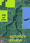
by library, of A1 scenery (Como); railway station and trains are now present.
| Filename: | VFR_of_Lario__A1_Scenery_REVISION_1__Como_Lake_Ita.zip |
| License: | Freeware |
| Added: | 4th December 2013, 22:22:01 |
| Downloads: | 677 |
| Author: | Aldo Della Vedova, Daniele Lanfranchi, Gian Mario Verga |
| Size: | 25.01 MB |
| Category: Flight Simulator X - AFCAD Files | |
| KCHS - Charleston AFB / Intl - Charleston, SC, USA v3.0 |
|
Images related to this file:
File Description:
Located near Charleston, South Carolina, KCHS is a combination commercial, general aviation, and military airport. This is a complete airport rebuild with new scale runways, ramps, and taxiways. This release features a detailed main terminal complex and access roads, enhanced general aviation facilities with two FBOs, detailed Air Force C-17A flight line, detailed Boeing South Carolina 787 facility, flying club, fire station, ICAO signage, enhanced approach scenery, and parking (including hangar parking) for over 135 aircraft.
| Filename: | KCHS__Charleston_AFB__Intl__Charleston_SC_USA_v30.zip |
| License: | Freeware |
| Added: | 25th May 2013, 00:52:03 |
| Downloads: | 2,498 |
| Author: | Allen Laughmiller |
| Size: | 61.18 KB |
| Category: Flight Simulator 2004 - Scenery | |
| TNCS - Juancho E. Yrausquin Airport - Saba, Netherlands Antilles |
|
Images related to this file:
File Description:
This island is the smallest municipality of the Netherlands. Saba is just under 30 miles south of St. Maarten, the island that was split between France and the Netherlands; to the southeast and 20 miles away is the small island of St. Eustatius, then St Kitts and then Nevis. The island comes out of the water like the top of Everest and keeps going, and there is no large space for a runway and no possibility of creating one with landfill with those steep sea cliffs. So what you have is a small runway (aligned 12/30) of 1,000 feet plus over-runs at each end that have small "closed" markings (see the white crosses) for a usable total of around 1,300 feet.
The airport restricts access as there is only space for four planes to park, plus a helicopter. And of course there is also the short runway to contend with. Landings are carried out under waivers issued by the Netherlands Civil Aviation Authority, and will always be on runway 12 as the southeast trade winds predominate. Twotters land there but only in real life; FS9 AI Twotters don't seem to find it adequate. There is no fuel or any other facility except for a small terminal building and a car park.
| Filename: | TNCS__Juancho_E_Yrausquin_Airport__Saba_Netherland.zip |
| License: | Freeware, limited distribution |
| Added: | 8th May 2013, 02:52:26 |
| Downloads: | 1,495 |
| Author: | Roger Wensley |
| Size: | 3.09 MB |
| Category: Flight Simulator 2004 - Scenery | |
| Galena PAKP in Alaska |
|
Images related to this file:
File Description:
Galena is a village on the Yukon River, around 30 miles east of the corner where the westward running river turns south. The population is just under 500 and the city is noted for its educational facilities that attract residential students from across the state. Adjacent to the city is the Galena Air Force Station that previously shared the use of the Edward G. Pitna Snr. airport until 2007, when the station was closed and the air force personnel left. The station facilities have been taken over by the community and the airport became the largest state-maintained airport in the interior of Alaska. Substantial resurfacing and finishing work was then carried out, and the new asphalt runway is now 6,000 feet long and aligned 7-25, with VASI at both ends and ILS on 25. There is a secondary gravel runway beside part of the main asphalt runway, and this is treated in radio announcements as if it is not a separate runway and landing or take off are on the adjacent asphalt. The airport is serviced by ERA (now called Ravn) and Wrights Air, with cargo flights by the eternal Everts. Included here is a small modification for Allakaket, which deletes a single remaining stock FS9 taxiway light. The AI included here also provided Allakaket with a Saturday Everts delivery flight, but I neglected to mention that before. A note here about my scenery making. There will not be many more to follow this as I am almost at the end of the photos I either took or found for scenery purposes, plus I expect to move on from FS9 at some point during next year.
| Filename: | Galena_PAKP_in_Alaska.zip |
| License: | Freeware, limited distribution |
| Added: | 27th November 2019, 19:14:00 |
| Downloads: | 257 |
| Author: | Roger Wensley |
| Size: | 13.95 MB |
| Category: Flight Simulator 2002 - Aircraft Repaints, Textures and Modifications | |
| Cathay Pacific Airways Airbus A330-300, Airbus A340-300, Airbus A340-600 - Three Pack |
|
File Description:
Cathay Pacific Airbus 3-Pack for the FSPainter Airbus Mega-Pack. This file contains the A330-300, A340-300, and the A340-600 (not in service with CPA yet, but who knows.....). If you want to populate the skies with AI traffic, these frame-rate friendly aircraft will work quite well. If you want a no-frills, fun-to-fly controllable aircraft, these aircraft again are very good. Day textures only, to save file space, requires the big FSPainter Airbus Base Pack availible on FSPainter's website, or right here on AVSIM. All aircraft and base textures by FSPainter.
| Filename: | Cathay_Pacific_Airways_Airbus_A330300_Airbus_A3403.zip |
| License: | Freeware |
| Added: | 9th January 2003, 18:33:51 |
| Downloads: | 5,018 |
| Author: | Michael Pearson |
| Size: | 1.01 MB |
| Category: Prepar3D V1-4 - Scenery | |
| Tucson International Airport Version 2 (KTUS) for Prepar3d v4 |
|
File Description:
In this update, I have changed the terminal buildings and widened the tarmac to allow more space for
aircraft at the gates. I have also added a few touch ups for the airport such as widening Runway 11L and 29R and adding the "TAXI" logo on taxiway just right of runway 29R. This scenery has been tested
on Prepar3d V4.5. Frame rates holds up pretty well. To INSTALL, just unzip and copy KTUS file to Prepar3dv4\addon Scenery, and overwrite all files. This Version of my Tucson International Airport will be more realistic than that of my previous KTUS version.
| Filename: | Tucson_International_Airport_Version_2_KTUS_for_Pr.zip |
| License: | Freeware |
| Added: | 30th October 2020, 17:45:09 |
| Downloads: | 244 |
| Author: | Wendell Melton |
| Size: | 14.85 MB |
© 2001-2026 AVSIM Online
All Rights Reserved
Privacy Policy |