
Where Flight Simulation Enthusiasts Gather from Around the World!
AVSIM Library - Search Results

| Category: Flight Simulator X - Aircraft Repaints, Textures and Modifications | |
| FS2004/FSX/P3D Overseas National - ONA DC-6A 1959 |

|
Images related to this file:
File Description:
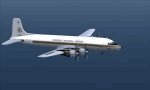
This is a repaint of the Douglas DC-6A (CB17 model) in Overseas National Airways - ONA 1959 colors. The freeware CalClassic DC-6A CB-17 model by Greg Pepper and Tom Gibson is needed for this repaint. ONA was originally formed in 1950 by George Tompkins to undertake overseas contracts on behalf of the USAF. Douglas DC-4s were initially used, with DC-6s joining them later. However, due to underbidding on contracts, ONA declared itself bankrupt on October 29 1963. After this, the airline was extensively re-organized and began operations once again in October 1965, with a fleet of 7 DC-7s. Soon after, in June and July 1966 the airline's first jetliners joined the fleet in the form of DC-8-50Fs. After a 1966 ruling by the CAB, ONA was granted permission to undertake inclusive tour charters, affinity group charters, and single entity charters to transatlantic and Caribbean markets. This was a godsend to the airline and it started to become quite profitable. Over the next decade, the fleet expanded to include: L-188s, DC-8-61/63CFs, DC-8-20/30s, DC-9-30s, and the granddaddy of them all; the DC-10-30CF. During the winter of 1975/76 tragedy struck. Two ONA DC-10s were lost in accidents in the space of two months (November 1975 & January 1976). This was a major blow to the airline and its image. This, coupled with financial difficulties, led the the filing of its second bankruptcy on September 7, 1978. That was the final nail in the coffin. This repaint is on DC-6A N660NA, which joined the airline in 1958, ans was sold to AAXICO in 1961. Textures are 32bit bmp. This repaint was tested on FSX-SE and should work on FSX, P3D v1-3, & FS2004.
| Filename: | FS2004FSXP3D_Overseas_National__ONA_DC6A_1959.zip |
| License: | Freeware |
| Added: | 19th June 2019, 15:55:19 |
| Downloads: | 71 |
| Author: | Ted Giana |
| Size: | 7.57 MB |
| Category: Flight Simulator X - Scenery | |
| US Navy Collection, with Flyable UAV |
|
Images related to this file:
File Description:

Unfortunately the Navy has cancelled or scaled down most fleet week celebrations around the nation. With this collection, you can stage your own!
Among the latest and hottest additions to the US Navy arsenal is the LCS. Two versions have been developed, the trimaran corvette by General Dynamics and Lockheed Martin's version, which promise to give a double black eye to Al Qaida, Somali pirates, or anyone else that opposes Freedom and Independence. Also are included in this package are the Arleigh-Burke class destroyer USS Fitzgerald, the Ticonderoga class cruiser Lake Champlain and two Oliver-Perry class frigates, FFG-58 Samuel B Roberts and FFG-60 Rodney M Davis. The centerpiece of the fleet is LHD-2 USS Essex and thanks to Arno's fantastic ModelConverterX, Essex is able to feature a highly detailed deck packed with 7 F-35b JSF, 6 MV-22 Osprey, 5 CH-53 and 2 Seahawks. Finally, SSN775 Texas, as part of the collection is available for patrol. All ships have landable decks, night lights and animation effects. Texas as a submarine is more of a boat, I believe, but it has navigation lights and wake effects.
I have also included another hot Navy addition, the RQ-8 fire Scout. There are two versions, a static RQ-8b lashed to the deck of Independence and an RQ-8c with the Flir Brite Star electro/optical turret which I have made flyable, largely for absence of deck space to place it as static.
Make no mistake that the Essex model is very resource intensive, with all it's polygons and what have you. The night lighting is stunning (imo) but seems to have an even heavier effect, you've been warned..
| Filename: | US_Navy_Collection_with_Flyable_UAV.zip |
| License: | Freeware, limited distribution |
| Added: | 19th October 2013, 20:27:36 |
| Downloads: | 1,290 |
| Author: | Rick Keller |
| Size: | 96.89 MB |
| Category: Flight Simulator 2004 - Scenery | |
| Ballina, New South Wales, Australia (YBNA) |
|
File Description:
A very attractive small airport approximately 120 nautical miles from Coffs Harbour and a slightly shorter distance to Grafton and Lismore. This makes a good stopover for hopping down the east coast of Australia. The airport handles around 11 flight a day from Sydney and is also a busy GA aiport. Airlines REX and Qantas link fly into Ballina. The size of the airport has allowed me to put in that extra detail which makes to terminal and surrounds very much "as in real life". Photographic textures are used throughout for the buildings and even the trees and shrubs are hand made macros from photographs at the airport. Thanks to the cooperation of Northern Airline Services - Mr Bruce Beesley the MD and Graeme from Ballina Council the relative position of all of the buildings are exactly to scale as shown on scale drawings of the airport. AFCAD and Traffic Tools files are included to add extra AI traffic. For that reason and because of limited apron space no static planes have been used. In addition a landclass is included to make the airport ground texture resemble the real thing and also to widen the river behind runway 24. The scenery concentrates on adding a realistic terminal to the airport and hangars which are as close as possible to the real thing. Many other details have been added all authentically Ballina. The default runway detail remain unchanged with the exception of VASI placement. Other than that the airport merges into the default scenery without the usual "green oasis" effect. Full night lighting is included plus a rather dubious attempt to model the inside of the terminal (strictly not to be taken too seriously)
| Filename: | Ballina_New_South_Wales_Australia_YBNA.zip |
| License: | Freeware |
| Added: | 25th January 2004, 19:16:25 |
| Downloads: | 5,910 |
| Author: | John Ross |
| Size: | 6.8 MB |
| Category: Flight Simulator X - Scenery | |
| RAF Honeybourne 1945 - Worcestershire, England |
|
File Description:
RAF Honeybourne was a Royal Air Force station located 0.6 miles (0.97 km) south of Honeybourne, Worcestershire, England and 4.6 miles (7.4 km) east of Evesham, Worcestershire, England.
The airfield was home to No. 24 Operational Training Unit RAF (OTU) which used Vickers Wellingtons and Armstrong Whitworth Whitleys from 15 March 1942 until July 1945 flying many operational bombing and leaflet dropping operations.
A number of units from Ferry Command were based here including a ferry training unit using Lockheed Hudsons and Bristol Beauforts.
The airfield was also temporarily home to No. 21 OTU flying Wellingtons from RAF Enstone from August 1945 for two months because the runways at their home base were being repaired. From October 1945 until 1946 107 Sub Storage Unit from No. 8 Maintenance Unit used the airfield for storing Wellingtons and General Aircraft Hamilcar gliders.
The role of the airfield after the war changed with the reduction of flying movements and with a slight change in what the units did on the airfield when No. 107 Sub Storage Unit from 1947 began to collect no longer needed Wellingtons which were then scrapped and taken to Weston Subedge goods yard (which was near to the south-western corner) where the railway would take them to the necessary destination.
In July 1948 the site was closed and much has reverted to farmland with runways being removed in 1968. Since then, the airside area has evolved into the Honeybourne Airfield Trading Estate with the five hangars being used for different purposes.
| Filename: | RAF_Honeybourne_1945__Worcestershire_England.zip |
| License: | Freeware |
| Added: | 3rd June 2016, 11:00:06 |
| Downloads: | 131 |
| Author: | Terry Boissel |
| Size: | 2.29 MB |
| Category: Flight Simulator X - Scenery | |
| RAF Bircham Newton - Norfolk, England |
|
File Description:
RAF Bircham Newton is a former Royal Air Force station located 2.1 miles (3.4 km) south east of Docking, Norfolk
and 13.4 miles (21.6 km) north east of King's Lynn, Norfolk, England.
The site was first used during the First World War and received the largest British bomber of the time, the Handley Page V/1500. They would have carried out bombing missions against Berlin but the Armistice was arranged before any missions were actually flown.
The airfield was equipped with one aircraft repair shed and three double bay general service sheds, although these had been demolished by 1937. It had two Belfast hangars, three C Type hangars, three Bellman hangars and ten Blister hangars. It operated through the Second World War as part of No. 16 Group RAF as part of Coastal Command.
No. 206 Squadron RAF was one of the squadrons being based there, on maritime patrol duties. Two satellite airfields, RAF Docking and RAF Langham were opened to accommodate units. In 1965 the airfield was used for evaluation trials of the Hawker Siddeley Kestrel V/STOL aircraft.
After closure as an operational airfield in 1966, the airfield became the home of the Construction Industry Training Board. The runways have gone, but the majority of buildings on the site, including some hangars and the control tower, remain in use by the CITB.The control tower was demolished in 2010 due to its poor condition. Constructionarium is also based within the estate, providing a week's practical learning opportunity for undergraduates
| Filename: | RAF_Bircham_Newton__Norfolk_England.zip |
| License: | Freeware |
| Added: | 25th December 2015, 18:15:50 |
| Downloads: | 360 |
| Author: | Terry Boissel |
| Size: | 1.6 MB |
| Category: Flight Simulator 2004 - Scenery | |
| Gjoa Haven CYHK, on King William Island, Nunavut, Canada, |
|
Images related to this file:
File Description:
Gjoa Haven is a village of 1,200 or so inhabitants at N 68 38 W 95 51 on the southeast corner of King William Island, around 155 miles north of the Arctic Circle. It's Inuit name is Uqsuqtuuq; the Gjoa Haven name was given by the Norwegian explorer Roald Amundsen when he spent two years there from 1903 to 1905 during his exploration of the northwest passage from east to west. His boat was called Gjoa and the cove was named Gjoa Harbour, in Norwegian. The village has been added in this scenery with approximately the right shape; though the coastline with Ultimate Terrain does have the small cove that serves as a harbor the coast shape is wrong. The airfield runway is 4,400 feet of gravel 100 feet wide at 154 feet above sea level. There is no LL100 available, only JetA1, delivered once a year by ship along with all the other requirements of the town. There is also a nearby CAM-B remotely operated defence radar station with its three protective domes. The old terminal building is still there, albeit repainted and spruced up, along with the far larger and newer one alongside it.
One of the screen shots shows Gjoa Haven as it appears for at least 8 months of the year, with snow on the ground and sea ice all around. If you want the ice then download my recent post of All Canada frozen lakes, rivers, and the northern seas, reversible with an untick in the FS scenery library.
| Filename: | Gjoa_Haven_CYHK_on_King_William_Island_Nunavut_Can.zip |
| License: | Freeware, limited distribution |
| Added: | 19th February 2011, 15:42:51 |
| Downloads: | 550 |
| Author: | Roger Wensley |
| Size: | 2.68 MB |
| Category: Flight Simulator X - Scenery | |
| RNAS Anthorn (HMS Nuthatch) - Cumbria, UK |
|
File Description:
This scenery is a representation of RNAS Anthorn (HMS Nuthatch) prior to runway and taxiway upgrades completed in 1948. It is not 100% accurate and no claim is being made that it is.
The scenery was made using ADE and is intended for use in FSX along with Horizon GenX VFR scenery but should work ok in Basic FSX.
Some History: Anthorn air field (also known as RAF Anthorn, RNAS Anthorn and HMS Nuthatch) was an airfield approximately 430 KM north-northwest of London
The airfield was built in february 1918 as a Fleet Air Arm (FAA) airfield. It was abandoned after World War I ended, however. The RAF reinstated the airfield at the beginning of World War II as an emergency landing ground for nearby RAF Silloth.
The site was taken over by the Royal Navy in December 1942, and renamed the site RNAS Anthorn. It was commissioned in September 1944 as 'HMS Nuthatch'.
The airfield served as No. ARDU (Aircraft Receipt and Dispatch Unit), a unit that accepts aircraft from their manufacturers and prepares them for operational use.
The last official flight took off from the airfield in November 1957. It was then put on Care and Maintenance, before it closed down in March 1958.
In 1961 the site was chosen to become a NATO VLF transmitting site for communicating with submarines. Construction of the site, by Continental Electronics of Dallas, U.S.A., began in 1962.
The station was accepted on behalf of the MoD in November 1964.
| Filename: | RNAS_Anthorn_HMS_Nuthatch__Cumbria_UK.zip |
| License: | Freeware |
| Added: | 1st March 2015, 23:11:58 |
| Downloads: | 435 |
| Author: | Mark Byers |
| Size: | 21.34 MB |
| Category: Flight Simulator 2004 - Scenery | |
| CNZ3 - Chatham-Kent - Ontario, Canada V1 |
|
Images related to this file:
File Description:
This is partly part of the Small Ontario Fields series. The airport ICAO was changed from CNZ3 to CYCK in November 2012; I have left it as it was. The runway too remains as it was a few years ago. Chatham is located 50 miles east of Detroit and 150 miles southwest of Toronto, between Lake St. Clair and Lake Erie, and the airfield is southeast of the town. There is a single asphalt runway 5,000 feet long and 75 feet wide, aligned 05/23 in FS9 but in fact in real life now 06/24 due to the wandering magnetic north. The apron is on the northern side of the runway at the eastern end, with added taxiways to cater for newer hangars wearing identical colour schemes. There is fuel, runway lighting, some taxiway lights, visitor parking on the grass, and plane maintenance in the large hangar beside the small terminal building on the north side of the apron. There is a train station in the middle of the town, and no scheduled flights to the airport that is 8 miles away; these two facts may be connected. Ditches along the road and around much of the airfield provide separation, which is why the fences are not continuous. If you are on the runway and find your path to the apron blocked by another plane that is stationary at the hold short, continue past the first turnoff to the threshold markers and turn off the runway and wait. The AI plane will then taxi out and you will have a clear path.
| Filename: | CNZ3__ChathamKent__Ontario_Canada_V1.zip |
| License: | Freeware, limited distribution |
| Added: | 27th August 2015, 21:02:59 |
| Downloads: | 341 |
| Author: | Roger Wensley |
| Size: | 9.89 MB |
| Category: Flight Simulator X - Scenery | |
| Whale Island (Hi Resolution Photo and mesh), New Zealand |
|
Images related to this file:
File Description:
Whale Island (Maori Name: Moutohora) is a small island located off the Bay of Plenty coast of New Zealand's North Island. It is located about 12 kilometers north of the town of Whakatane. A whaling station existed on the island during the 19th century. The 1.43 km island is a remnant of a complex volcano which has eroded, leaving two peaks. This is still an area of volcanic activity and there are hot springs on the island in Sulphur Valley, McEwans Bay, and Sulphur Bay.
This Hi Resolution scenery was created from a 0.25m pixel resolution Ortho-rectified Aerial mosaic owned by Environment Bay of Plenty (The Bay of Plenty Regional Council) and flown in 2007. The imagery has been slightly de-sampled for use in Flight Simulator X and utilizes the a custom hi resolution 5m Mesh derived from photogrammetry data off the photos. The textures are intended for summer daylight flying only, although due to the evergreen nature of New Zealand's native bush, the Islands appearance remains relatively constant throughout the year.
The island contains a small helicopter pad which is used for checking the various radio antennas on the Island. There is also a small Department of Conservation hut near the south western tip of the Island. These objects have been added from the FSX library of objects. Make sure to turn up your graphics sliders to make the most of this data! To find the Island fly north from Whakatane airport.
| Filename: | Whale_Island_Hi_Resolution_Photo_and_mesh_New_Zeal.zip |
| License: | Freeware, limited distribution |
| Added: | 20th January 2010, 10:12:14 |
| Downloads: | 4,650 |
| Author: | Tim Barnes |
| Size: | 9.94 MB |
| Category: Flight Simulator X - AFCAD Files | |
| MRLB - Daniel Oduber Quiros International Airport / Liberia, Guanacaste, Costa Rica |
|
Images related to this file:
File Description:
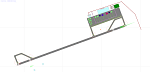
MRLB - Daniel Oduber Quiros International Airport / Liberia, Guanacaste, Costa Rica.
This airport update was made with the latest version of ADE (Airport Design Editor) and made for FSX as a replacement for the stock (default) airport. I found that most stock airports in FSX lack a decent amount of character and realism and I've tried to fix that a little bit. The stock airport file for the Liberia airport was sub par to say the least. There were absolutely no parking spots for commercial aircraft and no terminal buildings.
I've done major reworking to this airport and added the brand new terminal, which opened several months ago, I hope you enjoy. Below is a list of changes/additions. All these enhancements are as close to the real airport as I can get with stock library objects. I've used satellite images, terminal photos and maps throughout the whole process so building locations are as accurate as possible. Happy landings in Costa Rica!
Features:
*Greatly expanded parking apron
*Old terminal building added with GA parking area
*Brand new terminal building added with its 4 jetways and 3 additional ramp parking spots
*Parking lots with static vehicles
*Small current construction area
*Road that connects the airport to the main highway w/ static vehicles
*Hilton Garden Inn hotel south of runway 25
*Static vehicles and GA aircraft on the ramp
*Fire station
*Birds in the vicinity of the airport
| Filename: | MRLB__Daniel_Oduber_Quiros_International_Airport__.zip |
| License: | Freeware |
| Added: | 12th July 2012, 16:35:27 |
| Downloads: | 879 |
| Author: | Jaison Diaz |
| Size: | 7.63 KB |


© 2001-2026 AVSIM Online
All Rights Reserved
Privacy Policy |