
Where Flight Simulation Enthusiasts Gather from Around the World!
AVSIM Library - Search Results

| Category: X-Plane - Scenery | |
| Houston Galveston Scenery Package v6.51-7.xxx |

|
File Description:
As promised, here are my Houston-Galveston Scenery Packs. I live in Houston and have been working on these areas for quite some time. Like all of us, we like to make our hometown airports as elaborate and as challenging as possible. Even tho these packs are in no way accurate, they are fun and interesting to fly around and site-see. Being the lazy person I am, no research was done and no claim to RL landmarks are implied.
I have added many objects to the airports and cities including terminals, hangers, buildings, parks, balloons, and other fun and interesting things. All of which were begged, borrowed or stolen from all the wonderful designers in the X-Plane Community such as Dave Spurlock, Christian Franz, Ted Davis, Robert Bunce, Tom Curtis, B. Brooks and all the others who have inspired me.
Like all my scenery packages, the additions to the citys and airports are purely fictional. The airports themselves are unaltered. I have enhanced "George Bush Intercontinental"(KIAH), "William P. Hobby"(KHOU), "Ellington Field Military Base"(KFLD) and "Scholes International" at Galveston (KGLS) airports. Look for the Johnson Space Center too.
| Filename: | Houston_Galveston_Scenery_Package_v6517xxx.zip |
| License: | Freeware |
| Added: | 16th June 2003, 00:51:43 |
| Downloads: | 2,659 |
| Author: | Bill Moore |
| Size: | 23.72 MB |
| Category: Flight Simulator X - AFCAD Files | |
| Southern Cross Airport (C01), NJ |
|
File Description:
Located 03 miles SW of Williamstown, New Jersey on 18 acres of land, Southern Cross is a public turf airstrip with an ample 2400' runway. The runway is hard surfaced in order to allow for AI traffic to use this airport, however the end user must enable flights to arrive/depart from this airfield within their AI traffic program in order for AI to appear here. Tie down space is available north of Runway 09 and fuel is available at the tank next to the hangar. This airport is not lit at night so daytime VFR operations only are recommended. In addition to trees at the ends of both runways, power lines are strung up across there too.
Scenery constructed with use of satellite images/streetview/aerial photos - the author has not been there in person.
This scenery is meant to be used in conjunction with MegaScenery Earth New Jersey/Delaware 004. It is not required, but apron use is minimized to allow satellite scenery to show through as much as possible, and objects are placed based on the MSE textures - lack of it may make scenery look out of place.
| Filename: | Southern_Cross_Airport_C01_NJ.zip |
| License: | Freeware |
| Added: | 25th March 2011, 16:38:00 |
| Downloads: | 192 |
| Author: | Drew Sikora |
| Size: | 630.77 KB |
| Category: Flight Simulator 2004 - Scenery | |
| Los Angeles VTerminal (KLAX) 2009 V2 |
|
File Description:
UPDATE: After reports of people not getting the complete file, I have re-uploaded it. The problem was my program that I was using to zip the file. I have since changed programs and fixed the problem. Sorry for the inconvenience.
The LAX Vterminal was originally released to a select few virtual airlines and can now be yours. These were West Express, Atlantic Sun, Empora Virtual, City Bird, Arizona Pacific, and Family Virtual Airlines. The terminal contains three concourses, forty-three (43) gates, and eight overflow parking spots. Parking assignments have not been assigned to any of the gates, so you will need to go through and do so. The terminal was created by Michael Wood and Nick O'Dell. It was designed to fit the needs of virtual airlines, in order to return parking spots in the main terminal to their real world owners. This scenery is frame rate friendly, and will not take up a lot of space on your hard drive. Included in this file are AFCAD's for the default and OceanFlight scenery. Enjoy our scenery, and look for more scenery projects coming in the near future.
| Filename: | Los_Angeles_VTerminal_KLAX_2009_V2.zip |
| License: | Freeware, limited distribution |
| Added: | 16th March 2009, 11:13:46 |
| Downloads: | 1,805 |
| Author: | Nick O'Dell, Michael Wood |
| Size: | 231.75 KB |
| Category: Flight Simulator X - AFCAD Files | |
| High Meadow Farms Airport (9NJ8), NJ |
|
File Description:
Located 02 miles SW of Hope, New Jersey on 88 acres of land, High Meadow Farms Airport is a private turf strip 1850' in length. Take notice that the traffic pattern for Runway 13 is Right while the pattern for Runway 31 is Left. There is no hard surface runway so have your terrain mesh set as high as possible. There is tie down space available next to the paved area by the other parked aircraft however there are no official services offered for transient aircraft. This is a great airport to depart from to see some nice hilly terrain in northern NJ, it is just a few miles from the Delaware River Water Gap.
Scenery constructed with use of satellite images/streetview/aerial photos - the author has not been there in person.
This scenery is meant to be used in conjunction with MegaScenery Earth New York 007. It is not required, but apron use is minimized to allow satellite scenery to show through as much as possible, and objects are placed based on the MSE textures - lack of it may make scenery look out of place.
| Filename: | High_Meadow_Farms_Airport_9NJ8_NJ.zip |
| License: | Freeware |
| Added: | 7th April 2011, 00:16:49 |
| Downloads: | 200 |
| Author: | Drew Sikora |
| Size: | 641 KB |
| Category: Flight Simulator X - Scenery | |
| LFMI - Istres/Le Tube |
|
File Description:
Welcome to Istres Air Base/BA 125.
Istres is an Air Base use by the French Air Force and is also a base for the helicopter squadron. It has a large repair and is a large training facility.
It's common to see the Alpha jet visiting the BA 125 during their training. Alpha Jet used by the Patrouille de France.
The Air base is large enough to accomodate all type of aircrafts and even up to the B747. It has 1 major Rwy 15/33 of 12303 Ft /3750 m.
I have included the 15C/33C grass rwy for use by ligth G.A aircraft and other Gliders. Put up on a nice landing and Hot dog will be waiting for you down there! ;)
I have developped all aprons, included the ILS rwy 15 and developped the Tower area, increased the amount of parking due to the space available.
Istres has a tremendous amount of parking spot. I have included the chart as well for VFR traffic.
2 Parallel Rwy to the active one, these are closed! do not mistake them with the grass one! ;)
Have fun!
| Filename: | LFMI__IstresLe_Tube.zip |
| License: | Freeware |
| Added: | 12th May 2009, 10:30:16 |
| Downloads: | 2,741 |
| Author: | Daniel Louvet |
| Size: | 4.13 MB |
| Category: Flight Simulator 2004 - Scenery | |
| Hicks Farm Field CF12 near Ottawa in Ontario, Canada |
|
Images related to this file:
File Description:
Hicks Farm is in Ontario and around 8 miles west of Rideau Valley Airpark CPL3 (which did not appear in FS9, probably because it was then mainly used by gliders, but is a post of mine). CPL3 is 15 miles south of Ottawa Airport, tucked into a right angle bend of the Rideau River. Ultimate Terrain puts the river into place, and I am not sure of how or if either CPL3 or CF12 work without UT, maybe somebody can let me know. Fly west from CPL3 along the river and Hicks Farm will be on the south side. It has a (mainly) grass runway 34/16 with a section of asphalt and totals some 5,500 feet overall. Alan, the owner of Hicks Farm, is in his mid 80's and was told last year that his insurance company no longer felt comfortable with him flying his Lear off a farm strip. The result of his enforced retirement from flying his Lear is that the grass has been allowed to take over somewhat, though there is still sufficient space to land most single engine light aircraft.
| Filename: | Hicks_Farm_Field_CF12_near_Ottawa_in_Ontario_Canad.zip |
| License: | Freeware, limited distribution |
| Added: | 11th February 2010, 00:50:23 |
| Downloads: | 271 |
| Author: | Roger Wensley |
| Size: | 1.43 MB |
| Category: Flight Simulator 2004 - Scenery | |
| Carp CYRP in Ontario Canada (updated October 2011) |
|
Images related to this file:
File Description:
This version further updates the post of 2006 and the 2009 update with more bespoke buildings for the west GA apron plus the revised fuelling area, and corrected surroundings with large forested areas and a modified airfield grass shape. This is a stand-alone version and does not require you to have downloaded and installed the previous posts; this REPLACES those versions. Carp airfield is fifteen miles west of Ottawa and two miles south of the town of Carp. There are two runways, 10/28 which is asphalt and almost 4,000 feet long and 100 feet wide, and 04/22 which is gravel and 2,000 feet long. The airfield has a fairly large population of general aviation residents and is slowly expanding under new ownership. This version models the large hangar beside the terminal, the "Touch'n Go" aviation warehouse that has opened more recently, and the ramshackle collection of hangars and sheds that make up Westair, the maintenance facility. The nearby pagoda-roof flight school building has in fact now been demolished, but I like it too much to do that, at least until something else has been built on that space.
| Filename: | Carp_CYRP_in_Ontario_Canada__updated_October_2011.zip |
| License: | Freeware, limited distribution |
| Added: | 25th November 2011, 09:25:34 |
| Downloads: | 587 |
| Author: | Roger Wensley |
| Size: | 7.59 MB |
| Category: Flight Simulator 2004 - Scenery | |
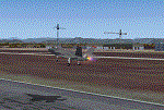
| KPMD - Palmdale AF Plant 42 |
|
Images related to this file:
File Description:

FS2004 Scenery for KPMD Palmdale AF A huge 5,800 acres/23 km² airfield that has somehow been overlooked by addon developers. almost all hangers and buildings are custom built due to their uniqueness to KPMD. Most of the facilities are owned by private contractors and serve as a manufacturing plant
for aircraft used by the United States .Rockwell's Palmdale assembly facility is where Space Shuttle came together
and were assembled and tested. Upon completion, the Shuttles were turned over to NASA for transport overland
to Edwards Air Force Base, California.
The airfield was opened in the early 1930s.At the outbreak of the Korean War in 1950, the U.S. Air Force realized a need
for a location for use in final assembly and flight testing of military jet aircraft, away from major population centers but close enough to the major
centers of aircraft design and production .Year round excellent flying weather was also a prerequisite. The land which
became AF Plant 42 fit all these criteria. Therefore the USAF bought the facility in in 1951.In the 1960's Lockheed
relocated to Plant 42 from its original Burbank, Ca .
| Filename: | KPMD__Palmdale_AF_Plant_42.zip |
| License: | Freeware |
| Added: | 29th January 2015, 21:22:39 |
| Downloads: | 825 |
| Author: | Brian Sturrock |
| Size: | 1.43 MB |
| Category: Flight Simulator 2004 - Original Aircraft | |
| On Mark A-26 Marksman |
|
File Description:
Utilizing the WWII A-26 airframe, the On Mark comapny of Van Nuys, California began converting Invaders to executive transports following WWII with their first examples designated the Marketeer. The epitome of comfort for the executive air traveller was found however in the further developed Marksman. The Marksman featured a significantly re-manufactured fuselage incorporating full pressurisation and a radical modification allowing a substantial increase in internal cabin space. All Marksmans featured the addition of wing tip fuel tanks as well as increased tail surface dimensions to compensate for the higher power engines offered in various models. Out of approximately sixty Invader airframes modified for civilian use by On Mark, only about a dozen were full Marksman conversions.
For all effects, gauges, and the excellent A-26 sound package by David Copley, the original SOH A-26 Invader is required to be installed before installation of this aircraft. Included in this package: model by Milton Shupe with Marksman modifications by John Terrell, textures by John Terrell, 2D panel and gauges by Rich Murray, flight dynamics by Jerry Beckwith and Tom Falley, pilot figures by Jan Visser.
| Filename: | On_Mark_A26_Marksman.zip |
| License: | Freeware |
| Added: | 27th April 2007, 04:15:36 |
| Downloads: | 3,769 |
| Author: | John Terrell |
| Size: | 10.4 MB |
| Category: Flight Simulator 2004 - Scenery | |
| Cameri and Turbigo sceneries (rev. 3) - north Italy |
|
Images related to this file:
File Description:
The following files are required by this file:
http://library.avsim.net/esearch.php?DLID=163723&UploadID=&Name=&FileName=&Author=&CatID=root
http://library.avsim.net/esearch.php?DLID=186350&UploadID=&Name=&FileName=&Author=&CatID=root
This scenery includes a global review of the previous Sceneries of Cameri Military airport (rev.2 Oct 2011), Cameri Museum (rev. 2 Oct 2011), Cameri Babini (rev. 2 oct 2011), Turbigo power station (rev. 2 Sep 2011 and update rev. 2.1 Oct 2014). All the above ARE NOW INCLUDED in this new unique scenery. Contents: Terrain in new version photo-realistic multi-seasons/night; adapted to Western Europe special elevation meshes; cover area of over 120 sqkm from Bellinzago-Oleggio (NW) to Magnago-Bienate (NE), from Novara (SW) to Cuggiono-Inveruno (SE); all the terrain has been restorated with 3D buildings, either through autogen that with specific dedicated objects (by GMax) and with significant addition of library objects ("dva51" and other existings). This scenery (located on the final approach to the Milan Malpensa international airport) includes the Cameri's Mil Airport with the Babini closed Army area and the planes of the Historical Museum of the airport; it is also included the thermoelectric power station of Turbigo. All the buildings are placed to recreate cities and villages covered in the photo-realistic terrain, including Bellinzago, Bienate, Buscate, Caltignaga, Cameri, Castano Primo, Castelletto Ticino, Cuggiono, Galliate, Inveruno, Magnago, Malvaglio, Nibbia, Novara, Oleggio, Pernate, Robecchetto, Romentino, Sant'Anna, San Pietro Mosezzo, Turbigo , Vanzaghello, and the covered Turin-Milan highway.
Details of the new buildings for the care and maintenance to F35 completely recreated, as obtainable from the current satellite view.
It REQUIRES the use of the following, to be downloaded separately :
- the libraries dva51 - the system of vegetations TreePlanter - the West Europe Meshes of Daniele Lanfranchi. See the Readme file. Enjoy!
Videos available here:
https://dl.dropboxusercontent.com/u/38829151/FS9/Cameri_Turbigo_v3%20shots.WMV
http://youtu.be/yVI2KeJKS5o
http://youtu.be/oKa0e_5kxIk
| Filename: | Cameri_and_Turbigo_sceneries_rev_3__north_Italy.zip |
| License: | Freeware |
| Added: | 21st January 2015, 21:32:36 |
| Downloads: | 994 |
| Author: | Aldo Della Vedova, Daniele Lanfranchi and Gian Mario Verga |
| Size: | 103.7 MB |
© 2001-2026 AVSIM Online
All Rights Reserved
Privacy Policy |