
Where Flight Simulation Enthusiasts Gather from Around the World!
AVSIM Library - Search Results

| Category: Flight Simulator X - Scenery | |
| YAUG Augusta (Western Australia) plus Cape Leewin Lighthouse. |

|
File Description:
YAUG Augusta plus Cape Leewin Lighthouse. REQUIRES Blencowe_LibraryKit.zip
The airstrip is located approximately 1km to the west of the town centre via Blackwood Avenue, Hillview Road and Airstrip Road. No landing charges apply but all landings are recorded and pilots should call the reporting officer on 9780 5643. There is no fuel available or navaids. There are no terminal facilities or telephone but there is an RFDS transfer station.
Parking is on the grassed hardstand to the east and south of the apron. Parking on that is reserved for RFDS. Hangars at the strip are privately owned and a helipad and fuel storage for that have been constructed recently.
Runway 16/34 is 1100m x 90m, 30m AHD and sealed with 15m. Pilot Activated lighting is available on 119.65 MHz VHF. No general aviation night landings or take offs are permitted without prior approval of Augusta Margaret River Shire Council.
| Filename: | YAUG_Augusta_Western_Australia_plus_Cape_Leewin_Li.zip |
| License: | Freeware |
| Added: | 25th February 2013, 07:07:33 |
| Downloads: | 557 |
| Author: | Alan Blencowe |
| Size: | 1.87 MB |
| Category: Flight Simulator X - Scenery | |
| KDAY - Dayton International Airport - Vandalia, Ohio |
|
Images related to this file:
File Description:
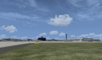
The Dayton International Airport, located 11 miles north of Dayton in Vandalia, Ohio, is a medium sized commercial airport serving nearly three million passengers annually with daily nonstop service to about twenty destinations.
This scenery includes a custom terminal building, moving jetways, and an AFX file with accurate parking assignments. Also modeled is the new air traffic control tower, terminal parking garage, the Fed Ex building, the PSA Airlines headquarters and maintenance hanger, the former Emery Worldwide cargo sort facility, the airport hotel, and hangers for fixed base operators Stevens Aviation and Wright Brothers Aero.
More than a thousand objects have been added to enhance detail around the airport using Flight 1's excellent instant scenery program. AI Traffic has been tested to ensure efficient flow. The landclass file has also been adjusted to better reflect the real airport.
| Filename: | KDAY__Dayton_International_Airport__Vandalia_Ohio.zip |
| License: | Freeware |
| Added: | 2nd December 2012, 22:32:37 |
| Downloads: | 1,571 |
| Author: | Matt Parr |
| Size: | 5.78 MB |
| Category: X-Plane - Scenery | |
| BR RS SBPA - Salgado Filho Intl v1.1.0 |
|
Images related to this file:
File Description:
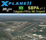
This is an X-Plane 11 and X-Plane 10 scenery package for Salgado Filho International Airport (IATA: POA, ICAO: SBPA), the main airport serving Porto Alegre, in Brazil. It includes corrected aprons, ramps, gates, taxiways, lighting system, city buildings, ortho pohoto scenery for the airport area, and (XP11 only) airport ground services (like push back). This scenery was tested and is operational (as of March 30, 2017) in "X-Plane 11.00 RC #1 64 bit", Windows 10 Home. It was also tested and is also operational (as of March 30, 2017) in "X-Plane 10.51 64 bit", Windows 10 Home. Only the default X-Plane 11 libraries, by Laminar Research, are needed. No third party libraries are used. v1.1.0 adds ortho pohoto scenery for the airport area, and it also adds the Gremio Arena stadium reference for the scenery.
| Filename: | BR_RS_SBPA__Salgado_Filho_Intl_v110.zip |
| License: | Freeware |
| Added: | 1st April 2017, 17:55:29 |
| Downloads: | 99 |
| Author: | Rui Mesquita |
| Size: | 22.87 MB |
| Category: X-Plane - Scenery | |
| BR AC SBRB - Rio Branco Intl Airport v1.0.0 |
|
Images related to this file:
File Description:
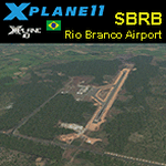
This is an X-Plane 11 and X-Plane 10 scenery package for Rio Branco-Plácido de Castro International Airport (IATA: RBR, ICAO: SBRB) is the airport serving Rio Branco, Brazil. It includes corrected aprons, ramps, gates, taxiways, lighting system, city buildings, ortho-photoscenery for the airfield area, and (XP11 only) airport ground services (like push back). The airport was opened on November 22, 1999 as a replacement to Presidente Médici International Airport, which was then closed. This scenery was tested and is operational (as of April 05, 2017) in "X-Plane 11.00 RC #1 64 bit", Windows 10 Home. It was also tested and is also operational (as of April 05, 2017) in "X-Plane 10.51 64 bit", Windows 10 Home. Only the default X-Plane 11 libraries, by Laminar Research, are needed. No third party libraries are used.
| Filename: | BR_AC_SBRB__Rio_Branco_Intl_Airport_v100.zip |
| License: | Freeware |
| Added: | 6th April 2017, 08:16:03 |
| Downloads: | 185 |
| Author: | Rui Mesquita |
| Size: | 12.93 MB |
| Category: Prepar3D V1-4 - Scenery | |
| Progetto Maldive |
|
File Description:
The Atolls of the Maldives are numerous and some atolls are also uninhabited. The most famous atolls are: The Male Atoll and Baros island N4.18.26 E73.20.91 with the VRMM airport, the Gan atoll N0.41.36 E73.9.27 with the VRMG airport, Hanimardhoo Atoll N6.44.56 E73.10.06 with the VRMH airport, the Kaadedhahoo atoll N0.29.21 E72.59.41 with the VRMT airport and the Kadhdhoo N1.51.30 E73.31.15 with the VRMK airport. The aforementioned airports have been improved and the most important resorts have been created on the islands of Baros, Gan, Hanimaadhoo, Kaadedhahoo and Kadhdhoo, and small ports have been created with ships and boats with Google Maps report. I remember that all the islands can be easily visited by seaplanes in their respective tiny ports. Good VFR flight.
Within the downloaded package you will find readme files for scenery installation. Good fly VFR. Pasquale Marrulli.
| Filename: | Progetto_Maldive.zip |
| License: | Freeware |
| Added: | 29th January 2018, 18:38:35 |
| Downloads: | 328 |
| Author: | Pasquale Marrulli |
| Size: | 8.56 KB |
| Category: Flight Simulator 2004 - Flight Plans | |
| Peninsula Air (Penair Alaska) complete package |
|
File Description:
René Tanggaard and Juergen Baumbusch are proud to present the flightplans and paints for the entire fleet for PenAir. After several months of investigations for flight schedules and fleet details, the plans will now be ready for you, Peninsula Airways, usually called PenAir, is an American airline based in Anchorage, Alaska, USA. It is Alaska's largest commuter airline operating an extensive scheduled passenger and cargo services to over 85 communities, as well as charter and medevac services. Its main base is Ted Stevens Anchorage International Airport, with hubs at Dillingham Airport, Unalaska Airport, King Salmon Airport and Cold Bay Airport.
In this Package you will find all necessary files to put the entire fleet and Flightplans in your Flightsim. Please read The Readme-PDF carefully to avoid problems by running PenAir.
Watch out for the aurora borealis. :-)
| Filename: | Peninsula_Air_Penair_Alaska_complete_package.zip |
| License: | Freeware |
| Added: | 16th December 2008, 21:40:51 |
| Downloads: | 2,138 |
| Author: | Rene Tanggaard and Juergen Baumbusch |
| Size: | 9.28 MB |
| Category: Prepar3D V1-4 - Scenery | |
| KMYR Myrtle Beach South Carolina USA International Airport For P3Dv4 |
|
Images related to this file:
File Description:
This is an enhancement of the default P3Dv4 airport. A custom built terminal building is included to replace the inadequate one included in the default scenery; aircraft gates have been correctly coded using Airport Design Editor 1.76.6715, according to the latest terminal map information; a new airport vehicle network has been built; extra fuel trucks have been added throughout the airport; the tower view has been changed to display from the roof of the control tower; all taxiway designators are correct and all taxiway signs are correctly placed and named; and there is a file included for GSX 2 users to enable them to have custom GSX SODE jetways displayed. This airport has only been tested in P3Dv4, and is not guaranteed to work in earlier versions. Please refer to the README FIRST.txt file to insure proper installation of all files.
| Filename: | KMYR_Myrtle_Beach_South_Carolina_USA_International.zip |
| License: | Freeware, limited distribution |
| Added: | 23rd February 2019, 18:24:13 |
| Downloads: | 780 |
| Author: | Patrick Finch |
| Size: | 1.06 MB |
| Category: Flight Simulator X - Scenery | |
| KLAW - Fort Sill Regional / Lawton Muni - Oklahoma, USA |
|
Images related to this file:
File Description:
FSX Scenery - Lawton Fort Sill Regional Airport (IATA: LAW[2], ICAO: KLAW, FAA LID: LAW) is a city owned airport two miles south of Lawton, in Comanche County, Oklahoma. It is used for military aviation from nearby Fort Sill and Sheppard Air Force Base and is served by American Eagle. Allegiant Air runs occasional charters to various destinations in the western United States. The National Plan of Integrated Airport Systems for 2011-2015 categorized it as a primary commercial service airport. Federal Aviation Administration records say the airport had 77,533 passenger boardings (enplanements) in calendar year 2008, 71,389 in 2009 and 68,054 in 2010. The 2013 Federal sequester will result in the closure of the airport's control tower and will require pilots to rely on air traffic controllers from other area airports. For your flying pleasure by John B. Loney, Jr.
| Filename: | KLAW__Fort_Sill_Regional__Lawton_Muni__Oklahoma_US.zip |
| License: | Freeware, limited distribution |
| Added: | 19th August 2015, 20:58:38 |
| Downloads: | 600 |
| Author: | John B. Loney, Jr. |
| Size: | 12.61 MB |
| Category: Flight Simulator 2004 - Scenery | |
| EPGD 2008 - Gdansk Lech Walesa Airport, Poland |
|
Images related to this file:
File Description:
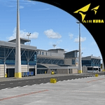
Gdansk Lech Walesa Airport (EPGD) is an international airport located in Gdansk, Poland, not far from the city centers of the Tricity metropolitan area: Gdansk (6.25 miles/10 km), Sopot (6.25 miles/10 km) and Gdynia (14.4 miles/23 km). The airport is named after Lech Walesa, the former Polish president. On the outside wall of the terminal building one can see the logo of the airport, which is Lech Walesa's actual signature, a stylized "W".
EPGD 2008 is the first Polish scenery in this quality. Main features of the scenery are:
-Airport ground high resolution textures - (five seasons + night textures);
-Highly detailed 3D objects, all photo textured;
-Animation vehicles ground services;
-Detailed autogen and photorealistic trees;
-Detail mesh.
For more details please look at the README file attached to the scenery file.
| Filename: | EPGD_2008__Gdansk_Lech_Walesa_Airport_Poland.zip |
| License: | Freeware |
| Added: | 18th May 2010, 10:37:46 |
| Downloads: | 25,754 |
| Author: | Kuba Paczek |
| Size: | 24.06 MB |
| Category: Flight Simulator X - AFCAD Files | |
| GMMX - Marrakech/Menara Intl Airport, Morocco, Phase 1 |
|
Images related to this file:
File Description:
GMMX - Menara Intl Airport - Marrakech, Morocco, Phase 1. Marrakech-Menara Airport is an airport serving Marrakech, the capital city of the Marrakech-Tensift-El Haouz region in Morocco. It is an international facility that receives several European flights as well as flights from Casablanca and some of the Arab world nations.
Construction is going on to enlarge the airport. Impressions of what the new situation will be like are enclosed. This reworked AFCAD shows the construction area, adds taxiways P1 and P2, updates the airports lay-out as per today's situation, enhances the surrounding area and improves the overall signage, pavement and parking facilities. Once the new terminal is open, the AFCAD will be updated.
Using ADEx 1.51, aeronautical maps and Google Earth all these changes have been built into the default FSX airport.
| Filename: | GMMX__MarrakechMenara_Intl_Airport_Morocco_Phase_1.zip |
| License: | Freeware |
| Added: | 17th August 2012, 19:51:44 |
| Downloads: | 5,897 |
| Author: | Menno C. Robert |
| Size: | 4.62 MB |


© 2001-2026 AVSIM Online
All Rights Reserved
Privacy Policy |