
Where Flight Simulation Enthusiasts Gather from Around the World!
AVSIM Library - Search Results

| Category: X-Plane - Scenery | |
| BR PB SNTS - Patos Airport v1.0.0 |

|
Images related to this file:
File Description:
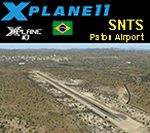
This is an X-Plane 11 and X-Plane 10 scenery package for Brigadeiro Firmino Ayres Airport (ICAO: SNTS, no IATA code), whici is the airport serving Patos, ParaÃba, in Brazil.
It includes corrected aprons, ramps, gates, taxiways, lighting system, city buildings, ortho-photoscenery for the airfield area, and (XP11 only) airport ground services (like push back).
The airport is located 12 km from the city center and 30 km north from Rio Grande do Norte (same distance south of Pernambuco). The city of Patos is strategically located to house an airport.
This scenery was tested and is operational (as of January 17, 2018) in "X-Plane 11.11 64 bit", Windows 10 Home. It was also tested and is also operational (as of January 17, 2018) in "X-Plane 10.51 64 bit", Windows 10 Home.
| Filename: | BR_PB_SNTS__Patos_Airport_v100.zip |
| License: | Freeware |
| Added: | 2nd February 2018, 00:13:22 |
| Downloads: | 49 |
| Author: | Rui Mesquita |
| Size: | 8.36 MB |
| Category: Prepar3D V1-4 - Scenery | |
| KMCI - Kansas City Missouri USA International Airport For Prepar3Dv4 |
|
Images related to this file:
File Description:
This is an enhancement of the default P3Dv4 airport. Aircraft gates have been correctly coded using Airport Design Editor 1.76.6715, according to the latest terminal map information (due to space constraints some gates could not be included); a new airport vehicle network has been built; extra fuel trucks have been added throughout the airport; the tower view has been changed to display from the roof of the control tower; all taxiway designators are correct and all taxiway signs are correctly placed and named; there is the option to open all runways to AI traffic; and cargo ramps for UPS and FedEx are displayed. This airport has only been tested in P3Dv4, and is not guaranteed to work in earlier versions. Please refer to the README FIRST.txt file to insure proper installation of all files.
| Filename: | KMCI__Kansas_City_Missouri_USA_International_Airpo.zip |
| License: | Freeware, limited distribution |
| Added: | 1st September 2018, 00:47:37 |
| Downloads: | 923 |
| Author: | Patrick Finch |
| Size: | 3.94 MB |
| Category: Flight Simulator 2004 - Scenery | |
| Laramie Regional KLAR |
|
Images related to this file:
File Description:
FS2004 Scenery-Laramie Regional Airport (KLAR) is located in Laramie Wyoming, home of the University of Wyoming, Wyoming Technical Institute and a number of businesses and organizations. Laramie Regional Airport was built in 1934 and was originally named Brees Field, after General Herbert Jay Brees of the US Army. The original hangar still stands today. In 1944, the runways were paved to allow hundreds of B-24 bombers to land at Laramie and bring crews for rest and recuperation to the UW recreation camp in the Snowy Range. In 1945 Summit Airways began to provide passenger service. The Brees Field Airport Board was formed in 1965 to oversee airport operations. In 1992, the airport's board changed the airport's name to Laramie Regional Airport. Created with EZ Scenery by John B. Loney, Jr.
| Filename: | Laramie_Regional_KLAR.zip |
| License: | Freeware, limited distribution |
| Added: | 23rd May 2010, 01:32:22 |
| Downloads: | 1,331 |
| Author: | John B. Loney, Jr. |
| Size: | 835.24 KB |
| Category: Flight Simulator 2004 - Scenery | |
| Murray Field KEKA |
|
Images related to this file:
File Description:
FS2004 Scenery - Murray Field (IATA: EKA, ICAO: KEKA, FAA LID: EKA) is a county-owned public-use airport in Humboldt County, California, United States. Murray Field Airport serves Eureka and Humboldt County. The airport has more than one runway. The longest is a paved runway extending 3000 feet. The facility is at an elevation of 7 feet at a distance of about 3 miles from Eureka. The airport is primarily used for general aviation. Also FedEx Express utilizes the small airport as a stop for package delivery from and to Humboldt County. Murray Field was first established in 1919 by pilot Dayton Murray, and was later renamed in his honor. It has a restaurant and a charter service, Northern Air, as well as a Civil Air Patrol office. Created by John B. Loney, Jr.
| Filename: | Murray_Field_KEKA.zip |
| License: | Freeware, limited distribution |
| Added: | 20th March 2012, 01:35:39 |
| Downloads: | 346 |
| Author: | John B. Loney, Jr. |
| Size: | 5.92 MB |
| Category: Flight Simulator X - Scenery | |
| Rio Vista Municipal Airport, California (O88) |
|
Images related to this file:
File Description:
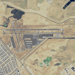
Rio Vista Municipal Airport, is located on the western edge of the city of Rio Vista in the heart of California's San Joaquin River Delta, about 260 mile northeast of San Francisco. Rio Vista Municipal Airport has an 4,200-foot long, 75-foot wide primary runway. There is also a 2,200-foot long, 60-foot wide secondary runway and a helipad. This is a major overhaul of the default airport, dramatically improving accuracy of taxiways, runways, aprons, structures and other scenery details. Designed so that anyone familiar with the actual airport will experience immediate recognition, the project includes several custom buildings and many custom scenery objects modeled on the actual airport. The surrounding area has been extensively modeled. Including, 324 accurately place wind turbines, 3690 houses, and a total count of 4740 scenery objects.
| Filename: | Rio_Vista_Municipal_Airport_California_O88.zip |
| License: | Freeware |
| Added: | 5th December 2011, 21:26:45 |
| Downloads: | 944 |
| Author: | John Hottel |
| Size: | 19.21 MB |
| Category: Flight Simulator 2004 - Scenery | |
| Castellon - Costa Azahar Airport - Spain |
|
Images related to this file:
File Description:
Castellon - Costa Azahar Airport (Spain): LECS in Flight Simulator // Only includes the AFCAD file with runway, apron and parking stands--NOT the buildings.
Castellon Costa Azahar Airport(ICAO: LECS) is an airport in Vilanova d'Alcolea and Benlloch in Spain.
The airport was officially declared "open" by local authorities in March 2011 despite having no airlines signed up to land there, nor government approval to operate. Delayed for several years and at a current cost of 150 million, commercial flights were due to begin on 1 April 2012, as of June 2013, there have been none.
The airport has a single runway (06/24), 2,700 m (8,858 ft) long and 45 m (147 ft) wide which could service national and international commercial flights (regular and charter).
| Filename: | Castellon__Costa_Azahar_Airport__Spain.zip |
| License: | Freeware |
| Added: | 8th April 2014, 17:05:15 |
| Downloads: | 663 |
| Author: | Nicolas Neveu |
| Size: | 420.45 KB |
| Category: Flight Simulator X - AFCAD Files | |
| 7N1 - Costa's Corning Painted Post - New York |
|
Images related to this file:
File Description:
7N1
Corning-Painted Post Airport (FAA LID: 7N1) is a public use airport in Steuben County, New York, United States.[1] It is located two nautical miles (4 km) northwest of the central business district of Corning.[1] The airport is owned by the Town of Erwin[1] and located near Painted Post, New York. It is included in the National Plan of Integrated Airport Systems for 2011-2015, which categorized it as a general aviation facility. The stock FSX airport was a generic type. I updated most everything to 2014 Google Earth standards. I use generic buildings and resize reshape to suit. All objects are stock.I put in most of the parking spaces, gas trigger, the neighborhood houses and some trees to round it out. Hope you enjoy.
| Filename: | 7N1__Costas_Corning_Painted_Post__New_York.zip |
| License: | Freeware |
| Added: | 17th June 2014, 07:51:50 |
| Downloads: | 207 |
| Author: | Jon Davidson |
| Size: | 8.5 KB |
| Category: Flight Simulator 2004 - AFCAD Files | |
| Boston Logan Int'l (KBOS) with active Crosswind Runways |
|
Images related to this file:
File Description:
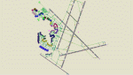
This is a high spec AFCAD2 for the (Freeware) FS2004 Boston Logan Int'l Airport (KBOS) scenery by Fly Tampa / George Grimshaw. This afcad has been built using FAA Charts and information from the Airport Website. All gates are named and have airlines assigned to them. The Fedex and UPS aprons are represented and can accommodate many cargo aircraft. The final parking area is random GA parking and the various maintenance areas to the north of the airport. This airport now features an accurate tower view. Finally, by using the crosswind runway technique, all runways can be used simultaneously for take-off and landing (see brief). Enjoy!!
This file will work with version 2.1 of the airport ONLY (adds the new runway 14/32, new American Eagle gates).
| Filename: | Boston_Logan_Intl_KBOS_with_active_Crosswind_Runwa.zip |
| License: | Freeware |
| Added: | 4th March 2010, 13:26:27 |
| Downloads: | 2,246 |
| Author: | Lee Brompton |
| Size: | 40.32 KB |
| Category: Flight Simulator X - Scenery | |
| YBNS Bainsdale airport Victoria Australia |
|
Images related to this file:
File Description:
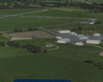
Airport YBNS Bairnsdale is a regional airport in Victoria Australia. It has 2 runways a long 1101m sealed and lit 04/22 and a 850m sealed 13/31 There is a gocart track and a disused drag strip next to the airport. There is a thriving aero club and training for light aircraft and helicopters. These files are for Flight Simulator X. Made using Airport Design Editor using some objects borrowed from Robert Budd's excellent Baccus Marsh. The standard airport bears only a passing resemblance to the real thing so this scenery is a big improvement and accurately reproduces real world. RECOMMENDED The scenery is designed to interface with ORBX FTX_AU scenery for Australia (payware). It will work without ORBX but will not interface as well with standard scenery.
| Filename: | YBNS_Bainsdale_airport_Victoria_Australia.zip |
| License: | Freeware |
| Added: | 10th April 2017, 06:36:06 |
| Downloads: | 566 |
| Author: | Colin Jeffery |
| Size: | 1.79 MB |
| Category: Flight Simulator 2004 - Scenery | |
| Marsa Alam Int. Airport (Iata: RMF, Icao: HEMA) |
|
Images related to this file:
File Description:
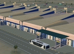
This FS2004 project reproduce the egyptian "Marsa Alam International Airport" (Iata: RMF, Icao: HEMA) located on the Red Sea coast. If you are a holiday-flights pilot, this airport is a “must have†!
In the scenery you'll find all buildings (airport, close surroundings and Port Ghalib resorts), hundred of custom made detailed objects, static and animated vehicles and a photoreal airport background. Each scenery part and object (frame-rate friendly thanks to the low poly design) has photoreal textures and everything is placed in the right position (which has been seen on summer 2016 at the real airport).English extended handbook is included. Watch the screenshot and the demo video on the Albysim youtube channel and enjoy all scenery features (in this free/demo edition some features are limited).
| Filename: | Marsa_Alam_Int_Airport_Iata_RMF_Icao_HEMA.zip |
| License: | Check within download |
| Added: | 29th October 2016, 21:26:52 |
| Downloads: | 1,012 |
| Author: | Albysim Scenery Design / Alberto Di Bolzano |
| Size: | 33.46 MB |


© 2001-2026 AVSIM Online
All Rights Reserved
Privacy Policy |