
Where Flight Simulation Enthusiasts Gather from Around the World!
AVSIM Library - Search Results

| Category: Flight Simulator 2004 - Scenery | |
| Turgovishte LBTG - Bulgaria |

|
File Description:
Turgovishte is a small bulgarian airport. It's location is 90 km west from Varna. In communism this airport was used for civilian flights. Now the airport is closed. It is suitable for small or medium planes. There is no VOR, NDB or ILS, but you can use your GPS. All buildings are real.
| Filename: | Turgovishte_LBTG__Bulgaria.zip |
| License: | Freeware |
| Added: | 10th January 2010, 22:07:55 |
| Downloads: | 851 |
| Author: | Vasil Madjarov, AFCAD by E.Genchev & N.Grozdanov |
| Size: | 8.87 MB |
| Category: Flight Simulator 2004 - Scenery | |
| Treviso airport scenery (LIPH) |
|
Images related to this file:
File Description:
Welcome to Treviso airport. This is an airport 20KM north of Venice and is used as a hub for Ryanair and Wizzair. This is a basic scenery but it includes an up to date AFCAD file!
This is the first AFCAD and scenery available for this airport so enjoy your ride there!
| Filename: | Treviso_airport_scenery_LIPH.zip |
| License: | Freeware |
| Added: | 15th January 2010, 20:25:39 |
| Downloads: | 4,156 |
| Author: | Daan S. |
| Size: | 4.56 MB |
| Category: X-Plane - Scenery | |
| BR GO SBIT - Itumbiara Airport v1.0.0 |
|
Images related to this file:
File Description:
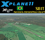
This is an X-Plane 11 and X-Plane 10 scenery package for Francisco Vilela do Amaral Airport (IATA: ITR, ICAO: SBIT), which is the airport serving Itumbiara, Goiás, in Brazil.
It includes corrected aprons, ramps, gates, taxiways, city buildings, lighting system, ortho-photoscenery for the airfield area, and (XP11 only) airport ground services (like push back).
The airport is dedicated to general aviation. No scheduled flights operate at this airport. The airport is located 7 km (4 mi) from downtown Itumbiara.
This scenery was tested and is operational (as of January 19, 2018) in "X-Plane 11.11 64 bit", Windows 10 Home. It was also tested and is also operational (as of January 19, 2018) in "X-Plane 10.51 64 bit", Windows 10 Home.
| Filename: | BR_GO_SBIT__Itumbiara_Airport_v100.zip |
| License: | Freeware |
| Added: | 2nd February 2018, 00:17:51 |
| Downloads: | 42 |
| Author: | Rui Mesquita |
| Size: | 15.04 MB |
| Category: X-Plane - Scenery | |
| BR AM SWHT - Humaita Airport v1.0.0 |
|
Images related to this file:
File Description:
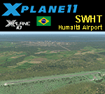
This is an X-Plane 11 and X-Plane 10 scenery package for Francisco Correa da Cruz Airport (IATA: HUW, ICAO: SWHT), which is the airport serving Humaitá, Amazonas, in Brazil.
It includes corrected aprons, ramps, gates, taxiways, lighting system, city buildings, ortho-photoscenery for the airfield area, and (XP11 only) airport ground services (like push back).
The airport is located 6 km (4 mi) from downtown Humaitá. The airport is dedicated to general aviation. No scheduled flights operate at this airport.
This scenery was tested and is operational (as of January 23, 2018) in "X-Plane 11.11 64 bit", Windows 10 Home. It was also tested and is also operational (as of January 23, 2018) in "X-Plane 10.51 64 bit", Windows 10 Home.
| Filename: | BR_AM_SWHT__Humaita_Airport_v100.zip |
| License: | Freeware |
| Added: | 2nd February 2018, 00:20:21 |
| Downloads: | 55 |
| Author: | Rui Mesquita |
| Size: | 8.4 MB |
| Category: X-Plane - Scenery | |
| BR AM SBMY - Manicore Airport v1.0.0 |
|
Images related to this file:
File Description:
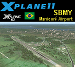
This is an X-Plane 11 and X-Plane 10 scenery package for Manicoré Airport (IATA: MNX, ICAO: SBMY), which is the airport serving Manicoré, Amazonas, in Brazil.
It includes corrected aprons, ramps, gates, taxiways, lighting system, city buildings, ortho-photoscenery for the airfield area, and (XP11 only) airport ground services (like push back).
The airport is located 4 km (2 mi) from downtown Manicoré. No scheduled flights operate at this airport. The airport is dedicated to general aviation.
This scenery was tested and is operational (as of January 23, 2018) in "X-Plane 11.11 64 bit", Windows 10 Home. It was also tested and is also operational (as of January 23, 2018) in "X-Plane 10.51 64 bit", Windows 10 Home.
| Filename: | BR_AM_SBMY__Manicore_Airport_v100.zip |
| License: | Freeware |
| Added: | 2nd February 2018, 00:20:41 |
| Downloads: | 74 |
| Author: | Rui Mesquita |
| Size: | 7.99 MB |
| Category: Flight Simulator X - AFCAD Files | |
| SPECIAL EDITION Van Nuys Airport (KVNY) |
|
File Description:
Smith Graphics proudly presents the all new SPECIAL EDITION Van Nuys Airport (KVNY) AFCAD. Opened in 1928, Van Nuys Airport is now the world's third busiest 'general aviation' airport and the 25th busiest airport (in terms of takeoffs and landings) in the world. Van Nuys Airport handled 448,681 aircraft movements in 2005, averaging over 1,200 operations per day. More than 100 businesses are located on the 730 acre airport, and is also home to four major fixed-base operators and numerous aviation service companies. This AFCAD has been carefully re-worked to function with maximum traffic capacity and efficiency, as well as Day & Night visual enhancement. This has not been tested in FS2004, but you are free to test it if you wish. http://en.wikipedia.org/wiki/Van_Nuys_Airport
| Filename: | SPECIAL_EDITION_Van_Nuys_Airport_KVNY.zip |
| License: | Freeware |
| Added: | 6th October 2008, 10:47:08 |
| Downloads: | 1,560 |
| Author: | Dakota Smith / Smith Graphics |
| Size: | 105.47 KB |
| Category: Flight Simulator 2004 - Gauges | |
| FS2004 Simulated Aircraft Bubble Sextant |
|
File Description:
As travel by air developed and matured, navigation over long distances also developed and improved. In the early days, however, air navigation essentially used ship navigation techniques adapted for aircraft. Without "landmarks", the navigators used Ded Reckoning (DR) and the stars. Celestial or Astronomical Navigation provides a means of obtaining Lines of Position (LOPs) from the stars. Crossing LOPs will fix a position. It requires a chart, and a planned course on that chart, with waypoints specified by Latitude and Longitude, an assumed time of arrival at each waypoint, and stars (including the Sun, Moon, or planets) in view. In the 1940s, extensive tables of star positions were made available to air navigators to be used with sextants to obtain these LOPs. In the tables, all times involved are GMT. This data is available from the Internet in "ready to use" form. This gauge simulates the sextant, and the process by which one obtains a LOP, or crossing LOPs to obtain a position, or fix. Can be used with any FS2004 aircraft. Includes comprehensive browser-based manual and references.
| Filename: | FS2004_Simulated_Aircraft_Bubble_Sextant.zip |
| License: | Freeware |
| Added: | 6th December 2004, 19:21:14 |
| Downloads: | 4,973 |
| Author: | Dave Bitzer, Mark Beaumont |
| Size: | 989.73 KB |
| Category: Flight Simulator 2004 - Scenery | |
| Polish Airports VOL. 1 DEMO |
|
Images related to this file:
File Description:

POLISH AIRPORTS VOL. 1 DEMO is a package of detailed sceneries of EPGD Gdansk, EPKT Katowice, EPRZ Rzeszow (including EPRJ) and EPLB Lublin (including EPSW) airports in Poland, fully compatible with FS2004.
This product is a fully functional DEMO version of the commercial payware product. It features same airports layout as in the full version but with limited 3D objects and low resolution textures. Using this free demo ensures no problems with online (VATSIM, IVAO, multiplayer etc.) flying in case some users use the payware scenery and some don't.
Gdansk Lech Walesa Airport (GDN/EPGD) is an international airport, the 3rd largest airport in Poland, often used as a diversionary airport for Warsaw Frederic Chopin Airport in the event of poor weather or emergencies. Katowice International Airport (KTW/EPKT) is an international airport, which service both passenger flow and cargo flights. Its concrete runway is 2,800 m * 60 m (9,186 ft * 197 ft) and can accommodate even heavy transports such as Antonov An-124 or An-225. Rzeszow-Jasionka Airport (RZE/EPRZ) is an international airport located in southeastern Poland. It is the seventh-busiest airport in Poland. Near to EPRZ there is located a smaller Rzeszow Jasionka Airport (EPRJ) used by Rzeszow Aeroclub (900x30m lighted asphalt runway (090/270), 700x100m grass strip). Lublin Airport (Port Lotniczy Lublin) (LUZ/EPLB) has a 2520m runway, and the terminal facilities are capable of handling 4 x B738/A320.
The product is equipped with an automatic installer, which means that the scenery will be automatically added to the Flight Simulator Scenery Library. Please uninstall all previous versions of this airport you may have installed before. Please make also sure that no duplicate AFCAD files are installed.
Enjoy your virtual flying with Drzewiecki Design!
| Filename: | Polish_Airports_VOL_1_DEMO.zip |
| License: | Commercial demo |
| Added: | 2nd September 2015, 22:18:50 |
| Downloads: | 1,054 |
| Author: | Drzewiecki Design |
| Size: | 35.47 MB |
| Category: Flight Simulator X - Aircraft Repaints, Textures and Modifications | |
| Dream-Aire Douglas C-47 / DC-3 (N64784) Circa 1992 |
|
Images related to this file:
File Description: For Manfred Jahn's C-47 with Jan Visser's VVC, version 3.14 repaint of N64784,
Dream-Aire. Operated from Lausanne airport in Switzerland from 1986 till 1994. Besides the outside, the inside and the pilot's got a different look. Also
added some more details, especially at the tires and gear struts and (cowling)flaps. These are repaint only, you need to install the beautiful freeware plane first. It's available here: https://library.avsim.net/download.php?DLID=198659
Update/fix: https://library.avsim.net/download.php?DLID=199046 Big thanks to Manfred Jahn and his team for creating this beautiful model and
Jan Visser and his team for all the work done to improve this model even further.
Ted "TuFun" Wolfgang for the improved engine textures. For this repaint the
excellent paintkit by Gordon "Gman5250" Madison was used. Works both in FSX and Prepar3D.

| Filename: | DreamAire_Douglas_C47__DC3_N64784_Circa_1992.zip |
| License: | Freeware, limited distribution |
| Added: | 10th April 2019, 05:53:37 |
| Downloads: | 446 |
| Author: | Marcel Ritzema |
| Size: | 27.39 MB |
| Category: Flight Simulator 2004 - Scenery | |
| Whale Cove CYXN in Hudson Bay, Nunavut, Canada |
|
Images related to this file:
File Description:
Whale Cove is a small village with 300 or so inhabitants at N62 W92 on the west shore of Hudson Bay, 40 miles south of the large airport at Rankin Inlet. The village does not feature in FS9, so the first thing to do was to add it; not all the smaller streets are in place but it is the right shape.
I also had to add the roads, delete the stock airfield background, and add a new background. Plus, although the village isn't near the airfield I thought that if the place is called Whale Cove then the least I could do was create the cove, so there is also "whaleWATER" and "whalecoastDELETE", plus of course the scenery file and the AFCAD and AI.
NOTE: If you have had a problem with textures not showing up in the villages in these northern sceneries there is a note on how to fix it.
| Filename: | Whale_Cove_CYXN_in_Hudson_Bay_Nunavut_Canada.zip |
| License: | Freeware, limited distribution |
| Added: | 15th October 2010, 20:48:12 |
| Downloads: | 420 |
| Author: | roger Wensley |
| Size: | 1.19 MB |


© 2001-2026 AVSIM Online
All Rights Reserved
Privacy Policy |