
Where Flight Simulation Enthusiasts Gather from Around the World!
AVSIM Library - Search Results

| Category: Flight Simulator X - Scenery | |
| SLYA - Yacuiba Airport - Tarija, Bolivia |

|
File Description:
Yacuiba Airport (Spanish: Aeropuerto Yacuiba, IATA: BYC, ICAO: SLYA) is a public use airport located in
Yacuiba - Tarija, Bolivia and near to Salvador Mazza - Salta, Argentina.
The airport resides at an elevation of 2,116 ft (645 m) above mean sea level. The airport have one runway designated 02/20 with an asphalt surface measuring 6,890 by 118.11 ft (2.100 m by 36 m).
Compatible with both FSX and P3D.
| Filename: | SLYA__Yacuiba_Airport__Tarija_Bolivia.zip |
| License: | Freeware |
| Added: | 21st November 2015, 20:24:12 |
| Downloads: | 767 |
| Author: | Marcos A. Rivas Torrez |
| Size: | 53.28 MB |
| Category: Flight Simulator X - Scenery | |
| FSX KRNO [Reno NV] Airport |
|
Images related to this file:
File Description:
Welcome to Reno Nevada! The Reno airport has been updated for FSX. All of the structures are new. Taxiways now conform to the current FAA Airport Diagram (copy included). The new tower complex is rendered. The Nevada ANG facility is updated. Both fire stations are updated. You will see airport vehicles using their vehicle paths all over the airport. Fedex and UPS as well as other cargo operations are reproduced, as is the Customs facility.
| Filename: | FSX_KRNO_Reno_NV_Airport.zip |
| License: | Freeware, limited distribution |
| Added: | 21st June 2018, 03:11:17 |
| Downloads: | 742 |
| Author: | Brett Delana |
| Size: | 2.85 MB |
| Category: Flight Simulator X - AFCAD Files | |
| Tansonnhat Intl Airport - VVTS - Hochiminh, Vietnam |
|
File Description:
This airport update was designed with the latest version of ADE (Airport Design Editor) and made only for the FSX default airport:
International Terminal 2 and Domestic Terminal 1 now added, assigned parking with extra parking, Taxiways and Taxi signs updated, helipad, extra fuel trucks, support vehicle roads rebuilt and many other improvements, airport views are from the roof of the control tower (when in tower view) please view the readme before installation
| Filename: | Tansonnhat_Intl_Airport__VVTS__Hochiminh_Vietnam.zip |
| License: | Freeware |
| Added: | 17th February 2011, 02:07:24 |
| Downloads: | 3,274 |
| Author: | Ray Smith |
| Size: | 241.49 KB |
| Category: Flight Simulator X - Scenery | |
| Teterboro Airport, New Jersey |
|
File Description:
Teterboro Airport is located across the Hudson River in New Jersey, just 12 miles from midtown Manhattan, Teterboro Airport is considered a general aviation reliever airport. As a reliever airport, it does not offer scheduled airline service, nor does it permit operations of any aircraft in excess of 100,000 pounds on any airport surface. Teterboro Airport has five Fixed Base Operators (FBOs), Atlantic Aviation, Jet Aviation, First Aviation, Meridian, and Signature Aviation. Scenery includes Phototexture to cover the unattractive stock FSX airport ground texture. Along with Night, Fall and Winter varience textures. Autogen is placed on top of phototexture in specific areas. ALL airport objects have been placed in proper position to photoscenery. Aprons and taxiways in alignment with photostexture. Supports AI traffic for the pilots who use. Numerous Airport vehicles and stacic aircraft on the gounds. There are a few GMAX scenery objects along with Stock FSX objects. If you have cast ground shadows checked in your display feature, some of the vegetation will show black blocks on its base, so uncheck this if you wish. I designed this for all the Charter and General Aviation pilots out there, including myself.
| Filename: | Teterboro_Airport_New_Jersey.zip |
| License: | Freeware |
| Added: | 7th July 2010, 00:47:37 |
| Downloads: | 1,786 |
| Author: | Eric McCloud |
| Size: | 36.84 MB |
| Category: Flight Simulator X - Scenery | |
| SKBO 2011 |
|
File Description:
El Dorado International Airport (IATA: BOG, ICAO: SKBO) is an international airport located in Bogota, Colombia. It is the largest Latin America airport in terms of cargo movements with 593,946 tons (2010) and the third in terms of passenger traffic, only behind Sao Paulo-Guarulhos International Airport and Mexico City's Benito Juarez International Airport, transporting 18,934,203 passengers in 2010; as well as the largest airport in Colombia and the main international and domestic air gateway in the country, serving as an important hub for Avianca, Copa Airlines Colombia, Aires, Satena, EasyFly and other cargo companies.
This file has the right coordinates, with the apron and characteristics of the airport. The runways were reoriented to the correct direction, runway were resized the gates placed on correct location and number, CATAM was placed (Colombian Air force and Colombian National Army) and Colombia National Police and Colombian National Armada were assigned a correct apron. All the jet ways including the ones of the executive terminal are working. There is a copy of all the airport charts required to navigate in and out of this airport which are courtesy of: Areonatica Civil de Colombia
| Filename: | SKBO_2011.zip |
| License: | Freeware |
| Added: | 29th June 2011, 21:16:37 |
| Downloads: | 2,949 |
| Author: | Anwar Gonzalez |
| Size: | 14.34 MB |
| Category: Flight Simulator 2004 - Scenery | |
| Chatrapatti Shivaji international Airport, Mumbai/ VABB |
|
Images related to this file:
File Description:
Mumbai is having frequent commissioning and decommissioning of various features especially aprons and stands and twy changing nomenclature. However the inf. and resources used while developing the scenery are as on Tue, 22 Jun 2010 13:14:00 UTC. Middle marker for rwy 27 has been permanently withdrawn so the missed approach point of the GP inop. procedure had been amended as 1D ILS/DME in place of middle marker(mm). Navaid BMB freq 396khz withdrawn from service.
New contents include - Commissioning of TWY L4 De-commissioning of portion of Taxi lane L beyond parking stand A1 Aircraft from parking stand A1 to A3 to push back facing west on the taxi lane L, to taxi out via TWY L4 on to TWY N.* Portion of taxi lane L beyond parking stand A1 shall be decommissioned w.e.f. 0430 UTC on 1st July 2010.1. Renaming portion of TWY P from RWY 14 to its junction with TWY E as E4 & TWY Y
as TWY S7
2. Commissioning of TWYs E7, E8, E9 & E10
3. Commissioning of one additional code C Parking Stand on Apron A named A1
4. Decommissioning of Parking Stands T4 & T5
5. Commissioning of Parking Stand G7and Decommissioning of Parking Stand G10 & G14
6. Renaming of Apron K(as apron J ) alongwith it's Parking Stands & Commissioning of
one additional code E Parking stand(J4).
7. Renaming of Apron M ( as apron K).layout chart included.
Scenery features includes - 3 different models of twy edge lights, holding point 3d lights at major intersection.check out pics. if you want extremely frame rate rate friendly update, look for file in library named as - Default mumbai.
| Filename: | Chatrapatti_Shivaji_international_Airport_Mumbai_V.zip |
| License: | Freeware |
| Added: | 22nd June 2010, 22:19:54 |
| Downloads: | 7,271 |
| Author: | Ashish Singh |
| Size: | 63.93 MB |
| Category: Flight Simulator 2004 - AFCAD Files | |
| HRYR / KIG Kigali Rwanda |
|
File Description:
Afcad for default scenery. Kigali International Airport is the primary airport serving Kigali, the capital of Rwanda. It is the main air gateway for all destinations in the country, and in addition serves as a transit airport for Goma and Bukavu in the eastern Democratic Republic of Congo. The airport is located in the suburb of Kanombe, at the eastern edge of Kigali, approximately 12 kilometres (7.2 mi) from the city centre. In 2004, the airport served 135,189 passengers. This afcad corrects taxiways, aprons, parking stands, runway markings, ils and papi slope, taxiway markings and more according to the real layout. Enjoy!
| Filename: | HRYR__KIG_Kigali_Rwanda.zip |
| License: | Freeware |
| Added: | 4th October 2007, 19:30:55 |
| Downloads: | 930 |
| Author: | Florian Kreuzer |
| Size: | 5.07 KB |
| Category: Flight Simulator 2004 - AI Flight Plans | |
| Great Lakes Airlines Winter 2008-2009 |
|
File Description:
Great Lakes Airlines, formerly Great Lakes Aviation, is an American airline based in Cheyenne, Wyoming, USA. It is a regional airline operating domestic scheduled and charter services. Its main base is Cheyenne Regional Airport (CYS), with a hub at Denver International Airport (DEN), and aircraft bases at Kansas City International Airport (MCI), Phoenix Sky Harbor International Airport (PHX) and Lambert-St. Louis International Airport (STL). Great Lakes has focus cities in Albuquerque, New Mexico and Milwaukee, Wisconsin. Does not include new service announced for beginning on Feb 1 2009. All flights are operated on Beechcraft 1900D and EMB-120 props.
| Filename: | Great_Lakes_Airlines_Winter_20082009.zip |
| License: | Freeware |
| Added: | 10th January 2009, 13:39:50 |
| Downloads: | 697 |
| Author: | Russell Boltz |
| Size: | 49.55 KB |
| Category: Flight Simulator 2004 - Scenery | |
| UNNT Tolmachevo 2012 - Novosibirsk |
|
Images related to this file:
File Description:
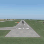
Tolmachevo airport is the largest airport complex in Siberia and the Far East of a Class A-1 with of a cargo capacity of more than 50,000 tonnes per year, 750 passengers per hour on international flights and 1,800 per hour on domestic routes.
The airport has two runways, the second one was put into operation in autumn 2010. It doesn't have any restrictions on take-off weight, and is certified for ICAO CAT II. Tolmachevo airport is included in a list of international hubs of Russia. In 2011 the airport handled 2,765,884 passengers (22.3% more than in 2010).
| Filename: | UNNT_Tolmachevo_2012__Novosibirsk.zip |
| License: | Freeware |
| Added: | 4th June 2012, 17:36:11 |
| Downloads: | 2,207 |
| Author: | Tolmachevo TEAM |
| Size: | 80.88 MB |
| Category: Flight Simulator X - Missions | |
| Fire in Tau Island |
|
File Description: This scene recreates a series of fires in Tau Island.
You are a rescuer!
The mission starts by taking off in Pago-Pago Airport (NSTU) and fly to Fitiuta
Airport (FAQ). Take a truck and go by coast road to Tau Airport (HI36), out of
service by fire. Rescue the settlers at the end of the road and return to the
Fitiuta Airport. Take again again your plane and take off to Pago-Pago Airport
with the rescued settlers, where they will receive hospitable attention.
Requires Tau Island Scenery: faq_-_tau_island.zip Download ID: 174863
| Filename: | Fire_in_Tau_Island.zip |
| License: | Freeware |
| Added: | 5th March 2013, 06:48:46 |
| Downloads: | 473 |
| Author: | Christian Svensson / Didisoft |
| Size: | 385.77 KB |


© 2001-2026 AVSIM Online
All Rights Reserved
Privacy Policy |