
Where Flight Simulation Enthusiasts Gather from Around the World!
AVSIM Library - Search Results

| Category: Flight Simulator X - Scenery | |
| China International Airports: ZBTJ Tianjin / Binhai - Update |

|
Images related to this file:
File Description:
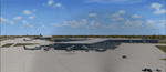
Tianjin Binhai International Airport in FSX is outdated. This scenery represents the airport as it is in 2021. The layout of the airport corresponds to satellite images and actual charts, the buildings are made with GMAX. In this update a missing model for the airbridges was added.
| Filename: | China_International_Airports_ZBTJ_Tianjin__Binhai_.zip |
| License: | Freeware, limited distribution |
| Added: | 9th October 2021, 20:53:29 |
| Downloads: | 744 |
| Author: | Winfried Orthmann |
| Size: | 65.02 MB |
| Category: Prepar3D V5 - Scenery | |
| ZUDC Daocheng Yading Airport (2020) |
|
Images related to this file:
File Description:
A framerate friendly design of Daocheng Yading Airport (ZUDC/DCY). ZUDC is the highest airport, sitting at just shy of 14,500 feet. The airport is used for domestic flights and can handle the A320 family. Modeled on recent aerial photographs. Optimized for use with ORBX packages.
| Filename: | ZUDC_Daocheng_Yading_Airport_2020.zip |
| License: | Freeware |
| Added: | 21st April 2021, 23:38:07 |
| Downloads: | 241 |
| Author: | Luc Maaskant |
| Size: | 179.32 KB |
| Category: Flight Simulator 2004 - Scenery | |
| SKAR El Eden International Airport - Armenia, Colombia |
|
File Description:
SKAR El Eden airport, Armenia, Colombia, for FS2004. Based on Google Earth.
El Edén International Airport (IATA: AXM, ICAO: SKAR) is an international airport located in the Colombian Department of QuindÃo, in the town of La Tebaida. It mainly serves the capital, Armenia.
| Filename: | SKAR_El_Eden_International_Airport__Armenia_Colomb.zip |
| License: | Freeware |
| Added: | 4th February 2012, 18:21:30 |
| Downloads: | 1,071 |
| Author: | Detlev J. Rohmer |
| Size: | 12.04 MB |
| Category: Flight Simulator 2004 - AFCAD Files | |
| Birmingham International Airport, Birmingham, Warwickshire, England (EGBB/BHX) |
|
File Description:
A high quality AFCAD2 file for the UK2000 Birmingham Airport (EGBB/BHX). Features Assigned gates for all airlines serving the airport, Bizjet parking and GA parking. Airlines will park at the correct terminals, and GA aircraft will only park in the GA area. This file has been built from scratch and is as accurate as can be made, using info from the airport website. Requires the UK2000 Birmingham Airport Scenery or the UK2000 Part 5 scenery by Gary Summons. This file is not suitable for the default airport. Enjoy.
| Filename: | Birmingham_International_Airport_Birmingham_Warwic.zip |
| License: | Freeware |
| Added: | 5th June 2007, 17:30:56 |
| Downloads: | 1,285 |
| Author: | Lee Brompton |
| Size: | 177.6 KB |
| Category: Flight Simulator X - Scenery | |
| TTPP |
|
File Description:
Piarco International Airport (IATA: POS, ICAO: TTPP) is the main airport serving Trinidad and Tobago located in Piarco, a town in northern Trinidad, about 25 km east of the capital city, Port of Spain. It is one of two international airports serving the twin isle republic. The other is located on the island of Tobago, Crown Point International Airport. The airport has one runway and helipads.
This file has the right coordenates, with the apron and characteristics of the airport. The runways and runways were resized the gates placed on correct location.
| Filename: | TTPP.zip |
| License: | Freeware |
| Added: | 1st May 2011, 00:24:55 |
| Downloads: | 2,203 |
| Author: | Anwar Gonzalez |
| Size: | 34.52 KB |
| Category: Flight Simulator 2004 - AFCAD Files | |
| KCHO Charlottesville-Albemarle Airport |
|
Images related to this file:
File Description:
FS2004 AFCAD File For KCHO, Charlottesville-Albemarle Airport, Charlottesville, Virginia (VA), USA 2012. CHO flies direct to six major connector airports. This airport needed overhauling. No large homemade scenery; uses default scenery. Modified with ADE 9x. Main changes: added new terminal/gates/jetways, runway 21 800' extension project plus 200' blast pad to name a few. Added default eye candy to give life. Modified airport taxiways/taxiway signs / facilities and structures to reflect current operations. Adjusted passenger terminals, added and realigned other airport buildings to 2012 locations. Verified with Google Earth images / FAA airport charts.
| Filename: | KCHO_CharlottesvilleAlbemarle_Airport.zip |
| License: | Freeware |
| Added: | 22nd August 2012, 03:49:05 |
| Downloads: | 285 |
| Author: | Dale Wingard |
| Size: | 1.04 MB |
| Category: Flight Simulator X - Scenery | |
| FCBB - Maya-Maya Airport - Brazzaville, Republic of the Congo |
|
File Description:
Maya-Maya Airport (IATA: BZV, ICAO: FCBB) is an airport located in Brazzaville, the capital of the Republic of the Congo. In 2004, the airport served 447,699 passengers. In 2010, a new runway 3300m long (05L/23R) and a new terminal, with 3 air bridges was opened. The older runway (05R/23L) was repaired and now is used as a taxiway. Airport runways were corrected also the jetways, aprons and buildings. Airport charts courtesy of www.ais-asecna.org/en/ad/ad2.htm
This work is dedicated to West Wind Airlines.
| Filename: | FCBB__MayaMaya_Airport__Brazzaville_Republic_of_th.zip |
| License: | Freeware |
| Added: | 2nd June 2013, 22:33:32 |
| Downloads: | 2,741 |
| Author: | Anwar Gonzalez |
| Size: | 4.03 MB |
| Category: Flight Simulator X - Scenery | |
| KTEX - Telluride Regional Airport - Colorado, USA |
|
Images related to this file:
File Description:
East Coast Simulations presents scenery for Telluride Regional Airport (KTEX/TEX) for FSX/P3D! Telluride Regional Airport (IATA: TEX, ICAO: KTEX, FAA LID: TEX) is a public airport six miles west of Telluride, in San Miguel County, Colorado. It is owned by the Telluride Regional Airport Authority. At an elevation of 9,078 feet (2767 m) above sea level, it was the highest commercial airport in North America with scheduled passenger flights, until Great Lakes Airlines ended service in 2014. This scenery includes all custom buildings and terminals with a season changing photoreal background.
| Filename: | KTEX__Telluride_Regional_Airport__Colorado_USA.zip |
| License: | Freeware |
| Added: | 30th June 2015, 23:47:41 |
| Downloads: | 1,699 |
| Author: | Wesley Chin and Kyle Kato |
| Size: | 92.55 MB |
| Category: Flight Simulator X - Scenery | |
| SLIX - Ixiamas Airport - Ixiamas, Bolivia |
|
File Description:
New Airport (Not included in FSX).
Ixiamas Airport (ICAO: SLIX) is a public use airport located near Ixiamas and close to Reserve Natural of Madidi National Park Madidi, one of the largest protected areas in the world, La Paz, Bolivia. The airport resides at an elevation of 725 ft (221 m) above mean sea level. It has one runway designated 18/36 with an asphalt surface measuring 7,874 by 98 ft (2,400 m by 30 m). This new airport is recently operational since May 2015.
Compatible with both FSX and P3D.
| Filename: | SLIX__Ixiamas_Airport__Ixiamas_Bolivia.zip |
| License: | Freeware |
| Added: | 29th July 2015, 11:22:41 |
| Downloads: | 446 |
| Author: | Marcos A. Rivas Torrez |
| Size: | 8.55 MB |
| Category: Online ATC - Software | |
| Transition Level Converter v1.2 |
|
File Description:
An utility to automatically convert the Transition Altitude of an airport in the Transition Level, depending upon the QNH. Simply choose the airport, press the OK button and here it is the METAR, the TA and the TL for that airport! Since version 1.2 it also calculate the wind component(TAIL/HEAD) for each runways of a certain airport.
To work properly, the converter needs a TXT file with the airport list and the TA and RWYs: this file can be customized following the instruction given in the README file which is in the archieve.
| Filename: | Transition_Level_Converter_v12.zip |
| License: | Freeware |
| Added: | 5th November 2004, 22:07:52 |
| Downloads: | 990 |
| Author: | Cristiano Esposito |
| Size: | 5.89 MB |


© 2001-2026 AVSIM Online
All Rights Reserved
Privacy Policy |