
Where Flight Simulation Enthusiasts Gather from Around the World!
AVSIM Library - Search Results

| Category: Flight Simulator 2004 - Scenery | |
| CZBF Bathurst, New Brunswick |

|
File Description:
CZBF Bathurst, New Brunswick is the third airport in our Maritime Airport series. Created with GMAX. Photoreal textures, static vehicles, custom ground textures, off airport buildings. NOTE: this zip contains some landclass files that enhance our previous sceneries namely CYFC and CYSJ.
| Filename: | CZBF_Bathurst_New_Brunswick.zip |
| License: | Freeware, limited distribution |
| Added: | 20th October 2005, 07:59:54 |
| Downloads: | 4,254 |
| Author: | CanUk Scenery Adam Bentley and David Madge |
| Size: | 5.62 MB |
| Category: Flight Simulator 2004 - Scenery | |
| KPHX Phoenix Sky Harbor Airport 2019 |
|
File Description:
KPHX Sky Harbor Airport in completely new design (textures) which better reflect the appearance. Textures included depict the airport much better in both day & night environments. The airport comes to life at night. Original design and conception provided by the Mach-1 Group.
| Filename: | KPHX_Phoenix_Sky_Harbor_Airport_2019.zip |
| License: | Freeware, limited distribution |
| Added: | 30th April 2019, 17:11:51 |
| Downloads: | 1,095 |
| Author: | Michael Lehkamp |
| Size: | 5.4 MB |
| Category: Flight Simulator X - Scenery | |
| LYPG Podgorica Airport, Montenegro |
|
File Description:
Podgorica Airport (IATA: TGD, ICAO: LYPG) is an international airport located 11 km (6.8 mi) south of Podgorica, Montenegro. It is the main hub for Montenegro Airlines.
It is one of two public airports in Montenegro, the other being Tivat Airport. Both are operated by the state-owned company Airports of Montenegro. The airport is sometimes called Golubovci Airport by the locals, as the town of
Golubovci is in close proximity. Airports Council International awarded Podgorica the best airport under 1 million passengers in 2007.
The IATA code of the airport is still TGD because Podgorica was named Titograd (after Josip Broz Tito) from 1946 to 1992, during which time the airport opened.
The airport handles domestic flights within Montenegro as well as international flights. As Montenegro's two main airports are merely 80 km apart, there are no regular passenger domestic flights. Domestic flights have been reduced to
charter flights and general aviation, and all scheduled traffic is international.
There are daily scheduled flights to various European destinations. During the summer season, there are many charter flights and air connections to various major cities in the world. The flight to Belgrade airport has traditionally
accounted for majority of the traffic at the airport, but the percentage is decreasing.
VIP and taxi airlines Vektra Aviation, Di Air and OKI Air are based at the airport. Serbian VIP airlines Air Pink and Prince Aviation also use the airport.
Podgorica Airport served 538,477 passengers in 2008. However, due to global economic downturn, passenger numbers declined to 450,504 in 2009. In 2010, strong growth was recorded, so numbers passed the 600,000 mark.
Thanks to Serbia And Montenegro Virtual Area Control Center for the airport charts.
This file has the right coordinates, with the apron and characteristics of the airport, airport vehicles and buildings, also it is set to the correct altitude of 126 feet or 38 meters.
| Filename: | LYPG_Podgorica_Airport_Montenegro.zip |
| License: | Freeware |
| Added: | 29th October 2012, 21:41:37 |
| Downloads: | 4,673 |
| Author: | Anwar Gonzalez |
| Size: | 10.52 MB |
| Category: Flight Simulator X - Scenery | |
| Mesolonghi Airport - Rio-Antirio Bridge - Greece ** UPDATED VERSION ** |
|
Images related to this file:
File Description:
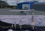
These are actually two sceneries offered in one pack. I started building the small airport of Mesolonghi in Western Greece. When nearing completion, I thought that FS was really missing the big suspension Bridge that connects mainland Greece with Peloponese that was finished in 2004, being the biggest in the world of the fully suspended type. The bridge project turned out bigger than the airport as I ended up doing the typical, Greek-style double ended ferries that served the straights for decades before the bridge and still offer a cheaper and, to some, more relaxing alternative.
Mesolonghi airport is situated 5 kilometers east of the historic city of Mesolonghi and is close to the technical school of fisheries. There is no ICAO code (ZZZZ) so I had to give it the fictional LGME in the sim. A purely day field, it houses the local Aeroclub and ultralight school. due to its small size and hospitable atmoshpere, it is a popular GA pilots destination, receiving also often international arrivals. The runway is asphalt and 800m (2635') in length. No PAPI or VASI are provided. There is no tower service and unicom frequency of 119.7MHz is used by the traffic. Closest controlled airport is Araxos (LGRX), a civil and military field, quite common in Greece, 12.5 nautical miles S-SE. The nearby city of Mesolonghi is famous for its heroic resistance and fall in 1826 during the Greek war of indepence. It is also famous for its fishery production, due to the natural lagoon, formed by the shallow waters.
Features of the Mesolonghi airport scenery include:
- Photoreal area with seasonal variations and watermask.
- Custom hangars and containerised buidings.
- AI default trike performing TnGs (in P3D it will work only if you copy over the FSX trike).
- The technical shool of fisheries on the north side.
- Customized shorelines, to fit with ORBX Global Vector.
- Optional shoreline fix for default scenery.
The Rio-Antirio bridge is located 14.5 nautical miles to the east of the airport. It connects the towns of Rio on the south side and Antirio on the north side. More data on the bridge can be found on Wikipedia.
Features of the Rio-Antirio bridge scenery include:
- Custom bridge model, bump mapped textures with hard platform surface and vehicle traffic.
- Night lighting textures and custom roadlights.
- Photoreal scenery for north and south shores, including hand placed autogen and night textures.
- Custom castle models on north and south sides, with bump mapped textures and night lighting.
- Custom model of the toll post on the north side.
- Custom AI ferry boats with constant shuttle service between Rio and Antirion piers.
- Customized shorelines, to fit with ORBX Global Vector.
- Optional shoreline fix for default scenery.
- Optional HDR optimized photoreal textures.
| Filename: | Mesolonghi_Airport__RioAntirio_Bridge__Greece___UP.zip |
| License: | Freeware |
| Added: | 16th March 2016, 09:15:21 |
| Downloads: | 2,629 |
| Author: | Vassilios Dimoulas |
| Size: | 300.05 MB |
| Category: Flight Simulator X - Scenery | |
| LFLJ - Courchevel, France |
|
File Description:
This FSX scenery package contains the LFLJ Courchevel airport in the French Alps. The airport has a very short, upslope runway of only 525 m (1,722 ft). The airport is considered one of the seven most dangerous in the world. It has a difficult approach, a 300 foot upslope runway and is adjacent to the Courchevel ski runs. The Courchevel airport altitude is the highest in Europe, with a mean elevation of 6,520 feet. This airport is intended to be used with FSX and the free addon - TileProxy. TileProxy provides real-time photorealistic satellite imagery in place of the stock auto generated FSX scenery or any other scenery package. The Courchevel airport was originally released as part of an FSX airport scenery package containing 15 airports, located in the French Alps. The link to the original 15 French Alps Airport package is shown below. This file is not required, but allows you to download 15 related French Alps airports. The LFLJ, Courchevel airport in the original 15 airport package was missing a required scenery file which corrects the airport altitude (from 6420 ft. to 6520 ft.) due to the mis-location of the stock FSX airport. This download provides all three of the required .bgl scenery files.
related download:
http://library.avsim.net/search.php?SearchTerm=french+alps+airports&CatID=root&Go=Search
| Filename: | LFLJ__Courchevel_France.zip |
| License: | Freeware |
| Added: | 30th November 2013, 20:20:07 |
| Downloads: | 6,045 |
| Author: | John Greenwood |
| Size: | 655.63 KB |
| Category: Flight Simulator X - AFCAD Files | |
| DAON - Zenata a Messali El Hadj Airport - Tlemcen, Algeria |
|
Images related to this file:
File Description:

Zenata - Messali El Hadj Airport (IATA: TLM, ICAO: DAON) is a public airport located 11.87 nautical miles (21.98 km) southwest of Tlemcen, the capital of the Tlemcen province (wilaya) in Algeria. It is also known as Leila Sebbar Airport. The airport has regularly scheduled domestic service via Air Algerie as well as service to points in France via Air Algerie and Aigle Azur.
Features:
*Expanded parking apron
*Taxiways properly designated and aligned
*Runway markings and lighting corrected
*Parking spots for commercial traffic
*Separate parking area for GA traffic
*Misc airport buildings added
*Airport vehicles and objects throughout the airport
*Fuel service vehicles
*Fire station and vehicles
*Caution: Birds in vicinity of airfield
| Filename: | DAON__Zenata_a_Messali_El_Hadj_Airport__Tlemcen_Al.zip |
| License: | Freeware |
| Added: | 14th April 2014, 23:31:47 |
| Downloads: | 556 |
| Author: | Jaison Diaz / Endeavour AI |
| Size: | 76.64 KB |
| Category: Flight Simulator X - Scenery | |
| KFRR - Front Royal-Warren County Airport - Front Royal - Virginia, USA |
|
Images related to this file:
File Description:
Front Royal-Warren County Airport (IATA: FRR[2], ICAO: KFRR, FAA LID: FRR) is a county owned, public use airport located three nautical miles (6 km) west of the central business district of Front Royal, a town in Warren County, Virginia, United States. It is included in the National Plan of Integrated Airport Systems for 2011-2015, which categorized it as a general aviation facility.
This is a complete re-work of the airport based on Google Maps. Created with Airport Design Editor by ScruffyDuck Software using current FAA documentation and Google Earth measurements, this package offers a replacement for FSX's stock airport. All these enhancements are as close to the real airport as I can get with stock library objects and custom buildings.
| Filename: | KFRR__Front_RoyalWarren_County_Airport__Front_Roya.zip |
| License: | Freeware |
| Added: | 1st October 2014, 14:01:40 |
| Downloads: | 369 |
| Author: | Wayne Roberts |
| Size: | 232.02 KB |
| Category: Flight Simulator X - Scenery | |
| KTTN - Trenton - Mercer Airport - New Jersey, USA |
|
Images related to this file:
File Description:
East Coast Simulations presents Trenton Mercer Airport Scenery for FSX/P3D! Trenton - Mercer Airport (IATA: TTN, ICAO: KTTN, FAA LID: TTN), sometimes also referred to as Trenton Mercer Airport, is a county-owned, joint civil military, public airport located four miles northwest of Trenton in the West Trenton section of Ewing Township, Mercer County, New Jersey. Formerly known as Mercer County Airport, the airport serves one scheduled airline plus general and corporate aviation. As reported in early 2014, about 325,000 passengers use the airport each year. This detailed scenery includes several custom buildings, a photoreal background for all seasons and custom ground polygons. This is the first release for East Coast Simulations, and more will be coming soon.
| Filename: | KTTN__Trenton__Mercer_Airport__New_Jersey_USA.zip |
| License: | Freeware |
| Added: | 30th June 2015, 23:45:58 |
| Downloads: | 1,113 |
| Author: | Wesley Chin and Kyle Kato |
| Size: | 91.41 MB |
| Category: Flight Simulator X - AFCAD Files | |
| MNMG - Augusto C. Sandino International Airport - Managua, Nicaragua |
|
Images related to this file:
File Description:

MNMG - Augusto C. Sandino International Airport / Managua, Nicaragua. Augusto Cesar Sandino International Airport (Spanish: Aeropuerto Internacional Augusto Cesar Sandino) (IATA: MGA, ICAO: MNMG) is the main airport in Managua, Nicaragua and the busiest airport in the country.
Features:
*Runway properly renumbered
*Taxiways properly designed and signs updated
*Runway length expanded to current length
*Expanded parking apron
*Runway markings and lighting corrected
*Parking spots for commercial traffic
*Parking area for domestic flights
*Separate parking area for GA traffic
*Misc airport buildings added
*Airport vehicles and objects throughout the airport
*Fuel service vehicles
*Fire station and vehicles
*Static vehicles (requires objlib-large-car-parking-fsx.zip)
*Light poles (requires fsx_lts.zip)
| Filename: | MNMG__Augusto_C_Sandino_International_Airport__Man.zip |
| License: | Freeware |
| Added: | 14th April 2014, 23:33:21 |
| Downloads: | 1,045 |
| Author: | Jaison Diaz / Endeavour ai |
| Size: | 90.52 KB |
| Category: Flight Simulator 2004 - AFCAD Files | |
| New Jersey General Aviation Airports |
|
File Description:
Package includes (KTEB) Teterboro Airport, Teterboro, NJ and (KTTN) Trenton Mercer Airport, Trenton, NJ. Accomodations made for Airline Transport Professionals (ATP) at Trenton.
| Filename: | New_Jersey_General_Aviation_Airports.zip |
| License: | Freeware |
| Added: | 18th March 2006, 14:32:56 |
| Downloads: | 1,478 |
| Author: | Eliot Jacobs |
| Size: | 152.94 KB |


© 2001-2026 AVSIM Online
All Rights Reserved
Privacy Policy |