
Where Flight Simulation Enthusiasts Gather from Around the World!
AVSIM Library - Search Results

| Category: Flight Simulator X - Scenery | |
| Chubu Centrair International Airport (RJGG), Japan |

|
File Description:
Chubu Centrair International Airport (IATA: NGO, ICAO: RJGG) is an airport on an artificial island in Ise Bay, 22 miles south of Nagoya in central Japan.
Chubu is Japan's third off-shore airport, after Nagasaki Airport and Kansai International Airport, and is also the second airport built in Japan on a man-made island.
| Filename: | Chubu_Centrair_International_Airport__RJGG_Japan.zip |
| License: | Freeware |
| Added: | 15th November 2011, 02:24:07 |
| Downloads: | 959 |
| Author: | Morten Thomas van der Linden |
| Size: | 29.15 MB |
| Category: Flight Simulator X - Scenery | |
| Charleroi- Brussels |
|
File Description:
Scenery for Charleroi- Brussels - For FSX ONLY
Installation
1.Copy the .bgl Files in the folder to Microsoft FLight Simulator X\Addon Scenery\scenery\
2.Run FSX
Credit to google earth
| Filename: | Charleroi_Brussels.zip |
| License: | Freeware |
| Added: | 13th January 2008, 20:08:19 |
| Downloads: | 1,718 |
| Author: | Alan Mccarthy |
| Size: | 75.91 KB |
| Category: Flight Simulator 2004 - Scenery | |
| I Brigada Aérea "El Palomar" - SADP 2006 |
|
File Description:
EL PALOMAR es la primera brigada aérea de la Fuerza Aérea Argentina y en el operan como base los C-130, L-100-30, B707-320, DH6, Learjet 35 y 23, F-28, F27 y el avion presidencial TANGO 01 (B757-200). Ademas de utilizar programas de última generación y las más avanzadas técnicas de diseño, Nowhere Media Studio® introduce con este escenario, el primer sistema de iluminación de plataforma por medio de efectos.
EL PALOMAR is the first air brigade of the Argentine Air Force and in this airfield operate the C-130's, L-100-30's, B707-320's, DH6's, Learjet 35's and 23's, F28's, F27's of this airforce, and the presidential airplane TANGO 01 (B757-200). In adittion to using the last generation design programs and tecnics, Nowhere Media Studio® is proud to offer an scenery with a platform ilumination system operated by effects
| Filename: | I_Brigada_Area_El_Palomar__SADP_2006.zip |
| License: | Freeware, limited distribution |
| Added: | 28th February 2006, 04:35:21 |
| Downloads: | 3,534 |
| Author: | Nowhere Media Studio® - Juan M. Cortéz |
| Size: | 11.83 MB |
| Category: Flight Simulator 2004 - Scenery | |
| Chilanko Lodge CBX3 in British Columbia Canada version 2 |
|
Images related to this file:
File Description:
This is a revised post of Chilanko Lodge, which is an airstrip that serves the Lodge of the same name on the beach of One Eye Lake. The lake is close to the eastern side of the Coastal Range, 30 miles south of Nimpo Lake and 30 miles west of Puntzi Mountain, both previous posts. There is also a dock for float planes. The runway is 2,900 feet of gravel aligned 10-28, unlit, and at 2,972 feet above sea level. I remade this scenery as I was not very satisfied with the surrounding terrain, and then there was a reported terrain level problem. It is now better than the first time around, in my opinion anyway. I have posted it as version 2 of Chilanko Lodge CBX3, but I suggest that you add this to your "BC airfields" folder as previously suggested. Up to you. If you find a defect, email me.
| Filename: | Chilanko_Lodge_CBX3_in_British_Columbia_Canada_ver.zip |
| License: | Freeware, limited distribution |
| Added: | 20th November 2020, 23:29:53 |
| Downloads: | 80 |
| Author: | Roger Wensley |
| Size: | 8.61 MB |
| Category: Flight Simulator 2004 - AI Flight Plans | |
| Airphil Express - Summer 2013 |
|
Images related to this file:
File Description:

Include Optimize speed version,Season:Summer 2013,Callsign:AIRPHIL,ICAO:GAP,IATA:2P,Weekly flights:900,Hubs:Mactan-Cebu International Airport (Cebu),Ninoy Aquino International Airport (Manila),Francisco Bangoy International Airport (Davao),Zamboanga International Airport.
| Filename: | Airphil_Express__Summer_2013.zip |
| License: | Freeware, limited distribution |
| Added: | 20th May 2013, 06:14:13 |
| Downloads: | 383 |
| Author: | Michael 'Pushen' Babitskiy / United Traffic Team |
| Size: | 193.64 KB |
| Category: Flight Simulator 2004 - AI Flight Plans | |
| Jet Airways - Winter 2013-14 |
|
Images related to this file:
File Description:

Include Optimize speed version,Season:Winter 2013/14,Callsign:JET AIRWAYS,ICAO:JAI,IATA:9W,Weekly flights:3482,Hubs:Chhatrapati Shivaji International Airport (Mumbai),Brussels Airport,Chennai International Airport (Chennai),Indira Gandhi International Airport (Delhi).
| Filename: | Jet_Airways__Winter_201314.zip |
| License: | Freeware, limited distribution |
| Added: | 17th November 2013, 18:43:27 |
| Downloads: | 437 |
| Author: | Michael 'Pushen' Babitskiy,UTT |
| Size: | 248 KB |
| Category: Flight Simulator X - Scenery | |
| Honduras Islands v3 |
|
Images related to this file:
File Description:

Version 3 includes all previous patches and updates. This version also restructures the file system to be fully compatible with the ORBX "FTX Global openLC North America" product as well as adding functionality for default FSX users. Additionally, water class scenery is updated to appear more realistic, MHRO is updated to reflect the newly expanded apron, and SRTMGL1 (30m) mesh is included. All landclass polygons and coastlines were meticulously hand-drawn directly from satellite imagery to provide the most detailed and accurate scenery available for this region.
This project rebuilds the islands of Roatán, Barbareta, Guanaja, and Utila, and adds Cayos Cochinos and the numerous cays associated with the "Islas de la Bahia" (Islands of the Bay). Roatán (MHRO), Guanaja (GJAJ/MHNJ) and Puerto Lempira (MHPL) are completely overhauled and positioning is corrected. New and fully functioning AI airports are added for Utila (MHUT), Fort Cay (MHFC) and Cochino Pequeño (MHCP) of the Cayos Cochinos chain, and La Ceiba (MHLC) is modified to accommodate more AI traffic. Accurate coastlines, lakes, road and river data, as well as corrected landclass are provided based on the latest available satellite imagery. GA flight plans are provided to add or enhance service to the smaller islands. Updates were created or rebuilt in a manner which carefully aligned airport data with current satellite imagery, when available. Scenery was created using Airport Design Editor X v1.70.6042, SBuilderX 3.13, and the FSX Object Placement Tool. Scenery objects were added and modified from stock FSX scenery to resemble as closely as possible the actual airports.
| Filename: | Honduras_Islands_v3.zip |
| License: | Freeware |
| Added: | 23rd December 2016, 08:17:26 |
| Downloads: | 1,614 |
| Author: | Carlyle Sharpe |
| Size: | 17.35 MB |
| Category: Flight Simulator 2004 - Scenery | |
| Kanab (KKNB), Utah/Arizona, Photo-Scenery (FS9 & FSX) |
|
Images related to this file:
File Description:
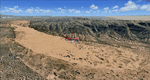
This scenery covers the southwestern part of Grand Staircase-Escalante National Monument. From the air
you can see all the "stairs" from the Pink Cliffs of Bryce Canyon in the north down to the Grey Cliffs,
the White Cliffs and the Vermillion Cliffs just north of Kanab and then the Chocolate Cliffs further south.
Nothwest of Kanab you can fly above beautiful Coral Pink Sand Dunes State Park which features coral-hued
sand dunes located beside red sandstone cliffs. These dunes consist of sand that formed thru erosion of
pink colored Navajo Sandstone surrounding the park and was deposited by wind. To explore the scenery depart
from Kanab Airport (KKNB).
High resolution versions of this scenery for FS9 and FSX (much sharper, but larger and multiple downloads)
are available at www.blueskyscenery.com/CNY_South3West4.html . The screenies are taken from the high-res versions,
so expect this version to be slightly more blurry. Thanks to Joop Mak for providing custom AFCADs that
correct airport layouts so that they align with the photo-textures! They are available at
www.blueskyscenery.com/AFCADs.html . YourDonation@Work: Dedicated to Jesper, Fabrizio and Glen.
| Filename: | Kanab_KKNB_UtahArizona_PhotoScenery_FS9__FSX.zip |
| License: | Freeware, limited distribution |
| Added: | 10th March 2010, 22:24:53 |
| Downloads: | 1,509 |
| Author: | Gottfried Razek - blueskyscenery.com |
| Size: | 95.36 MB |
| Category: Flight Simulator X - Scenery | |
| Murray river and SE Victoria v2 for ORBX v2. YRIO Robinvale YBRN Balranald YDLQ Deniliquin YLEG Leongatha YYRM Yarram |
|
Images related to this file:
File Description:
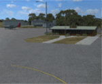
'Murray and SE Victoria v2' is made to match ORBX Australia v2 scenery. Use 'Murray + SE Victoria airports' for ORBX v1 or no ORBX. There are 5 airports. 3 airports near the Murray river in Victoria and NSW - YRIO Robinvale, YBRN Balranald, YDLQ Deniliquin. 2 airports in SE Victoria - YLEG Leongatha, YYRM Yarram. ORBX has done these as they have done every airport included with FSX in Australia to a reasonable standard. If I had not already done them for ORBX V1 I would not have bothered. However these are better than ORBX because the surroundings have been modified to match real life. Towns have been added or shifted. Forests cut down or added. Race courses, sewage treatment ponds and other stuff added. Local obstacles (towers etc) added. There are Included are 2 AI traffic files that cover the airports. These files are for Flight Simulator X. Made using Airport Design Editor using some objects borrowed from Robert Budd's excellent Baccus Marsh and 'Static aircrafts' by Jean-Pierre Fillion. REQUIRED The scenery is designed to interface with ORBX FTX_AU V2 scenery for Australia (payware).
| Filename: | Murray_river_and_SE_Victoria_v2_for_ORBX_v2_YRIO_R.zip |
| License: | Freeware |
| Added: | 15th December 2019, 19:06:10 |
| Downloads: | 317 |
| Author: | Colin Jeffery |
| Size: | 10.06 MB |
| Category: Flight Simulator X - Scenery | |
| Bhutan Airports and Paro Valley |
|
Images related to this file:
File Description:
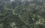
This project adds and updates all of the airports of Bhutan. Bathpalathang (VQBT) and Gelephu (VQGP) are added, Yongphulla (VQ10) is updated and recoded as VQTY, and Paro (VQPR) is fully updated to reflect current satellite imagery. These are all fully functioning AI airports as well. Special attention was given to the entire Paro Valley, and numerous road/river vectors were updated around Gelephu. Accurate coastlines, lakes, road and river data, as well as corrected landclass are provided based on the latest available satellite imagery. They are optimized to fit seamlessly with FTX Vector's roads/water, but they should be fully functional in all FSX configurations.
GA-encoded flight plans for the Buddha Air/Kathmandu charter are provided to enhance service to Paro. NASA SRTM Global 3 arc second terrain mesh is also included for all of Bhutan. Updates were created or rebuilt in a manner which carefully aligned airport data with current satellite imagery, when available. Scenery was created using Airport Design Editor X v1.61.5298, SBuilderX 3.13, and the FSX Object Placement Tool. Scenery objects were added and modified from stock FSX scenery to resemble as closely as possible the actual airports.
| Filename: | Bhutan_Airports_and_Paro_Valley.zip |
| License: | Freeware |
| Added: | 19th January 2015, 06:09:17 |
| Downloads: | 11,455 |
| Author: | Carlyle Sharpe |
| Size: | 21.4 MB |


© 2001-2026 AVSIM Online
All Rights Reserved
Privacy Policy |