
Where Flight Simulation Enthusiasts Gather from Around the World!
AVSIM Library - Search Results

| Category: Flight Simulator 2004 - AFCAD Files | |
| Liverpool (UK) |

|
File Description:
Contains flightplans and an AFCAD 2 file (for extra gates) for Liverpool airport(UK). The flightplan times are not real but the airlines and destinations are. Airlines included - Air Wales, EasyJet, Ryanair, British Airways, EuroManx and the new addition VLM. The AFCAD 2 file will only work with the default FS9 scenery but the flightplans should work with any addon scenery. Also included is a copy of my AI engine sounds instructions.
AFCAD 2 not needed for BGL installation but traffic tools for FS2004 is needed for FP installation.
| Filename: | Liverpool_UK.zip |
| License: | Freeware |
| Added: | 21st January 2004, 17:56:34 |
| Downloads: | 1,452 |
| Author: | Andrew Berry |
| Size: | 67.92 KB |
| Category: Flight Simulator X - Scenery | |
| Sliac (LZSL) enhanced scenery and ADE file |
|
File Description:
Sliac (LZSL) is a military and civilian airfield in the Slovak Republic.
This scenery replaces the default LZSL with an enhanced version of the
airport. Parking for military aircraft is provided on the ramps and in
numerous hardened shelters. Parking is also provided for general aviation
aircraft. This design was accomplished using ADE, SBuilderX, FSXPlanner
and Whisplacer. Custom hardened shelters created by Juri Masnik.
Default FSX library objects, autogen and RWY12 objects were used
for this creation, This scenery is for FSX only and was tested in
FSX-Acceleration\SP2 on WinXP Pro.
| Filename: | Sliac_LZSL_enhanced_scenery_and_ADE_file.zip |
| License: | Freeware |
| Added: | 3rd February 2008, 13:52:05 |
| Downloads: | 2,422 |
| Author: | Paul Strogen |
| Size: | 2.3 MB |
| Category: Flight Simulator 2004 - Scenery | |
| Innsbruck-LOWI, version 2 |
|
File Description:
Here is my second version of Innsbruck-lowi, the airport of Innsbruck located in Austria, in the middle of the alps. The scenery is made including the active approach system of Jim Vile, with his permission. I modified his afcad file, that is part of this system, a bit to better fit with my scenery. The result of this system is a better AI traffic behavior when flying in or departing from Innsbruck. (No more flying into the mountains). For user aircraft there is a more correct ATC vectoring when using an IFR flightplan.
| Filename: | InnsbruckLOWI_version_2.zip |
| License: | Freeware |
| Added: | 12th January 2010, 19:28:45 |
| Downloads: | 32,809 |
| Author: | Johan Thiers |
| Size: | 1.16 MB |
| Category: X-Plane - Scenery | |
| WABI Susi Air Nabire v1.0.0 |
|
Images related to this file:
File Description:
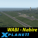
This is an X-Plane 11 scenery for Nabire Airport (WABI) in Nabire Regency, Papua, Indonesia. This is one of the destinations for "PT ASI Pujiastuti Aviation", operating as Susi Air, an Indonesia airlines established in late 2004 by Mrs. Susi Pudjiastuti. This scenery was tested and is operational (as of January 04, 2017) in "X-Plane 11 Public Beta #3 64 bit", Windows 10 Home. It was also tested and is operational (as of January 05, 2017) in "X-Plane 10.51 Public Beta #3 64 bit", Windows 10 Home.
| Filename: | WABI_Susi_Air_Nabire_v100.zip |
| License: | Freeware |
| Added: | 5th January 2017, 19:17:59 |
| Downloads: | 68 |
| Author: | Rui Mesquita |
| Size: | 1.25 MB |
| Category: Flight Simulator 2004 - Scenery Design | |
| Pumping Station |
|
Images related to this file:
File Description:
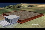
Scenery object. Suitable for EZ Scenery placement.
| Filename: | Pumping_Station.zip |
| License: | Freeware |
| Added: | 24th August 2011, 12:54:30 |
| Downloads: | 253 |
| Author: | Godfrey Tier |
| Size: | 44.83 KB |
| Category: Flight Simulator X - Scenery | |
| Sun 'N Fun |
|
Images related to this file:
File Description:
Put this in:
C:\Program Files (x86)\Steam\steamapps\common\FSX\Addon Scenery\scenery
or for BOXED:
C:\Program Files (x86)\Microsoft Games\Microsoft Flight Simulator X\Addon Scenery\scenery
| Filename: | Sun_N_Fun.zip |
| License: | Freeware |
| Added: | 15th June 2016, 02:06:22 |
| Downloads: | 100 |
| Author: | Liam Neff |
| Size: | 29.34 KB |
| Category: Flight Simulator X - Scenery | |
| Teterboro KTEB version 2.0 |
|
File Description:
FSX Scenery--Teterboro Airport (KTEB), NJ. Teterboro Airport is located across the Hudson River in New Jersey, just 12 miles from midtown Manhattan. Teterboro Airport is considered a general aviation reliever airport. As a reliever airport, it does not offer scheduled airline service, nor does it permit operations of any aircraft in excess of 100,000 pounds on any airport surface. Teterboro Airport has five Fixed Base Operators (FBOs), Atlantic Aviation, Jet Aviation, First Aviation, Meridian, and Signature Aviation. Teterboro - KTEB version 2 includes the latest google earth photo texture that depics the completed construction work of the taxiways and aprons. Photo texture includes summer, fall, winter, and spring variance textures. Night textures also included,along with snow textures in the winter months. Vegetation autogen has been re-worked. All taxiways, taxisigns are present and depicted to real-life. Custom taxilights and runway ground markings included, the ground detail is exact. All stock FSX hangars have been replaced with custom hangars. Animated people and birds are found on the airfield. Numerous SAMM generated static business jets and some light general aviation aircraft are present. Enjoy!
| Filename: | Teterboro_KTEB_version_20.zip |
| License: | Freeware |
| Added: | 14th April 2011, 16:57:39 |
| Downloads: | 2,621 |
| Author: | Eric McCloud |
| Size: | 52.63 MB |
| Category: Flight Simulator 2004 - Scenery | |
| Homer PaHO in Alaska US |
|
Images related to this file:
File Description:
Homer is a mainly GA airfield with rows of open air parking, but it also has scheduled flights, a terminal building, a long (for GA) runway of just under 6,700 feet that is 150 feet wide and aligned 03-21 with VASI on both ends and ILS on 03. So I think we can refer to it as an airport. Plus, at the time of this scenery (around 2010) there were three newly completed hangars on the north apron that I was told were for three companies, Bald Mountain Air service, Maritime Helicopters, and Pathfinder Aviation. I do not know which was for whom, but all three companies are in the helicopter and/or plane charter business. The south apron has a number of hangars and other buildings along it's length, starting at the western end with Smokey Bay Air that has an old control tower on the roof, then the Fire Station, and then Homer Air. I am not aware of who owns what after those first three, except that at the far eastern end there are several garages etc for the airport maintenance equipment. Next to the airport at that end there are a number of boat maintenance companies with boats pulled out of the water; this could not be well replicated due to the airport elevation above the sea level and a misplaced road. The nearby Beluga Lake 5BL float base is also included here, with some AI. The lake height above sea level has been adjusted to cope with too many cliffs intruding into the water; this is an annoying FS9 habit. The Homer scenery is as close to the actual airport as I could make it, while coping with inaccurate coast lines and roads, and grassed areas that could not all be modified for reasons that I will not bore you with. The Spit is a major scenery feature next to the airport, and I have added to this to provide some boats, docks, and nearby buildings etc. Small planes use the adjacent gravel taxi path instead of the runway when back-tracking to take off on runway 21. They only go as far as the path takes them and then u-turn onto the runway and take off. By the way, this airport's AI will function at its best if the prevailing wind makes 03 the runway in use. And I will eventually stop writing 03 and just call it 3, as the US, alone in the world, does not put a zero in front of 01, 02, 03, 04 etc. Just one other thing to note is that all access to the runway is from taxiways A and B; there was (in 2010) no access to the extreme western end of the runway as the taxiway there is marked as out of service pending a needed resurfacing.
If you find an error email me please, and note that my email address has been changed to rogwens at Gmail dot com.
| Filename: | Homer_PaHO_in_Alaska_US.zip |
| License: | Freeware, limited distribution |
| Added: | 28th July 2021, 03:31:04 |
| Downloads: | 133 |
| Author: | Roger Wensley |
| Size: | 11.86 MB |
| Category: Flight Simulator 2004 - Scenery | |
| CYYN Swift Current Municipal Airport |
|
File Description:
Swift Current Municipal airport is situated approximately 8 km east of the City of Swift Current. It is one of those tiny airports where the default flightsim scenery has no resemblance to the real world airport. CYYN was constructed using GMAX and represents the airport as it was in the Summer of 2007. It includes nearly all the buildings at the airport, runway signs, the addition of fencing, and a rotating beacon. CYYN also includes a landclass file to better represent the terrain around the airport, at least as far as the limits of the default landscape will allow. The airport has a long history, being built in 1937, as one of the hundred-mile airports on the Trans Canada airway. It was greatly expanded as an RCAF / RAF station during world war II. Many of the wartime structures still exist but many are in poor shape. Two of the original three runways remain in service. The airfield is often used by 15 Wing aircraft of CFB Moose Jaw to practice approaches.
| Filename: | CYYN_Swift_Current_Municipal_Airport.zip |
| License: | Freeware |
| Added: | 30th August 2008, 03:25:36 |
| Downloads: | 1,346 |
| Author: | Gregory Putz |
| Size: | 5.28 MB |
| Category: Prepar3D V1-4 - Scenery | |
| TNCA - Queen Beatrix International Airport - Aruba |
|
File Description:
The scenery was made using the Airport Design Editor, ModelConverterX, FSEarthTiles, SketchUp 2017 an others.
Queen Beatrix International Airport (Dutch: Internationale luchthaven Koningin Beatrix; Papiamento: Aeropuerto Internacional Reina Beatrix), colloquially known as Aruba Airport (IATA: AUA, ICAO: TNCA), is an international airport located in Oranjestad, Aruba. It has flight services to the United States, several countries in the Caribbean, the northern coastal countries of South America, Canada, as well as some parts of Europe, notably the Netherlands.
It is named after Beatrix of the Netherlands, who was Queen of the Netherlands from 1980 to 2013.
The airport offers United States border preclearance facilities. A terminal for private aircraft opened in 2007. The airport used to serve as the hub for bankrupt airline Air Aruba, which was for many years an international airline. Before Aruba's separation from the Netherlands Antilles in 1986 it was also one of three hubs for ALM Antillean Airlines as well as a home base for Tiara Air until 2016.
This scenario was only tested on P3Dv4.5.
History - fron Wikipedia.com
| Filename: | TNCA__Queen_Beatrix_International_Airport__Aruba.zip |
| License: | Freeware |
| Added: | 8th May 2021, 17:39:28 |
| Downloads: | 683 |
| Author: | Eduardo Puelker |
| Size: | 3.78 MB |


© 2001-2026 AVSIM Online
All Rights Reserved
Privacy Policy |