
Where Flight Simulation Enthusiasts Gather from Around the World!
AVSIM Library - Search Results

| Category: Flight Simulator 2004 - Scenery | |
| Ayer's Rock (Uluru) Photoreal |

|
File Description:
This package completely replaces the terrible default Ayer's Rock with a new and realistic satellite-textured model of the famous landmark, with new landclass, accurate roads, a few improvements to the nearby Connellan airport, and a lot of photorealistic tour buses. The scenery SHOULD also be commpatible with FS2002. V1.00 by Mat Dalton, June 2004.
| Filename: | Ayers_Rock_Uluru_Photoreal.zip |
| License: | Freeware, limited distribution |
| Added: | 25th June 2004, 14:18:49 |
| Downloads: | 6,779 |
| Author: | Mat Dalton |
| Size: | 501.73 KB |
| Category: Flight Simulator 2004 - Utilities | |
| Destination Finder for FS9 v1.1 |
|
File Description:
In this program, you enter the ICAO code of your start airport, the distance you wish to fly, and the heading on which you wish to fly. The program will search through all the stock airports in FS9, and will compile a list of airports nearest to your desired destination. For extra flexibility, you can also leave the heading and/or the distance unspecified. Alternatively, the program can now read your aircraft’s position in all versions of FS, and use that as the starting point of the search. You can optionally specify a maximum and/or minimum length for the runway, whether the runway must have an ILS, a maximum elevation for the destination airport, the runway surface (hard or soft or water) and whether the airport should be civil or military or either. The program can be useful for planning your own flight or for drawing up AI flightplans. It is a standalone program, and uses FS9 airport and runway data, but, with that limitation in mind, it can equally be used with other versions of FS. Version 1.1 has a much improved formula for calculating longitude and latitude over longer distances, and is now very accurate over all distances. Version 1.1 also incorporates a number of new features suggested by user feedback. The upgrade is recommended for all users. Needs the .NET Framework 2.0.
| Filename: | Destination_Finder_for_FS9_v11.zip |
| License: | Freeware |
| Added: | 24th January 2008, 00:17:07 |
| Downloads: | 4,880 |
| Author: | Martin Gleeson |
| Size: | 1.69 MB |
| Category: Flight Simulator X - Scenery | |
| Amsterdam Schiphol - EHAM - The Netherlands |
|
Images related to this file:
File Description:
This is a very accurate version of Schiphol Airport with two optional files and made only for FSX: one version with the Crosswind runways activated and in full operation where all six runways will be used for takeoff/landing and one version as the default airport runway operation, assigned parking as per their website with extra parking including gates for the A380, where there are dual jetways the static jetways are set to "Very Dense", taxiways and taxi signs updated to the latest charts, retention ponds and drainage canals added, aviation museum removed which has now moved to Lelystad Airport, fire brigade practice ground and airport support building included, extra fuel trucks, support vehicle roads rebuilt and many other scenery improvements and objects added, airport views are from the roof of the control tower (when in tower view) please view the readme before installation
| Filename: | Amsterdam_Schiphol__EHAM__The_Netherlands.zip |
| License: | Freeware, limited distribution |
| Added: | 7th December 2017, 07:21:15 |
| Downloads: | 56,094 |
| Author: | Ray Smith |
| Size: | 7.31 MB |
| Category: Flight Simulator X - Scenery | |
| Clark International Airport RPLC - CRK |
|
Images related to this file:
File Description:
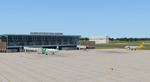
FSX scenery for Clark International Airport in Angeles city, Papamga Province , Philippines.
Clark International Airport, formerly the Diosdado Macapagal International Airport (IATA: CRK, ICAO: RPLC), is an airport that is an international gateway to the Philippines within Clark Freeport Zone located 80KM northwest of Manila. The airport is located along the border between the cities of Angeles and Mabalacat in the province of Pampanga and is accessible through the Subic-Clark-Tarlac Expressway, which is connected to the North Luzon Expressway.
Clark serves the general vicinity of central and northern Luzon. The name is derived from the former American Clark Air Force Base which was the largest overseas base of the United States Air Force until it was closed in 1991 and handed over to the Government of the Philippines.
Airlines serving CRK include Air Asia, Asiana, Cebu Pacific, Dragonair, Emirates, Jin Air, Qatar Airways, Tigerair, Fedex and Ups
| Filename: | Clark_International_Airport_RPLC__CRK.zip |
| License: | Freeware, limited distribution |
| Added: | 24th September 2016, 02:43:49 |
| Downloads: | 3,078 |
| Author: | Yann Martineau |
| Size: | 515.94 KB |
| Category: Flight Simulator X - Scenery | |
| GABS Bamako Senou International Airport |
|
File Description:
Bamako Senou International Airport (IATA: BKO, ICAO: GABS) is Malis main airport approximately 15 km south of downtown Bamako, the capital of Mali in West Africa. It is managed by Aeroports du Mali (ADM). Its operations are overseen
by the Malian Ministry of Equipment and Transports. Senou Airport was opened to traffic in 1974. The airport was upgraded between 2007 and 2012 in a 181 million US dollar project funded by the Millennium Challenge Corporation, a United
States foreign aid agency. Passenger traffic steadily increased in the early 2000s. Government figures show 403,380 passengers in 1999, 423,506 in 2003, 486,526 in 2004, and 516,000 in 2005. It is predicted to reach over 900,000 by 2015
under a low (4%) yearly growth rate scenario.
To date this growth rate has been surpassed. Total air traffic at BKO increased by 12.4% in 2007 and 14% in 2008. Most of this increase came in passenger transport, with the number of passengers served increasing by 20% in 2007 and 17%
in 2008. Twenty-seven airline carriers operated weekly or better at BKO in the 2007-2008 period. This continued growth was offset by cargo flights decline of 16.75% in 2007, and 3.93% in 2008.
The highest frequency route is on the Bamako-Dakar sector with 29 weekly non-stop connections. Domestic flights also serve Mali's regional capitals Kayes, Mopti, Timbuktu, Sikasso, Gao, and Kidal.
This work is dedicated to West Wind Airlines.
| Filename: | GABS_Bamako_Senou_International_Airport.zip |
| License: | Freeware |
| Added: | 27th March 2013, 01:12:43 |
| Downloads: | 3,407 |
| Author: | Anwar Gonzalez |
| Size: | 915.65 KB |
| Category: Flight Simulator 2004 - AI Flight Plans | |
| Iraqi Airways May 2011 |
|
Images related to this file:
File Description:

This flightplans includes all scheduled flights of Iraqi Airways for the week (22-28 May). All flights were taken from Iraqi Airways official site timetable. Iraqi Airways is now flying from (Baghdad, Erbil, Sulaymaniah, Najaf, Mosul and Basrah) to destinations in Europe (Istanbul), Middle East (Beirut, Damascus, Amman, Cairo, and Dubai) and Asia (Tehran, Mashad & Isfahan); Iraqi Airways' fleet is unstable changing frequently due to reforming and expansion, therefore, updating is necessary quite often.
| Filename: | Iraqi_Airways_May_2011.zip |
| License: | Freeware, limited distribution |
| Added: | 23rd May 2011, 22:42:30 |
| Downloads: | 471 |
| Author: | Zafer El-Khatib, globusworld.net |
| Size: | 44.95 KB |
| Category: Flight Simulator X - Aircraft Repaints, Textures and Modifications | |
| Piper PA28 Archer (D-EMLH) |
|
Images related to this file:
File Description:
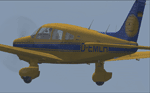
D-EMLH c/n 28-8090015. ex N2971Q. Named "Gundel" for what reason I have no clue. Maybe someone had a memorable meal there. (Google Gundel Hungary)
Gundel did service with Lufthansa as a trainer and now belongs to aero-beta Flight Training in Stuttgart. Love the tailfin. Who says the Germans have no sense of humour? :-)
As per usual, only download this paint if you possess a bona fide copy of Carenado's Archer II.
| Filename: | Piper_PA28_Archer_DEMLH.zip |
| License: | Freeware |
| Added: | 6th March 2014, 02:25:00 |
| Downloads: | 481 |
| Author: | Ron Attwood |
| Size: | 2.67 MB |
| Category: Flight Simulator 2004 - AI Flight Plans | |
| Air Ivoire 2004 |
|
File Description:
100% accurate 2004 Air Ivoire flight plans.Air Ivoire is an african carrier linking Abidjan (Ivory Coast) to 10 major cities in west Africa ,from Dakar to Libreville.They operate services with Fokker 28 Fellowship.You can find repaints on the web.
A call sign is enclosed in this file.The "Air Ivoire" replaces the FS "Airivoire" one.
Africa is the less considered continent in Flight Simulator but it's a wonderful place to fly!
Enjoy flying in Africa !
| Filename: | Air_Ivoire_2004.zip |
| License: | Freeware |
| Added: | 17th April 2004, 23:37:22 |
| Downloads: | 1,061 |
| Author: | Patrick Lattarullo |
| Size: | 4.5 KB |
| Category: Flight Simulator 2004 - Scenery | |
| The Thanlwin Bridge Mawlamyine VYMM (Moulmein-Martaban) |
|
Images related to this file:
File Description:

The Thanlwin Bridge (Mawlamyine), linking Mawlamyine, the capital of Mon State, and Mottama side, is the longest and largest of its kind in Myanmar (Burma). It is 11575 feet long and has a 28-foot-wide two-lane motorway with the length of two miles, a 14-foot-wide railroad with the length of four miles, and two six-foot-wide walkways on it. It was opened 05-02-2005. Re-upload
| Filename: | The_Thanlwin_Bridge_Mawlamyine_VYMM_MoulmeinMartab.zip |
| License: | Freeware, limited distribution |
| Added: | 8th June 2010, 00:59:54 |
| Downloads: | 680 |
| Author: | HOUSE-RP |
| Size: | 10.6 KB |
| Category: Flight Simulator X - Aircraft Repaints, Textures and Modifications | |
| Fairchild Republic A-10C 25th FS |
|
Images related to this file:
File Description:
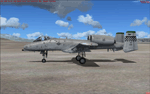
This is a repaint (textures only) for the payware Iris A-10. You can get it here: http://www.irisfss.com/storefront/product_info.php?cPath=21&products_id=28
This repaint was made with the included paint kit.
The original textures were created by and are property of IRIS.
Thank you IRIS for this incredible plane and paint kit.
This repaint represents a A-10C #651 from the 25th FS, 51st FW, Osan Air Base, Korea.
| Filename: | Fairchild_Republic_A10C_25th_FS.zip |
| License: | Freeware |
| Added: | 9th October 2011, 21:05:03 |
| Downloads: | 367 |
| Author: | Brian HIll/IRIS |
| Size: | 7.94 MB |


© 2001-2026 AVSIM Online
All Rights Reserved
Privacy Policy |