
Where Flight Simulation Enthusiasts Gather from Around the World!
AVSIM Library - Search Results

| Category: Flight Simulator 2004 - Scenery | |
| Mangalore Airport VOML |

|
File Description:
This scenery models Bajpe Airport, Mangalore (VOML) in Southern India (as seen in 2004). Works best when combined with my "India_76m-Mesh_Part_A" available at the AVSIM library.
Mangalore airport is known for it's infamously short runway that sits on top of a table-top mountain. This is modelled quite accurately in my mesh for Southern India. There have been quite a few near miss incidents in the past 20Yrs. So, if you're flying big tin, don't forget to step on the brakes ;-)
| Filename: | Mangalore_Airport_VOML.zip |
| License: | Freeware |
| Added: | 21st January 2006, 22:36:44 |
| Downloads: | 2,873 |
| Author: | Keith Sebastian |
| Size: | 169.52 KB |
| Category: Flight Simulator X - Scenery | |
| EGNM Leeds Bradford Intl., West Yorkshire, UK |
|
Images related to this file:
File Description:
This update is for EGNM, Leeds Bradford Intl airport and made only for FSX: the terminal is completely remodeled, new control tower, taxiways and taxi signs updated to the latest charts, the PAPI for R14 now on the correct side of the runway, fire station added, fuel trucks and vehicle service paths included and many other scenery objects, 11 general aviation parking spots, airport views are from the roof of the control tower (when in tower view) please view the readme before installation.
| Filename: | EGNM_Leeds_Bradford_Intl_West_Yorkshire_UK.zip |
| License: | Freeware, limited distribution |
| Added: | 14th December 2013, 01:17:45 |
| Downloads: | 13,918 |
| Author: | Craig Scott |
| Size: | 644.92 KB |
| Category: Flight Simulator X - Scenery | |
| YBCS - Cairns Intl Airport - Queensland, Australia |
|
Images related to this file:
File Description:
This airport update is made only for FSX: airline gates assigned to their terminals as per their website with extra parking, taxiways and taxi signs updated to the latest charts, runway 12/30 decommissioned, PAPI corrected to both sides of the runway, helipads moved to the correct locations, extra fuel trucks, support vehicle roads rebuilt, with many other scenery objects added, airport views are from the roof of the control tower (when in tower view) please view the readme before installation
| Filename: | YBCS__Cairns_Intl_Airport__Queensland_Australia.zip |
| License: | Freeware, limited distribution |
| Added: | 18th August 2014, 09:53:05 |
| Downloads: | 14,679 |
| Author: | Craig Scott |
| Size: | 544.45 KB |
| Category: Flight Simulator X - Scenery | |
| Rome Urbe airport - LIRU |
|
Images related to this file:
File Description:
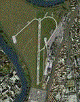
Urbe is the third airport in Rome, base for flight schools and also the Capital city's main heliport.
Despite its size, it can reach up to 300 movements a day.
This is a very accurate version of Roma Urbe airport created using only default library objects and precisely geo-referred.
The scenery has been created with ADE and tested on FSX and P3D (couple of ground texture issues reported with the latter). Tested also on IVAO with AURORA ATC software.
| Filename: | Rome_Urbe_airport__LIRU.zip |
| License: | Freeware |
| Added: | 18th May 2020, 18:54:13 |
| Downloads: | 852 |
| Author: | Lorenzo Stroppa |
| Size: | 1.76 MB |
| Category: Flight Simulator 2004 - Scenery | |
| PHJH Kapalua-West Maui |
|
Images related to this file:
File Description:

Kapalua airport (ICAO: PHJH—IATA: JHM—FAA:JHM) is located on the west side of the Hawaiian island of Maui. It serves Lahaina, and the resort communities of Kaanapali, Napili-Honokowai and Kapalua. This scenery includes a detailed model of Kapalua airport, the rooftop Hyatt Regency Resort helipad, approximately 170 square kilometers of West Maui terrain including extensive autogen buildings and trees, as well as numerous models of real-world resorts and hotels on a 12 km strip along the coast of West Maui.
| Filename: | PHJH_KapaluaWest_Maui.zip |
| License: | Freeware, limited distribution |
| Added: | 30th August 2017, 17:21:57 |
| Downloads: | 1,580 |
| Author: | Gregory Putz |
| Size: | 54.76 MB |
| Category: Flight Simulator X - AFCAD Files | |
| Buck's Airport (00N), NJ |
|
File Description:
Located 03 miles NE of Bridgeton, New Jersey on 63 acres of land, Buck's Airport is a small turf field privately owned by J. Di Orio and open to the public. The field in FSX has room for 8 small GA aircraft to park on the square of grass north of the greenhouses. Be careful of the trees to the north and south of the runway.
Scenery constructed with use of Google Maps images, the author has not been there in person.
This scenery is meant to be used in conjunction with MegaScenery Earth New Jersey/Delaware 004. It is not required, but apron use is minimized to allow satellite scenery to show through as much as possible - lack of it may make scenery look out of place.
| Filename: | Bucks_Airport_00N_NJ.zip |
| License: | Freeware |
| Added: | 3rd October 2010, 23:47:29 |
| Downloads: | 233 |
| Author: | Drew Sikora |
| Size: | 566.5 KB |
| Category: Flight Simulator 2004 - Scenery | |
| FREEflow Bermuda v1.3 |
|
File Description:
FREEflow Bermuda is a FREE scenery addon for Microsoft Flight Simulator: ACOF which will transform the Islands of Bermuda. Features include: Land class scenery which accurately reflects vegetation and population of the Islands of Bermuda. Water class scenery which properly reflects vibrant tropical reefs of Bermuda. Completely new ocean coasts, bays, and ponds accurately placed using Landsat imagery. All new detailed Bermuda International Airport (TXKF) with accurate AFCAD. Accurately placed, custom GMax models for many landmarks in Bermuda, including both lighthouses and many historic buildings. All major roads, highways and bridges. AI surface traffic including a custom designed ferry system with accurate scheduling, and many others. A configuration utility to tailor this scenery to your system and personal preferences. v1.3 adds taxiway signs to TXKF and addresses a number of minor problems.
| Filename: | FREEflow_Bermuda_v13.zip |
| License: | Freeware, limited distribution |
| Added: | 7th October 2005, 18:38:50 |
| Downloads: | 13,351 |
| Author: | FS-FREEflow (Scott Gridley, Joe Watson, Jim Campisi, Ron Jeffers, Bob Brown, Barry Wells) |
| Size: | 19.77 MB |
| Category: X-Plane - Scenery | |
| BR RJ SBME - Macae Airport v1.0.0 |
|
Images related to this file:
File Description:
This is an X-Plane 11 and X-Plane 10 scenery package for Benedito Lacerda Airport (IATA: MEA, ICAO: SBME) is the airport serving Macaé, RJ, in Brazil. It includes corrected aprons, ramps, gates, taxiways, lighting system, city buildings, ortho-photoscenery for the airfield area, and (XP11 only) airport ground services (like push back). The airport was established in the 1960s as an airfield for general aviation and a Flying club. In the 1980s the runway was paved and an apron and a terminal with 941 m² were constructed, enabling Macaé Airport to fully support the operations related to the Campos basin (off shore oil platform in the costal area of the state of Rio de Janeiro). In fact, most of its movement (98%) is related to helicopter flights to/from offshore oil platforms of the Campos basin. It features a lot of apron positions for rotorcrafts. This scenery was tested and is operational (as of March 26, 2017) in "X-Plane 11 Public Beta #17 64 bit", Windows 10 Home. It was also tested and is also operational (as of March 26, 2017) in "X-Plane 10.51 64 bit", Windows 10 Home. Only the default X-Plane 11 libraries, by Laminar Research, are needed. No third party libraries are used.
| Filename: | BR_RJ_SBME__Macae_Airport_v100.zip |
| License: | Freeware |
| Added: | 29th March 2017, 03:50:00 |
| Downloads: | 80 |
| Author: | Rui Mesquita |
| Size: | 14.62 MB |
| Category: Flight Simulator 2004 - Scenery | |
| Prudhoe Bay area on Alaska North Slope US |
|
Images related to this file:
File Description:
The Prudhoe Bay area of the Alaska north slope is dominated by all the equipment and machinery that is necessary for the extraction of oil and its transfer by the pipeline that reaches south to Valdez. Prudhoe Bay airport is now closed, and its replacement just to the south is Deadhorse PASC, with numerous storage, maintenance, and accomodation areas immediately to the north of the apron, and others adjacent to the road between the two. The runway is just under 6,500 feet with approach lights at both ends and ILS on 04 (true heading of 75 degrees). This scenery reflects the overall situation in 2011 and oil production facilities and buildings are included here. The airport buildings and those close to the airport are replicas of the real life buildings; while as distance increases the accuracy fades somewhat there are everywhere replica trucks and cross country vehicles that are true to life. Deadhorse handles around 7,000 passengers per month as staff are rotated in and out on Alaska Air and ERA flights and by oil company private flights. There are also freight flights to complement the trucking effort up the Dalton Highway. The Alaska Airlines terminal building and ERA (the red buildings nearby) are at one end of the apron, while at the other end is a very large and new green terminal, storage, hangar building built by the airport authority. All of the airport components, runways, taxiways, and aprons, are built up on a gravel base to raise them above the surrounding terrain that floods with melting snow, freezes, or dries out, according to the seasons. There are other new airstrips included here that serve the oil industry. Around 33 miles to the east is Badami PABP airport servicing a subsiduary oil producing area, with 5,000 feet of gravel runway. Some 28 miles to the west of Deadhorse is Ugnu-Kuparuk UBW with just over 6,000 feet of gravel (gravel in 2011, it is now asphalted) servicing oil production by Conoco Phillips, which uses 737's to fly staff in and out. A further 32 miles west is Alpine AK15 with 5,400 feet of gravel and also served by the Conoco Phillips 737's. To the south of Alpine and connected by road is the village of Nuiqsut. To the north of Alpine and reachable only by air in the delta of the Sagavanirktok River is CD-3, an oil collection and pump station area with another gravel runway of 3,000 feet. Other airstrips that were prviously posted are now updated, Nuiqsut and Oliktok. I experimented, but decided against trying to reproduce the several hundred miles of pipelines. The are new AI aircraft, and there are notes regarding downloading. There is a new "cement" texture (not its name, but used as that by SBuilder) for the built up gravel bases. It is slightly darker than the original but not so much that any previous use will be spoilt. You may wish to download my "Alaska Frozen Rivers and Lakes" which freezes lakes and the northern sea and makes them landable on wheels.
| Filename: | Prudhoe_Bay_area_on_Alaska_North_Slope_US.zip |
| License: | Freeware, limited distribution |
| Added: | 19th December 2017, 00:38:06 |
| Downloads: | 590 |
| Author: | Roger Wensley |
| Size: | 28.54 MB |
| Category: Flight Simulator X - Scenery | |
| Hartebeespoort Dam, South Africa (Fictional Water Runway Airport) |
|
Images related to this file:
File Description:
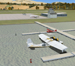
Due to no available airports in South Africa, with water runways in FSX, I decided to create a fictional airport at Hartebeespoort Dam with both a water runway as well as normal asphalt runway. FAHD also allows you to taxi from the main apron into the water as well as exit the water onto the main apron. 4 Water docking facilities also exist for aircraft with floats, which means you have a choice if you would like to start on the apron or at the water docks parking spaces. Amongst other facilities are ILS, NDB, Runway and Taxiway lights, 6 Small GA and 2 Medium GA Parking spot as well as refueling facility, a Tower and Small Terminal Building etc.
| Filename: | Hartebeespoort_Dam_South_Africa_Fictional_Water_Ru.zip |
| License: | Freeware |
| Added: | 26th March 2011, 19:50:07 |
| Downloads: | 395 |
| Author: | Otto Marais |
| Size: | 5.82 KB |


© 2001-2026 AVSIM Online
All Rights Reserved
Privacy Policy |