
Where Flight Simulation Enthusiasts Gather from Around the World!
AVSIM Library - Search Results

| Category: Flight Simulator 2004 - Scenery | |
| Liverpool John Lennon (Speke) Airport (EGGP) Ver 4.0 |

|
File Description:
This all new version has been specifically created with the Default FS2004 scenery in mind. However, it is also aligned to the Visual Flight / getmapping VFR Scenery published by Just Flight. Files are also included to make the scenery FS2002 compatible.
Version 4.0 contains all new macros and textures including for the first time full night textures! Note however, the download no longer contains the additional landmark objects included with previous versions. These are still available however from the derbosoft website and from AVSIM.
This scenery forms part of the "UK2002 Scenery Project" co-ordinated by John Woodside - http://fsaviation.net/.
Thanks go to John Woodside and to Peter Leadbeater for the information they have supplied to me regarding the airport.
Special thanks also go to Dave Graham and the rest of the guys at North West Air News (www.nwan.co.uk) without whose photo's and information this new version just wouldn't exist!
| Filename: | Liverpool_John_Lennon_Speke_Airport_EGGP_Ver_40.zip |
| License: | Freeware |
| Added: | 27th June 2004, 05:09:39 |
| Downloads: | 22,322 |
| Author: | Paul Derbyshire |
| Size: | 6.14 MB |
| Category: Prepar3D V1-4 - Scenery | |
| Progetto Maldive |
|
File Description:
The Atolls of the Maldives are numerous and some atolls are also uninhabited. The most famous atolls are: The Male Atoll and Baros island N4.18.26 E73.20.91 with the VRMM airport, the Gan atoll N0.41.36 E73.9.27 with the VRMG airport, Hanimardhoo Atoll N6.44.56 E73.10.06 with the VRMH airport, the Kaadedhahoo atoll N0.29.21 E72.59.41 with the VRMT airport and the Kadhdhoo N1.51.30 E73.31.15 with the VRMK airport. The aforementioned airports have been improved and the most important resorts have been created on the islands of Baros, Gan, Hanimaadhoo, Kaadedhahoo and Kadhdhoo, and small ports have been created with ships and boats with Google Maps report. I remember that all the islands can be easily visited by seaplanes in their respective tiny ports. Good VFR flight.
Within the downloaded package you will find readme files for scenery installation. Good fly VFR. Pasquale Marrulli.
| Filename: | Progetto_Maldive.zip |
| License: | Freeware |
| Added: | 29th January 2018, 18:38:35 |
| Downloads: | 328 |
| Author: | Pasquale Marrulli |
| Size: | 8.56 KB |
| Category: Prepar3D V1-4 - Scenery | |
| KMYR Myrtle Beach South Carolina USA International Airport For P3Dv4 |
|
Images related to this file:
File Description:
This is an enhancement of the default P3Dv4 airport. A custom built terminal building is included to replace the inadequate one included in the default scenery; aircraft gates have been correctly coded using Airport Design Editor 1.76.6715, according to the latest terminal map information; a new airport vehicle network has been built; extra fuel trucks have been added throughout the airport; the tower view has been changed to display from the roof of the control tower; all taxiway designators are correct and all taxiway signs are correctly placed and named; and there is a file included for GSX 2 users to enable them to have custom GSX SODE jetways displayed. This airport has only been tested in P3Dv4, and is not guaranteed to work in earlier versions. Please refer to the README FIRST.txt file to insure proper installation of all files.
| Filename: | KMYR_Myrtle_Beach_South_Carolina_USA_International.zip |
| License: | Freeware, limited distribution |
| Added: | 23rd February 2019, 18:24:13 |
| Downloads: | 780 |
| Author: | Patrick Finch |
| Size: | 1.06 MB |
| Category: Flight Simulator X - Scenery | |
| KLAW - Fort Sill Regional / Lawton Muni - Oklahoma, USA |
|
Images related to this file:
File Description:
FSX Scenery - Lawton Fort Sill Regional Airport (IATA: LAW[2], ICAO: KLAW, FAA LID: LAW) is a city owned airport two miles south of Lawton, in Comanche County, Oklahoma. It is used for military aviation from nearby Fort Sill and Sheppard Air Force Base and is served by American Eagle. Allegiant Air runs occasional charters to various destinations in the western United States. The National Plan of Integrated Airport Systems for 2011-2015 categorized it as a primary commercial service airport. Federal Aviation Administration records say the airport had 77,533 passenger boardings (enplanements) in calendar year 2008, 71,389 in 2009 and 68,054 in 2010. The 2013 Federal sequester will result in the closure of the airport's control tower and will require pilots to rely on air traffic controllers from other area airports. For your flying pleasure by John B. Loney, Jr.
| Filename: | KLAW__Fort_Sill_Regional__Lawton_Muni__Oklahoma_US.zip |
| License: | Freeware, limited distribution |
| Added: | 19th August 2015, 20:58:38 |
| Downloads: | 600 |
| Author: | John B. Loney, Jr. |
| Size: | 12.61 MB |
| Category: Flight Simulator 2004 - Miscellaneous Files | |
| GoTo Any Airport |
|
File Description:
GoTo Any Airport.
Inclued here Heathrow and London Luton. Always wanted to return to your favourite local Airport from anywhere in the world? simply - with no fuss? Look no Further.
Start at these Designated Airports,then Goto any Airport! - via the FS9 World menu and return to the Original Airport - every time! - By Just turning the GPS/nav switch to GPS and Flight Director and autothrottle on whilst still on the ground.Click on the Autopilot, IAS, ALT and Nav Hold switches once above 1000ft - thats it !! . Set Weather and Altitude as required and Speed in autopilot and away you go. Use the FS9 ATC as You Travel, call into Airport when close and receive the curent ATIS and Runway approach in use.
The added circuit flights are on Autopilot and allow you to observe the airport befor landing.They make good moving screen savers - but make sure you have plenty of fuel!compatible with UK2000 Airports & VFR scenery for UK.
| Filename: | GoTo_Any_Airport.zip |
| License: | Freeware |
| Added: | 19th June 2004, 07:12:30 |
| Downloads: | 690 |
| Author: | Alan Trussell |
| Size: | 38.37 KB |
| Category: Flight Simulator 2004 - Scenery | |
| EBAW2004 Deurne, Antwerpen (Belgium) |
|
File Description:
The airport:
FS2002/2004. Is situated on the western edge of the city of Antwerp and is the home base of VLM Airlines (Vlaamse Luchtvaart Maatschappij). On one side, the airport is enclosed by a residential area, on the other side by an old fort (which is a protected area) an a major district road. All these factors make that the runway is pretty short and a challenge to land on with a larger jet, like a 737 for example. Extra info about this airport can be found on the net : http://www.antwerpairport.be/
Members of FSCB (Flight Simulator Club Belgium), together with the airport authorities made it possible for me to have a guided tour on the airport so I got the opportunity to make pictures of each and every building. This together with other information that people sent to me, I had all the ingredients to make a scenery to what it has become : an exact replica of the real Antwerp airport.
| Filename: | EBAW2004_Deurne_Antwerpen_Belgium.zip |
| License: | Freeware, limited distribution |
| Added: | 27th December 2003, 19:52:39 |
| Downloads: | 8,000 |
| Author: | Robert Buysen |
| Size: | 8.39 MB |
| Category: Flight Simulator X - Scenery | |
| CYDA - Dawson Airport - Yukon, Canada |
|
Images related to this file:
File Description:
FSX Scenery - Dawson City Airport (IATA: YDA, ICAO: CYDA) is located 8 nautical miles (15 km; 9.2 mi) east of Dawson City, Yukon, Canada, in the Klondike River valley, and is operated by the Yukon government. It has a terminal building and like most airports in its class, the runway is not paved. The gravel runway is 5,006 ft (1,526 m) long and at an elevation of 1,215 ft (370 m). A number of studies have recommended moving the airport or realigning the runway as it is in a narrow mountain valley. The airport is classified as an airport of entry by Nav Canada and is staffed by the Canada Border Services Agency (CBSA). CBSA officers at this airport can normally handle aircraft with up to 15 passengers, but are equipped to handle daily Boeing 737 charters between Dawson City and Fairbanks (Fairbanks International Airport) during the peak summer tourism season. For your flying pleasure by John B. Loney, Jr.
| Filename: | CYDA__Dawson_Airport__Yukon_Canada.zip |
| License: | Freeware, limited distribution |
| Added: | 7th April 2016, 17:20:42 |
| Downloads: | 910 |
| Author: | John B. Loney, Jr. |
| Size: | 13.92 MB |
| Category: Flight Simulator 2004 - Scenery | |
| LFRD2004 Dinard/St-Malo VFR Scenery |
|
Images related to this file:
File Description:
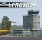
LFRD is a regional airport in Brittany, France. This scenery was created entirely with GMax and the latest Microsoft compilers. Everything was made to ensure maximum framerate while giving maximum visual impact, even on humbler machines. This scenery will run just as fast as the default one (which is very bare) with your current settings, even though there are literally thousands of houses, buildings, trees and a detailed airport.
This is a complete package:
-SRTM local mesh with custom coast trimming
-Custom phototexture (200sq km), with seamless blending into FS9 standard landclass
-Full autogen with custom local texture
-Custom landclass and waterclass
-AFCAD2 file with parking codes
-Custom Hi-res photographic textures at airport.
-Gmax buildings and xml librairy objects.
It was made by a real life pilot and is totally aimed at recreating the feeling of being there, not so much on the ground (after all, this is a FLIGHT simulator), but at circuit altitudes. This is not about recreating an airport in all its glorious details at the cost of framerate, but instead an exercise in balancing visual cues and details as viewed from up there to make it 'as real as it gets' within the limits of FS9. Scenery made by Vauchez (http://mapage.noos.fr/euro_vauchez/)
| Filename: | LFRD2004_DinardStMalo_VFR_Scenery.zip |
| License: | Freeware, limited distribution |
| Added: | 28th April 2010, 18:06:05 |
| Downloads: | 46,567 |
| Author: | Etienne Vauchez |
| Size: | 10.55 MB |
| Category: Prepar3D V5 - Scenery | |
| VOBL_P3Dv5 |
|
File Description:
Kempegowda International Airport (IATA: BLR, ICAO: VOBL) is an international airport serving Bangalore, the capital of the Indian state of Karnataka, in the Southern part of India. Spread over 4,000 acres (1,600 ha), it is located about 30 kilometres (19 mi) north of the city near the suburb of Devanahalli. It is owned and operated by Bengaluru International Airport Limited (BIAL), a public–private consortium. The airport opened in May 2008 as an alternative to increased congestion at HAL Airport, the original primary commercial airport serving the city. It is named after Kempe Gowda I, the founder of Bangalore. Kempegowda International Airport became Karnataka's first fully solar powered airport developed by CleanMax Solar.[5][6]
Kempegowda Airport is the third-busiest airport by passenger traffic in the country, behind the airports in Delhi and Mumbai, and is the 29th busiest airport in Asia. It handled around 33.30 million passengers in the calendar year 2018 with 658 aircraft movements a day. The cargo handled by the airport continues to increase steadily, with the airport handling about 386,849 tonnes (426,428 short tons) of cargo between April 2018 and March 2019.[7]
The airport consists of two runways and a passenger terminal, which handles both domestic and international operations. The second runway, constructed by Larsen & Toubro, was commissioned on 6 December 2019.[8][9] A second terminal is in the early stages of construction. Also, there is a cargo village and three cargo terminals. The airport serves as a hub for AirAsia India, Alliance Air, and IndiGo and is a focus city for Air India and SpiceJet.
Note: All terminal buildings credit goes to thomlinden. It's freeware scenery.
| Filename: | VOBL_P3Dv5.zip |
| License: | Freeware |
| Added: | 28th October 2020, 22:42:22 |
| Downloads: | 191 |
| Author: | Abhishek Banerjee |
| Size: | 20.83 MB |
| Category: Prepar3D V5 - Scenery | |
| VOBL_P3Dv5 |
|
File Description:
Kempegowda International Airport (IATA: BLR, ICAO: VOBL) is an international airport serving Bangalore, the capital of the Indian state of Karnataka, in the Southern part of India. Spread over 4,000 acres (1,600 ha), it is located about 30 kilometres (19 mi) north of the city near the suburb of Devanahalli. It is owned and operated by Bengaluru International Airport Limited (BIAL), a public–private consortium. The airport opened in May 2008 as an alternative to increased congestion at HAL Airport, the original primary commercial airport serving the city. It is named after Kempe Gowda I, the founder of Bangalore. Kempegowda International Airport became Karnataka's first fully solar powered airport developed by CleanMax Solar.[5][6] Kempegowda Airport is the third-busiest airport by passenger traffic in the country, behind the airports in Delhi and Mumbai, and is the 29th busiest airport in Asia. It handled around 33.30 million passengers in the calendar year 2018 with 658 aircraft movements a day. The cargo handled by the airport continues to increase steadily, with the airport handling about 386,849 tonnes (426,428 short tons) of cargo between April 2018 and March 2019.[7] The airport consists of two runways and a passenger terminal, which handles both domestic and international operations. The second runway, constructed by Larsen & Toubro, was commissioned on 6 December 2019.[8][9] A second terminal is in the early stages of construction. Also, there is a cargo village and three cargo terminals. The airport serves as a hub for AirAsia India, Alliance Air, and IndiGo and is a focus city for Air India and SpiceJet. Note: All terminal buildings credit goes to thomlinden. It's freeware scenery.
| Filename: | VOBL_P3Dv5.zip |
| License: | Freeware |
| Added: | 31st October 2020, 19:00:11 |
| Downloads: | 862 |
| Author: | Abhishek Banerjee |
| Size: | 16.84 MB |


© 2001-2026 AVSIM Online
All Rights Reserved
Privacy Policy |