
Where Flight Simulation Enthusiasts Gather from Around the World!
AVSIM Library - Search Results

| Category: X-Plane - Scenery | |
| XP11 German Scenery EDHK 2018+ Kiel-Holtenau |

|
File Description:
The small Zip-file will include a link for scenery download, because the scenery file size is above 500 Mbyte. Just follow the link and download EDHK 2018. This is an "install and fly" version, everything you need is already included (*see info below) and I will continously update the scenery. The story, in November 2012 the German MFG5 (Marineflieger-Geschwader) was relocated to Nordholz (ETMN). This was the end of the main military use in the southern and eastern part of the airport. Because the German harbor city Kiel needs living space for their citizens, opponents of the airport tried to convince citizens and politics to close the airport and to create there living space instead. In 2018 the citizen of Kiel voted with a citizen’s decision with the result that the majority voted for the preservation of the traditional airport. Personally, I am very happy with this decision. On the area of the airport some companies are settled, their employees should be able to sleep a little better now. In addition, there will certainly be future investments in the airport due to the election results. Since the airport has been financially in the red for years, the operator of the airport, the Port of Kiel Flughafen GmbH & Co. KG has converted large areas of the airport as parking area. These parked vehicles are part of the constantly increasing cruise ship operations within Kiel, making it possible for passengers to safely park their vehicles for extended periods of time. The taxiways “A†and “D†of EDHK are no longer in operation. This was of course taken into account in my scenery. The access to this taxiway was marked as in the original by yellow "X". The taxiway lighting was also turned off there. The on-site Luftsportverein (LSV) uses above the runway 08/26 an individually marked grass runway (not official), I called it 08S/26S and it is for the winch launch of their gliders only. The size of this provisional winch runway is about 820x20m. A glider takeoff by towing aircraft is usually handled by the Runway 08/26.(*) There is no copyright infringement, since I have received all the needed permissions to use the listed objects/libraries full or in parts within my scenery, the same for the single objects or non-Library bound objects/elements. I got all these permissions in writing from each individual author/rights holder. Take the time and read the full, included descritpion, please. If you have question, ask me first!
| Filename: | XP11_German_Scenery_EDHK_2018_KielHoltenau.zip |
| License: | Freeware |
| Added: | 28th November 2018, 22:46:11 |
| Downloads: | 70 |
| Author: | Marco Moschet |
| Size: | 1.3 KB |
| Category: X-Plane - Scenery | |
| XP11 German Scenery EDHK 2018+ Kiel-Holtenau |
|
Images related to this file:
File Description:
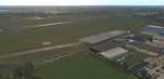
The small Zip-file will include a link for scenery download, because the scenery file size is above 500 Mbyte. Just follow the link and download EDHK 2018. This is an "install and fly" version, everything you need is already included (*see info below) and I will continously update the scenery. The story, in November 2012 the German MFG5 (Marineflieger-Geschwader) was relocated to Nordholz (ETMN). This was the end of the main military use in the southern and eastern part of the airport. Because the German harbor city Kiel needs living space for their citizens, opponents of the airport tried to convince citizens and politics to close the airport and to create there living space instead. In 2018 the citizen of Kiel voted with a citizen’s decision with the result that the majority voted for the preservation of the traditional airport. Personally, I am very happy with this decision. On the area of the airport some companies are settled, their employees should be able to sleep a little better now. In addition, there will certainly be future investments in the airport due to the election results. Since the airport has been financially in the red for years, the operator of the airport, the Port of Kiel Flughafen GmbH & Co. KG has converted large areas of the airport as parking area. These parked vehicles are part of the constantly increasing cruise ship operations within Kiel, making it possible for passengers to safely park their vehicles for extended periods of time. The taxiways “A†and “D†of EDHK are no longer in operation. This was of course taken into account in my scenery. The access to this taxiway was marked as in the original by yellow "X". The taxiway lighting was also turned off there. The on-site Luftsportverein (LSV) uses above the runway 08/26 an individually marked grass runway (not official), I called it 08S/26S and it is for the winch launch of their gliders only. The size of this provisional winch runway is about 820x20m. A glider takeoff by towing aircraft is usually handled by the Runway 08/26.(*) There is no copyright infringement, since I have received all the needed permissions to use the listed objects/libraries full or in parts within my scenery, the same for the single objects or non-Library bound objects/elements. I got all these permissions in writing from each individual author/rights holder. Take the time and read the full, included descritpion, please. If you have question, ask me first!
| Filename: | XP11_German_Scenery_EDHK_2018_KielHoltenau.zip |
| License: | Freeware |
| Added: | 29th November 2018, 19:24:38 |
| Downloads: | 66 |
| Author: | Marco Moschet |
| Size: | 1.3 KB |
| Category: Flight Simulator 2004 - AFCAD Files | |
| China Airports |
|
File Description:
Afcads, Exclude files and grass skirtings to create 29 minor airports in China which Microsoft omitted from FS9.
Made primarily with Ultimate Traffic users in mind, and designed for use together with Curt Jardey's China_1.zip, China_2.zip and China_3.zip, and Jan "Uranusjay" Martin's tibet_95.zip, to activate all the Chinese airports in UT's database and provide full UT traffic in China. Airports built using official CAAC charts, so runway locations, dimensions, alignments, elevations, navaids, and apron dimensions are fairly accurate. Parking spots mostly fictional! And no airport buildings included!
Tested only with default FS9 scenery mesh.
Includes: DLU/ZPDL Dali, DIG/ZPDQ Diqing, DOY/ZSDY Dongying, DNH/ZLDH Dunhuang, GYS/ZUGU Guangyuan, HEK/ZYHE Heihe, HYN/ZSLQ Huangyan/Luqiao, JDZ/ZSJD Jingdezhen, JJN/ZSQZ Jinjiang, JUZ/ZSJU Quzhou (Juzhou), KRL/ZWKL Korla, KCA/ZWKC Kuqa, LYG/ZSLG Lianyungang, LNJ/ZPLC Lincang, LLF/ZGLG Ling Ling, LYI/ZSLY Linyi, LYA/ZHLY Luoyang, LUM/ZPMS Luxi/Mangshi, MXZ/ZGMX Meixian, NTG/ZSNT Nantong, SHP/ZBSH Qinhuangdao, TCG/ZWTC Tacheng, WXN/ZUWX Wanxian, WEF/ZSWF Weifang, WEH/ZSWH Weihai, WUS/ZSWY Wuyishan, YBP/ZUYB Yibin, YIH/ZHYC Yichang, HSN/ZSZS Zhoushan.
| Filename: | China_Airports.zip |
| License: | Freeware |
| Added: | 17th April 2005, 18:29:18 |
| Downloads: | 3,250 |
| Author: | Adrian Wright |
| Size: | 81.6 KB |
| Category: Flight Simulator 2004 - Gauges | |
| FS2004/FSX VOR/DME RNAV Computer and CDI/GSI |
|
Images related to this file:
File Description:
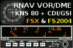
Contains a VOR/DME based RNAV (a.k.a. Rho-Theta RNAV) system, consisting of a KNS 80 RNAV computer and compatible CDI / CDI/GSI. Features: VOR, VOR/PAR, RNAV/ENR, RNAV/APR mode; 4 waypoints memory; distance, ground speed, time to station display; ILS, DME HOLD. With waypoint calculator. New with v1.6: compatibility with FS2004 and FSX, minor improvements.
| Filename: | FS2004FSX_VORDME_RNAV_Computer_and_CDIGSI.zip |
| License: | Freeware, limited distribution |
| Added: | 18th October 2018, 17:36:56 |
| Downloads: | 166 |
| Author: | Markus Schober |
| Size: | 150.73 KB |
| Category: Flight Simulator 2004 - Scenery | |
| CYUL 2002 V1.0 Scenery Upgrade 1 |
|
File Description:
This upgrade aligns the ILSs in FS2004 with CYUL2002 V1.0 runways, adds real life airline assignement to gates and the ILS/DME for runway 06R is now tuned to it's real life frequency of 110.50 MHz (instead of 110.60 MHz that we had to use for FS2002). Updated approach charts for runway 06R in JPEG format (.JPG) are included.
| Filename: | CYUL_2002_V10_Scenery_Upgrade_1.zip |
| License: | Freeware, limited distribution |
| Added: | 7th March 2004, 17:22:58 |
| Downloads: | 18,833 |
| Author: | Guy F. Jutras, Rafael G. Sanchez and Normand Boucher. Quebec Virtual Pilots |
| Size: | 523.07 KB |
| Category: Fly! II - Navigation | |
| Australian Database Update Version 1.10 |
|
File Description:
This version of the Australian Database Update for Fly 2 adds a few more airports and runways, adds over 250 new waypoints and corrects all waypoints to the 13 Jun 02 Australian Enroute Supplement. Over 15 ILS have been added and the remainder corrected. A number of Navaids have also been added. From the Australian Fly! Group.
| Filename: | Australian_Database_Update_Version_110.zip |
| License: | Freeware |
| Added: | 12th July 2002, 20:37:38 |
| Downloads: | 459 |
| Author: | Daniel Vickers |
| Size: | 124.29 KB |
| Category: Flight Simulator X - Scenery | |
| Seattle Tacoma Intl (KSEA) Asbuilt Scenery Ver2 |
|
File Description:
This update adds photo-based terrain in and around the airport with seasonal and night variations, and has minor tweaks to the airport design to help AI traffic movement. This is in addition to the Version 1 features that include: Current runway numbering (16R/34L changed to 16C/34C) is included. All runways and taxiways are placed at correct geographic coordinates. Shoulders along the runways and taxiways have been added and surfaces changed to present an appearance that looks a little more realistic than the default airport. Default scenery for terminals and buildings are reused, parking and jetways have been adjusted to match current assignments. A current copy of the FAA Airport Diagram is included for reference.
| Filename: | Seattle_Tacoma_Intl_KSEA_Asbuilt_Scenery__Ver2.zip |
| License: | Freeware, limited distribution |
| Added: | 18th January 2008, 01:23:59 |
| Downloads: | 7,782 |
| Author: | Dan Downs |
| Size: | 5.38 MB |
| Category: Flight Simulator X - Scenery | |
| Winter Haven, FL Gilbert Airport (KGIF) and Jack Browns Seaplane School (F57) |
|
Images related to this file:
File Description:
Winter Haven's Gilbert Airport is somewhat unique in that it adjoins Jack Browns Seaplane School on Lake Jessie. The airport serves as a fly-in location for the nearby Lakeland Sun N' Fun airshow where camping is allowed under aircraft wings on the apron.
Scenery in this package is based on Virtual Earth (Bing) and Google Earth imagery. Gilbert Airport includes a new GA terminal and apron and is connected with a taxiway to Jack Browns Seaplane School. Ramps from the water to the apron at Jack Browns are also included. Landclass changes, roads, rework of taxiways and aprons, placement of library objects and a library of new airport buildings are included.
| Filename: | Winter_Haven_FL_Gilbert_Airport_KGIF_and_Jack_Brow.zip |
| License: | Freeware |
| Added: | 9th May 2010, 08:29:56 |
| Downloads: | 908 |
| Author: | Art Poole |
| Size: | 759.09 KB |
| Category: Flight Simulator X - AFCAD Files | |
| Kota Kinabalu International Airport AFCAD WBKK Update 1.4 |
|
Images related to this file:
File Description:
This update to the WBKK airport I created using the freeware Airport Design Editor X (v1.47.07) includes:
- a working parallel taxipath that runs from runway 20 and expanded apron
- additional buildings and designated airline codes for parking
- addition/edit of some objects' appearance and/or position, including a rotating tower beacon at night
with FSX object libraries. Some objects (lightposts and car parking lots) from the Acceleration pack are added for more realism, but may not be visible for the FSX RTM users.
The surrounding scenery buildings are created based on photos taken from Google Maps and other sites about Kota Kinabalu International Airport (KKIA).
This airport has been tested with a Boeing 747-400 and Airbus A330-200.
| Filename: | Kota_Kinabalu_International_Airport_AFCAD_WBKK_Upd.zip |
| License: | Freeware |
| Added: | 21st September 2010, 13:20:40 |
| Downloads: | 796 |
| Author: | Harry Sung |
| Size: | 327.5 KB |
| Category: Flight Simulator 2004 - Scenery | |
| Long Beach Airport (Daugherty Field) KLGB |
|
Images related to this file:
File Description:
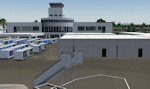
Detailed scenery for Long Beach Airport (Daugherty Field), Long Beach, California, USA. This commercial airport is one of the most famous aviation landmarks once being the home of the commercial arm of the McDonnell Douglas Corporation (now part of Boeing). Long Beach Airport was the production home for most of the MDD models including the DC-9, MD-80, DC-10, MD-11, B717 and is currently the home of the C-17 military freighter. The large number of resident companies and FBOs ensure that Long Beach is a busy airport while also being situated in the heart of one of the busiest terminal areas in the world, the Los Angeles basin.
| Filename: | Long_Beach_Airport_Daugherty_Field_KLGB.zip |
| License: | Freeware, limited distribution |
| Added: | 8th October 2010, 20:22:46 |
| Downloads: | 7,249 |
| Author: | Shehryar Ansari / Wil Morgan |
| Size: | 68.03 MB |


© 2001-2026 AVSIM Online
All Rights Reserved
Privacy Policy |