
Where Flight Simulation Enthusiasts Gather from Around the World!
AVSIM Library - Search Results

| Category: X-Plane - Scenery | |
| BR BA SNVR - Itaparica Airfield v1.0.0 |

|
Images related to this file:
File Description:
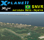
This is an X-Plane 11 and X-Plane 10 scenery package for Aeroclube da Bahia Airfield (ICAO: SNVR, no IATA), which is a private aviation school and general aviation airport located in the Itaparica Island, Bahia, Brazil, south of Salvador International Airport (SBSV). It includes corrected aprons, ramps, gates, taxiways, lighting system, city buildings (for Itaparica Island), ortho-photoscenery for the airfield area, and (XP11 only) airport ground services (like push back). This scenery was tested and is operational (as of June 25, 2017) in "X-Plane 11.02r1 64 bit", Windows 10 Home. It was also tested and is also operational (as of June 25, 2017) in "X-Plane 10.51 64 bit", Windows 10 Home. Only the default X-Plane 11 libraries, by Laminar Research, are needed. No third party libraries are used.
| Filename: | BR_BA_SNVR__Itaparica_Airfield_v100.zip |
| License: | Freeware |
| Added: | 25th June 2017, 22:25:01 |
| Downloads: | 69 |
| Author: | Rui Mesquita |
| Size: | 6.92 MB |
| Category: X-Plane - Scenery | |
| BR RJ SBJR - Jacarepagua Airport v1.0.0 |
|
Images related to this file:
File Description:
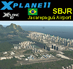
This is an X-Plane 11 and X-Plane 10 scenery package for Jacarepagua–Roberto Marinho Airport (ICAO: SBJR), which is an airport in the neighborhood of Barra da Tijuca, in the city of Rio de Janeiro, RJ - Brazil. It includes corrected aprons, ramps, gates, taxiways, lighting system, city buildings (Rio de Janeiro's Barra da Tijuca area), ortho-photoscenery for the airfield area, and (XP11 only) airport ground services (like push back). This scenery was tested and is operational (as of May 27, 2017) in "X-Plane 11 1.02b1 64 bit", Windows 10 Home. It was also tested and is also operational (as of May 27, 2017) in "X-Plane 10.51 64 bit", Windows 10 Home. Only the default X-Plane 11 libraries, by Laminar Research, are needed. No third party libraries are used.
| Filename: | BR_RJ_SBJR__Jacarepagua_Airport_v100.zip |
| License: | Freeware |
| Added: | 27th May 2017, 19:19:36 |
| Downloads: | 123 |
| Author: | Rui Mesquita |
| Size: | 19.06 MB |
| Category: X-Plane - Scenery | |
| BR SP SBSR - Sao Jose do Rio Preto Airport v1.0.0 |
|
Images related to this file:
File Description:
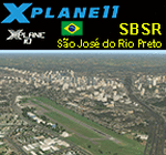
This is an X-Plane 11 and X-Plane 10 scenery package for Prof. Eribelto Manoel Reino–Sao Jose do Rio Preto State Airport (IATA: SJP, ICAO: SBSR) is the airport serving São José do Rio Preto, SP, Brazil. It includes corrected aprons, ramps, gates, taxiways, lighting system, city buildings, ortho-photoscenery for the airfield area, and (XP11 only) airport ground services (like push back). This scenery was tested and is operational (as of June 03, 2017) in "X-Plane 11.02b1 64 bit", Windows 10 Home. It was also tested and is also operational (as of June 03, 2017) in "X-Plane 10.51 64 bit", Windows 10 Home. Only the default X-Plane 11 libraries, by Laminar Research, are needed. No third party libraries are used.
| Filename: | BR_SP_SBSR__Sao_Jose_do_Rio_Preto_Airport_v100.zip |
| License: | Freeware |
| Added: | 3rd June 2017, 17:53:19 |
| Downloads: | 127 |
| Author: | Rui Mesquita |
| Size: | 13.27 MB |
| Category: X-Plane - Scenery | |
| BR AP SBOI - Oiapoque Airport v1.0.0 |
|
Images related to this file:
File Description:
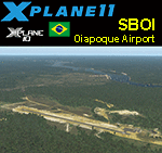
This is an X-Plane 11 and X-Plane 10 scenery package for Oiapoque Airport (IATA: OYK, ICAO: SBOI), which is the airport serving Oiapoque, Amapa, in Brazil. It is located by the border between Brazil and French Guyana, in the Amazon rainforest region. It includes corrected aprons, ramps, gates, taxiways, lighting system, city buildings, ortho-photoscenery for the airfield area, and (XP11 only) airport ground services (like push back). This scenery was tested and is operational (as of June 04, 2017) in "X-Plane 11.02b1 64 bit", Windows 10 Home. It was also tested and is also operational (as of June 04, 2017) in "X-Plane 10.51 64 bit", Windows 10 Home. Only the default X-Plane 11 libraries, by Laminar Research, are needed. No third party libraries are used.
| Filename: | BR_AP_SBOI__Oiapoque_Airport_v100.zip |
| License: | Freeware |
| Added: | 5th June 2017, 14:01:08 |
| Downloads: | 86 |
| Author: | Rui Mesquita |
| Size: | 11.26 MB |
| Category: X-Plane - Scenery | |
| BR MG SBBH - Pampulha Belo Horizonte Airport v1.0.0 |
|
Images related to this file:
File Description:

This is an X-Plane 11 and X-Plane 10 scenery package for Belo Horizonte/Pampulha–Carlos Drummond de Andrade Airport (IATA: PLU, ICAO: SBBH) which is an airport serving Belo Horizonte, Brazil, located in the neighborhood of Pampulha. It includes corrected aprons, ramps, gates, taxiways, lighting system, city buildings, ortho-photoscenery for the airfield area, and (XP11 only) airport ground services (like push back). This scenery was tested and is operational (as of April 13, 2017) in "X-Plane 11.00 RC #1 64 bit", Windows 10 Home. It was also tested and is also operational (as of April 13, 2017) in "X-Plane 10.51 64 bit", Windows 10 Home. Only the default X-Plane 11 libraries, by Laminar Research, are needed. No third party libraries are used.
| Filename: | BR_MG_SBBH__Pampulha_Belo_Horizonte_Airport_v100.zip |
| License: | Freeware |
| Added: | 14th April 2017, 07:17:40 |
| Downloads: | 130 |
| Author: | Rui Mesquita |
| Size: | 22.08 MB |
| Category: Flight Simulator 2002 - Scenery | |
| Newport News/Williamsburg Intl Airport (FSSE) |
|
File Description:
This is my absolute first try at any scenery work. This is a fairly accurate representation of the NNWIA (PHF). The scenery adds updated terminal buildings, jetways, ground support, ect. My focus was mostly on the terminal and GA area. The maint. section near where the two runways meet was mostly imrovised. Although I have been to this airport dozens of times, I have never seen this area (reason why my focus was on the terminal area :-) ). Newport News Airport is a small international airport which is only serviced by three major airlines (and small jets). AirTran flies Boeing 717s (using the only two jetways), ASA Delta Connection flies CRJs, and US Airways express flies Dash 8s. Small GA used by NOAA and charter (as well as some ex-military jets) park here.
| Filename: | Newport_NewsWilliamsburg_Intl_Airport_FSSE.zip |
| License: | Freeware |
| Added: | 23rd April 2003, 20:33:40 |
| Downloads: | 849 |
| Author: | Samuel Hawks |
| Size: | 328.35 KB |
| Category: Flight Simulator 2004 - Scenery | |
| Deering PADE in Alaska |
|
Images related to this file:
File Description:
Deering is a coastal village around 55 miles southwest of Kotzebue, living from fishing and the land and with a population of around 130. The airfield is inland from the coast and has two gravel runways, 11-29 of just under 3,000 feet and 2-20 of 3,700 feet; the US is the only country that names runways with single numerals, hence 2-20 that in Canada would be 02-20. And Canada, which is a metric country and gives speed limits on roads in kilometres per hour, flies in feet and not metres for runway lengths and flight levels. The two runways could have something to do with there being a National Guard Armoury in the village, and perhaps personnel being flown in for exercises in the local countryside. Apart from the airfield itself, and it's buildings, this scenery modifies the local (mostly treeless) land class, reduces the village size to reality, and creates a new airfield background. Bering Air flies into Deering from Kotzebue and is included in the AI. A note here about my scenery making. This is post number 504 and there will not be many more to follow this as I am almost at the end of the photos I either took or found for scenery purposes. There is a limit to what can be located online and I have already been making use of the little there is; eg Unalakleet. So, if you are near an airport (preferably Canadian or Alaskan) and have a camera..... Let me know.
| Filename: | Deering_PADE_in_Alaska.zip |
| License: | Freeware, limited distribution |
| Added: | 7th August 2019, 16:37:12 |
| Downloads: | 137 |
| Author: | Roger Wensley |
| Size: | 4.32 MB |
| Category: Flight Simulator X - Scenery | |
| RAF Manston 1944 |
|
File Description:
RAF Manston (ICAO EGMH)was an RAF station in the north-east of Kent, on the Isle of Thanet from 1916 until 1996. The site is now split between a commercial airport Kent International Airport (KIA) and a continuing military use by the Defence Fire Training and Development Centre (DFTDC), following on from a long-standing training facility for RAF firefighters at the Manston base.
Source: Wikipedia
I have represented it here in 1944 leading up to its part in Operation Market garden and D Day. It was one of the few airfields installed with the Fog Investigation Dispersal Organisation (FIDO) system designed to remove fog from airfields by burning it off with petrol and I have represented this with the 8 fuel tanks at the 29 end of the mail runway. I have laid the station out roughly according to an old map made in the mid 40s but I make no claims to the accuracy of building I have used.
| Filename: | RAF_Manston_1944.zip |
| License: | Freeware |
| Added: | 26th April 2016, 00:15:35 |
| Downloads: | 160 |
| Author: | Terry Boissel |
| Size: | 1.71 MB |
| Category: Prepar3D V1-4 - Aircraft Repaints, Textures and Modifications | |
| Douglas C-54 (44-9002) 320th TCS |
|
Images related to this file:
File Description:
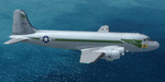
This folder contains a repaint for the Douglas C-54 / DC-4 by Flight Replicas. It shows Douglas C-54B 44-9002 of the 320th TCS, 509th Composite Group, based on Tinian Island, 1945. It was B-29's of the 509th CG that dropped the atomic bombs on Japan in 1945. Repaint by Jan Kees Blom, based on the paintkit by Flight Replicas.
| Filename: | Douglas_C54_449002_320th_TCS.zip |
| License: | Freeware |
| Added: | 19th April 2020, 18:44:55 |
| Downloads: | 79 |
| Author: | Jan Kees Blom |
| Size: | 56.7 MB |
| Category: Flight Simulator X - Miscellaneous Files | |
| Samoa Time Zone Fix |
|
Images related to this file:
File Description:
Samoa has changed its time zone (WST) to effectively move it west of the international dateline as of 29 Dec 2011. Samoa time is now UCT +13 hrs during standard time, and +14 hrs during daylight savings time observed from the end of September to the beginning of April. This update corrects the timezone in FSX within the Faleolo CTA/Class D airspace surrounding Samoa.
| Filename: | Samoa_Time_Zone_Fix.zip |
| License: | Freeware, limited distribution |
| Added: | 30th December 2011, 23:54:34 |
| Downloads: | 475 |
| Author: | Scott Smart |
| Size: | 1.21 KB |


© 2001-2026 AVSIM Online
All Rights Reserved
Privacy Policy |